My Store
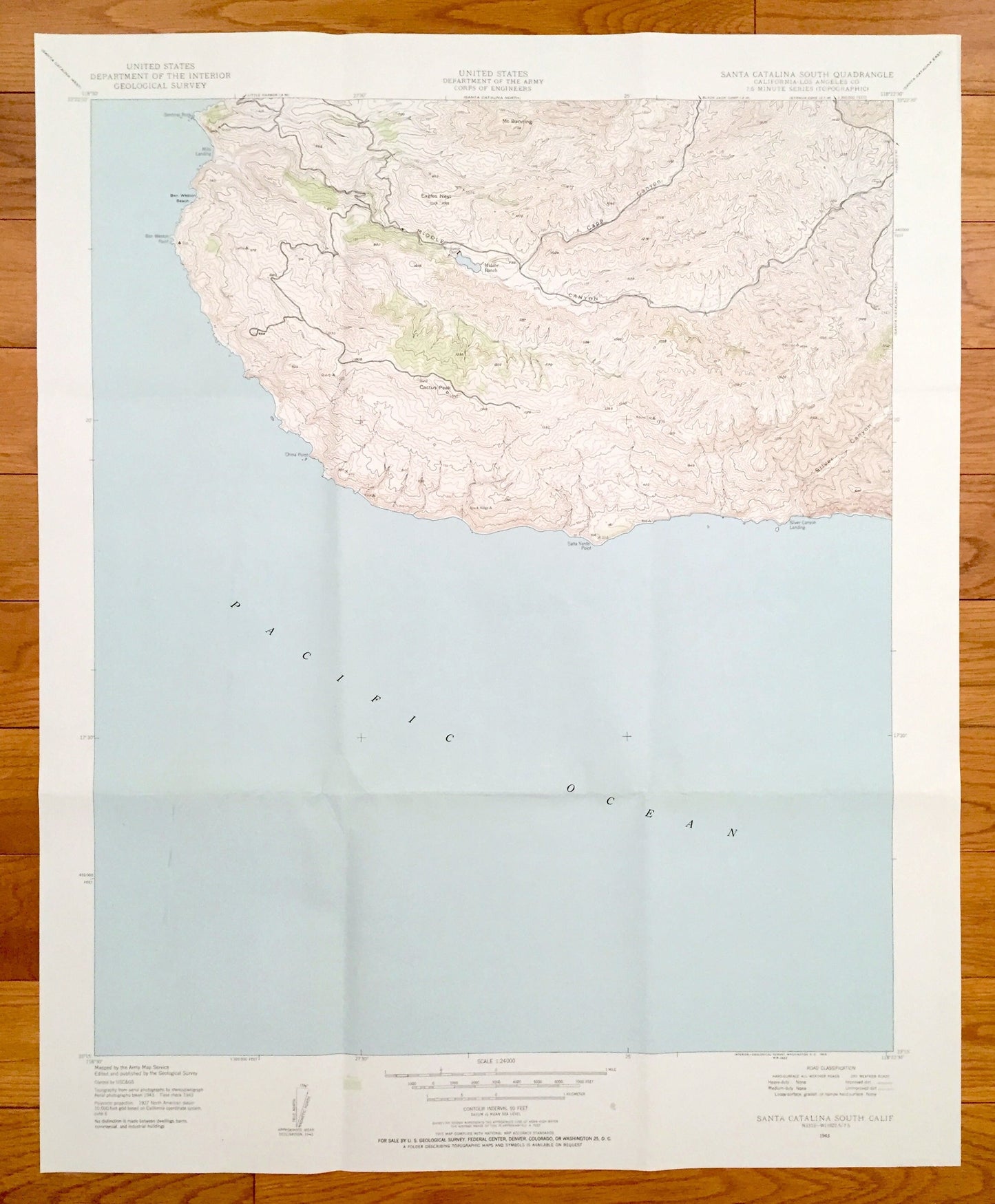
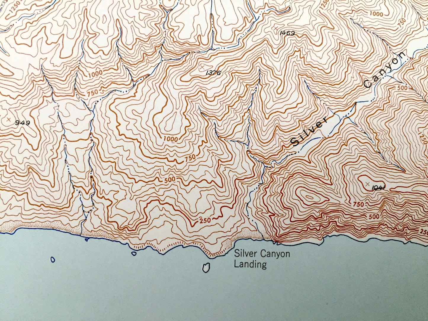
Antique Santa Catalina South, California 1943 US Geological Survey Topographic Map – Los Angeles County, Eagles Nest, Silver Canyon Landing
Antique Santa Catalina South, California 1943 US Geological Survey Topographic Map – Los Angeles County, Eagles Nest, Silver Canyon Landing
Beautiful, antique map of Santa Catalina South, California and surrounding Los Angeles County area. This is an authentic 1943 edition, 1974 print from the U.S. Geological Survey and NOT a computer reproduction.
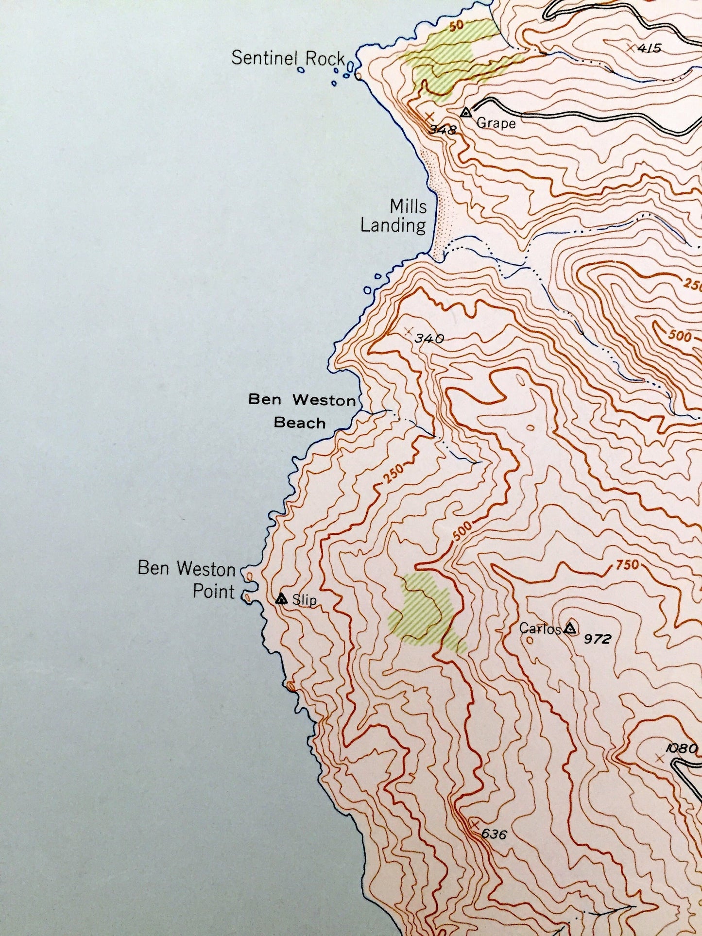
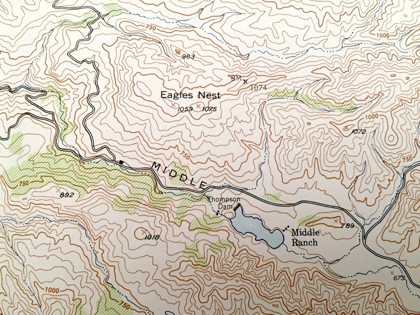
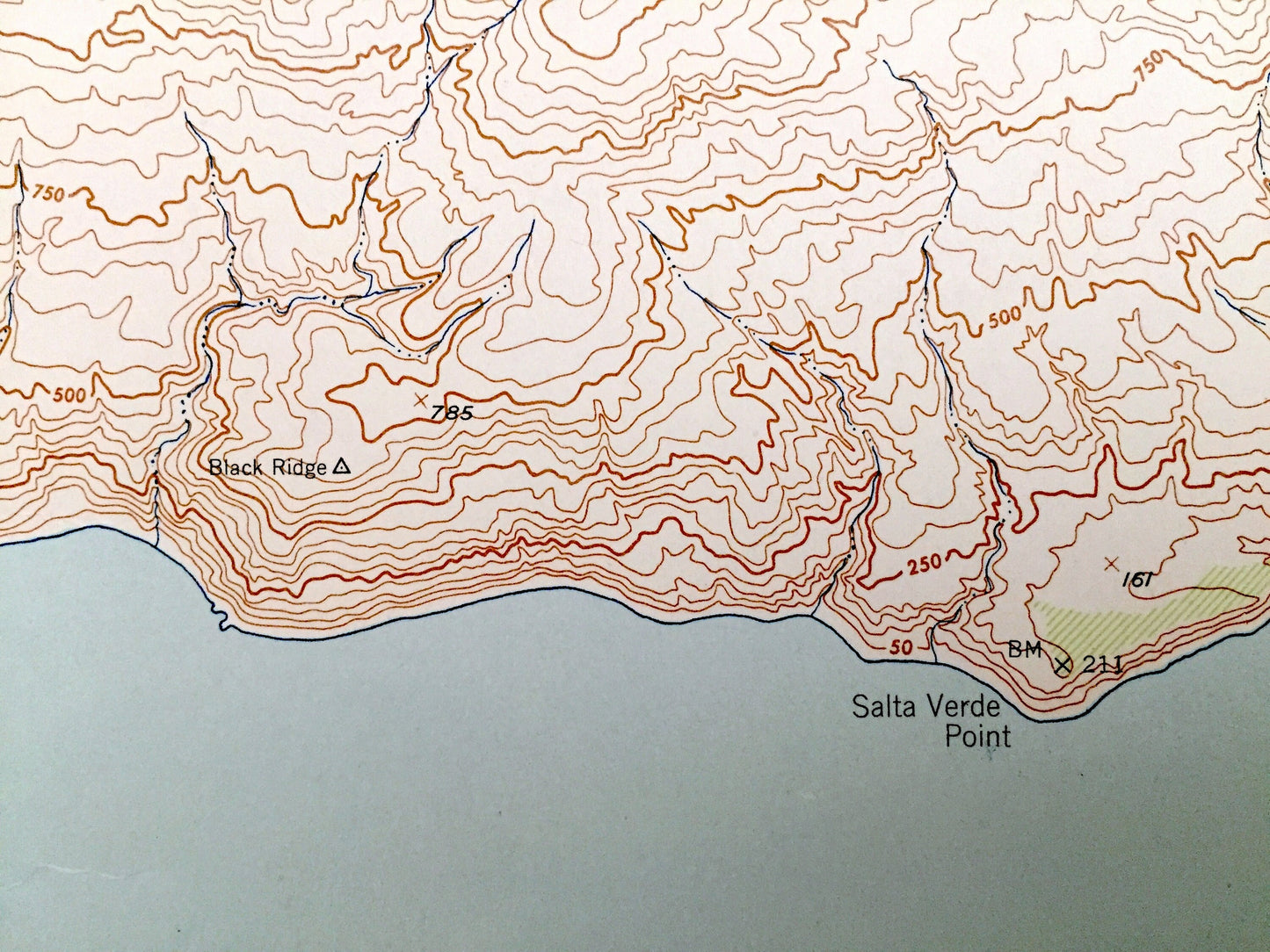
See what California looked like 75 years ago. Lots of intricate details and geological contours. Map even has little squares for every house that existed at the time. The USGS cartographers were very thorough back then!
Perfect for the historian, map-lover, the curious or just as a conversation starter. Wonderful and rare. Vintage maps such as these make great gifts.
Edition of 1943, Printed 1974
Dimensions: 22" width x 27" height
----
Features
Cities & Towns: Middle Ranch, Eagles Nest.
Points of Interest: Pacific Ocean, Ben Weston Beach, Middle Canyon, China Point, Salta Verde Point, Caps Cayon, Cactus Peak, Mt Banning, Cape Canyon and many more hills, peaks, reservoirs, canyons, beaches, points and more.
Condition: Very Good Vintage condition, commensurate with age. This map is in great shape for being over 60 years old. Has light wear and folds as issued, but these will flatten easily and all will add to vintage character when framed.
----
We will happily adjust shipping price for multiple purchases. Maps are rolled up and shipped in sturdy mailing tubes, never folded.
Couldn't load pickup availability
Share