My Store
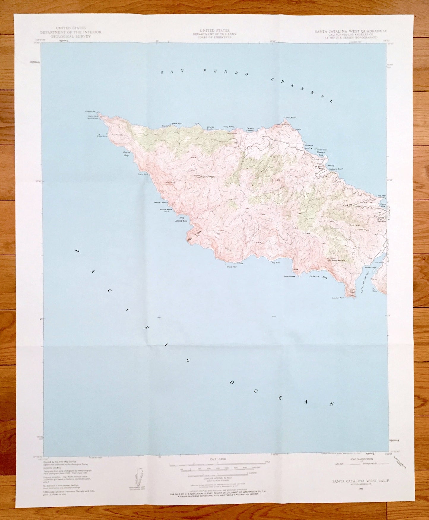
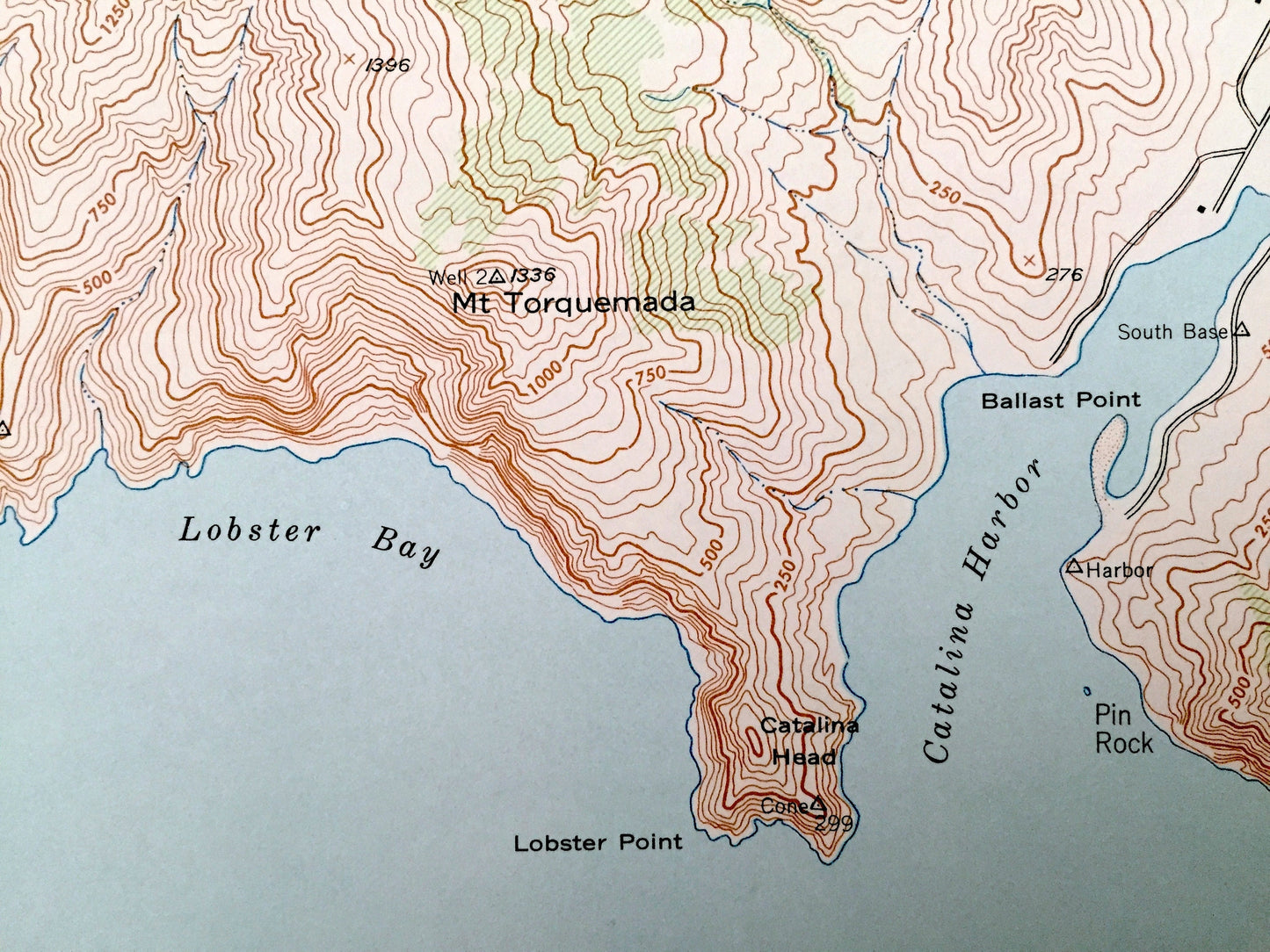
Antique Santa Catalina West, California 1943 US Geological Survey Topographic Map – Los Angeles County, Lobster Bay, Cherry Valley, CA
Antique Santa Catalina West, California 1943 US Geological Survey Topographic Map – Los Angeles County, Lobster Bay, Cherry Valley, CA
Beautiful, antique map of Santa Catalina West, California and surrounding Los Angeles County area. This is an authentic 1943 edition, 1963 from the U.S. Geological Survey and NOT a computer reproduction.
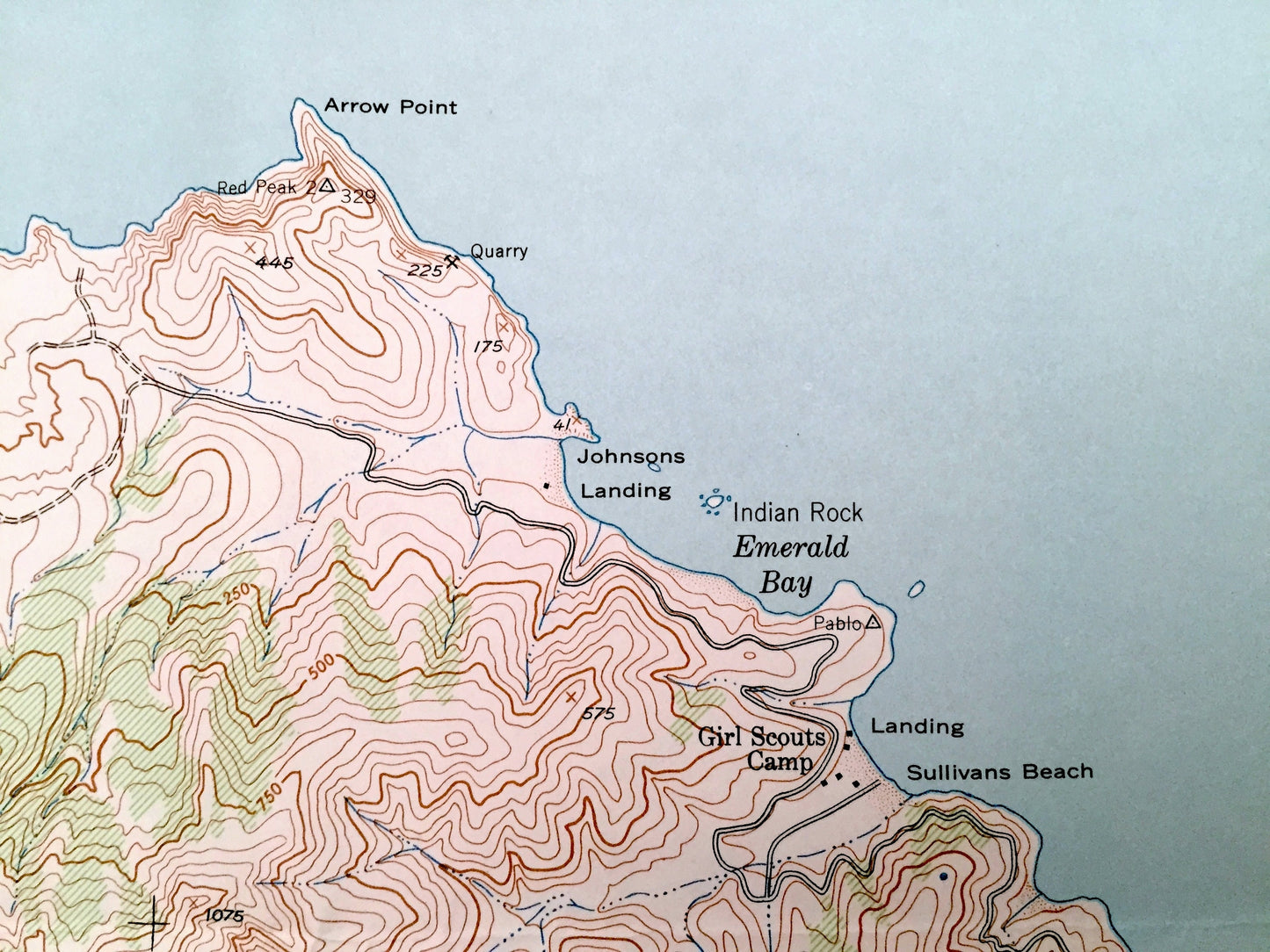
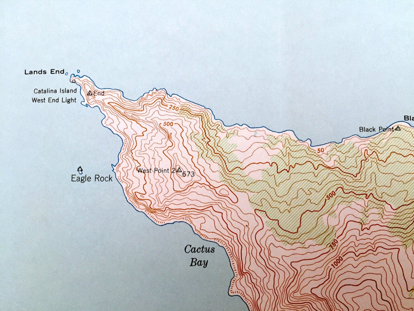
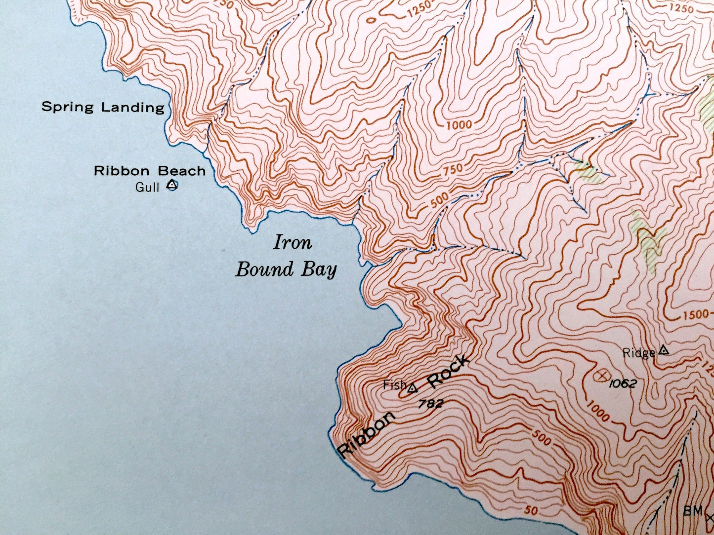
See what California looked like 80 years ago. Lots of intricate details and geological contours. Map even has little squares for every house that existed at the time. The USGS cartographers were very thorough back then!
Perfect for the historian, map-lover, the curious or just as a conversation starter. Wonderful and rare. Vintage maps such as these make great gifts.
Edition of 1943, Printed 1963
Dimensions: 22" width x 27" height
----
Features
Cities & Towns: Cherry Valley, Sullivans Beach.
Points of Interest: Pacific Ocean, San Pedro Channel, Catalina Harbor, Lobster Bay, Iron Bound Bay, Cactus Bay, Emerald Bay, Cherry Cove, Silver Peak, Lands End, Mt Torquernada and many more hills, peaks, beaches, points and more.
Condition: Very Good Vintage condition, commensurate with age. This map is in great shape for being over 60 years old. Has light wear and folds as issued, but these will flatten easily and all will add to vintage character when framed.
----
We will happily adjust shipping price for multiple purchases. Maps are rolled up and shipped in sturdy mailing tubes, never folded.
Couldn't load pickup availability
Share