My Store
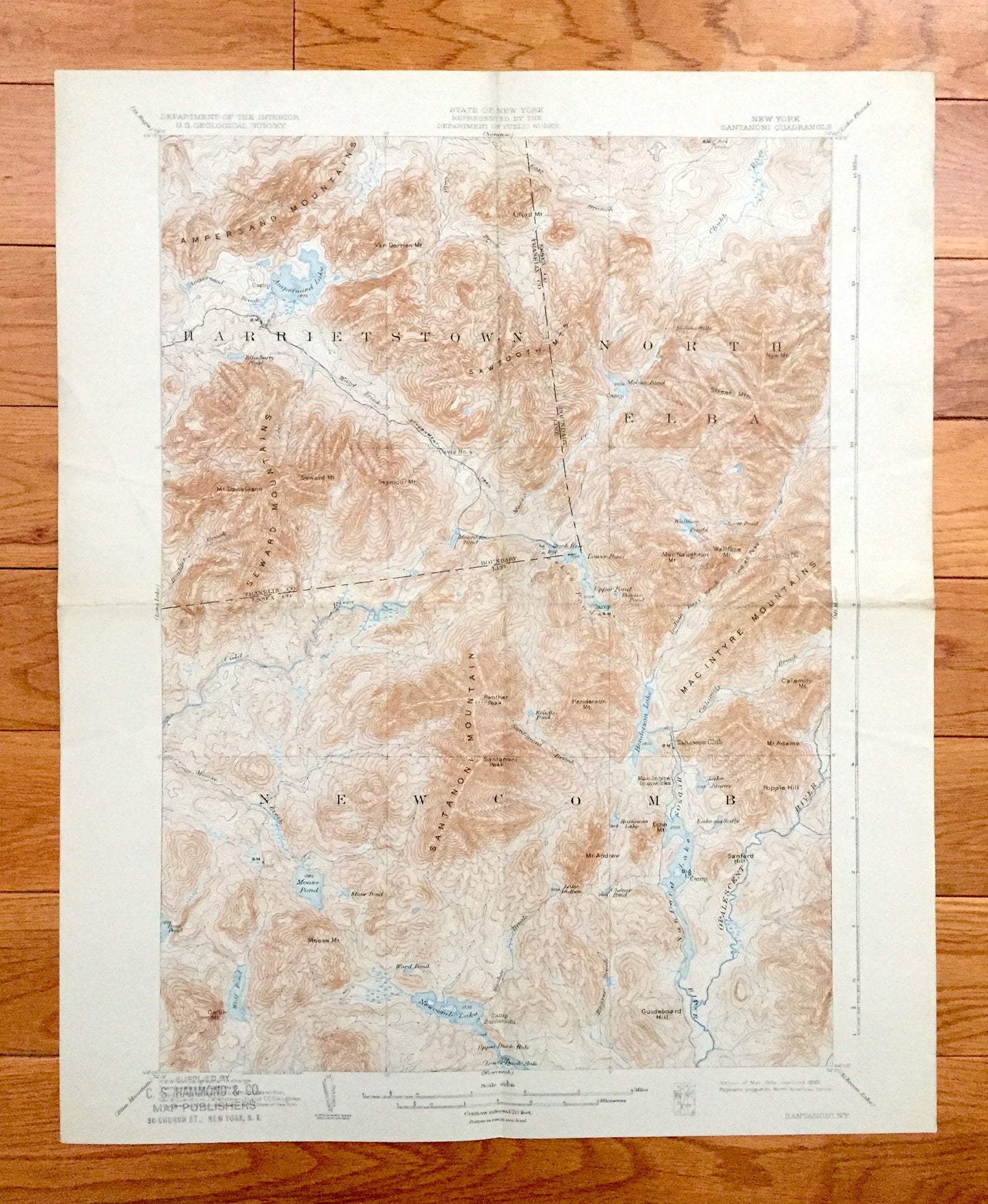
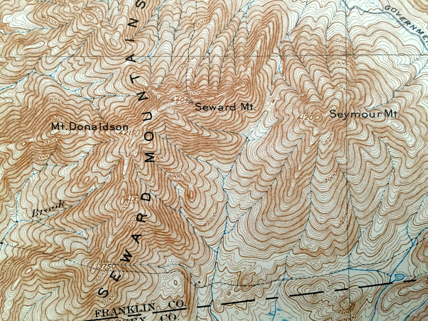
Antique Santanoni, New York 1904 US Geological Survey Topographic Map – Adirondacks, Ampersand Lake, Tahawus, Franklin, Essex County, NY
Antique Santanoni, New York 1904 US Geological Survey Topographic Map – Adirondacks, Ampersand Lake, Tahawus, Franklin, Essex County, NY
Beautiful, antique map of Santanoni, New York and surrounding Franklin & Essex County area. This is an authentic 1904 edition, 1930 print from the U.S. Geological Survey and NOT a computer reproduction.
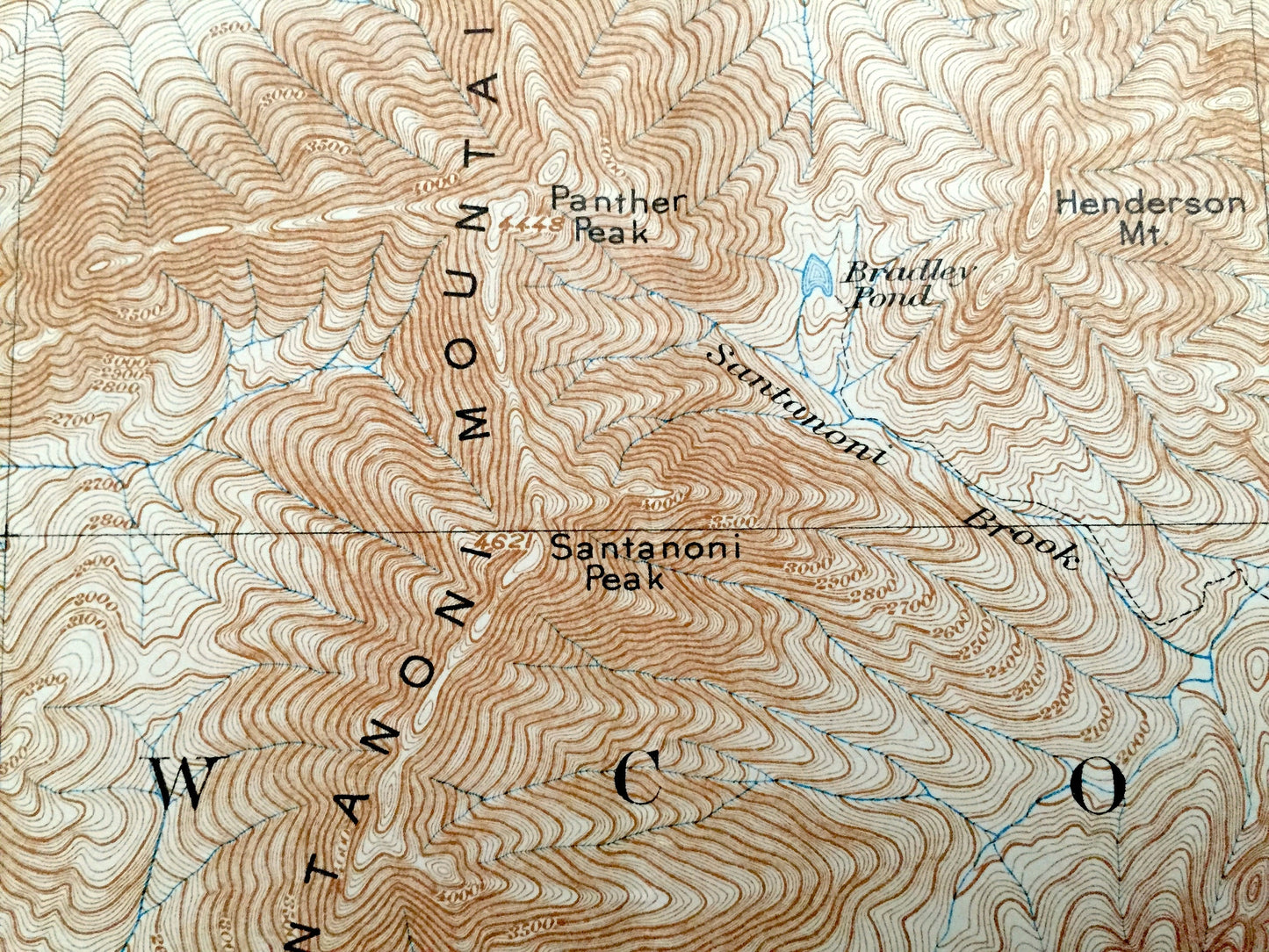
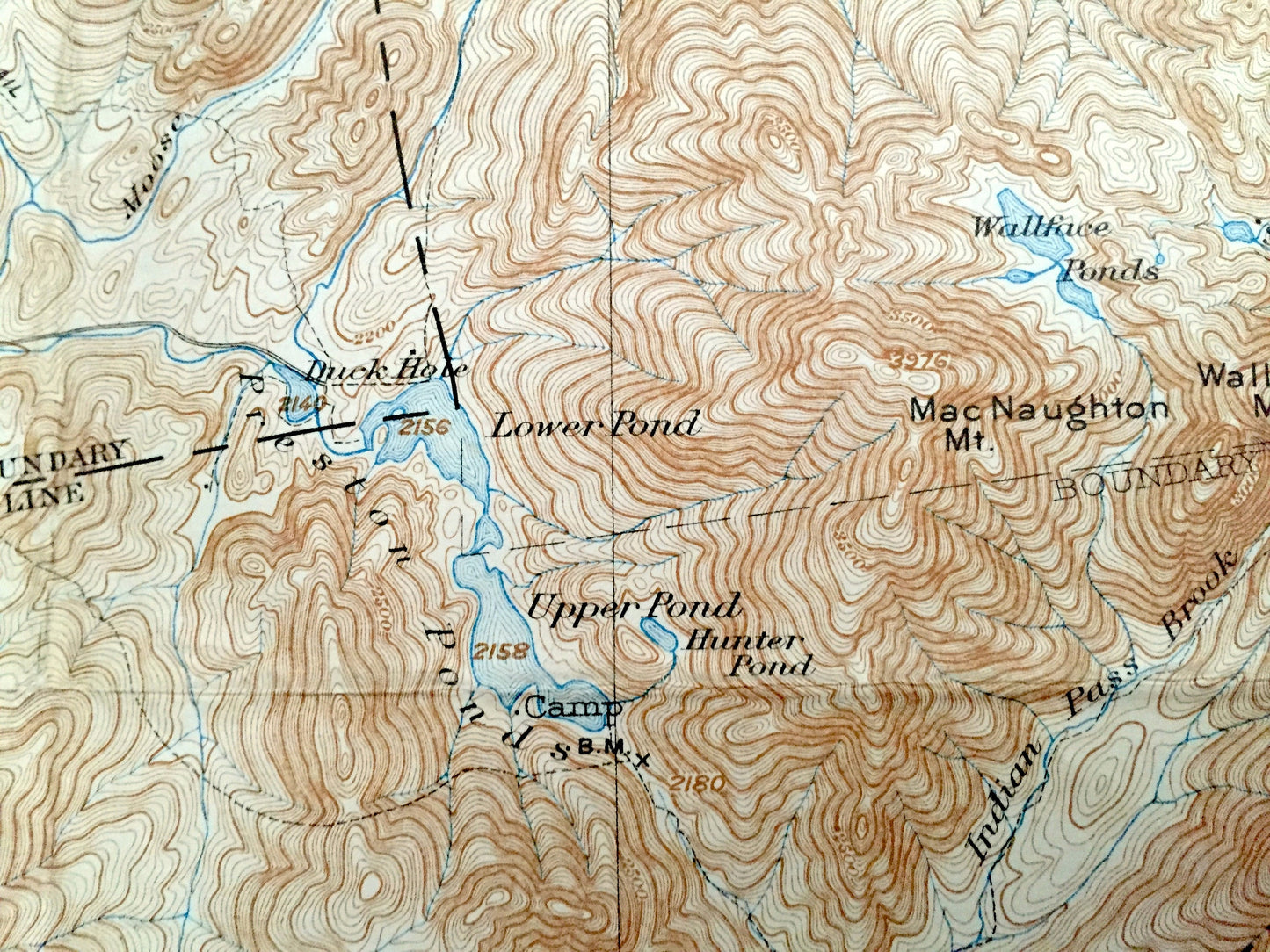
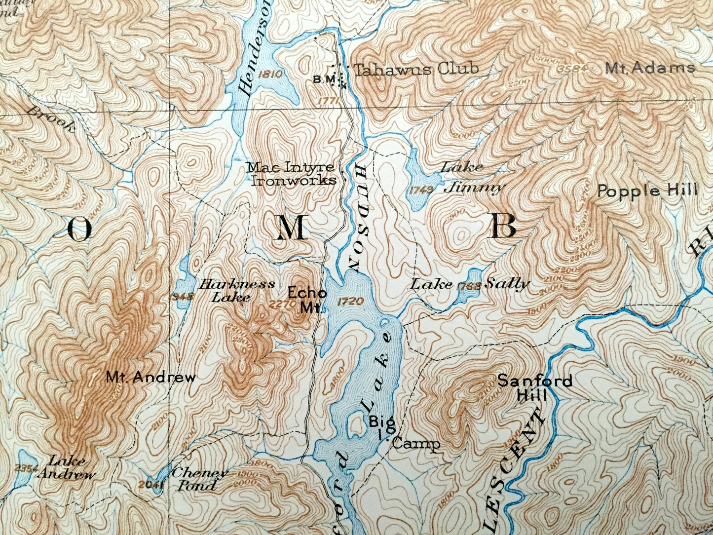
See what The Adirondacks looked like more than 115 years ago. Lots of intricate details and geological contours. Map even has little squares for every house that existed at the time. The USGS cartographers were very thorough back then! On the back is a description of topographic symbols and map guide.
Perfect for the historian, map-lover, the curious or just as a conversation starter. Wonderful and rare. Vintage maps such as this make great gifts.
Edition of 1904, printed 1930
Dimensions: 16 1/2" width x 20" height
----
Features
Cities & Towns: Harrietstown, North Elba, Newcomb, Averyville, Tahawus.
Points of Interest: Franklin County, Essex County, Santanoni Mountains, Ampersand Lake, Henderson Lake, Moose Pond, Wolf Pond, Newcomb Lake, Sanford Lake, Sawtooth Mountains, Ampersand Mountains, Seward Mountains, Street Mountain, MacNaughton Mountain, Duck Hole, Upper Pond, MacIntyre Mountains, Couchsachraga Peak, Dudley Brook, North River Mountains and many more lakes, ponds, islands, coves, hills, mountains, houses, train tracks, roads.
Condition: Good Vintage condition, commensurate with age. This map is in great shape for being 80 years old. Has some wear and folds as-issued, but these will flatten easily and all will add to vintage character when framed.
----
We will happily adjust shipping price for multiple purchases. Maps are rolled up and shipped in sturdy mailing tubes, never folded.
Couldn't load pickup availability
Share