My Store
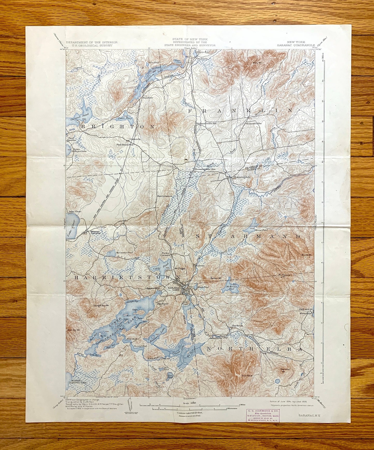
Antique Saranac Lake, New York 1904 US Geological Survey Topographic Map – Adirondacks, Brighton, Franklin, Harrietstown, St Armand, Elba NY
Antique Saranac Lake, New York 1904 US Geological Survey Topographic Map – Adirondacks, Brighton, Franklin, Harrietstown, St Armand, Elba NY
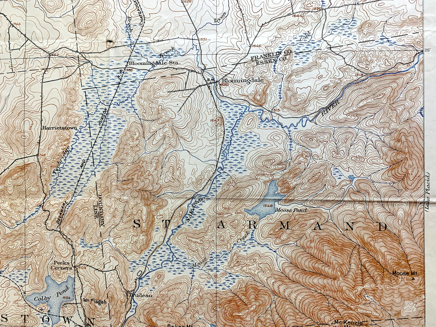
Beautiful, antique map of Saranac, New York and surrounding Franklin and Essex County area. This is an authentic 1904 edition, 1925 print from the U.S. Geological Survey and NOT a computer reproduction.
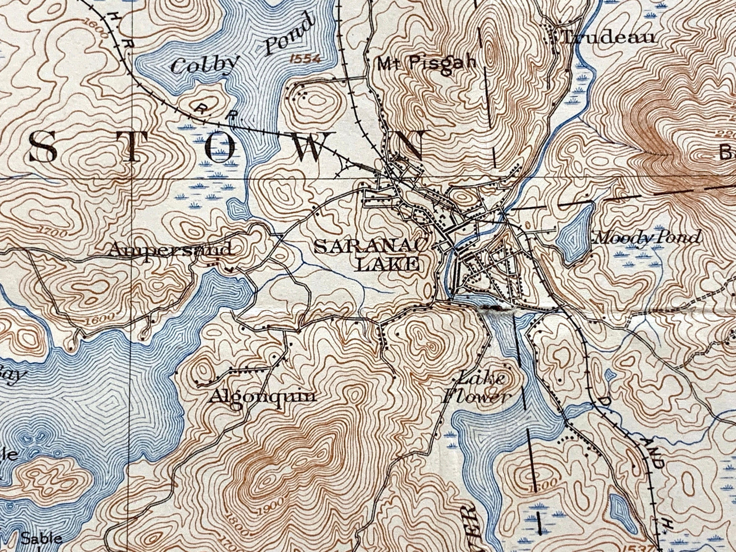
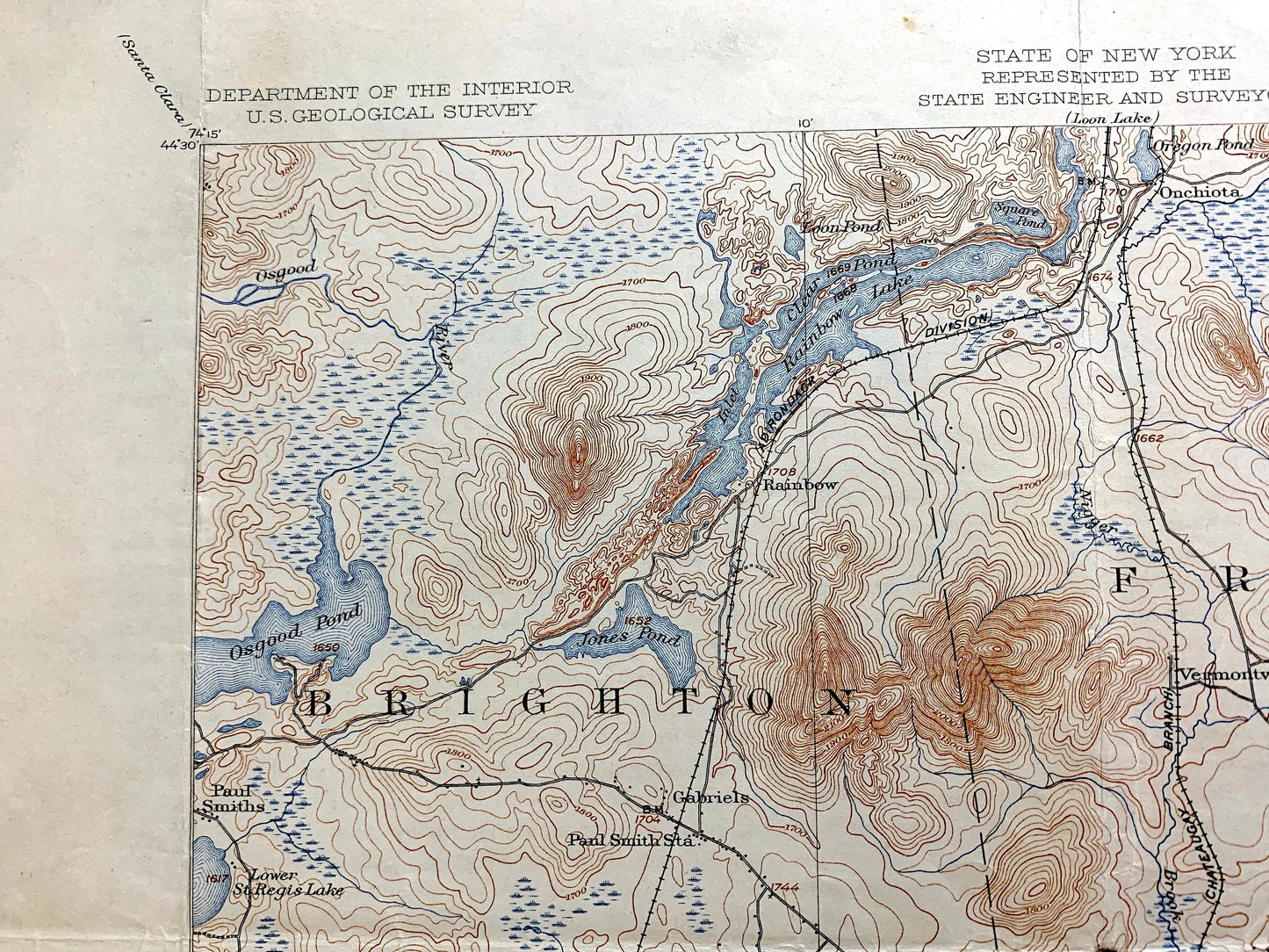
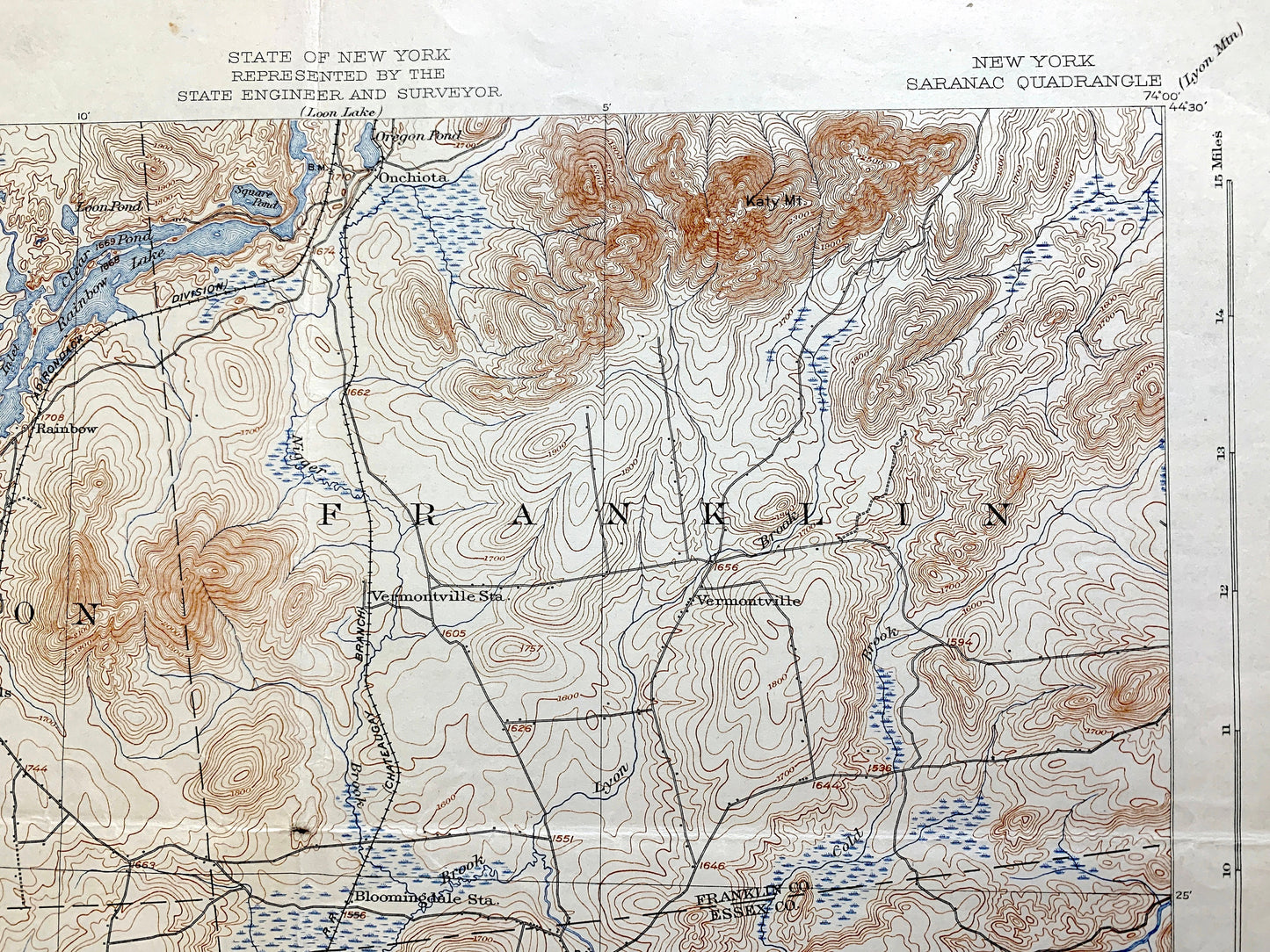
See what the Adirondacks looked like about 120 years ago. Lots of intricate details and geological contours. Map even has little squares for every house that existed. The USGS cartographers were very thorough back then! On the back is a description of topographic symbols and map guide.
Perfect for the historian, map-lover, the curious or just as a conversation starter. Wonderful and rare. Vintage maps such as these make great gifts.
Edition of 1904, printed 1925
Dimensions: 16 1/2" width x 20" height
----
Features
Cities & Towns: Saranac Lake, Brighton, Franklin, Harrietstown, St. Armand, North Elba, Paul Smiths, Paul Smiths Easy Street, Rainbow Lake, Gabriels, Onchiota, Vermontville, Lake Clear Junction, Trudeau, Bloomingdale, Ray Brook, Whitelace.
Bodies of Water: Essex County, Franklin County, Adirondacks, Lower Saranac Lake, Lake Colby, Lake Flower, Oseetah Lake, McKenzie Pond, Lake Clear, Osgood Pond, Rainbow Lake, Jones Pond, Moose Pond, Lake Placid, Saranac River, Ray Brook, Osgood River, Lyon Brook, Mose Mountain, Brewster Mountain, Scarface, Seymour Mountain, Skiff Hill, Flue Hill, McKenzie Mountain, and many more lakes, ponds, islands, coves, hills, mountains, houses, train tracks, roads.
Condition: Good Vintage condition, commensurate with age. This map is in great shape for being almost 100 years old. Has some edge-wear, foxing, toning, stamp in margin, and folds as-issued, but these will flatten easily and all will read as vintage character when framed.
----
We will happily adjust shipping price for multiple purchases. Maps are rolled up and shipped in sturdy mailing tubes, never folded.
Couldn't load pickup availability
Share