My Store
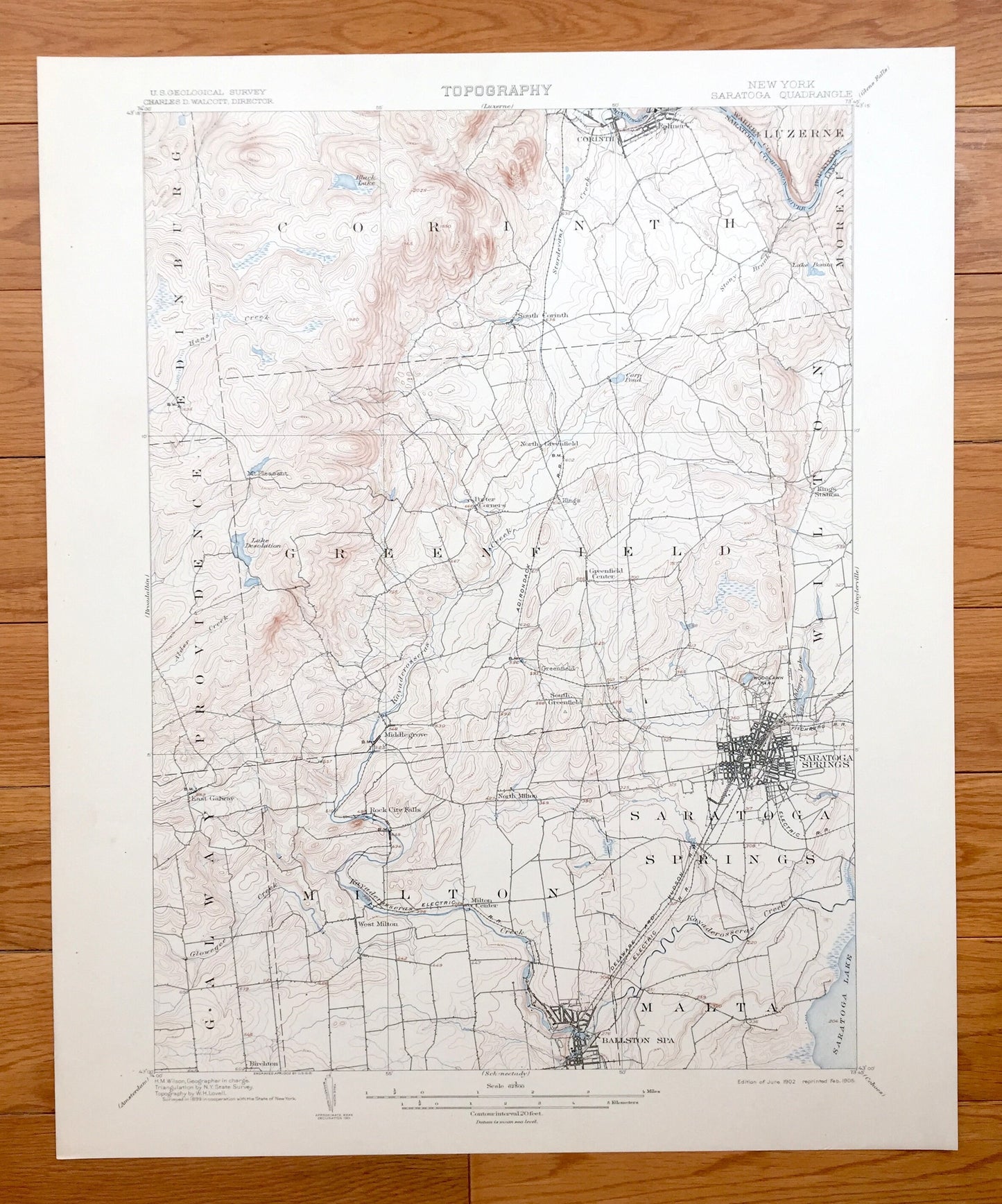
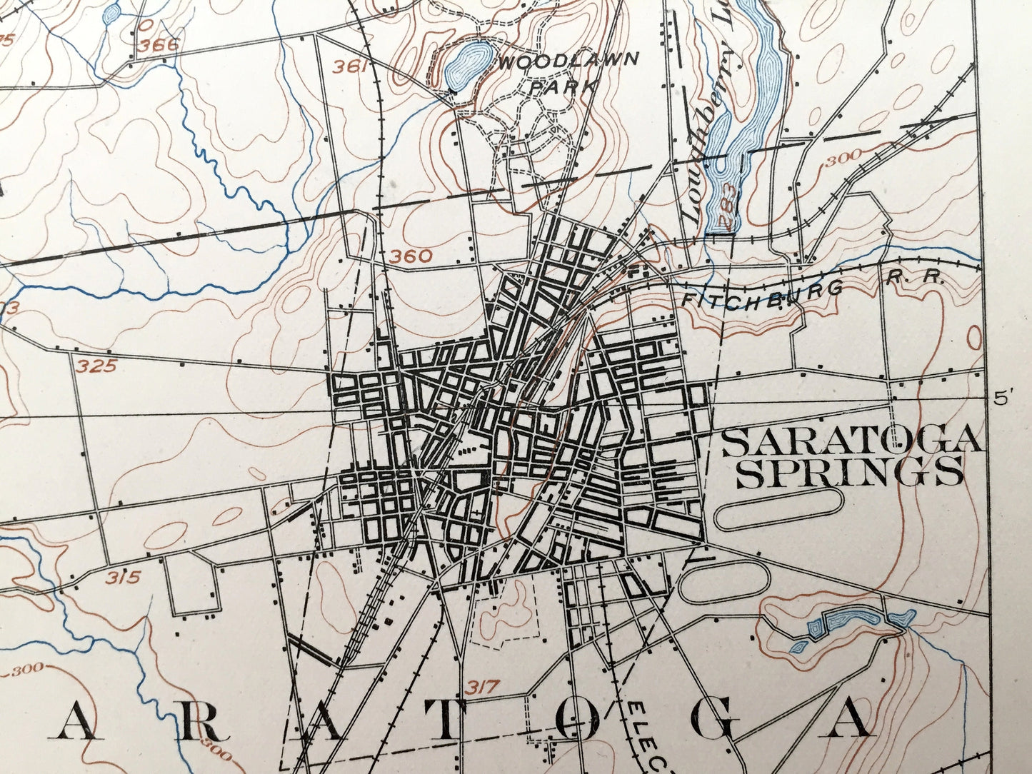
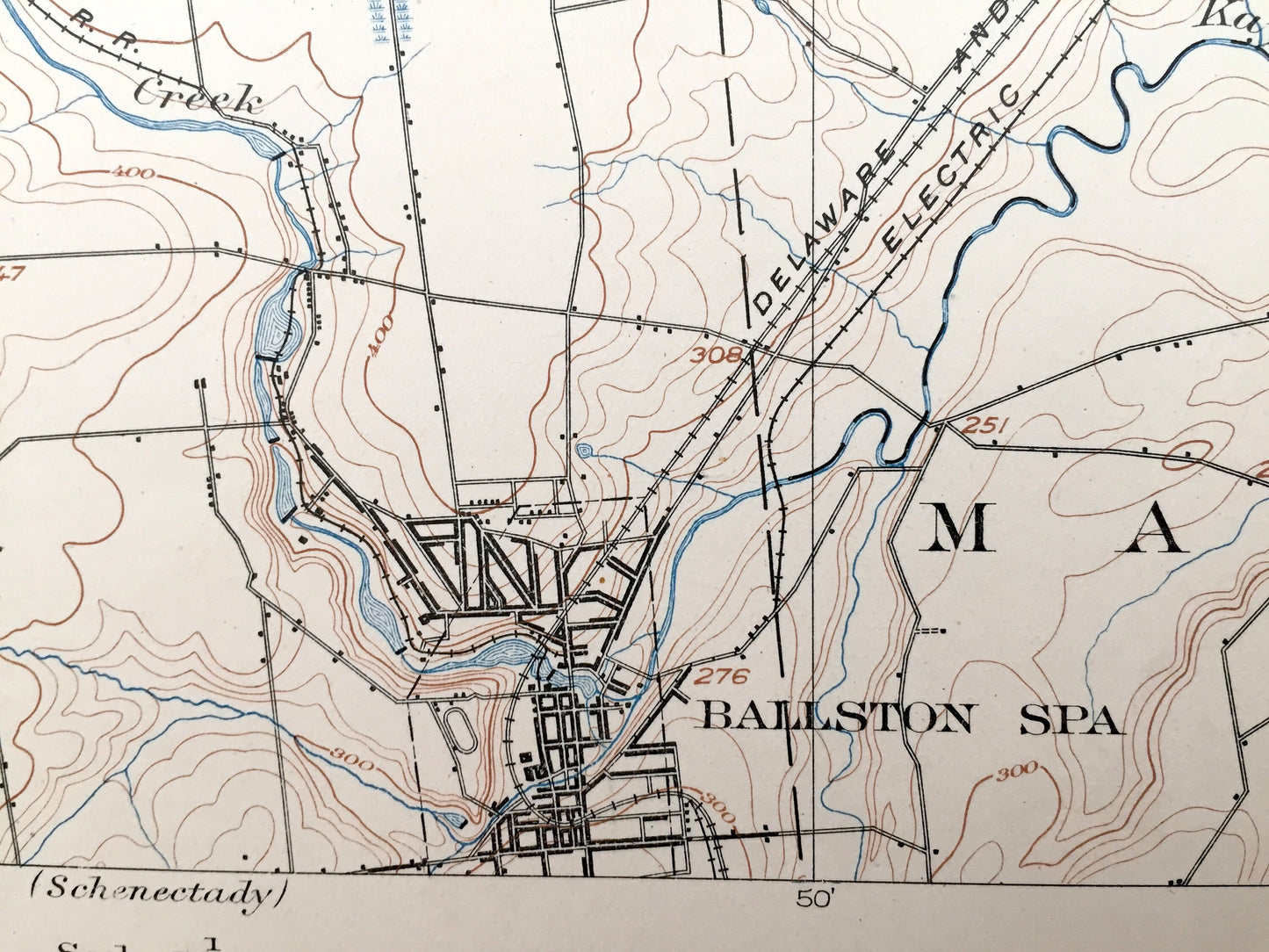
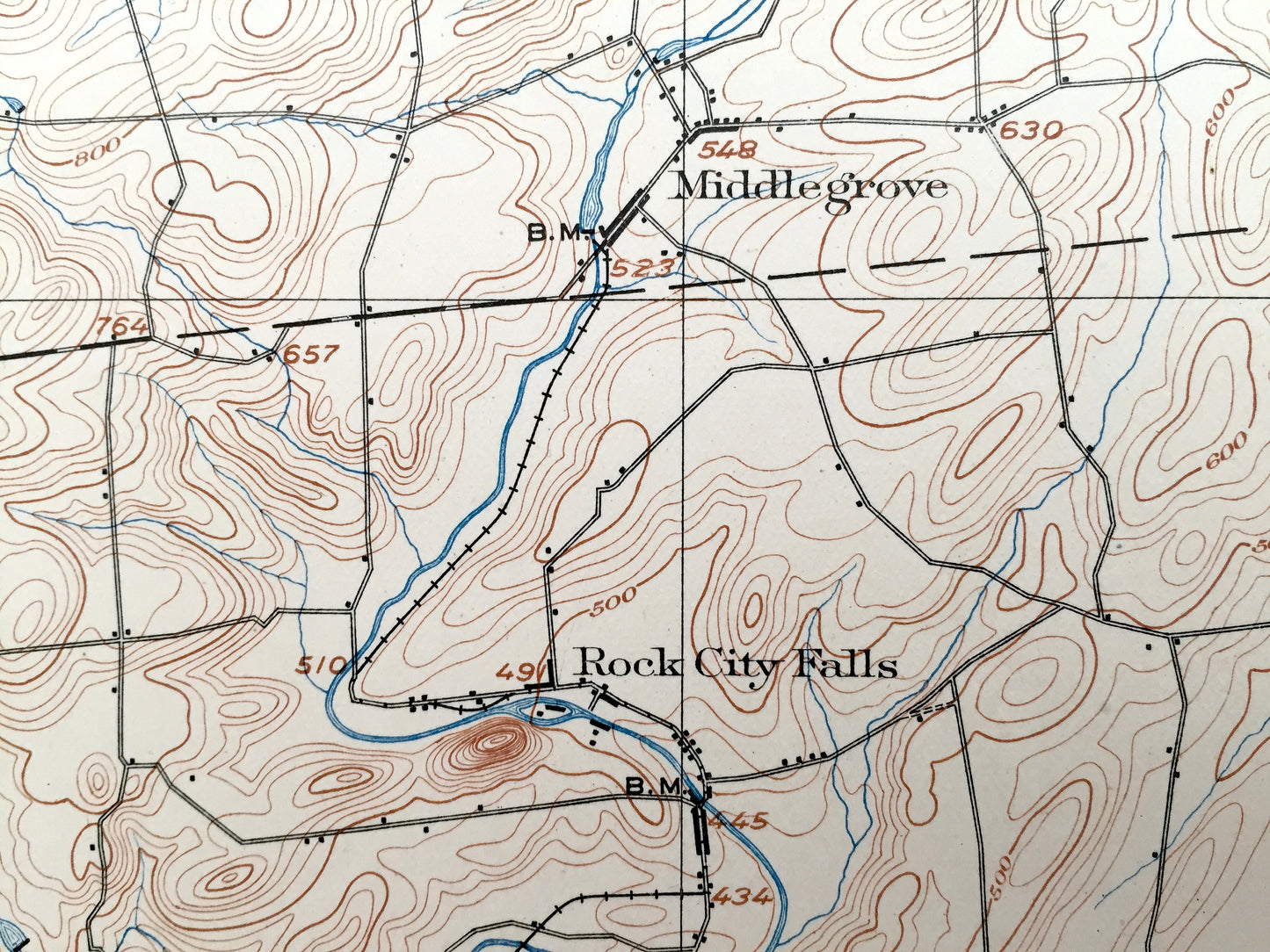
Antique Saratoga Springs, New York 1902 US Geological Survey Topographic Map – Ballston, Corinth, Palmer, Milton, Malta, Wilton, Greenfield
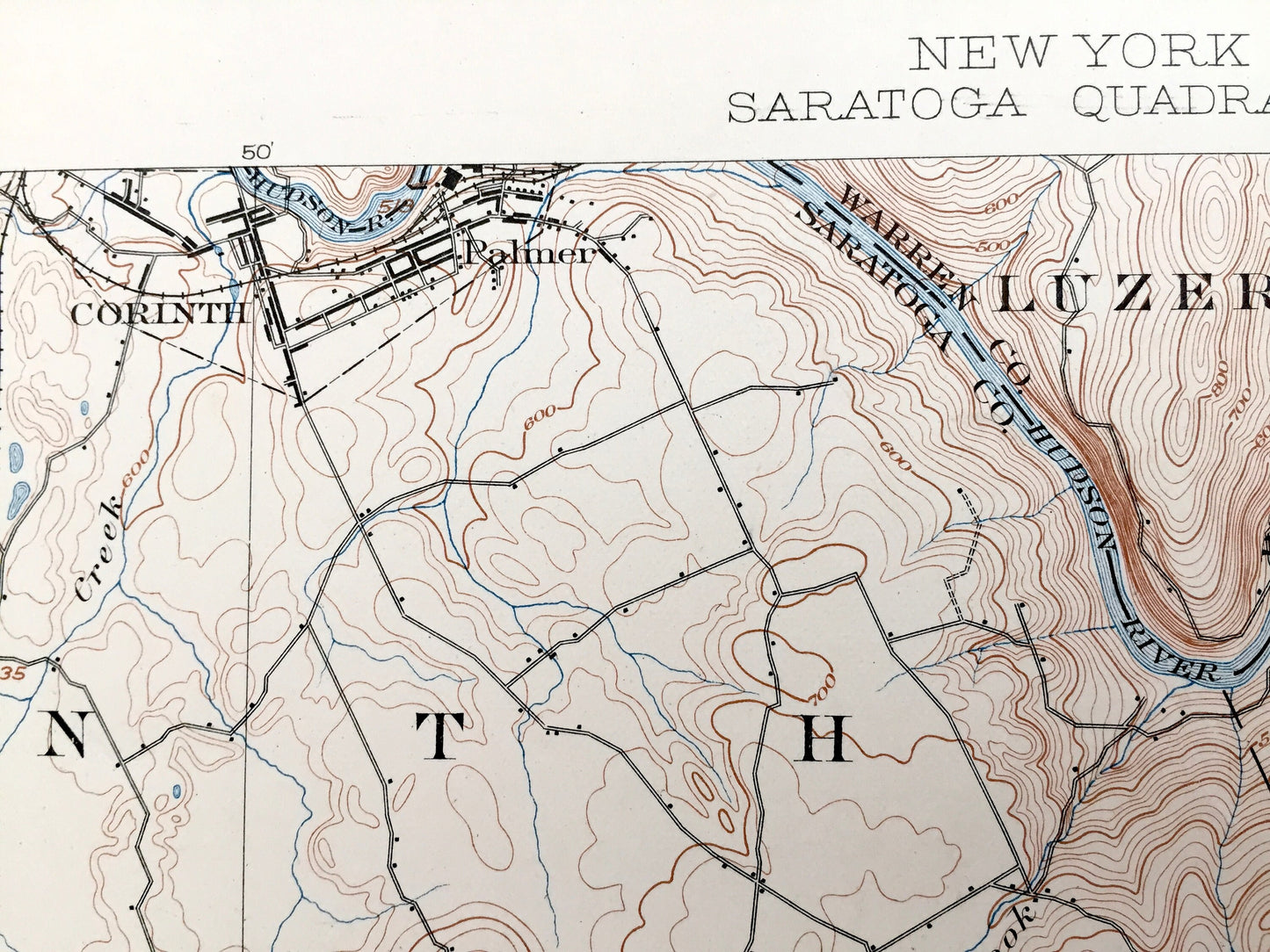
Antique Saratoga Springs, New York 1902 US Geological Survey Topographic Map – Ballston, Corinth, Palmer, Milton, Malta, Wilton, Greenfield
Beautiful, antique map of Saratoga Springs, New York and surrounding Saratoga County & Warren County area. This is an authentic 1902 edition, 1905 print from the U.S. Geological Survey and NOT a computer reproduction.
See what New York looked like more than 120 years ago. Lots of intricate details and geological contours. Map even has little squares for every house that existed at the time. The USGS cartographers were very thorough back then! On the back is a description of topographic symbols and map guide.
Perfect for the historian, map-lover, the curious or just as a conversation starter. Wonderful and rare. Vintage maps such as these make great gifts.
Edition of 1902, printed 1905
Dimensions: 16 1/2" width x 20" height
----
Features
Cities & Towns: Saratoga Springs, Ballston Spa, Corinth, Edinburg, Luzerne, Moreau, Providence, Greenfield, Wilton, Galway, Milton, Malta, South Corinth, Palmer, Mt. Pleasant, Middlegrove, North Greenfield, Porter Corners, Kings, Kings Station, Rock City Falls, West Milton, Birchton.
Points of Interest: Saratoga County, Warren County, Lake Saratoga, Kayaderosseras Creek, Woodlawn Park, Hudson River, Black Lake, Stony Brook, Carp Pond, Lake Desolation, Glowegee Creek, and many more streams, ponds, villages, hills and mountains.
Condition: Very Good Vintage condition, commensurate with age. This map is in great shape for being over 115 years old. An exceedingly well-preserved print.
----
We will happily adjust shipping price for multiple purchases. Maps are rolled up and shipped in sturdy mailing tubes, never folded.
Couldn't load pickup availability
Share