My Store
Antique Saxton, Pennsylvania 1968 US Geological Survey Topographic Map – Bedford County, Huntingdon County, Broad Top City, Defiance, Dudley
Antique Saxton, Pennsylvania 1968 US Geological Survey Topographic Map – Bedford County, Huntingdon County, Broad Top City, Defiance, Dudley
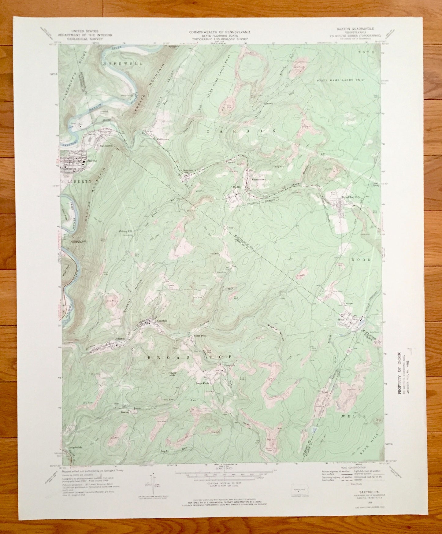
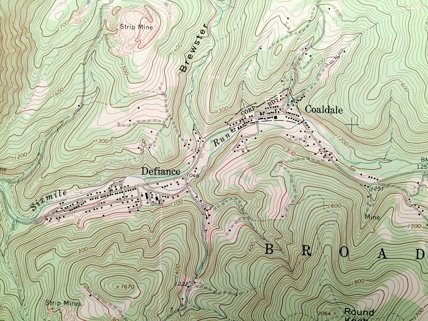
Beautiful, antique map of Saxton, Pennsylvania and surrounding Bedford, Huntingdon, and Fulton County area. This is an authentic 1968 print from the U.S. Geological Survey and NOT a computer reproduction.
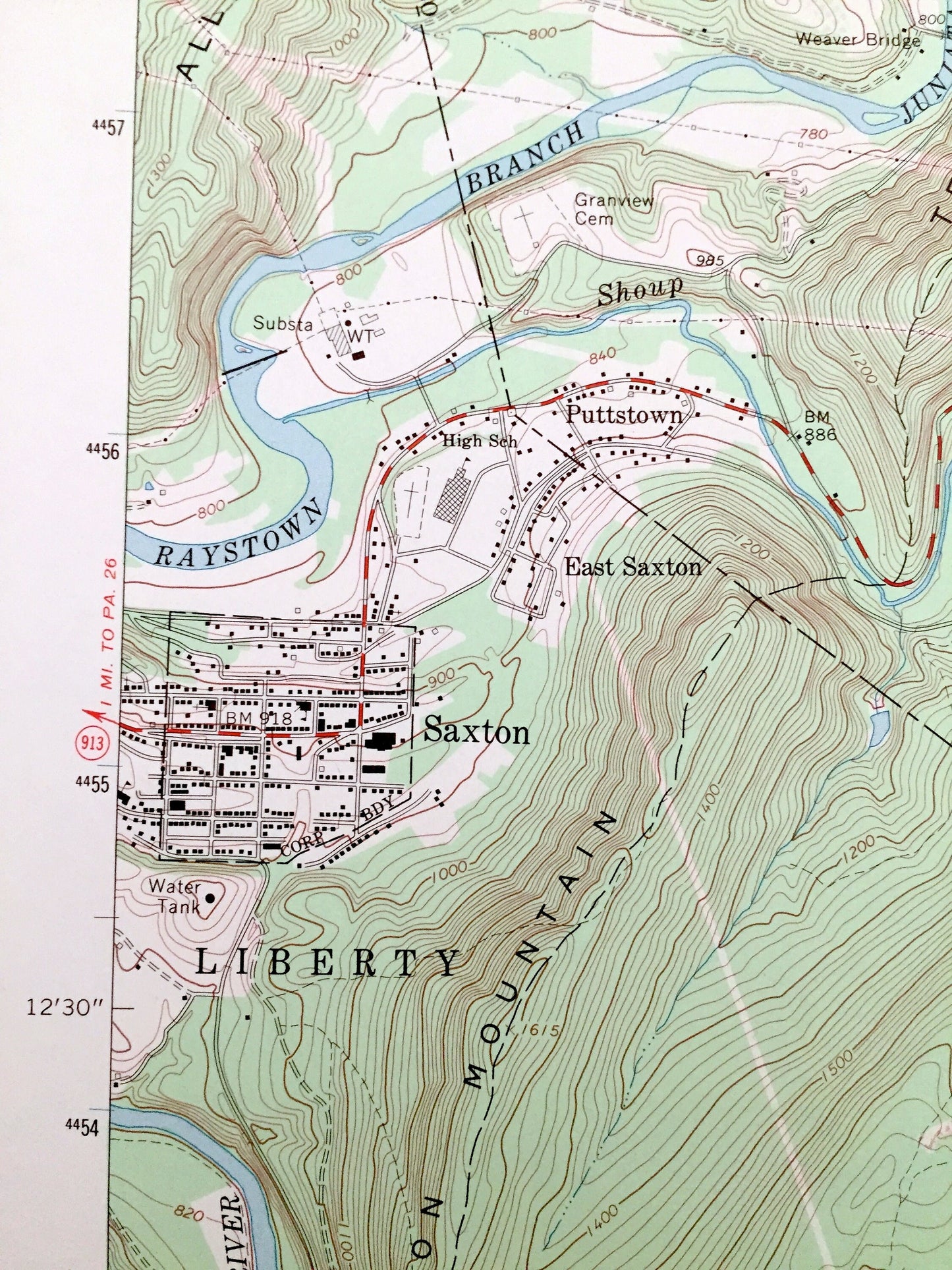
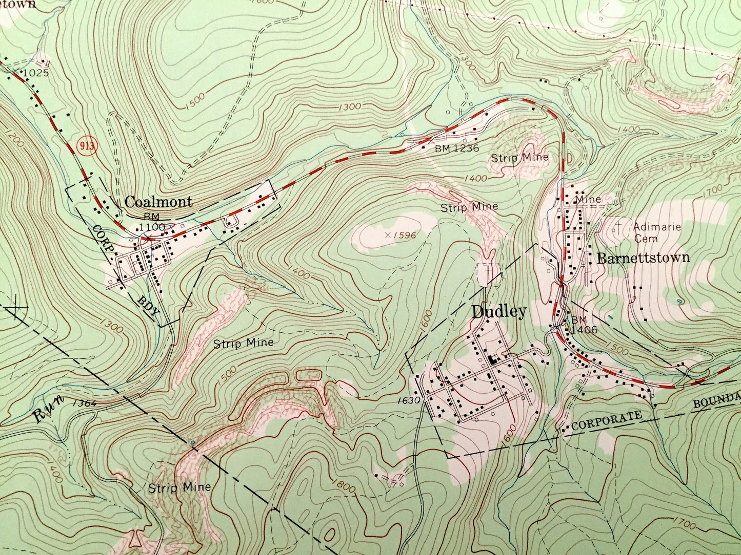
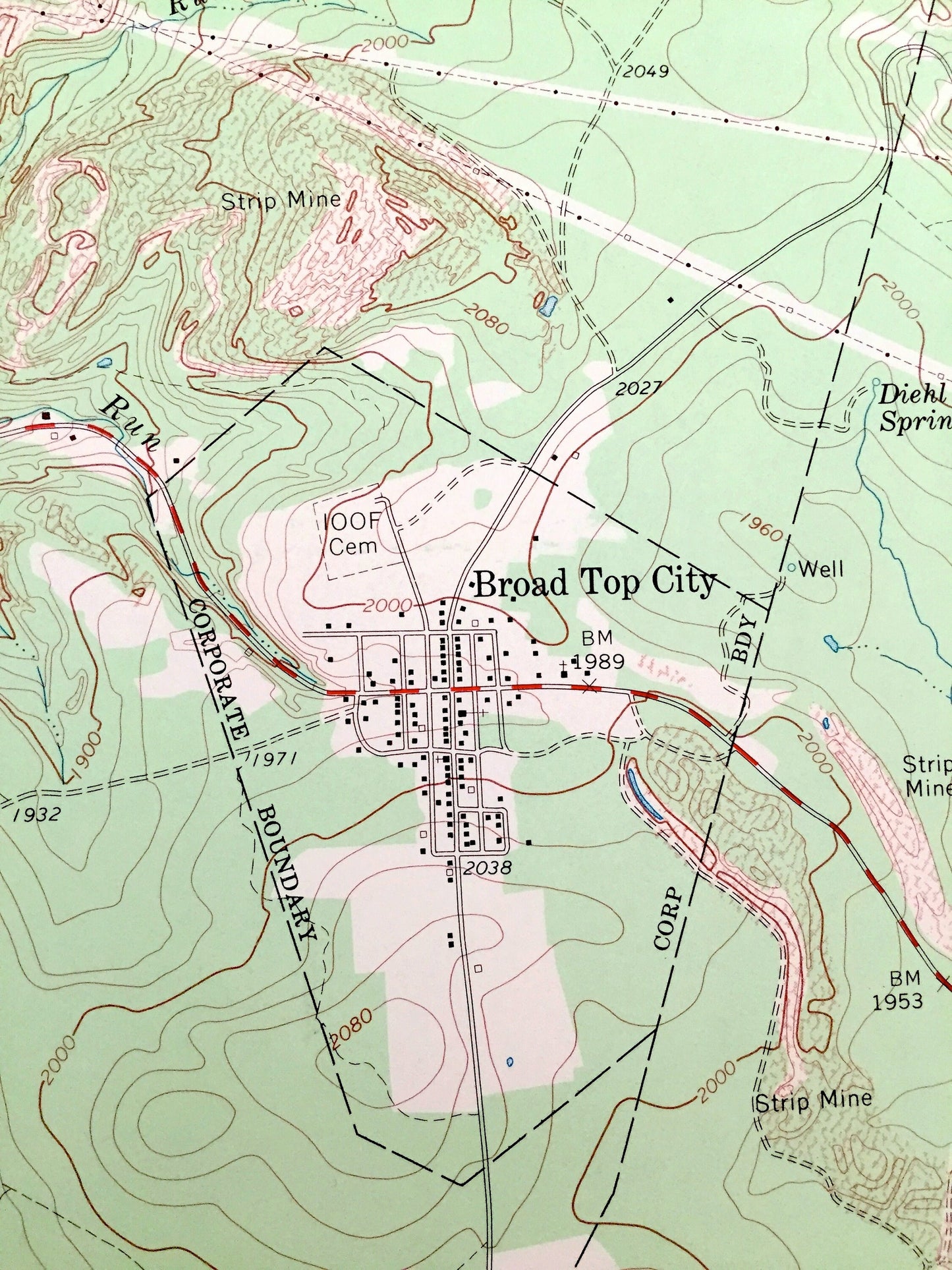
See what Pennsylvania looked like 50 years ago. Lots of intricate details and geological contours. Map even has little squares for every house that existed at the time. The USGS cartographers were very thorough back then!
Perfect for the historian, map-lover, the curious or just as a conversation starter. Wonderful and rare. Vintage maps such as these make great gifts.
Edition of 1968, printed 1968
Dimensions: 22" width x 27" height
----
Features
Cities & Towns: Saxton, East Saxton, Hickory Hill, Defiance, Langdondale, Kearney, Coaldale, North Point, Round Knob, Finleyville, Wood, Alvan, Broad Top, Liberty, Wells, Broad Top City, Dudley, Coalmont, Middletown, Puttstown, Hopewell, Carbon, Kenrock, Barnettstown, Todd.
Points of Interest: Raystown Branch Juniata River, Round Knob, Brewster Hollow, Wisdom Hollow, Sixmile Run, Rays Hill, Shoup Run, Allegrippis Ridge, Terrace Mountain, Little Valley, State Game Lands, Warriors Path State Park, River Mountain, and many more hills, streams, ponds, houses, schools, churches and roads.
Condition: Very Good condition, commensurate with age. This map is in incredible shape for being 50 years old.
----
We will happily adjust shipping price for multiple purchases. Maps are rolled up and shipped in sturdy mailing tubes, never folded.
Couldn't load pickup availability
Share