My Store
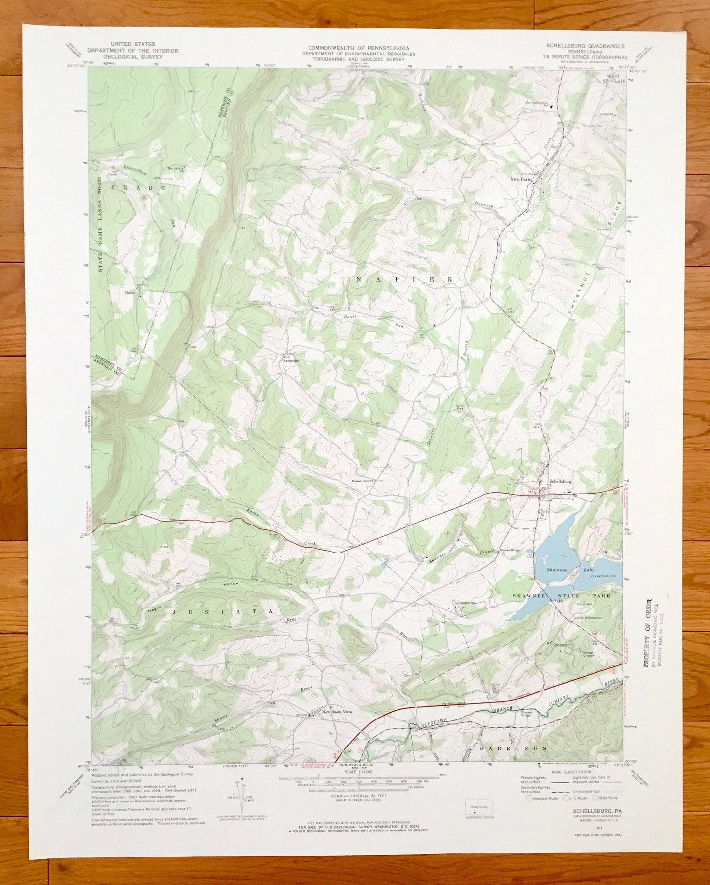
Antique Schellsburg, Pennsylvania 1971 US Geological Survey Topographic Map – Bedford County, Somerset County, Napier, Juniata, Harrison
Antique Schellsburg, Pennsylvania 1971 US Geological Survey Topographic Map – Bedford County, Somerset County, Napier, Juniata, Harrison
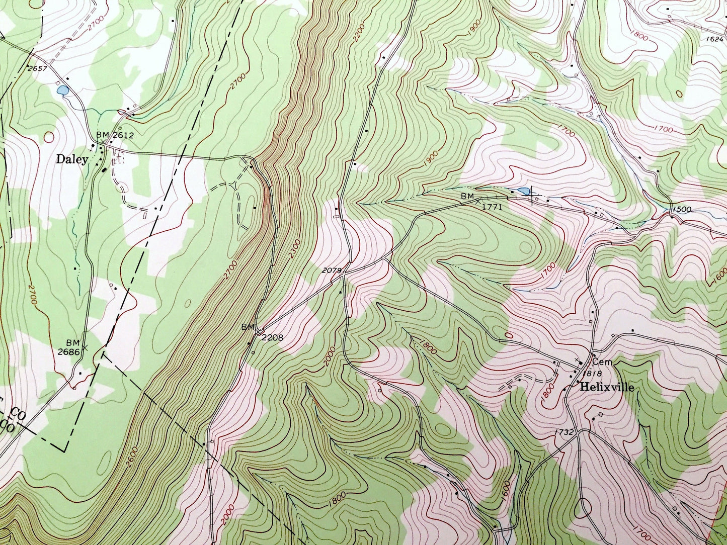
Beautiful, antique map of Schellsburg, Pennsylvania and surrounding Bedford County and Somerset County areas. This is an authentic 1971 edition, 1971 print from the U.S. Geological Survey and NOT a computer reproduction.
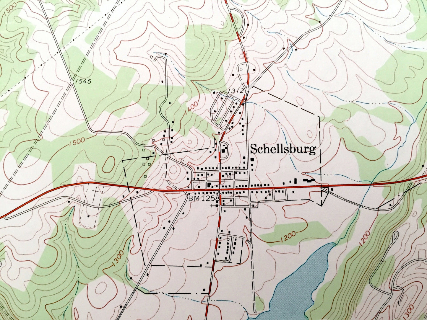
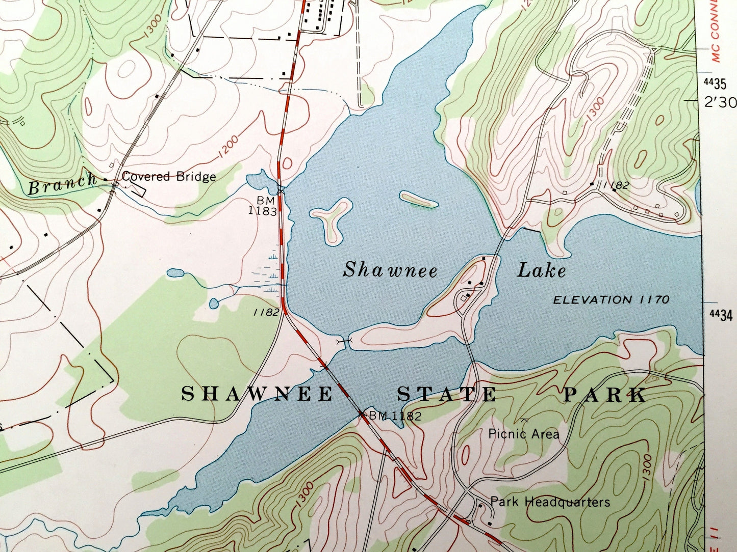
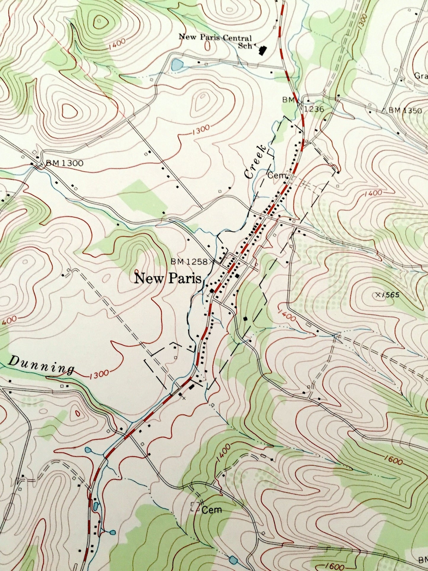
See what Pennsylvania looked like over 45 years ago. Lots of intricate details and geological contours. Map even has little squares for every house that existed at the time. The USGS cartographers were very thorough back then!
Perfect for the historian, map-lover, the curious or just as a conversation starter. Wonderful and rare. Vintage maps such as these make great gifts.
Edition of 1971, printed 1971
Dimensions: 22" width x 27" height
----
Features
Cities & Towns: Schellsburg, New Buena Vista, Shade, New Paris, Daley, West St. Clair, Helixville, Napier, Juniata, Harrison.
Points of Interest: Bedford County, Somerset County, Shawnee State Park, Shawnee Lake, Raystown Branch Juniata River, Chestnut Ridge, Spicer Brook, Shawnee Branch, Burns Creek and many more hills, streams, ponds, houses, schools, churches and roads.
Condition: Very Good condition, commensurate with age. This map is in incredible shape for being over 45 years old. Has some light edge-wear and a stamp, all of which will read as vintage character when framed.
----
We will happily adjust shipping price for multiple purchases. Maps are rolled up and shipped in sturdy mailing tubes, never folded.
Couldn't load pickup availability
Share