My Store
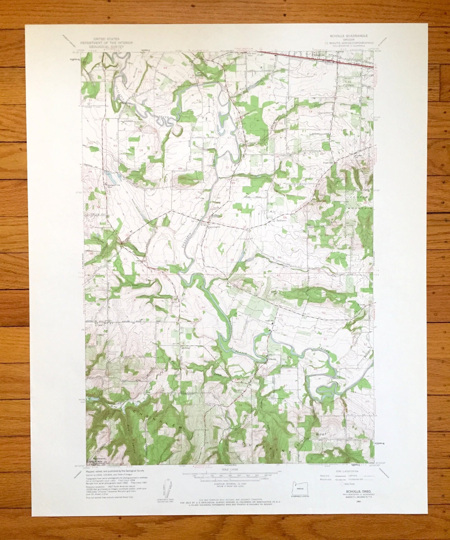
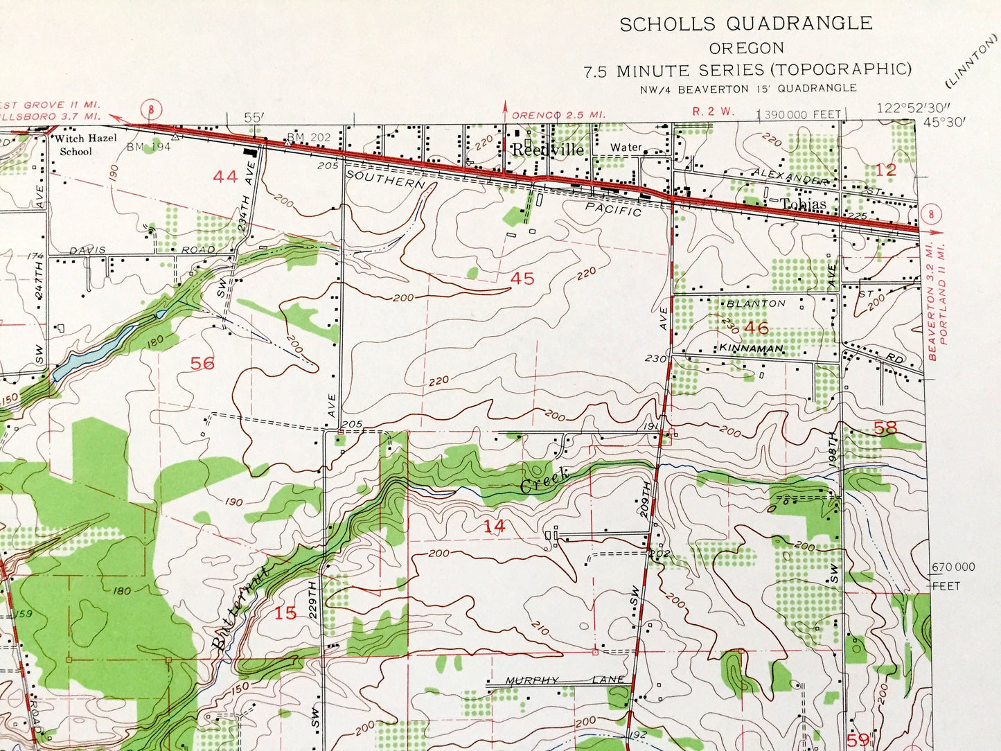
Antique Scholls, Oregon 1961 US Geological Survey Topographic Map – Yamhill, Washington County, Farmington, Reedville, Laurel, Kinton, OR
Antique Scholls, Oregon 1961 US Geological Survey Topographic Map – Yamhill, Washington County, Farmington, Reedville, Laurel, Kinton, OR
Beautiful, antique map of Scholls, Oregon and surrounding Yamhill County and Washington County areas. This is an authentic 1961 edition, 1961 print from the U.S. Geological Survey and NOT a computer reproduction.
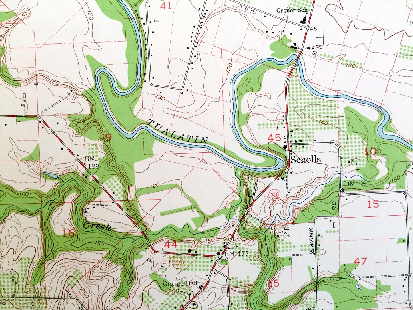
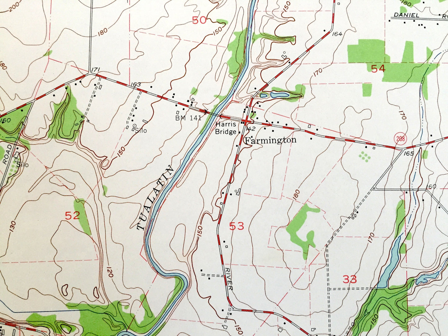
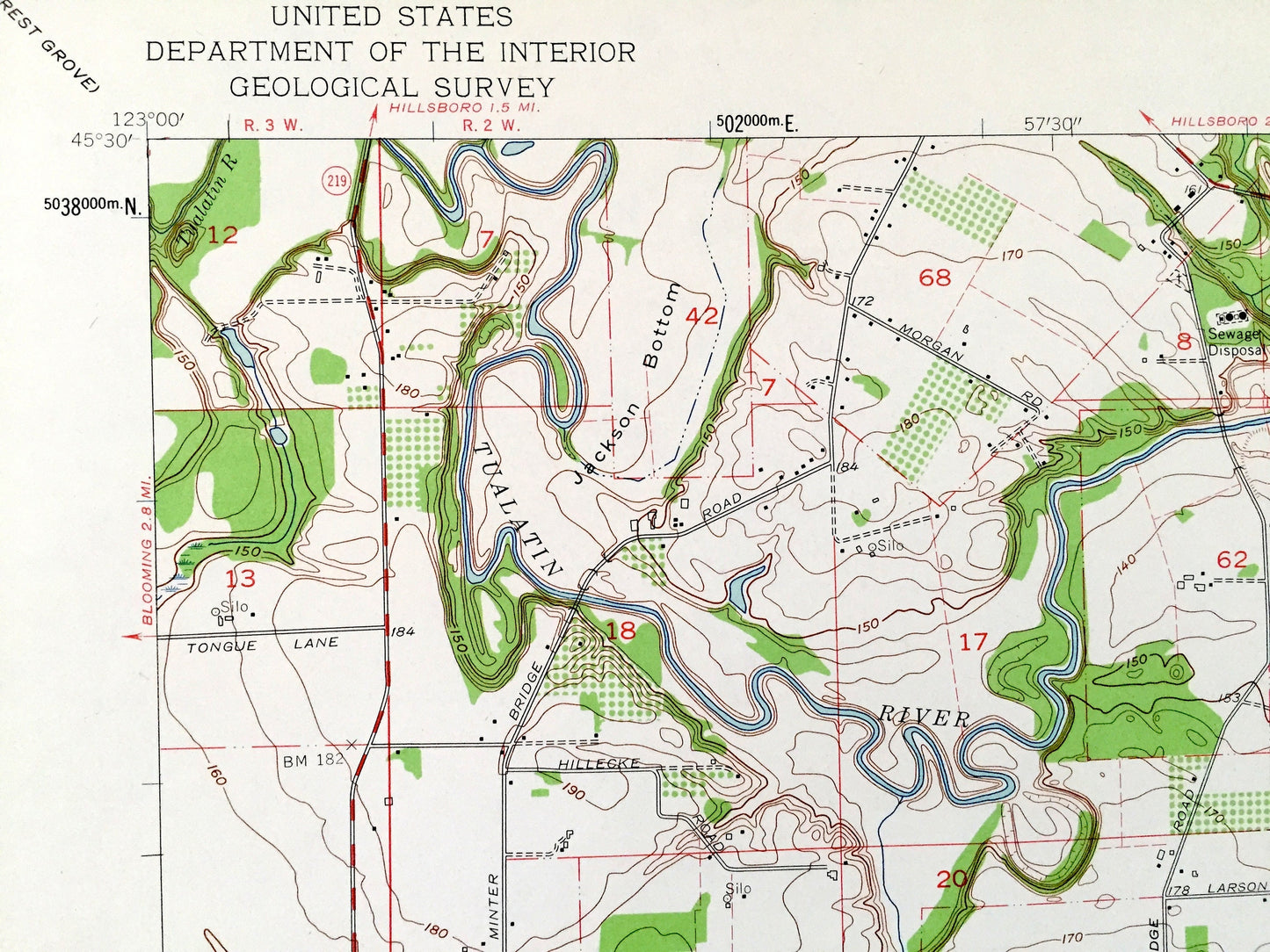
See what Oregon looked like over 60 years ago. Lots of intricate details and geological contours. Map even has little squares for every house that existed at the time. The USGS cartographers were very thorough back then!
Perfect for the historian, map-lover, the curious or just as a conversation starter. Wonderful and rare. Vintage maps such as these make great gifts.
Edition of 1961, printed 1961
Dimensions: 22" width x 27" height
----
Features
Cities & Towns: Farmington, Kinton, Reedville, Laurel, Tobias, Hazeldale, Midway, Jacktown, Buckheaven.
Points of Interest: Chehalem Mountains, Harris Bridge, Cooper Mountain, Laurel Ridge, Tualatin River, Butternut Creek, Christensen Creek, Burris Creek, McFee Creek, Heaton Creek, Baker Creek, and many more hills, streams, ponds, houses, schools, railroads, churches and roads.
Condition: Very Good Vintage condition, commensurate with age. This map is in incredible shape for being over 60 years old.
----
We will happily adjust shipping price for multiple purchases. Maps are rolled up and shipped in sturdy mailing tubes, never folded.
Couldn't load pickup availability
Share