My Store
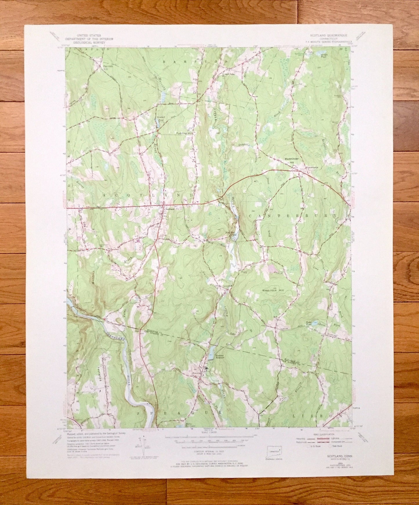
Antique Scotland, Connecticut 1953 US Geological Survey Topographic Map– Windham, New London County, Chaplin, Hampton, Canterbury, Lisbon CT
Antique Scotland, Connecticut 1953 US Geological Survey Topographic Map– Windham, New London County, Chaplin, Hampton, Canterbury, Lisbon CT
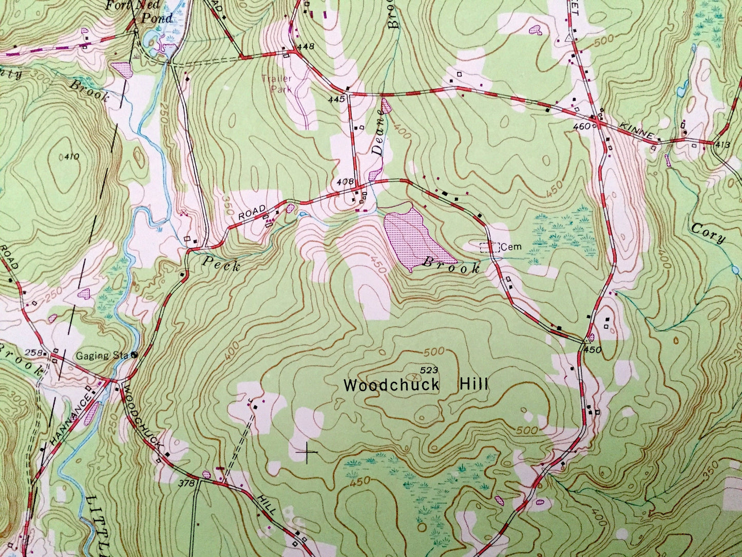
Beautiful, antique map of Scotland, Connecticut and surrounding Windham County and New London County areas. This is an authentic 1953 edition, 1971 print from the U.S. Geological Survey and NOT a computer reproduction.
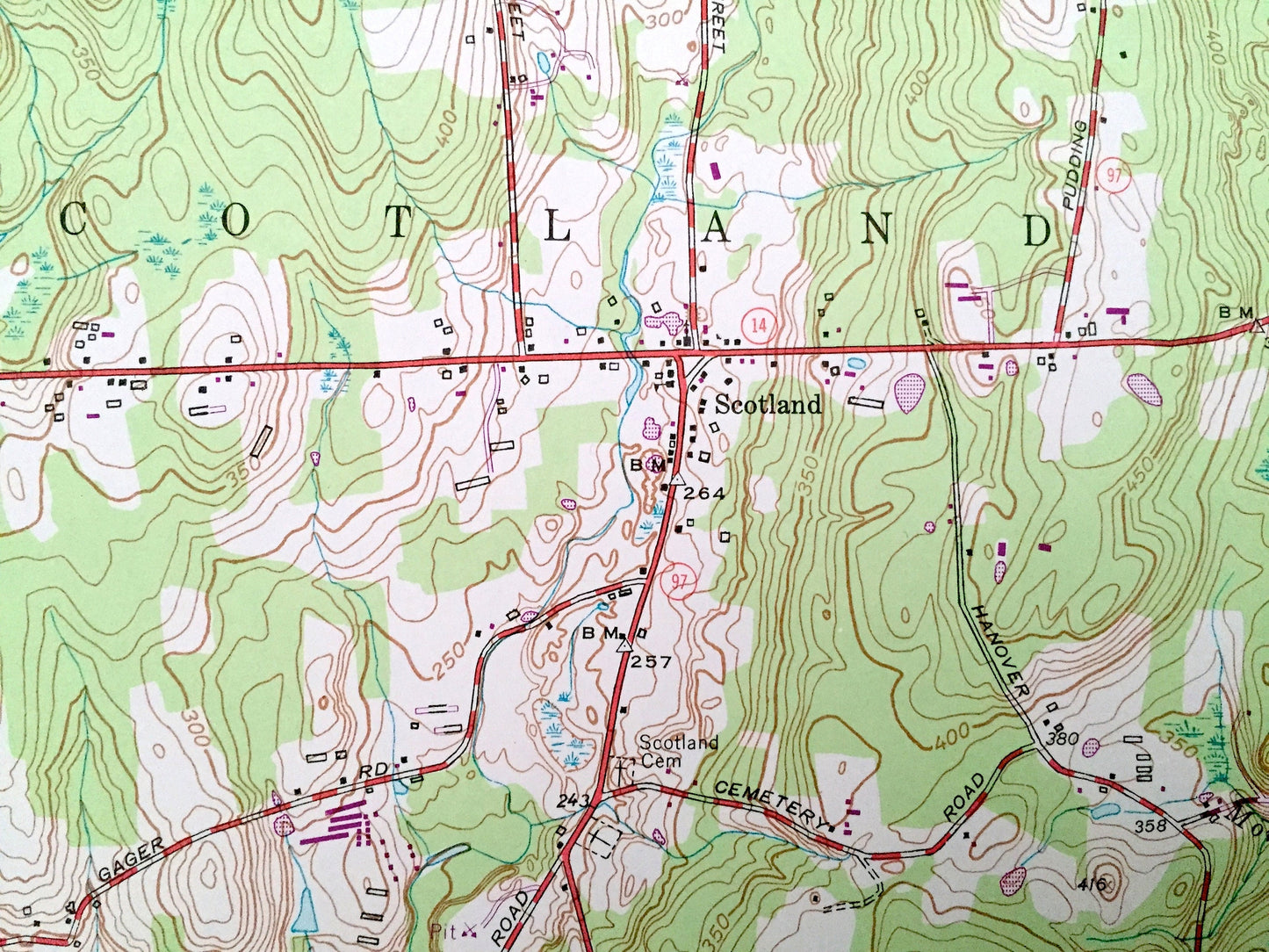
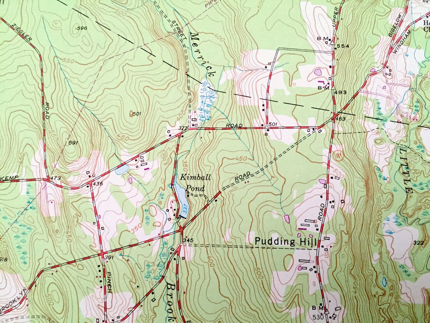
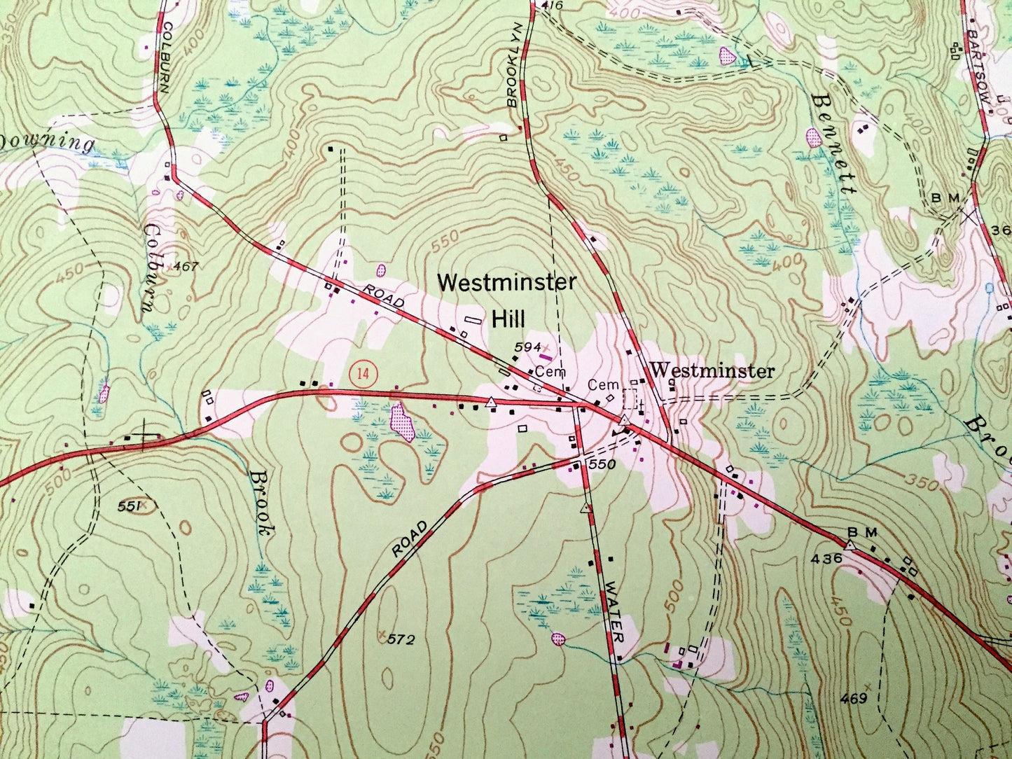
See what Connecticut looked like over 65 years ago. Lots of intricate details and geological contours. Map even has little squares for every house that existed at the time. The USGS cartographers were very thorough back then!
Perfect for the historian, map-lover, the curious or just as a conversation starter. Wonderful and rare. Vintage maps such as these make great gifts.
Edition of 1953, printed 1971
Dimensions: 22" width x 27" height
----
Features
Cities & Towns: Franklin, Sprague, Windham, Westminster, Hanover.
Points of Interest: Parrish Hill, Pudding Hill, Westminster Hill, Woodchuck Hill, Pautipaug Hill, Hanover Reservoir, Baltic Reservoir, Bates Pond, Wright Pond, Kimball Pond, Shetucket River, Merrick Brook, Little River, Downing Brook, Bennett Brook, Beaver Brook, Monty Brook, and many more hills, streams, ponds, houses, schools, railroads, churches and roads.
Condition: Very Good Vintage condition, commensurate with age. This map is in great shape for being over 50 years old. Has subtle edge-wear but will read as character when framed.
----
We will happily adjust shipping price for multiple purchases. Maps are rolled up and shipped in sturdy mailing tubes, never folded.
Couldn't load pickup availability
Share