My Store
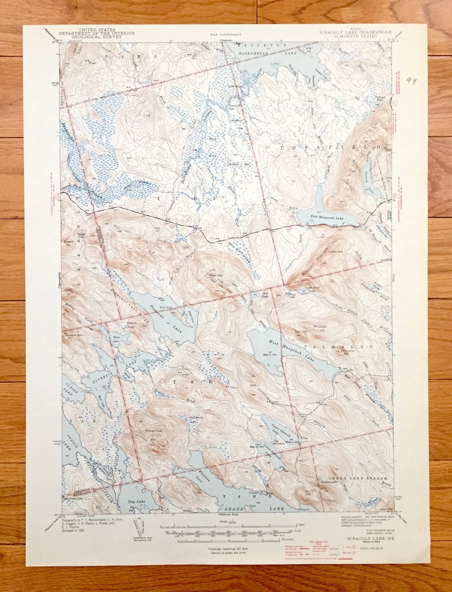
Antique Scraggly Lake, Maine 1944 US Geological Survey Topographic Map– Penobscot, Washington County, Talmadge, Grand Lake Stream, Topsfield
Antique Scraggly Lake, Maine 1944 US Geological Survey Topographic Map– Penobscot, Washington County, Talmadge, Grand Lake Stream, Topsfield
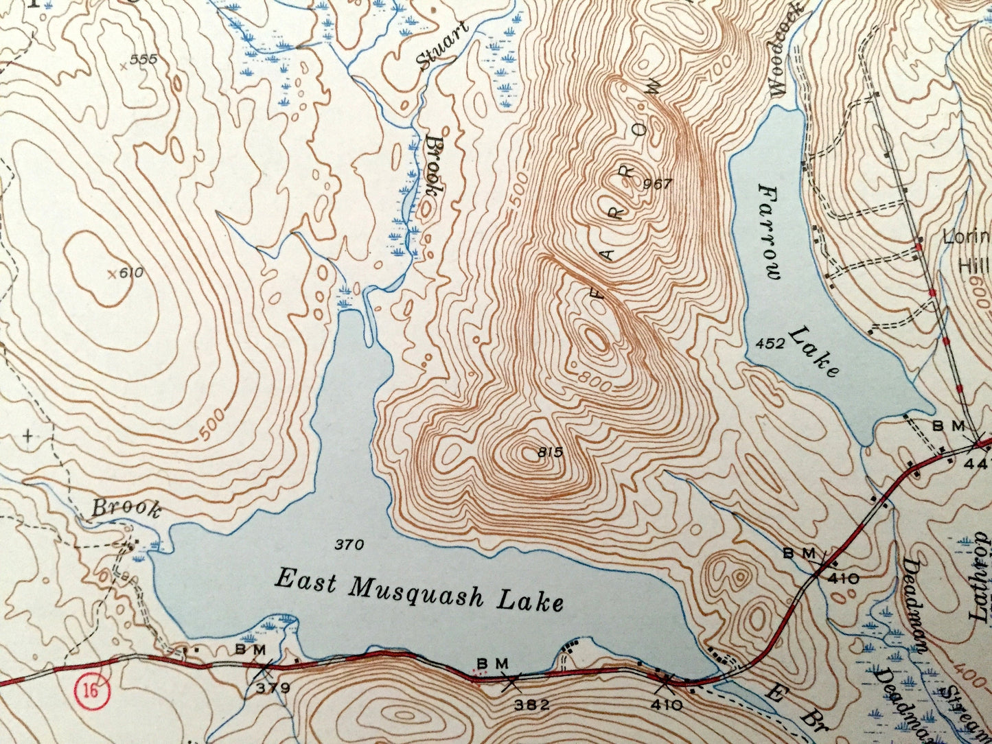
Beautiful, antique map of Scraggly Lake, Maine and surrounding Washington & Penobscot County area. This is an authentic 1944 edition, 1944 print from the U.S. Geological Survey and NOT a computer reproduction.
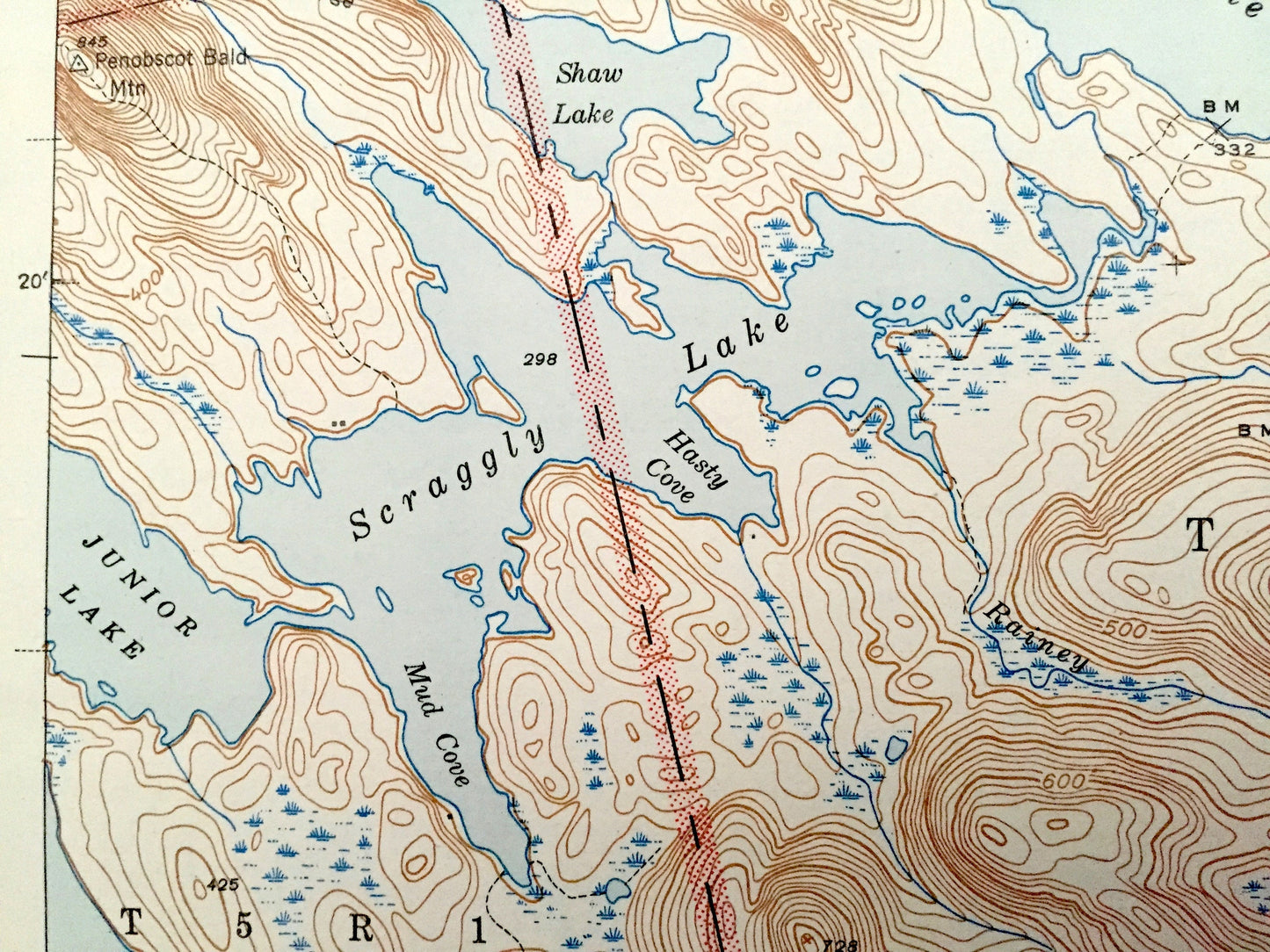
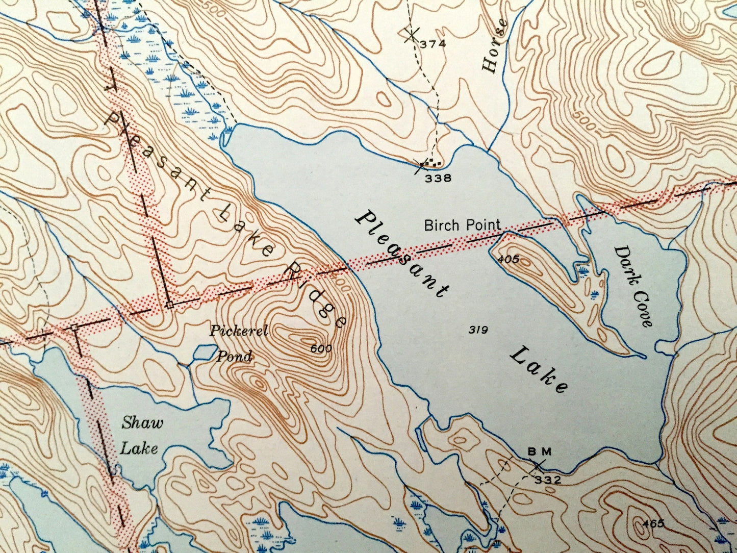
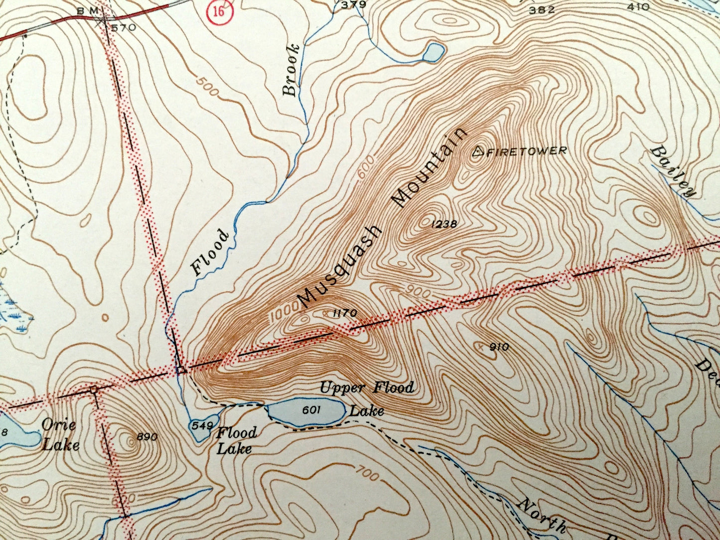
See what Maine looked like over 75 years ago when large parts of the state were still unnamed. Lots of intricate details and geological contours. Map even has little squares for every house that existed at the time. The USGS cartographers were very thorough back then!
Perfect for the historian, map-lover, the curious or just as a conversation starter. Wonderful and rare. Vintage maps such as these make great gifts.
Edition of 1944, printed 1944
Dimensions: 14 1/2" width x 20" height
----
Features
Cities & Towns: Brookton, Talmadge, Grand Lake Stream, Carroll, Topsfield.
Points of Interest: Penobscot County, Washington County, Baskahegan Lake, East Musquash Lake, Pleasant Lake, Scraggly Lake, Junior Lake, Pug Lake, Grand Lake, Musquash Mountain, Mt Delight, Porcupine Mountain, Horse Hill Brook, Baskahegan Stream, and many more streams, ponds, and mountains.
Condition: Very Good Vintage condition, commensurate with age. This map is in great shape for being almost over 75 years old. Very light edge-wear and margin pencil but this will add to vintage character when framed.
----
We will happily adjust shipping price for multiple purchases. Maps are rolled up and shipped in sturdy mailing tubes, never folded.
Couldn't load pickup availability
Share