My Store
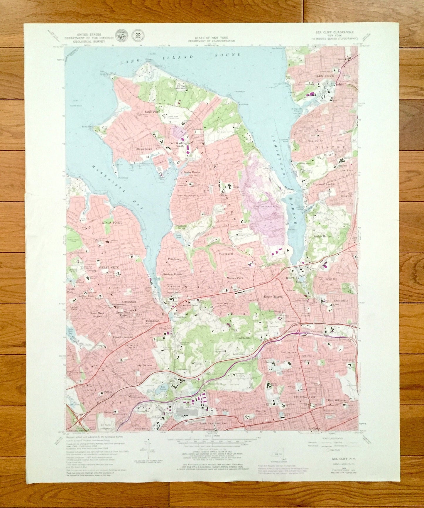
Antique Sea Cliff, New York 1968 US Geological Survey Topographic Map – Queens, Nassau County, Oyster Bay, Glen Cove, North Hempstead, NY
Antique Sea Cliff, New York 1968 US Geological Survey Topographic Map – Queens, Nassau County, Oyster Bay, Glen Cove, North Hempstead, NY
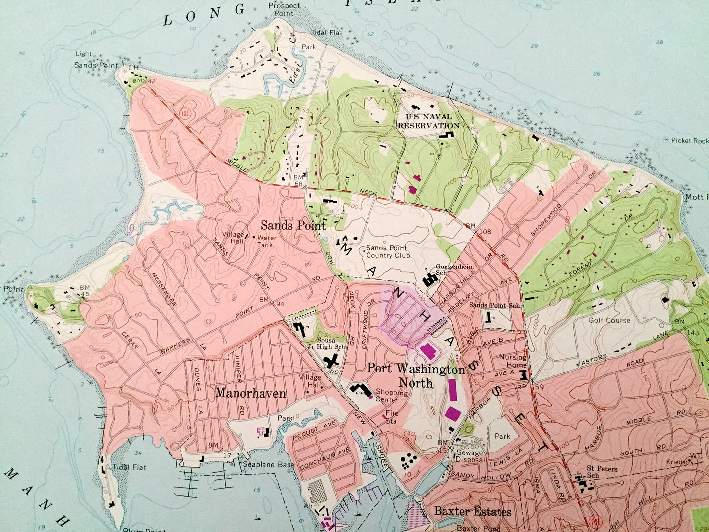
Beautiful, antique map of Sea Cliff, New York and surrounding Queens County and Nassau County areas. This is an authentic 1968 edition, 1979 print from the U.S. Geological Survey and NOT a computer reproduction.
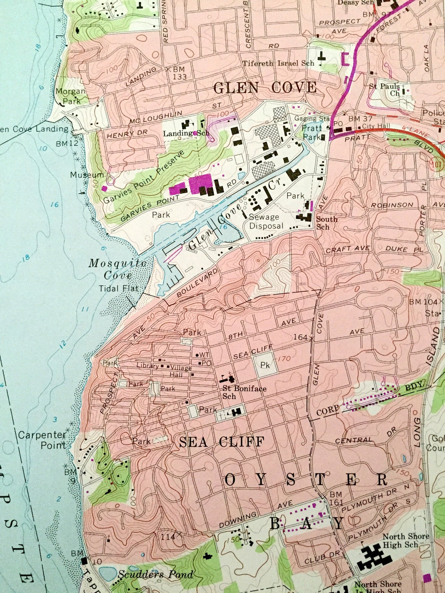
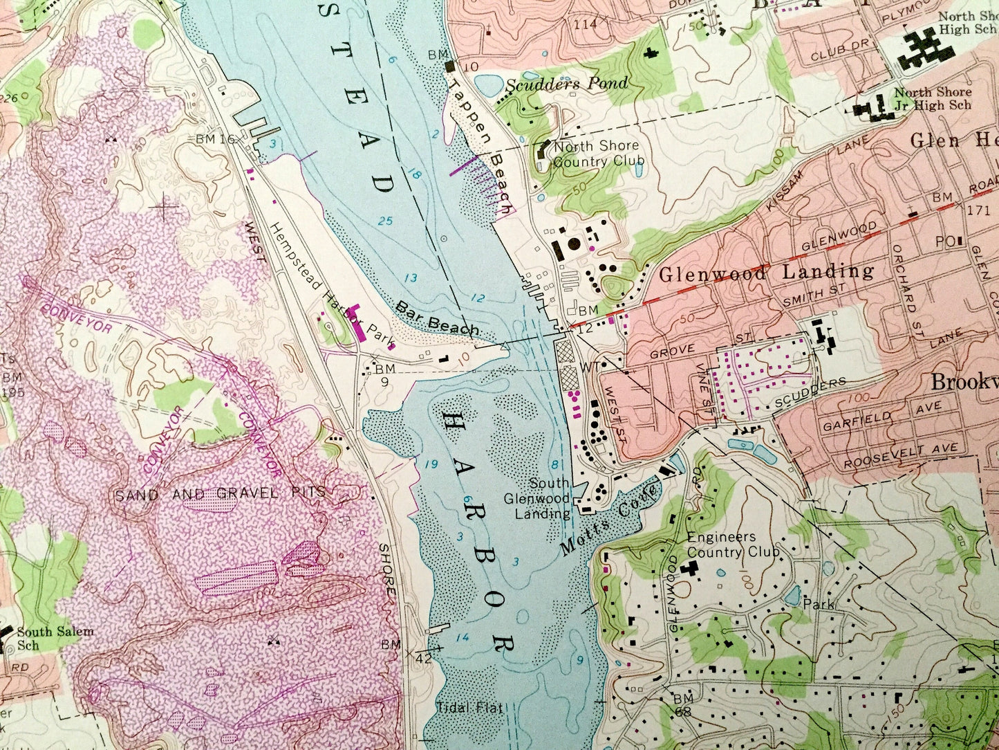
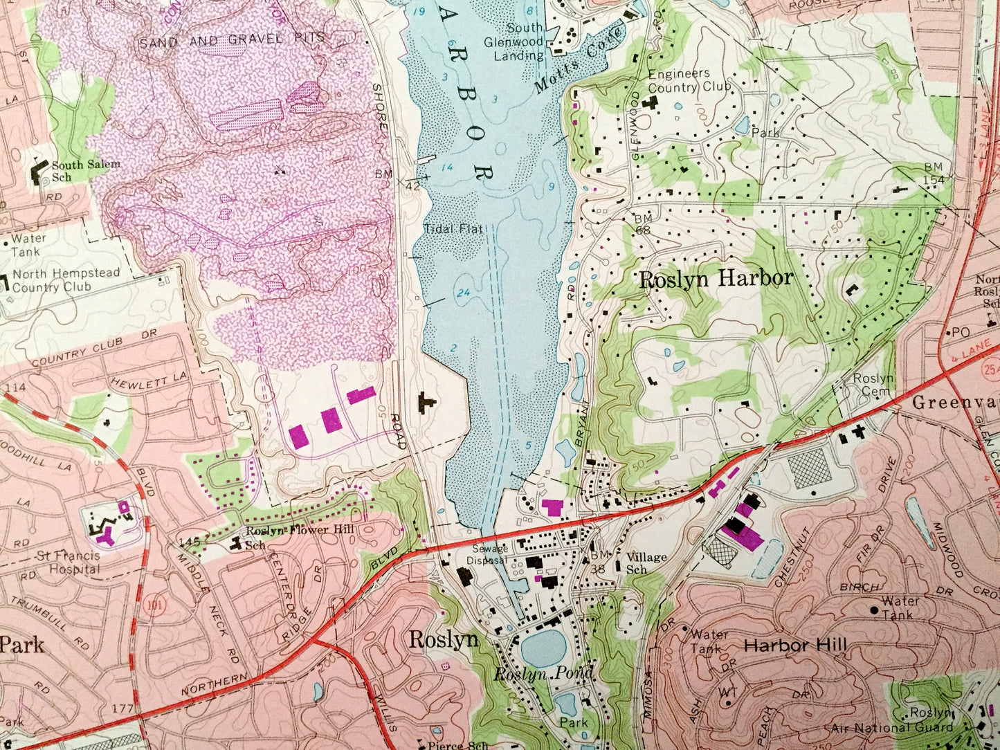
See what New York looked like over 50 years ago. Lots of intricate details and geological contours. Map even has little squares for every house that existed at the time. The USGS cartographers were very thorough back then!
Perfect for the historian, map-lover, the curious or just as a conversation starter. Wonderful and rare. Vintage maps such as these make great gifts.
Edition of 1968, printed 1979
Dimensions: 22" width x 27" height
----
Features
Cities & Towns: Queens, Kings Point, Great Neck, Saddle Rocks, Saddle Rock Estates, Harbor Hills, Great Neck Estates, Kensington, Great Neck Plaza, Thomaston, Russell Gardens, University Gardens, Lake Success, Douglaston, Little Neck, Oakland Gardens, Glen Oaks, Sands Point, Manorhaven, Port Washington North, Baxter Estates, Port Washington, Plandome, Plandome Manor, Plandome Heights, Flower Hill, Munsey Park, Manhasset, Strathmore, North Hills, North New Hyde Park, Roslyn, Roslyn Estates, Herricks, Mineola, Williston Park, East Williston, Searingtown, Albertson, Roslyn Heights, East Hills, Roslyn Harbor, Old Brookville, Glen Head, Glenwood Landing.
Points of Interest: US Naval Reservation, Kings Point Park, Alley Park, Long Island Jewish Hospital, Hillside Hospital, Grace Avenue Park, Garvies Point Preserve Park, Lake Success, Glen Cove, Mosquito Cove, Whitney Lake, Leeds Pond, Little Neck Bay, Mitchell Creek, Riddler Pond, Long Island Sound, Manhasset Bay, Hempstead Harbor, and many more hills, streams, ponds, houses, schools, railroads, churches and roads.
Condition: Good Vintage condition, commensurate with age. This map is in great shape for being over 40 years old. Has light edge-wear and fold creases, all of which will read as character when framed.
----
We will happily adjust shipping price for multiple purchases. Maps are rolled up and shipped in sturdy mailing tubes, never folded.
Couldn't load pickup availability
Share