My Store
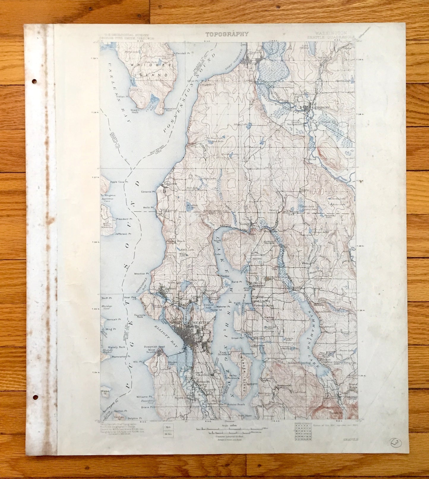
Antique Seattle, Washington 1895 US Geological Survey Topographic Map – Puget Sound, Snohomish, King, Kitsap County, Sammamish Green Lake WA
Antique Seattle, Washington 1895 US Geological Survey Topographic Map – Puget Sound, Snohomish, King, Kitsap County, Sammamish Green Lake WA
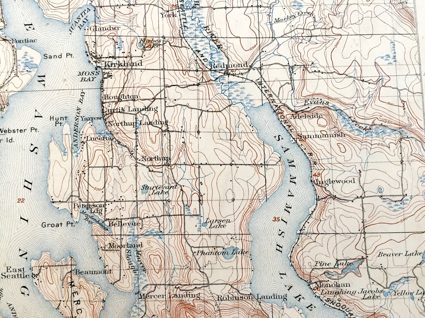
Beautiful, antique map of the Seattle, Washington and Puget Sound area. This is an authentic 1897 edition, 1909 print from the U.S. Geological Survey and NOT a computer reproduction.
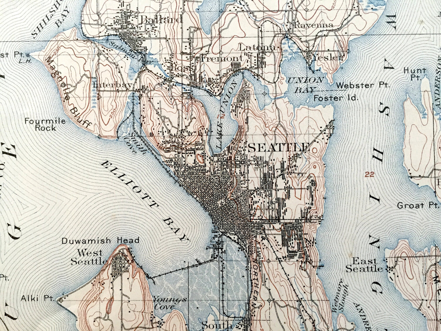
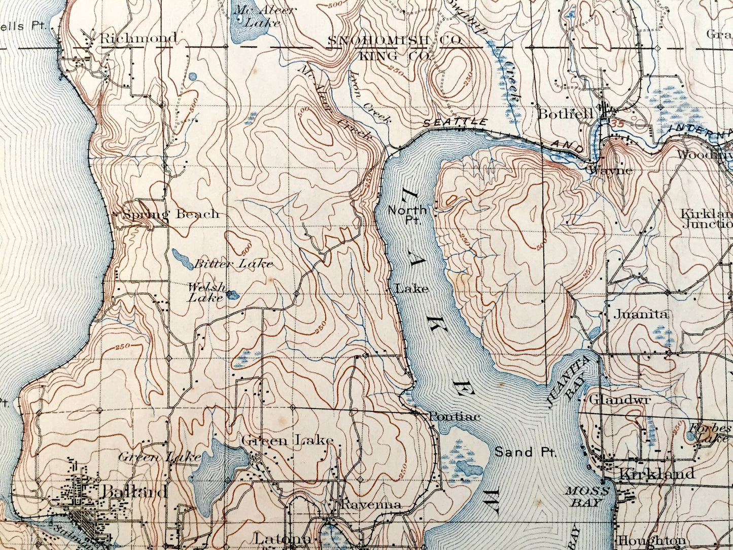
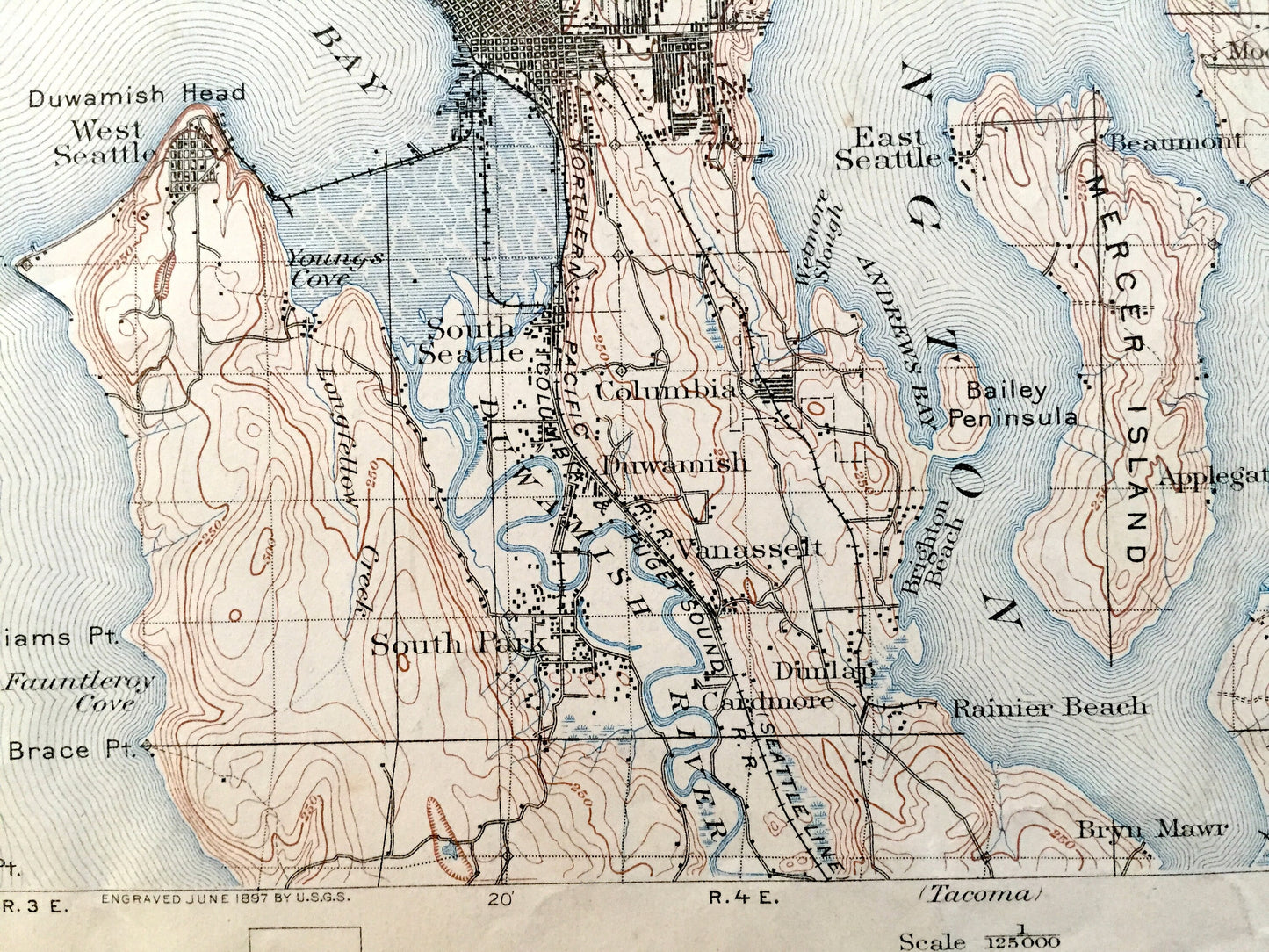
See what Seattle and Puget Sound looked like over 125 years ago. Lots of intricate details and geological contours. Map even has little squares for every house that existed at the time. The USGS cartographers were very thorough back then!
Perfect for the historian, map-lover, the curious or just as a conversation starter. Wonderful and rare. Vintage maps such as this make great gifts.
Edition of 1897, printed 1909
Dimensions: 16 1/2" width x 20" height (The atlas binding on the left margin is another inch.)
----
Features
Cities & Towns: King County, Kitsap County, Snohomish County, Seattle, Clinton, Island, Everett, Machias, Valalta, Lowell, Snohomish, South Snohomish, Edmonds, Maltby, Cathcart, Bothell, Richmond, Grace, Woodinville, Spring Ranch, Wayne, Ballard, Fremont, Green Lake, Latona, Ravenna, Pontiac, Kingston, Interbay, Yesler, West Seattle, South Seattle, Columbia, Duwamish, Vanassett, South Park, Cardmore, Rainier Beach, Bryn Mawr, Juanita, Glandwr, York, Kirkland, Houghton, Curtis Landing, Northup Landing, Lucerne, Yarrow, Northun, Bellevue, Moorland, Redmond, Mercer Landing, Beaumont, Applegate, Robinson Landing, Newcastle Landing, Newcastle, Coal Creek, Issaquah, Monohan, Inglewood, Sammamish, Adelaide, and many more.
Points of Interest: Puget Sound, Useless Bay, Possession Sound, Elliott Bay, Lake Washington, Sammamish Lake, Whidbey Island, Lake Union, Snohomish River, Mercer Island, Port Madison Indian Reservation, Appletree Cove, MaAleer Lake, Green Lake, Duwamish Head, Sammamish River, Juanita Bay, Port Gardner, Duwamish River, Squak Mountain and many more towns, bays, rivers, islands, train tracks, roads, hills, streams and rivers.
Condition: Good Vintage condition, commensurate with age. This map is in great shape for being over 110 years old. Has light wear, toning, foxing, edge-wear, as well as pencil in lower right margin, but these will read as vintage character when framed. Canvas binding at left margin has been left on map, for discretion of buyer to keep or remove.
----
We will happily adjust shipping price for multiple purchases. Maps are rolled up and shipped in sturdy mailing tubes, never folded.
Couldn't load pickup availability
Share