My Store
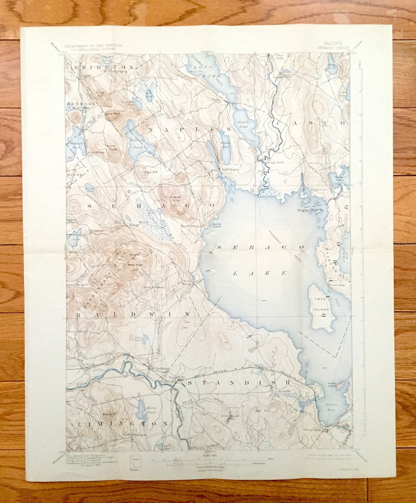
Antique Sebago Lake, Maine 1896 US Geological Survey Topographic Map – Naples, Casco, Baldwin, Limington, Standish, Raymond, Cumberland, ME
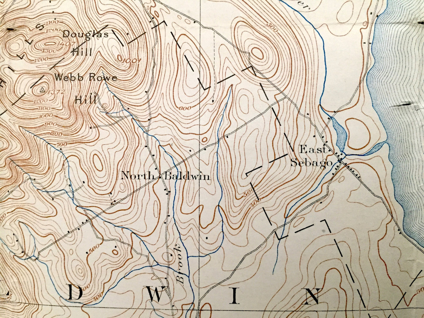
Antique Sebago Lake, Maine 1896 US Geological Survey Topographic Map – Naples, Casco, Baldwin, Limington, Standish, Raymond, Cumberland, ME
Beautiful, antique map of Sebago Lake, Maine and surrounding area. This is an authentic 1896 edition, 1929 print from the U.S. Geological Survey and NOT a computer reproduction.
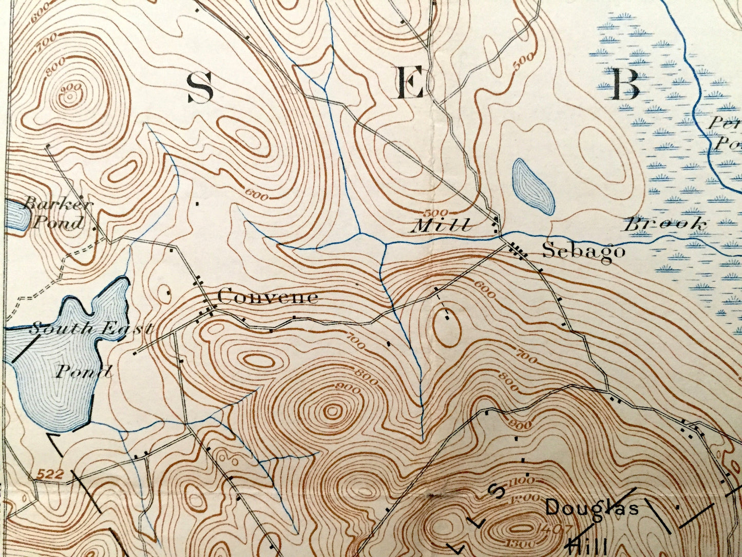
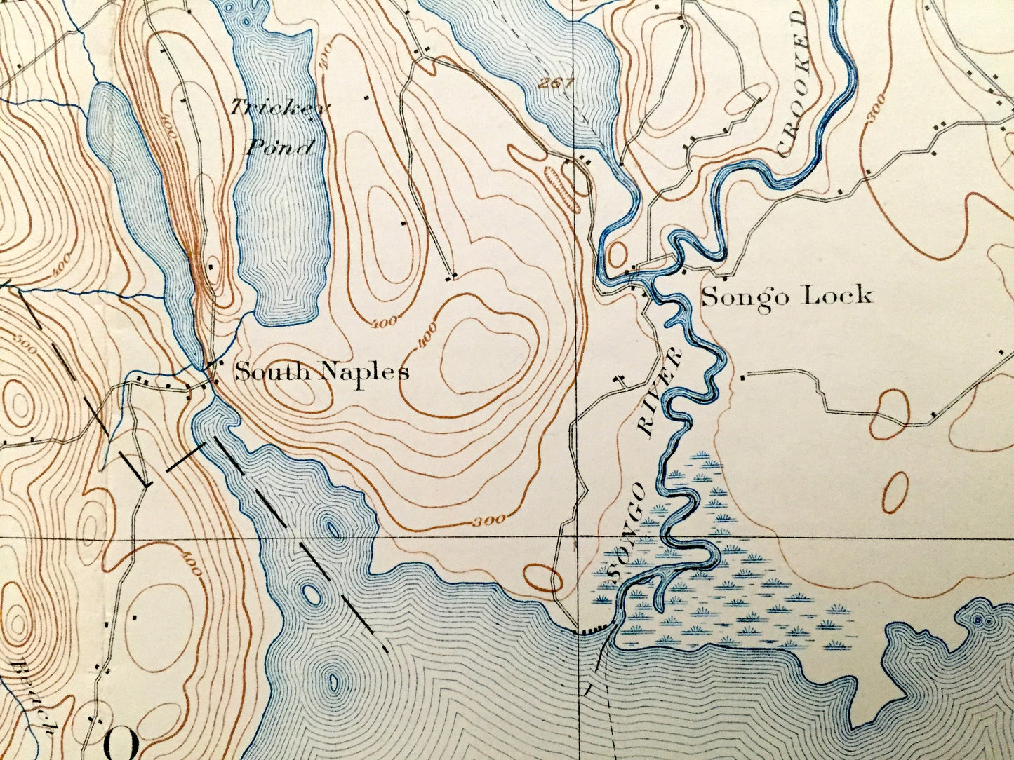
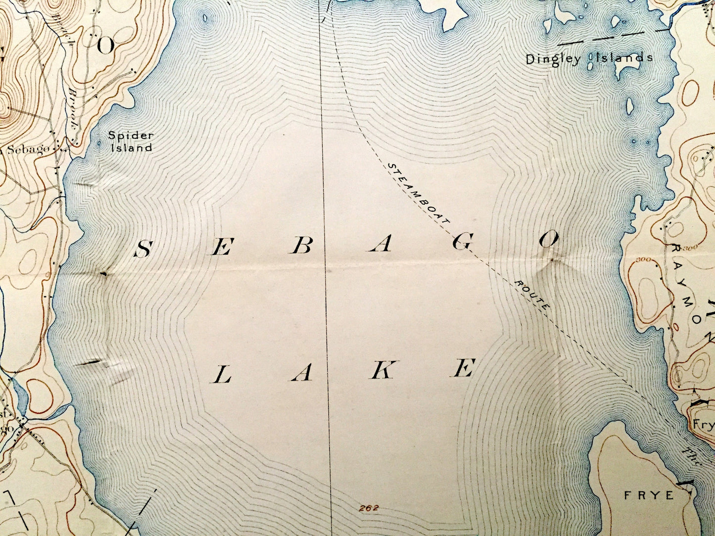
See what York & Cumberland County looked like more than 120 years ago in the late 1800's. Lots of intricate details and geological contours. Map even has little squares for every house that existed at the time. The USGS cartographers were very thorough back then! On the back is a description of topographic symbols and map guide.
Perfect for the historian, map-lover, the curious or just as a conversation starter. Wonderful and rare. Vintage maps such as these make great gifts.
Edition of 1896, printed 1929
Dimensions: 16 1/2" width x 20" height
----
Features
Cities & Towns: Bridgton, Denmark, Naples, Casco, Hiram, Sebago, Raymond, Baldwin, Limington, Standish, Gorham, Perley Mills, South Naples, Edes Falls, Cooks Mills, Songo Lock, Convene, North Baldwin, East Sebago, North Sebago, South Casco, Chase, East Baldwin, North Limington, Steep Falls, Richville, Sebago Lake.
Points of Interest: Sebago Lake, Long Lake, Brandy Pond, Jordan Bay, Lower Bay, Saco River, Peabody Pond, Tricky Pond, Horne Pond, Thomas Pond, Parker Pond, Hancock Pond, Bald Pate, Fitch Hill, Tiger Hill, Beach Ridge, Peaked Hills, Webb Rowe Hill, Douglas Hill, Moody Mountain, Oak Hill, Frye Island, Indian Island, Raymond Neck, Fryes Leap, Spider Island, Crooked River, Saddleback Hills, Quaker BrookMaine Central Railroad (White Mountains Line), and many more streams, ponds, marshes, villages and mountains.
Condition: Very Good Vintage condition, commensurate with age. This map is in great shape for being over 90 years old. Has light edge-wear, toning and folds as-issued, but this will all add to vintage character when framed.
----
We will happily adjust shipping price for multiple purchases. Maps are rolled up and shipped in sturdy mailing tubes, never folded.
Couldn't load pickup availability
Share