My Store
Antique Sequoia & Kings Canyon National Park, California 1958 US Geological Survey Topographic Map – Owens, Kaweah, Sierra, Mount Whitney CA
Antique Sequoia & Kings Canyon National Park, California 1958 US Geological Survey Topographic Map – Owens, Kaweah, Sierra, Mount Whitney CA
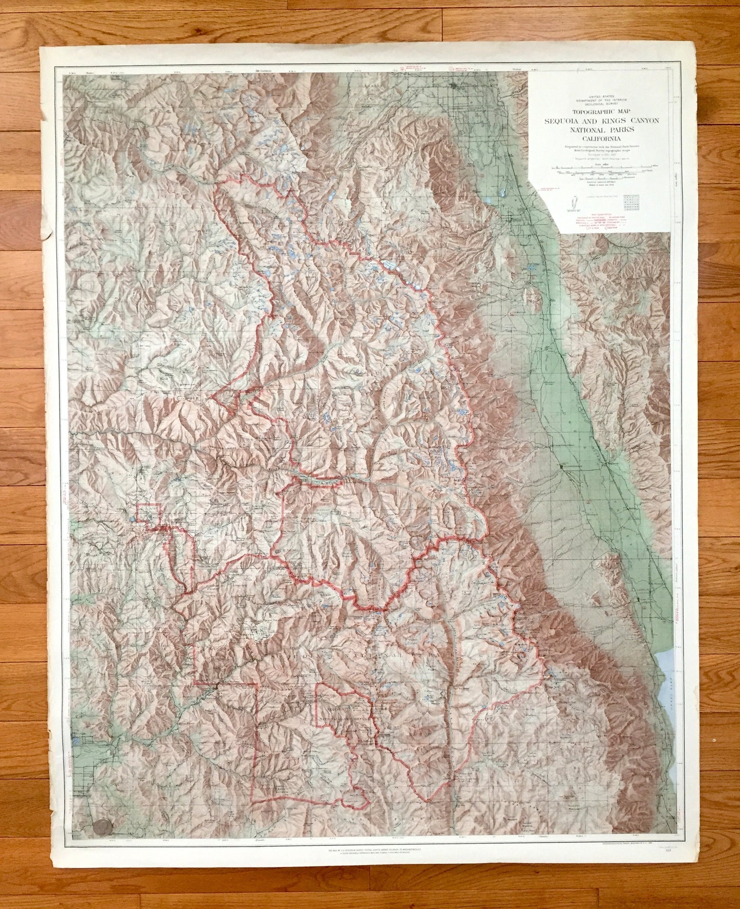
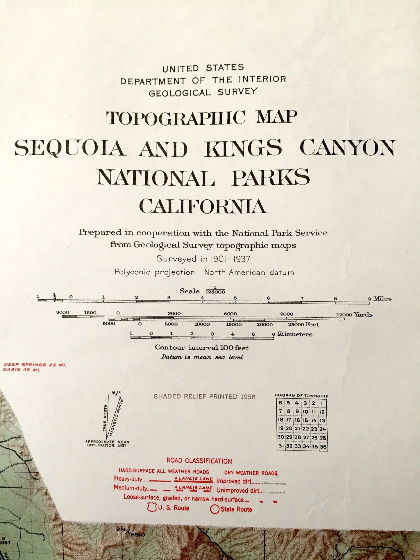
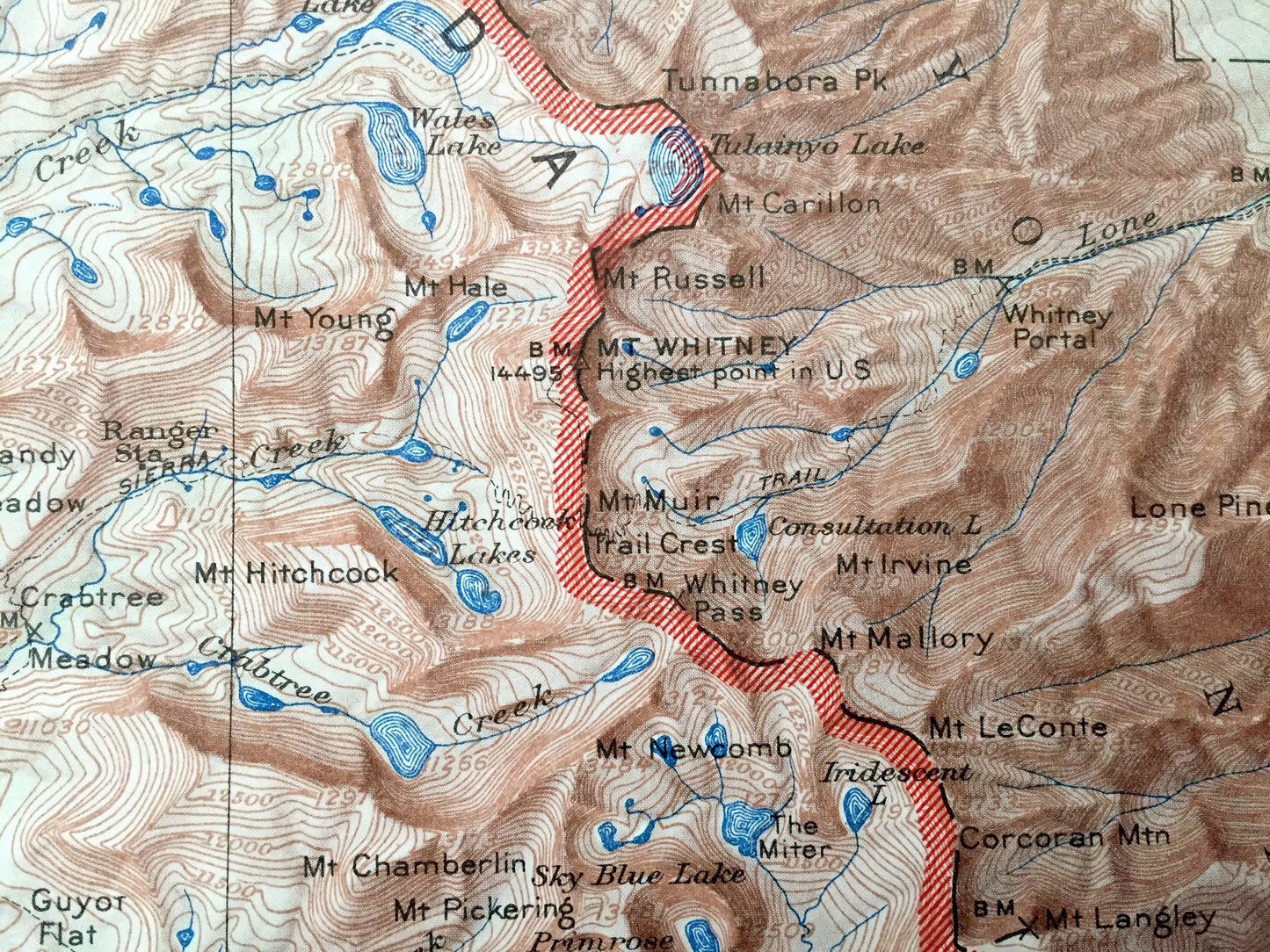
Beautiful, antique and VERY LARGE shaded-relief map of Sequoia National Park, California and surrounding Fresno, Inyo & Tulare County area, including Tule River Indian Reservation, Owens Valley, Sierra National Forest and Kings River Canyon. This is an authentic 1958 edition, 1965 print from the U.S. Geological Survey and NOT a computer reproduction.
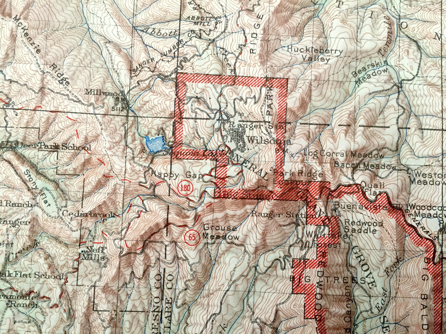
See what the Sequoia National Forest and Kings Canyon National Park looked like over 60 years ago. Lots of intricate details and geological contours. Map even has little squares for every house that existed at the time. The USGS cartographers were very thorough back then! This map is very large, nearly 3 feet by 4 feet, and the print is as detailed as the smaller USGS maps. The breadth of detail is incredible. (See quarter in first photo for scale.)
Perfect for the historian, map-lover, the curious or just as a conversation starter. Wonderful and rare. Vintage maps such as these make great gifts.
Edition of 1958, printed 1965
Dimensions: 33 1/2" width x 42" height
----
Features
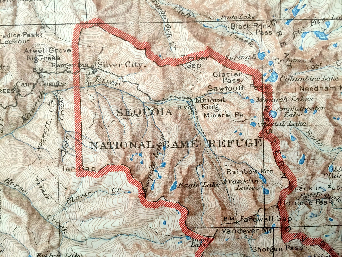
Towns & Cities: Bishop, Kaweah, Hammond, Three Rivers, Oakgrove, Atwells, Mineral King, Dillon Mill, Milo, Nelson, Frazier, Globe, Springville, Success, Wilsonia, Pinehurst, Miramonte, Hartland, Grant Grove Village, Ash Mountain, Lindcove, Lemoncove, Naranjo, Lodgepole, Cedar Grove, Big Pine, Independence, Fish Springs, Seven Pines, Silver City, Mineral King, Whitney Portal.
Points of Interest: Fresno County, Inyo County, Tulare County, Sequoia National Forest, Sequoia National Park, Kings Canyon National Park, Tule River Indian Reservation, Owens Valley, John Muir Wilderness, Sierra National Forest, Inyo National Forest, Giant Forest, Lake Kaweah, Courtwright Reservoir, Wilson Reservoir, Fort Independence Indian Reservation, Mineral King Game Refuge, Kaweah River, Blue Ridge, Great Western Divide, Frazier Valley, Tule River, Wet Meadows, Salt Creek Ridge, Homers Nose, Cherokee Flat, Yokohl Valley, Mount Whitney, Battle Mountain, Moses Mountain, Maggle Mountain, Pecks Canyon, and many more mountains, peaks, meadows, hills, canyons, brooks, creeks, rivers, valleys, waterfalls, trails and roads.
Condition: Good Vintage condition, commensurate with age. This map is in great shape for being 55 years old. Has some edge-wear and toning, but this will all read as vintage character when framed.
----
We will happily adjust shipping price for multiple purchases. Maps are rolled up and shipped fully-insured in sturdy mailing tubes, never folded.
Couldn't load pickup availability
Share