My Store
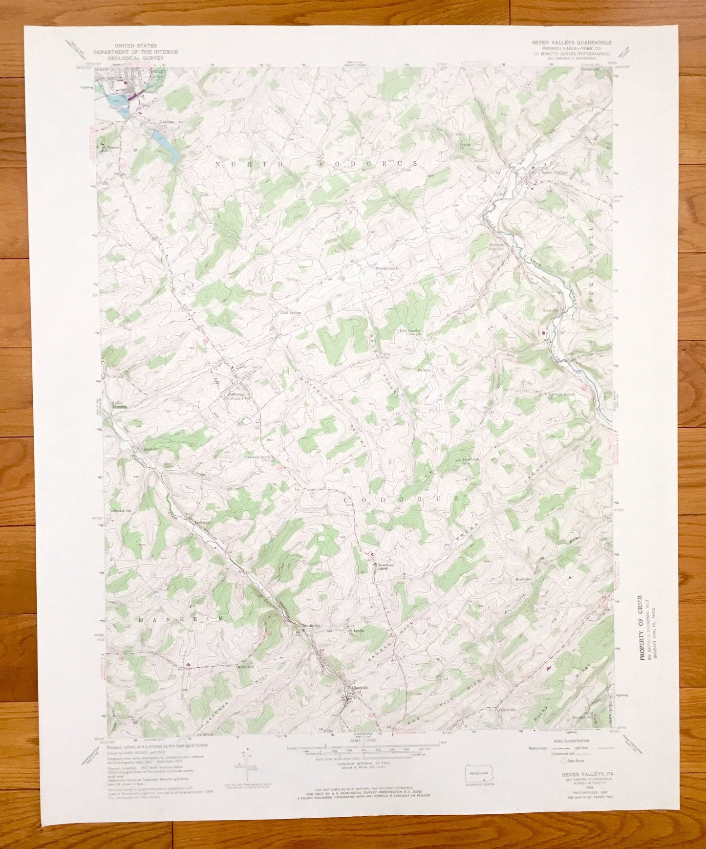
Antique Seven Valleys, Pennsylvania 1953 US Geological Survey Topographic Map – York County, Codorus, North Codorus, Manheim, Springfield
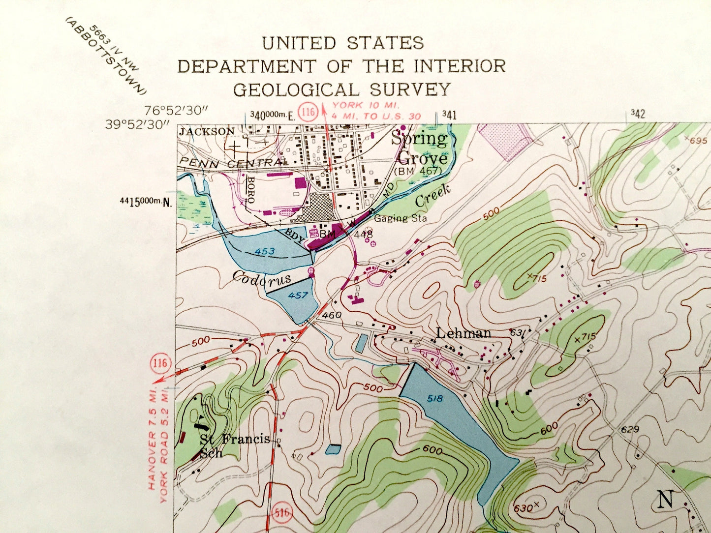
Antique Seven Valleys, Pennsylvania 1953 US Geological Survey Topographic Map – York County, Codorus, North Codorus, Manheim, Springfield
Beautiful, antique map of Seven Valleys, Pennsylvania and surrounding York County areas. This is an authentic 1953 edition, 1968 print from the U.S. Geological Survey and NOT a computer reproduction.
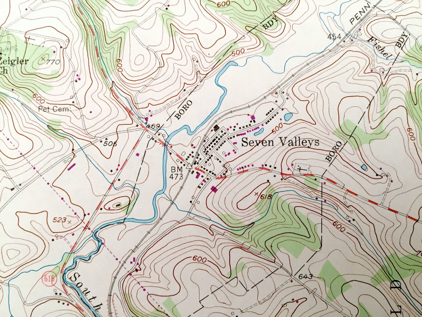
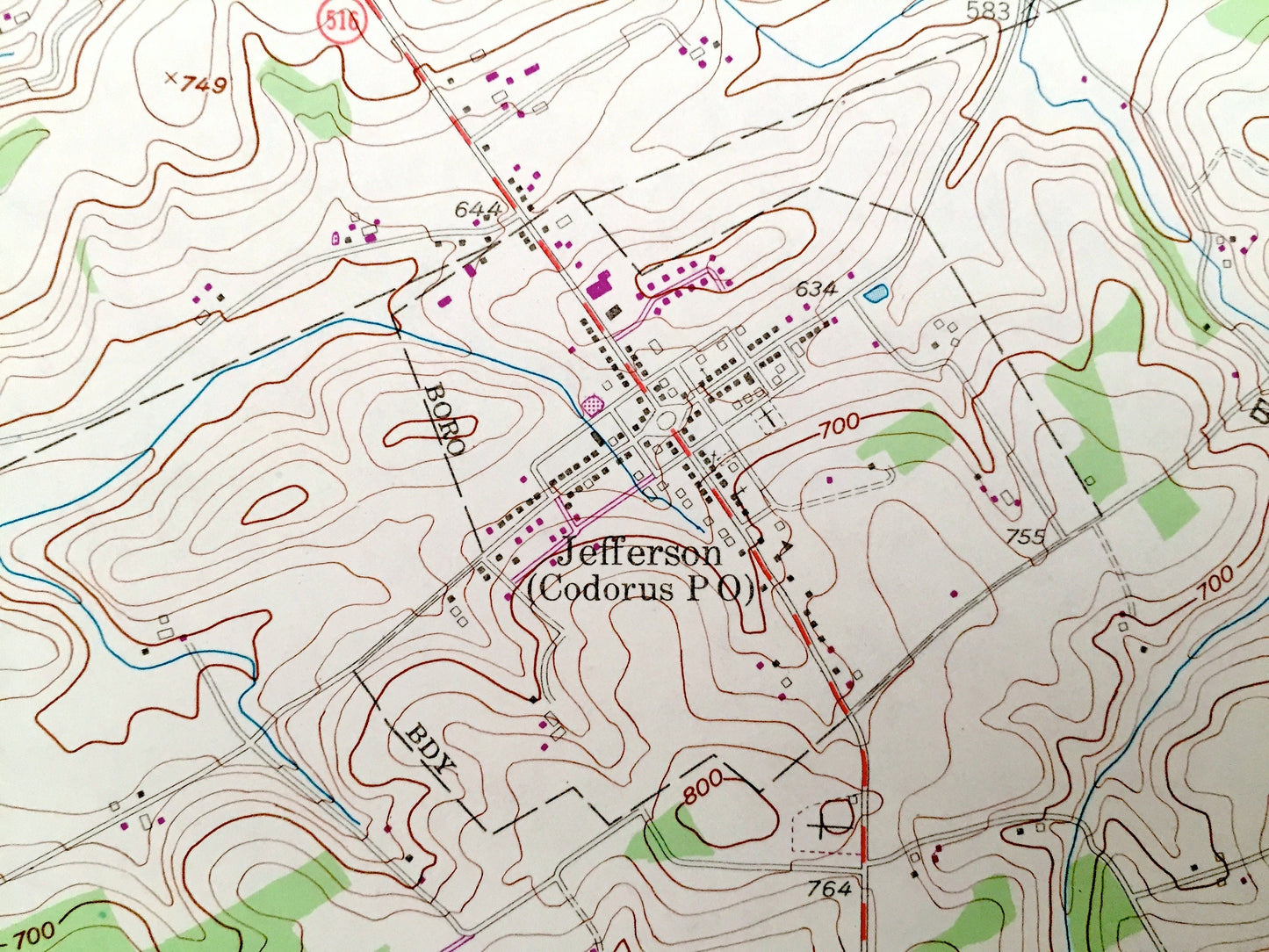
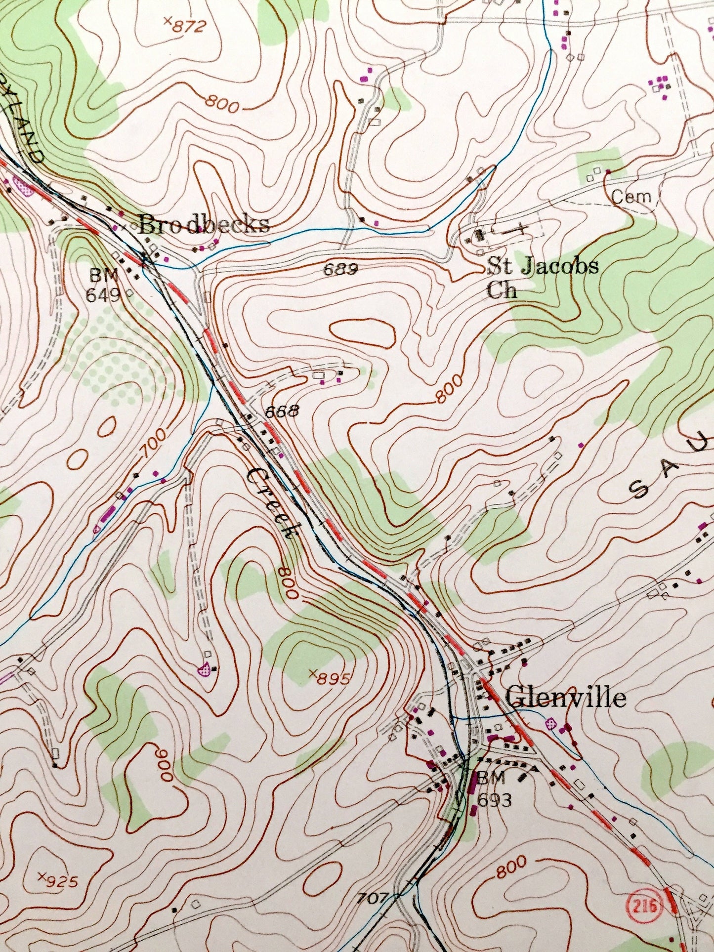
See what Pennsylvania looked like over 65 years ago. Lots of intricate details and geological contours. Map even has little squares for every house that existed at the time. The USGS cartographers were very thorough back then!
Perfect for the historian, map-lover, the curious or just as a conversation starter. Wonderful and rare. Vintage maps such as these make great gifts.
Edition of 1953, printed 1968
Dimensions: 22" width x 27" height
----
Features
Cities & Towns: Seven Valleys, Spring Grove, Lehman, Glatfelters, Hanover Junction, Strickhousers, Cold Springs, Jefferson, Valley Junction, Sinsheim, Pentland, Brodbecks, Bowmans Store, Glenville, Bonnair, Rockville, Seitzville, Neiman, Shrewsbury.
Points of Interest: York County, Rocky Ridge, Dug Hill Ridge, Saubel Hill, Beecher Hill, Krebs Valley, Buffalo Valley, Brush Valley, South Branch Codorus Creek and many more hills, streams, ponds, houses, schools, churches and roads.
Condition: Very Good condition, commensurate with age. This map is in incredible shape for being over 50 years old. Has some light edge-wear and a stamp, all of which will read as vintage character when framed.
----
We will happily adjust shipping price for multiple purchases. Maps are rolled up and shipped in sturdy mailing tubes, never folded.
Couldn't load pickup availability
Share