My Store
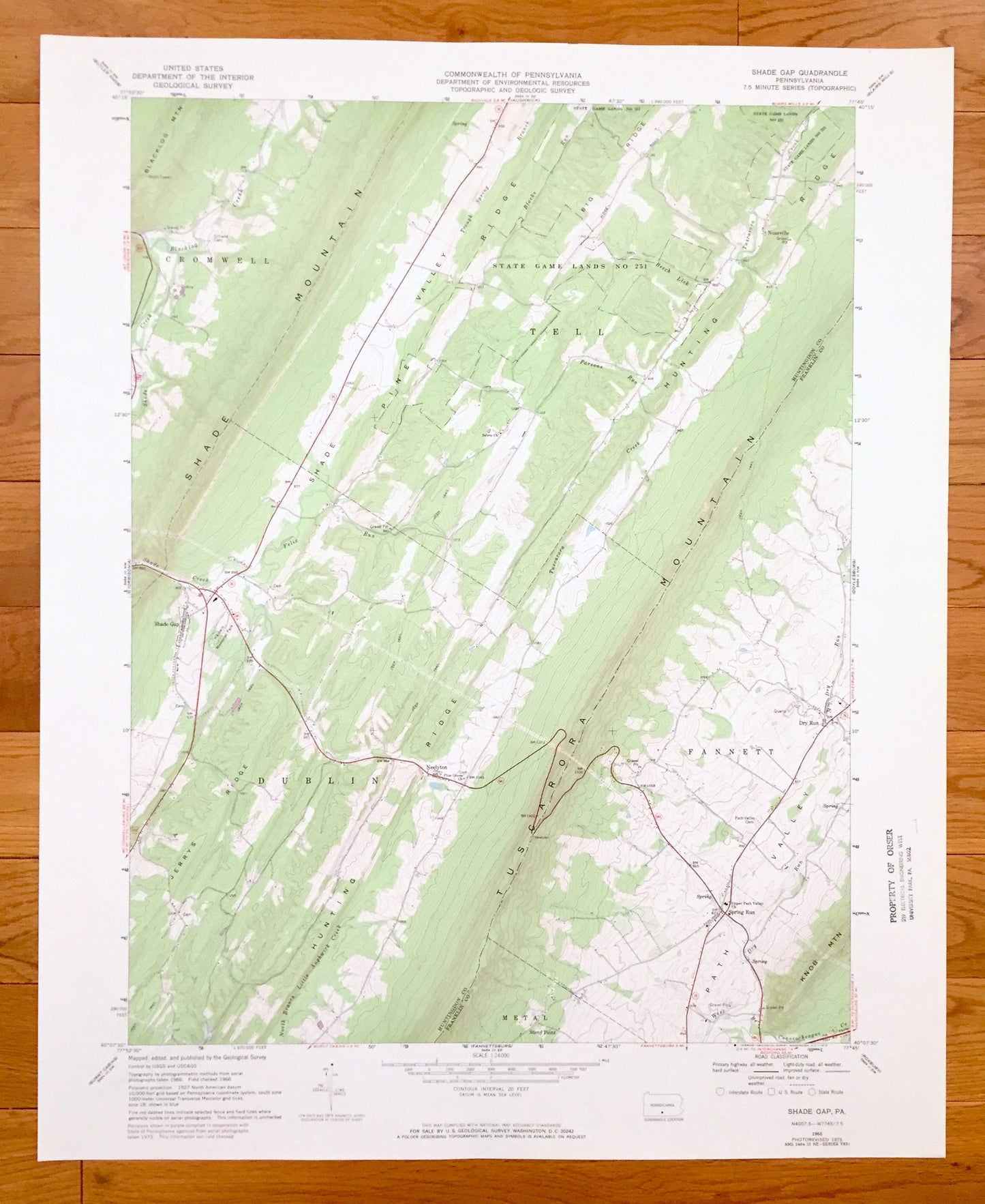
Antique Shade Gap, Pennsylvania 1966 US Geological Survey Topographic Map – Huntingdon County, Franklin County, Cromwell, Fannett, Dublin
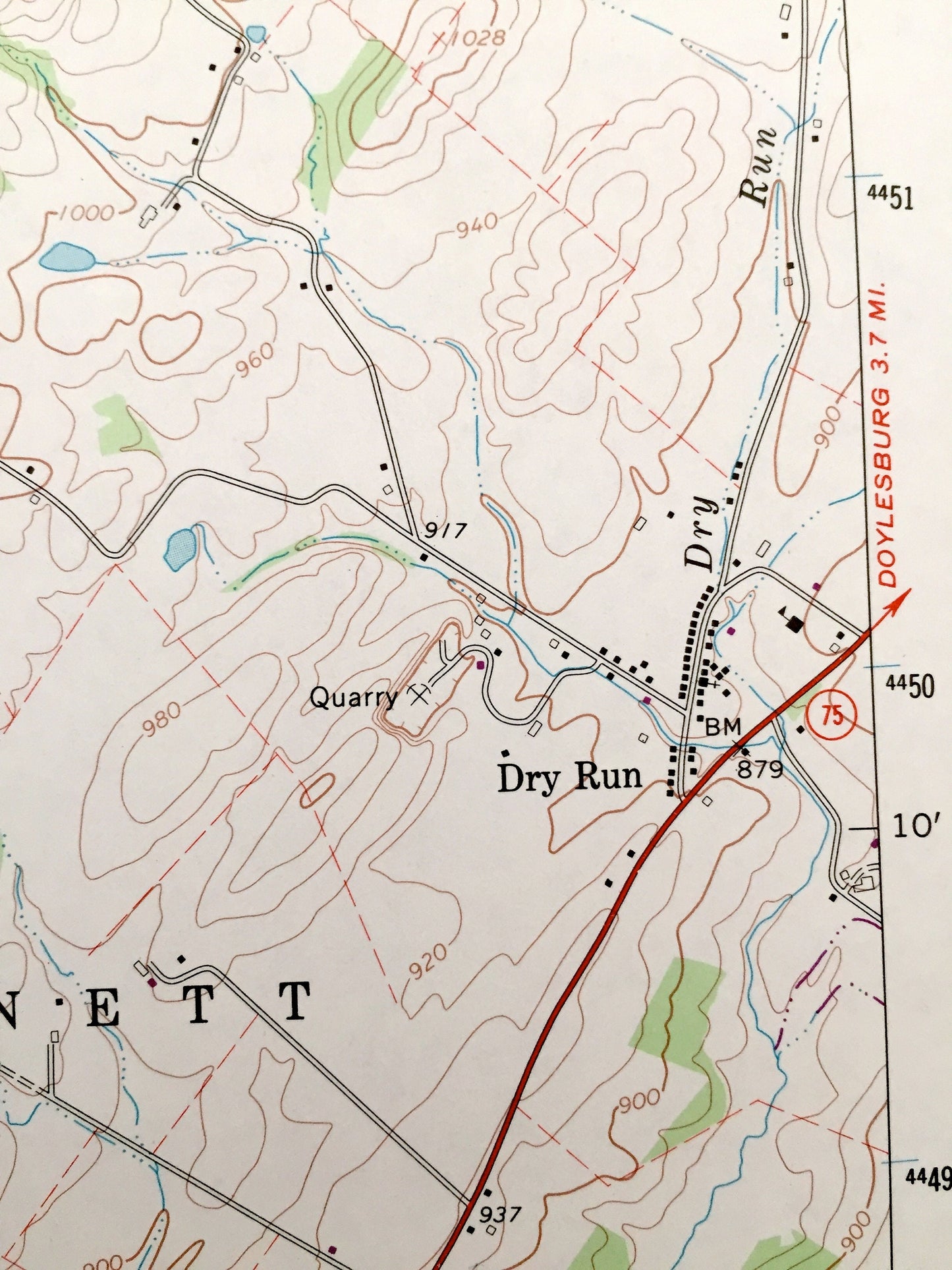
Antique Shade Gap, Pennsylvania 1966 US Geological Survey Topographic Map – Huntingdon County, Franklin County, Cromwell, Fannett, Dublin
Beautiful, antique map of Shade Gap, Pennsylvania and surrounding Huntingdon County and Franklin County areas. This is an authentic 1966 edition, 1973 print from the U.S. Geological Survey and NOT a computer reproduction.
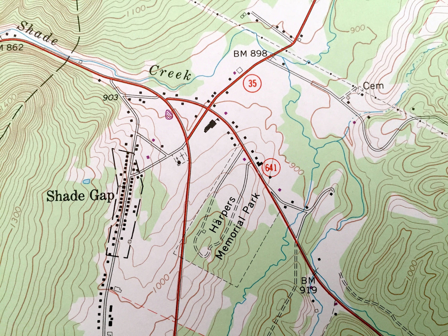
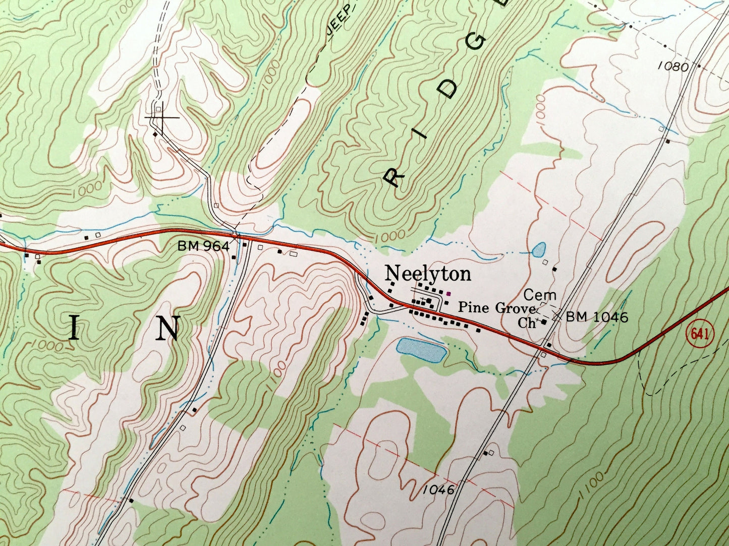
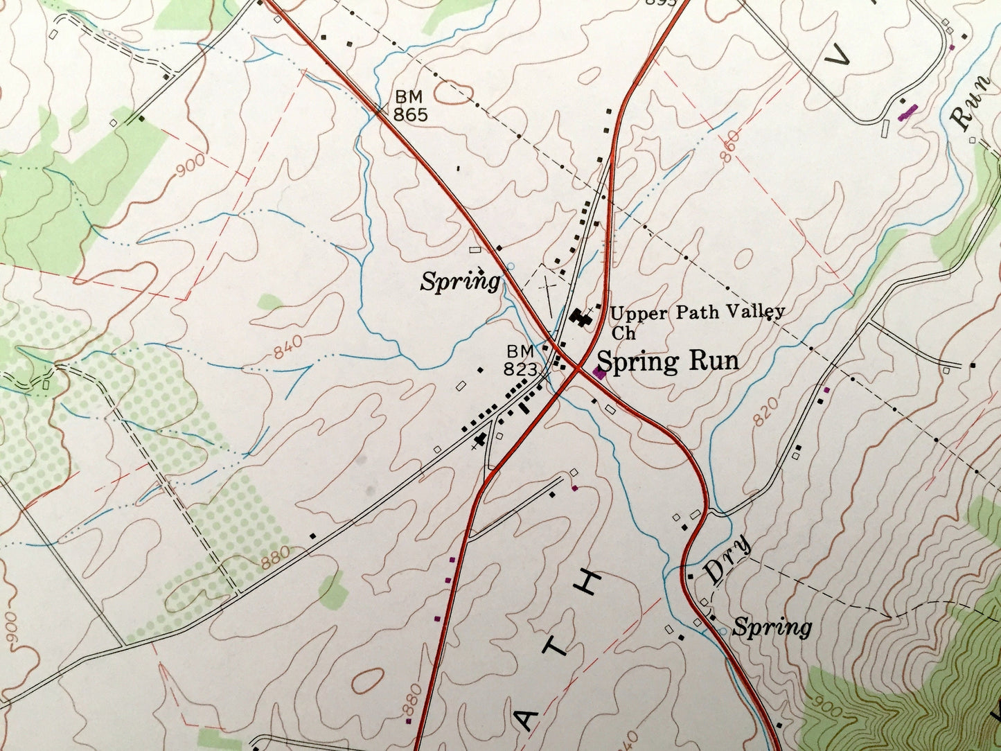
See what Pennsylvania looked like over 50 years ago. Lots of intricate details and geological contours. Map even has little squares for every house that existed at the time. The USGS cartographers were very thorough back then!
Perfect for the historian, map-lover, the curious or just as a conversation starter. Wonderful and rare. Vintage maps such as these make great gifts.
Edition of 1966, printed 1973
Dimensions: 22" width x 27" height
----
Features
Cities & Towns: Shade Gap, Tell, Metal, Stony Point, Spring Run, Dry Run, Neelyton, Nossville, Cromwell, Dublin, Fannett.
Points of Interest: Huntingdon County, Franklin County, Tuscarora Mountain, Shade Mountain, Knob Mountain, Blacklog Mountain, Pine Ridge, Hunting Ridge, Jerrys Ridge, Shade Valley, Path Valley, Felix Run, Parsons Run, Shade Creek, Tuscarora Creek, North Branch Little Aughwick Creek and many more hills, streams, ponds, houses, schools, churches and roads.
Condition: Very Good condition, commensurate with age. This map is in incredible shape for being over 45 years old. Has some light edge-wear and a stamp, all of which will read as vintage character when framed.
----
We will happily adjust shipping price for multiple purchases. Maps are rolled up and shipped in sturdy mailing tubes, never folded.
Couldn't load pickup availability
Share