My Store
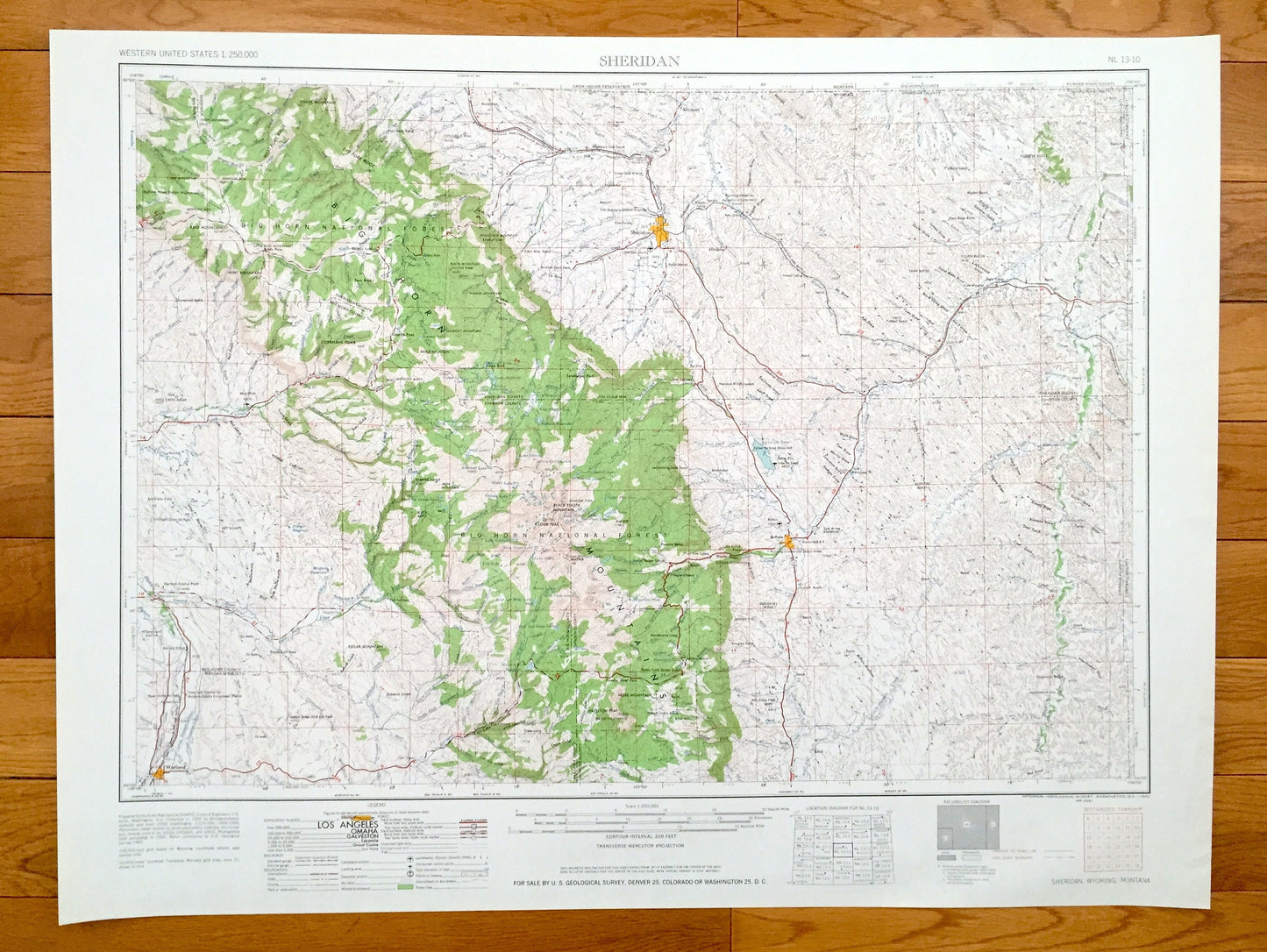
Antique Sheridan, Wyoming 1962 US Geological Survey Topographic Map – Buffalo, Worland, Manderson, Hyattville, Kleenburn, Big Horn Forest WY
Antique Sheridan, Wyoming 1962 US Geological Survey Topographic Map – Buffalo, Worland, Manderson, Hyattville, Kleenburn, Big Horn Forest WY
Beautiful, antique map of Sheridan, Wyoming and surrounding Montana area. This is an authentic 1962 edition, 1962 print from the U.S. Geological Survey and NOT a computer reproduction.
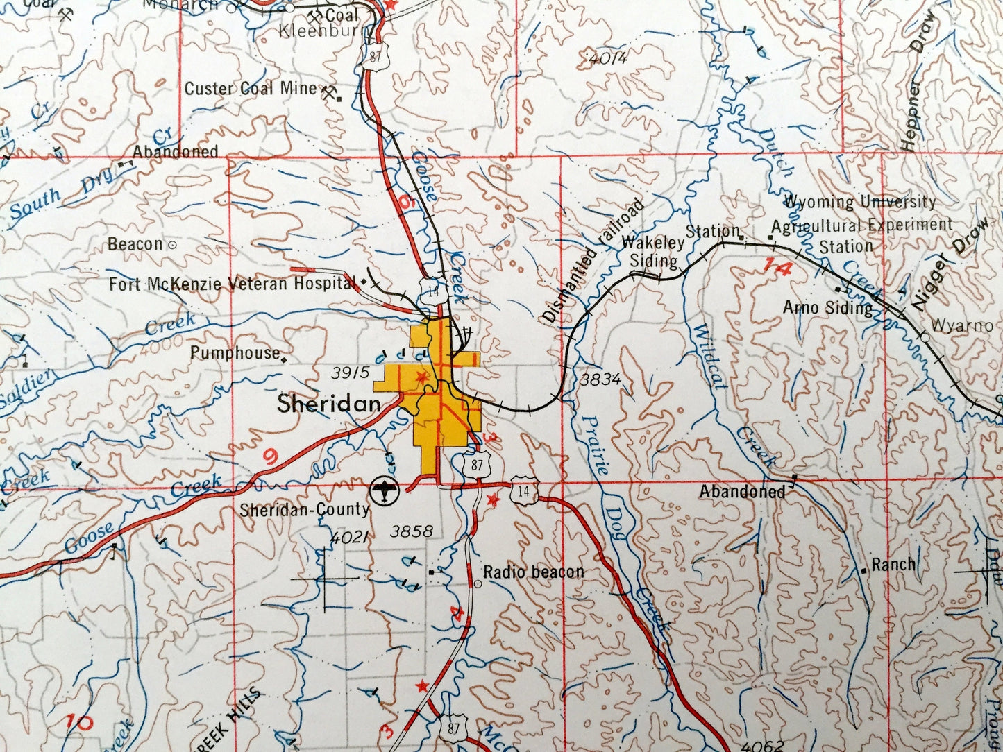
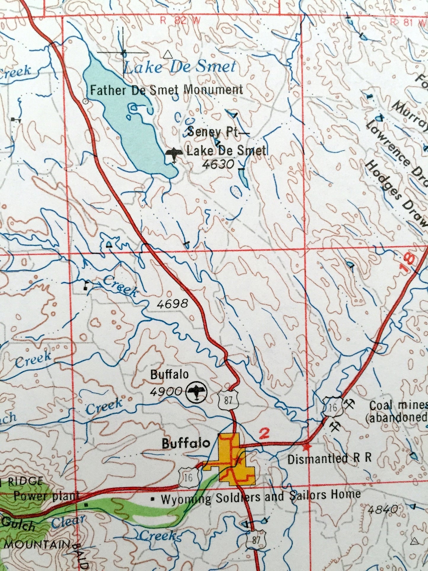
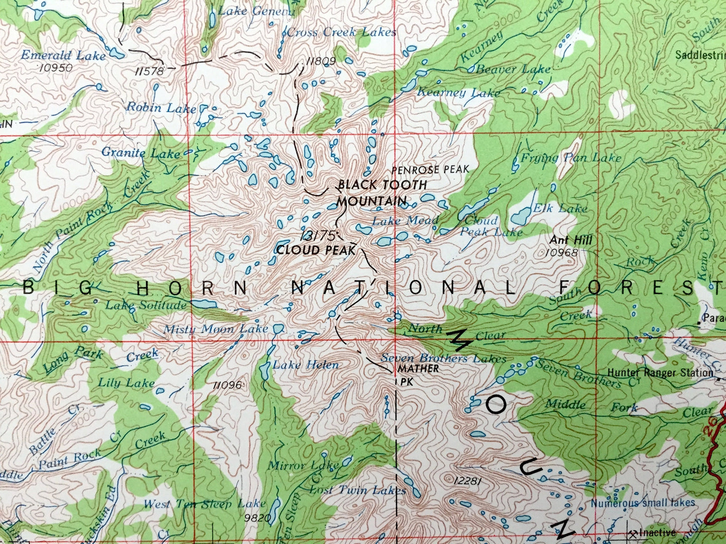
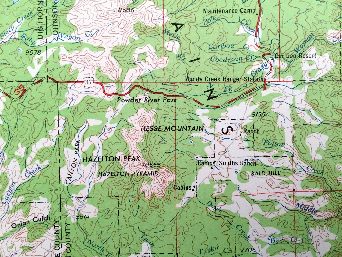
See what Wyoming and Montana looked like over 55 years ago. Lots of intricate details and geological contours. Map is incredibly large and in the grand 1:250,000 scale. The USGS cartographers were very thorough back then!
Perfect for the historian, map-lover, the curious or just as a conversation starter. Wonderful and rare. Vintage maps such as these make great gifts.
Edition of 1962, printed 1962
Dimensions: 32" width x 22 1/2" height
----
Features
Cities & Towns: WYOMING - Sheridan, Big Horn, Clearmont, Kendrick, Ten Sleep, Shell, Parkman, Dayton, Buffalo, Worland, Manderson, Hyattville, Kleenburn.
Points of Interest: WYOMING - Big Horn National Forest, Big Horn Mountain, Black Tooth Mountain, Bald Mountain, Powder River, Big Horn River, Nowood River, West Fork Ridge, Lake De Smet, Hazelton Peak, Ten Sleep Canyon, Goose Creek and lots more hills, mountains, lakes, rivers, creeks, roads, highways and railroads.
MONTANA - Crow Indian Reservation, Big Horn County, Powder River County and lots more hills, mountains, lakes, rivers, creeks, roads, highways and railroads.
Condition: Very Good condition, commensurate with age. This map is in incredible shape for being over 55 years old. Has some light edge-wear, all of which will read as vintage character when framed.
----
We will happily adjust shipping price for multiple purchases. Maps are rolled up and shipped in sturdy mailing tubes, never folded.
Couldn't load pickup availability
Share