My Store
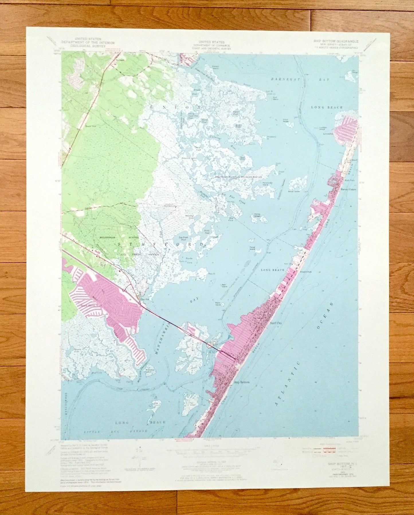
Antique Ship Bottom, New Jersey 1952 US Geological Survey Topographic Map – Ocean County, Union, Stafford, Beach View, Barnegat, Bay Side NJ
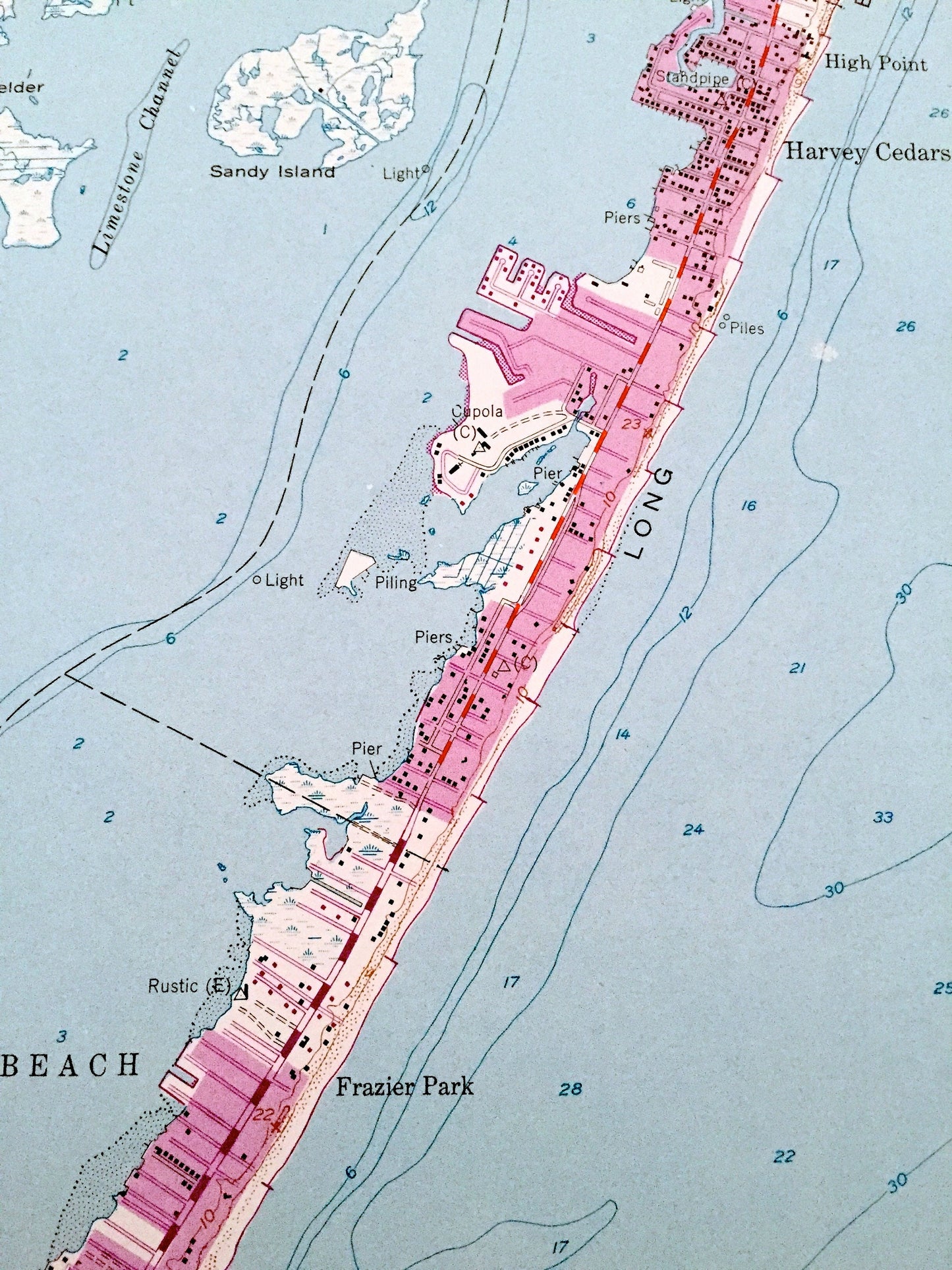
Antique Ship Bottom, New Jersey 1952 US Geological Survey Topographic Map – Ocean County, Union, Stafford, Beach View, Barnegat, Bay Side NJ
Beautiful, antique map of Ship Bottom, New Jersey and surrounding Ocean County area. This is an authentic 1952 edition, 1973 print from the U.S. Geological Survey and NOT a computer reproduction.
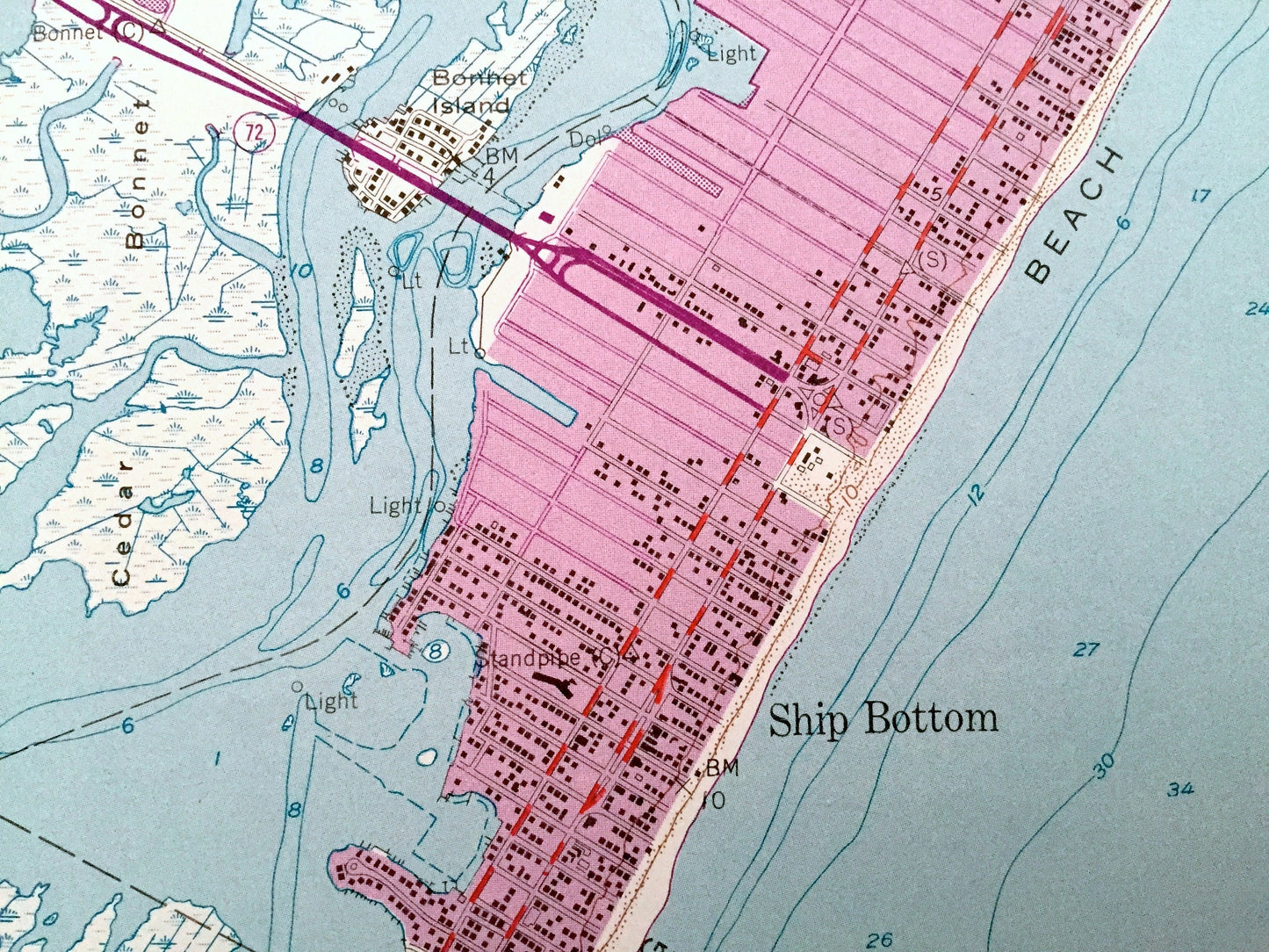
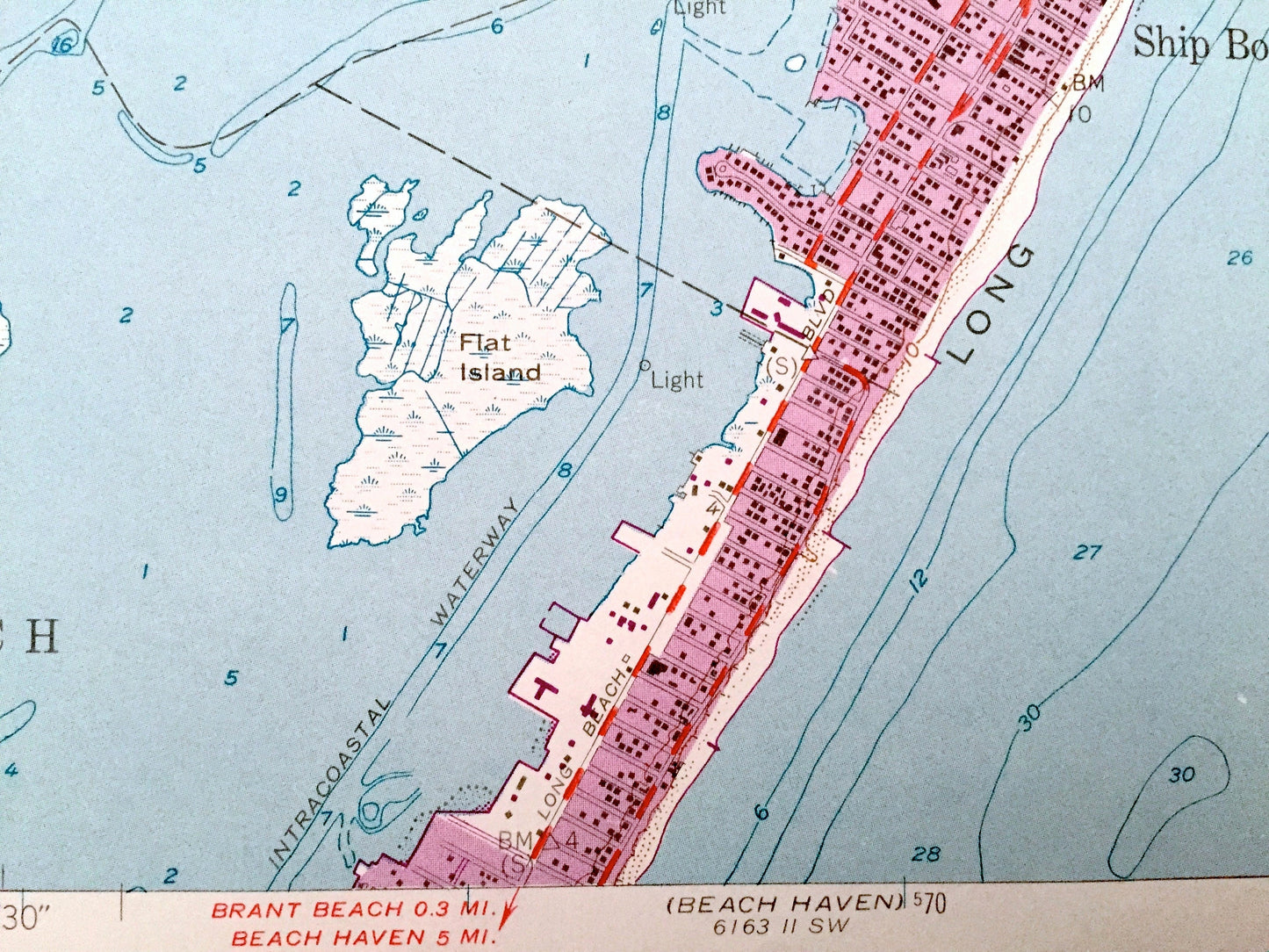
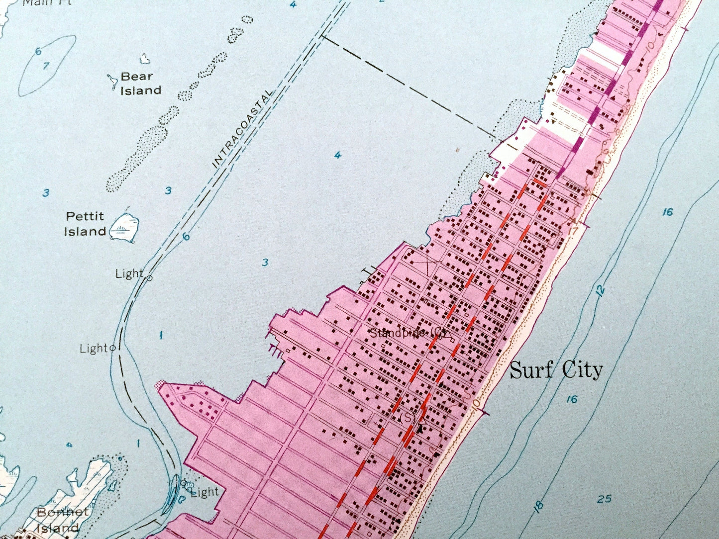
See what New Jersey looked like over 65 years ago. Lots of intricate details and geological contours. Map even has little squares for every house that existed at the time. The USGS cartographers were very thorough back then!
Perfect for the historian, map-lover, the curious or just as a conversation starter. Wonderful and rare. Vintage maps such as these make great gifts.
Edition of 1952, printed 1973
Dimensions: 22" width x 27" height
----
Features
Cities & Towns: Beach Haven West, Eagleswood, Long Beach, Surf City, Frazier Park, Harvey Cedars, High Point, Long Beach Park, Loveladies.
Points of Interest: Atlantic Ocean, Barnegat Bay, Manahawkin Hunting and Fishing Grounds, Barnegat National Wildlife Refuge, Manahawkin Bay, Little Egg Harbor, Conklin Island, Lovelady Island, Marshelder Island, Carvel Island, Bear Island, Petit Island, Egg Island, Mud Cove, Turtle Cove, Log Creek Pond, North Pond, Double Creek Wide Place, Gunning River, Fresh Creek, Standing Pond, Limestone Channel, Mill Creek Thorofare, Manahawkin Creek, and many more hills, creeks, thorofares, streams, ponds, houses, schools, railroads, churches and roads.
Condition: Very Good Vintage condition, commensurate with age. This map is in great shape for being over 45 years old. Has light edge-wear and a penciled note on the bottom right corner, all of which will add character when framed.
----
We will happily adjust shipping price for multiple purchases. Maps are rolled up and shipped in sturdy mailing tubes, never folded.
Couldn't load pickup availability
Share