My Store
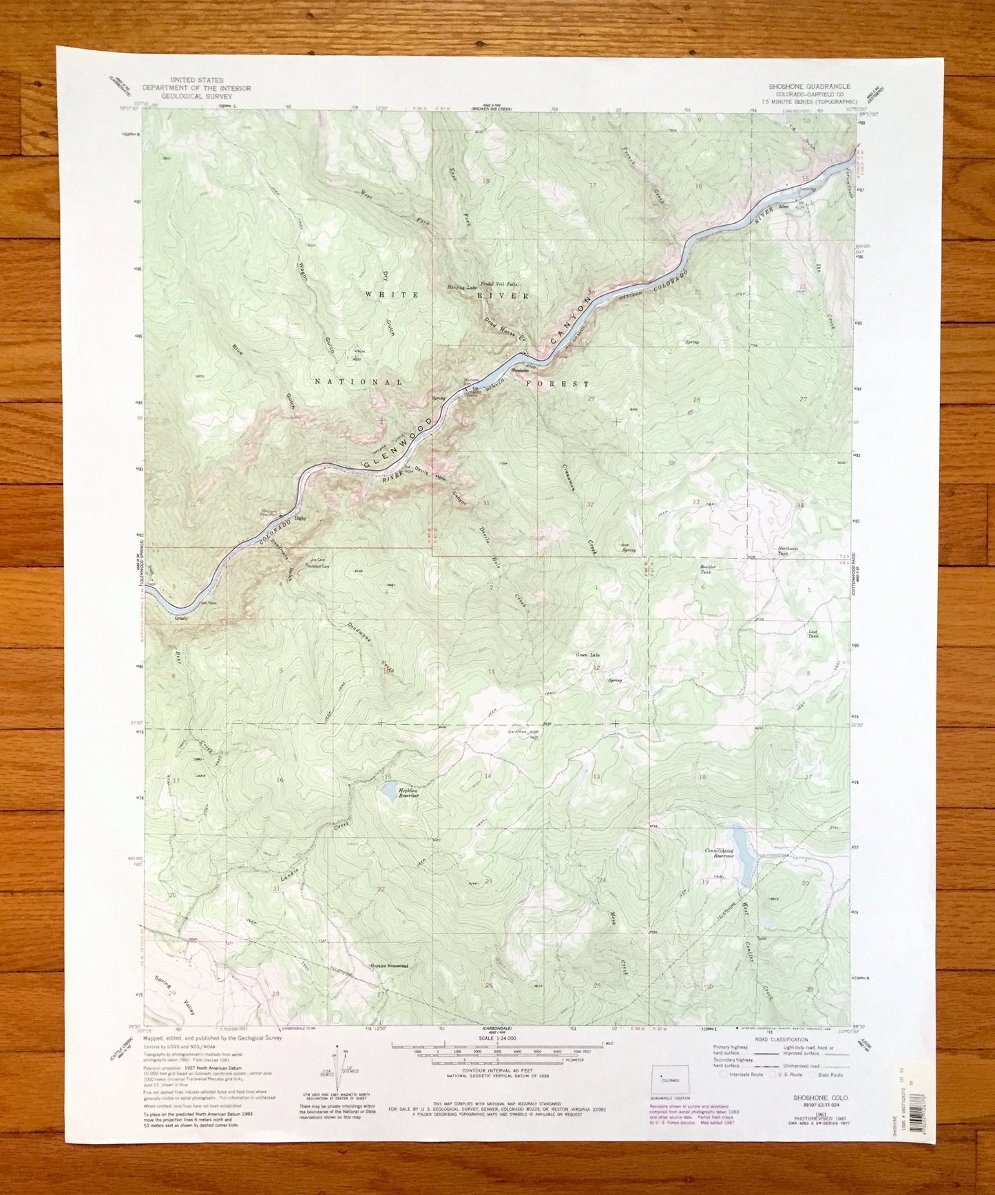
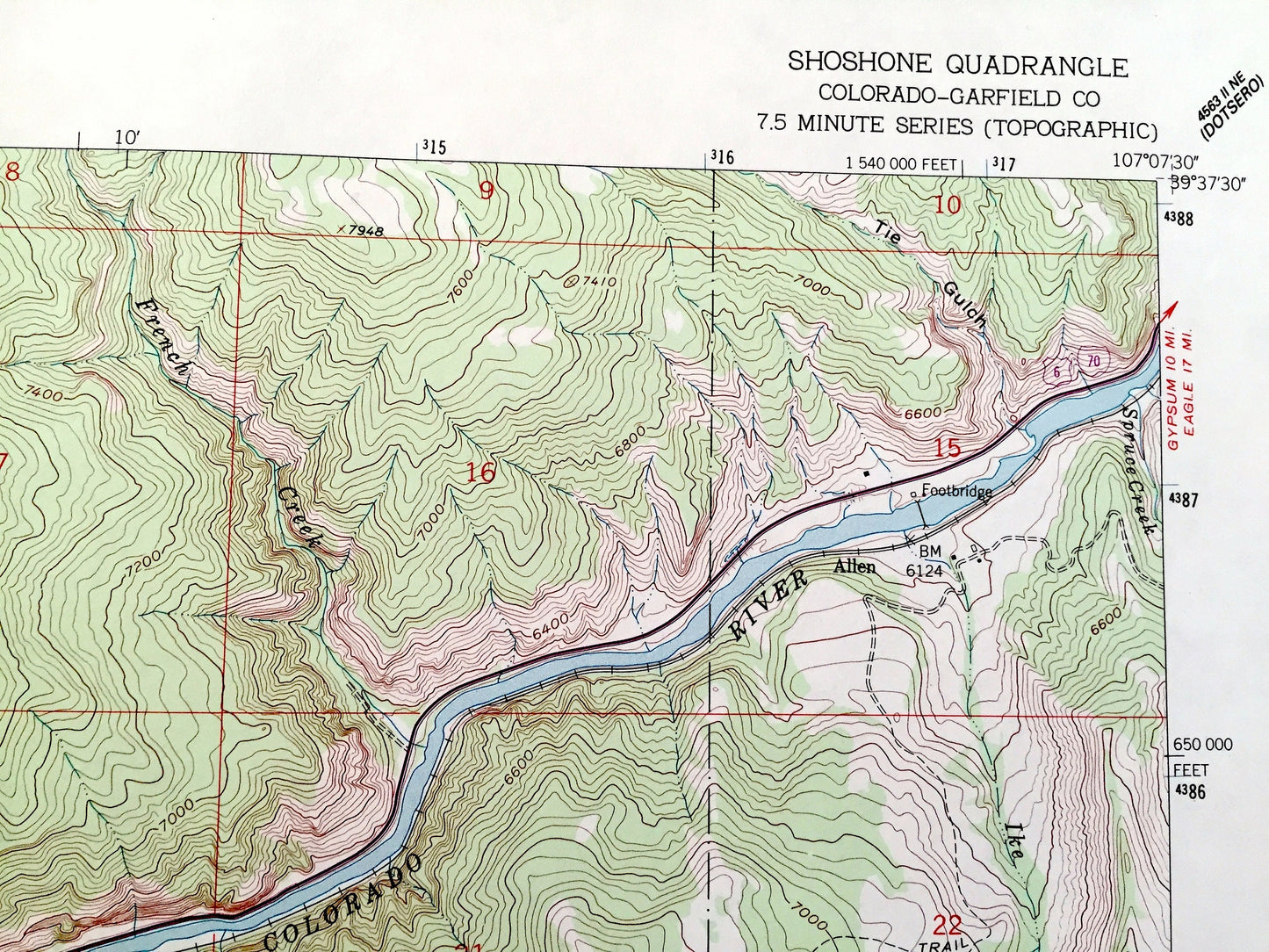
Antique Shoshone, Colorado 1961 US Geological Survey Topographic Map – White River National Forest, Glenwood Canyon, Colorado River, CO
Antique Shoshone, Colorado 1961 US Geological Survey Topographic Map – White River National Forest, Glenwood Canyon, Colorado River, CO
Beautiful, antique map of Shoshone, Colorado, White River National Park and surrounding Garfield County area. This is an authentic 1961 edition, 1988 print from the U.S. Geological Survey and NOT a computer reprint.
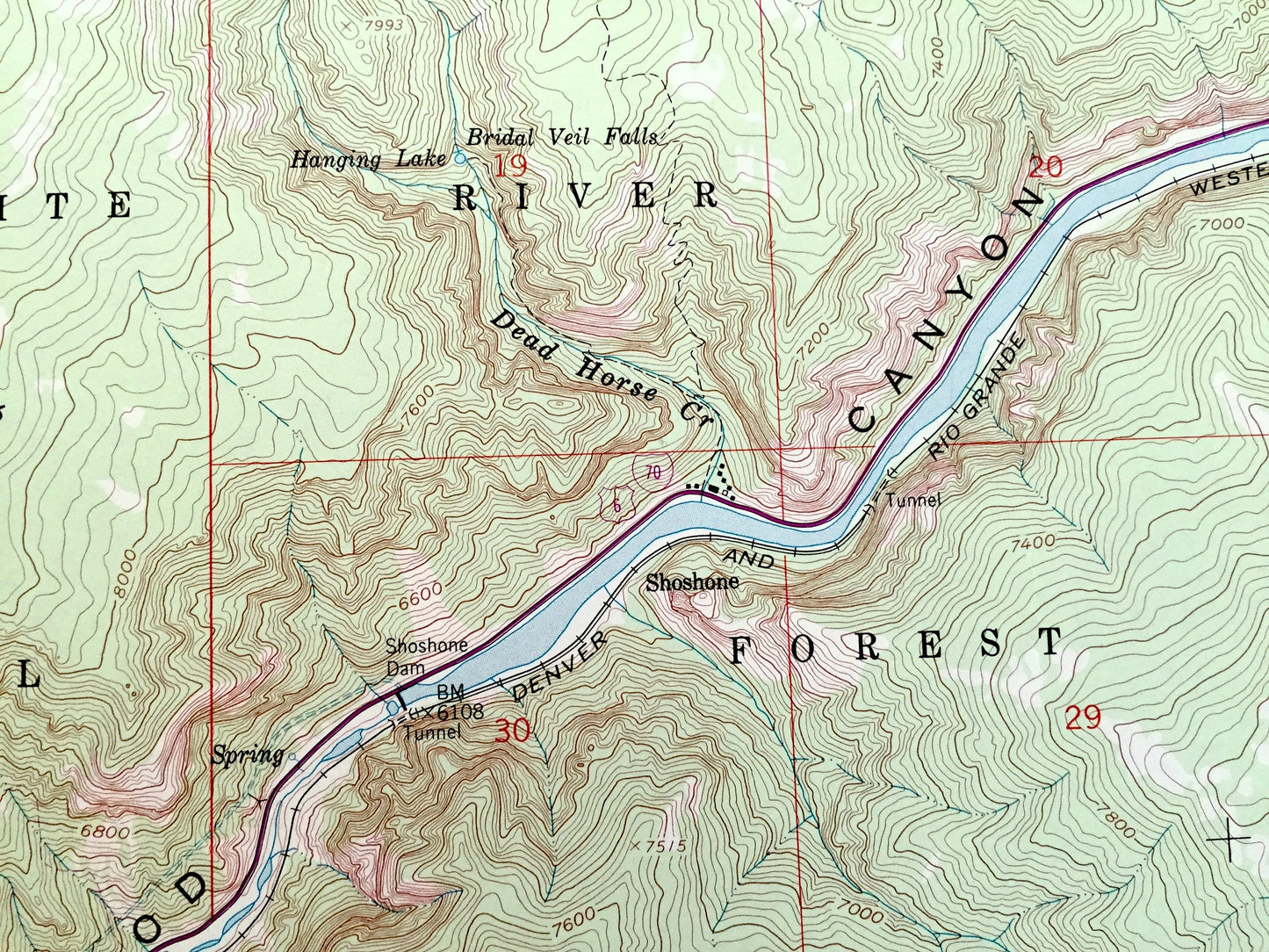
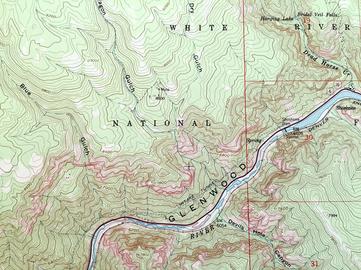
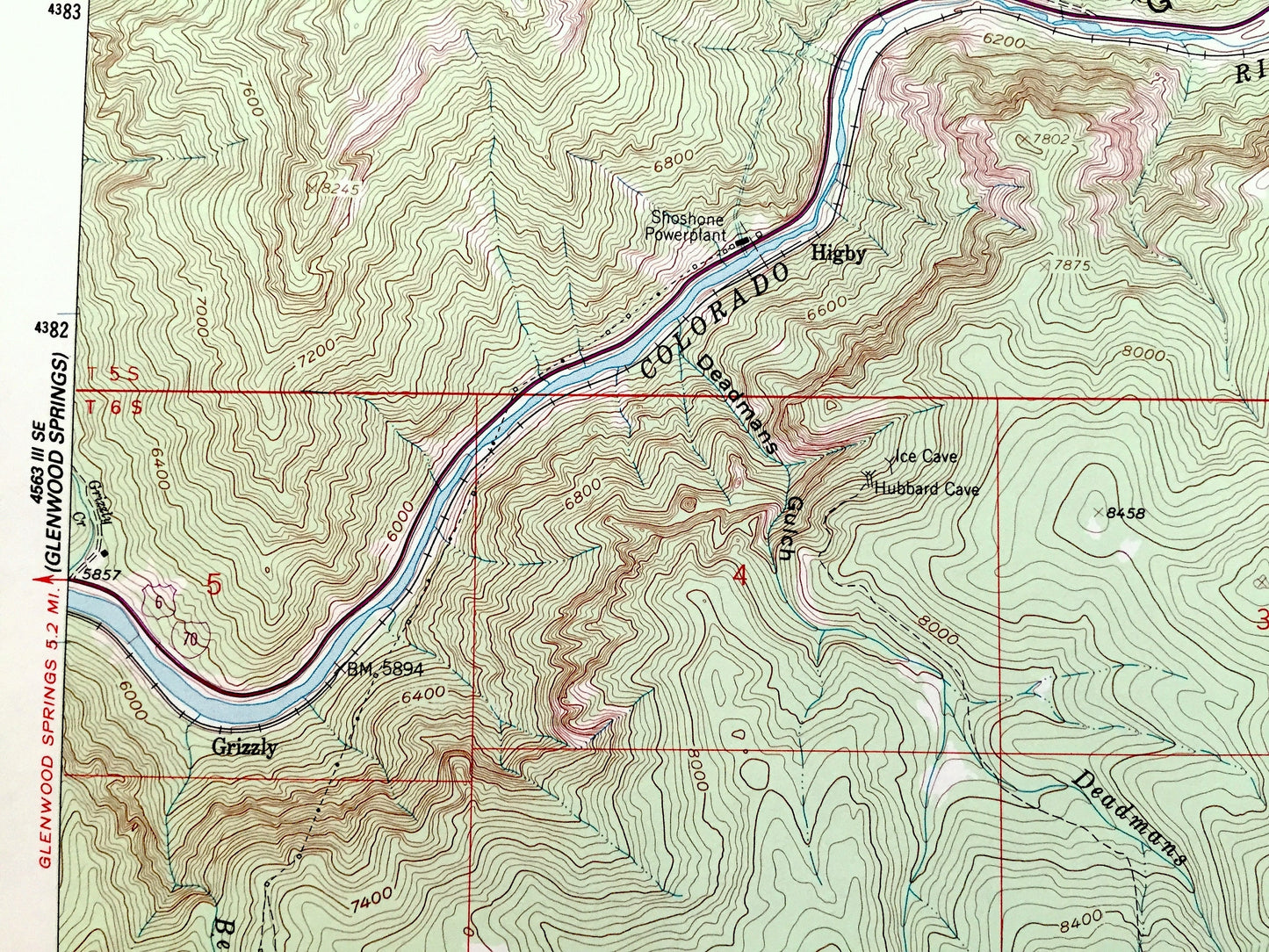
See what Colorado looked like over 60 years ago. Lots of intricate details and geological contours. Map even has little squares for every house that existed. The USGS cartographers were very thorough back then!
Perfect for the historian, map-lover, the curious or just as a conversation starter. Wonderful and rare. Vintage maps such as these make great gifts.
Edition of 1961, printed 1988
Dimensions: 22" width x 27" height
----
Features
Cities & Towns: Shoshone, Grizzly, Highy, Hopkins Homestead, Allen.
Points of Interest: Garfield County, White River National Forest, Glenwood Canyon, Colorado River,Spring Valley, Mesa Creek, West Coulter Creek, Consolidated Reservoir, Green Lake, Hopkins Reservoir, Landis Creek, Bear Creek, Deadmans Creek, Cinnamon Creek, Devils Hole Creek, Ike Creek, French Creek, Wagon Gulch, Blue Gulch, Dry Gulch, Dead Horse Creek, and many more smaller lakes, creeks, mountains, valleys, houses, schools, roads, churches and train tracks.
Condition: Very Good Vintage condition, commensurate with age. This map is in great shape for being over 30 years old. Has light wear but this will will add to vintage character when framed.
----
We will happily adjust shipping price for multiple purchases. Maps are rolled up and shipped in sturdy mailing tubes, never folded.
Couldn't load pickup availability
Share