My Store
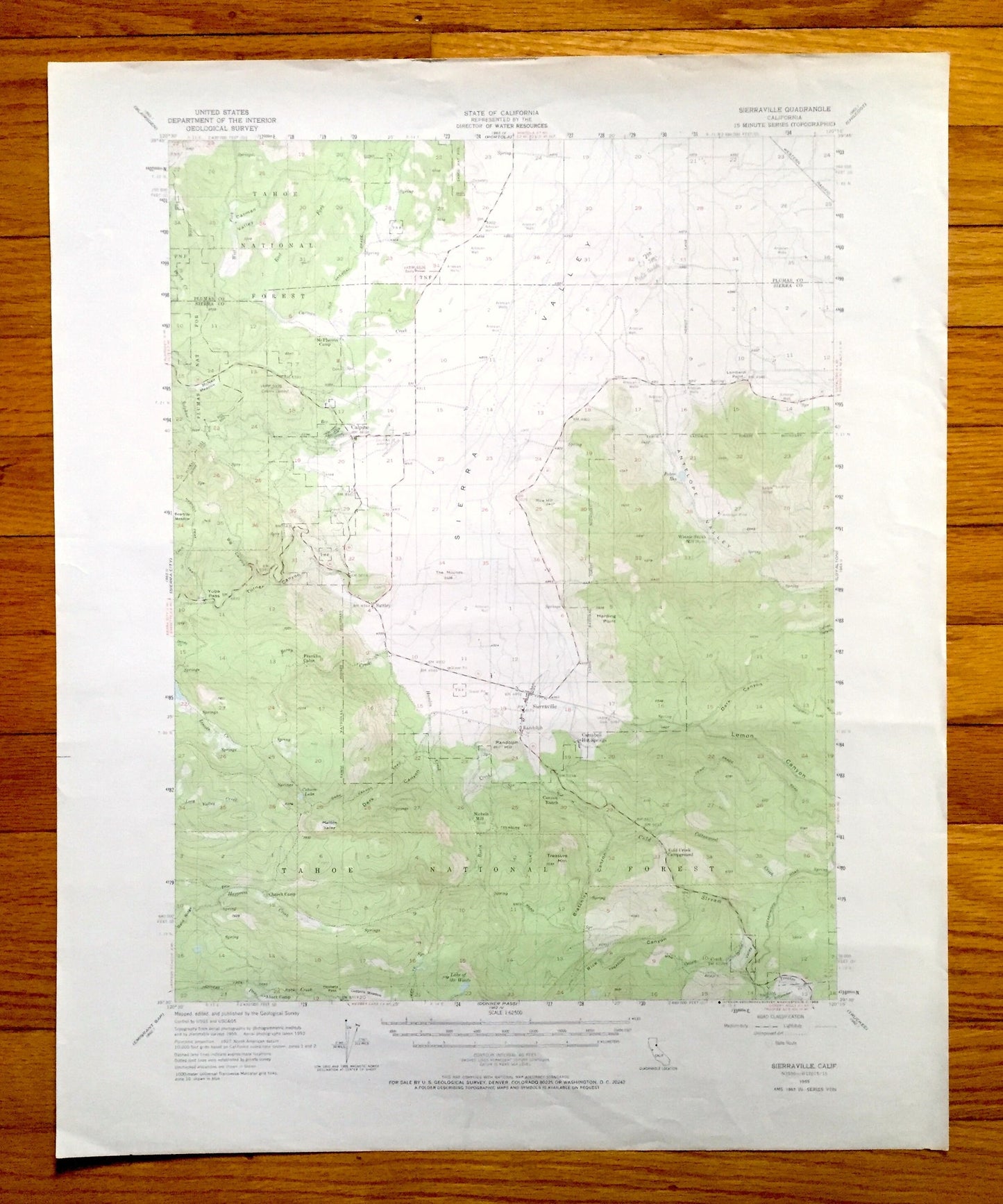
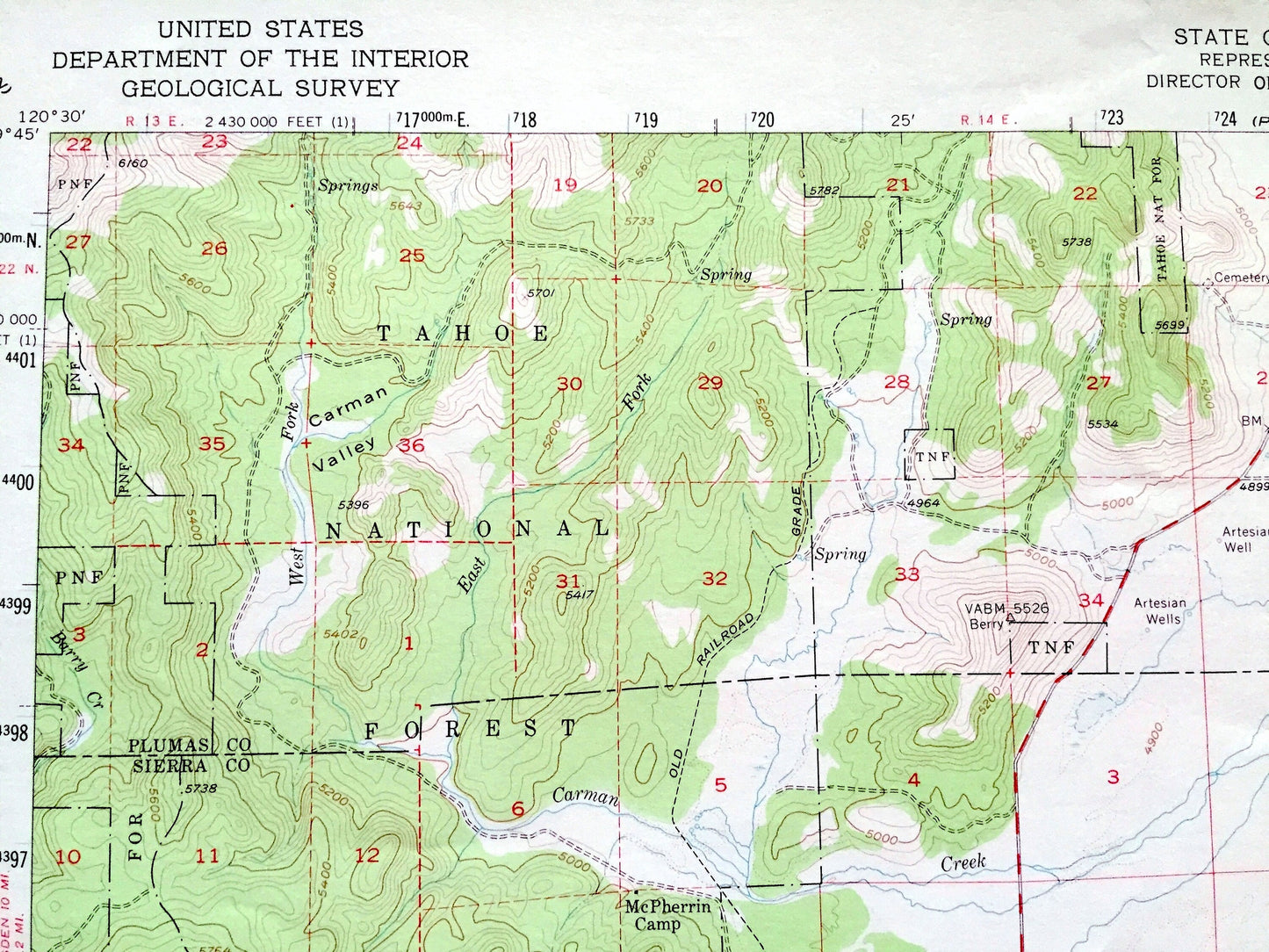
Antique Sierraville, California 1955 US Geological Survey Topographic Map – Plumas, Sierra County, Tahoe National Forest, Sierra Valley, CA
Antique Sierraville, California 1955 US Geological Survey Topographic Map – Plumas, Sierra County, Tahoe National Forest, Sierra Valley, CA
Beautiful, antique map of Sierraville, California and surrounding Sierra County & Plumas County area. This is an authentic 1955 edition, 1969 print from the U.S. Geological Survey and NOT a computer reproduction.
See what California looked like more than 65 years ago. Lots of intricate details and geological contours. Map even has little squares for every house that existed at the time. The USGS cartographers were very thorough back then!
Perfect for the historian, map-lover, the curious or just as a conversation starter. Wonderful and rare. Vintage maps such as this make great gifts.
Edition of 1955, printed 1969
Dimensions: 18" width x 22" height
----
Features
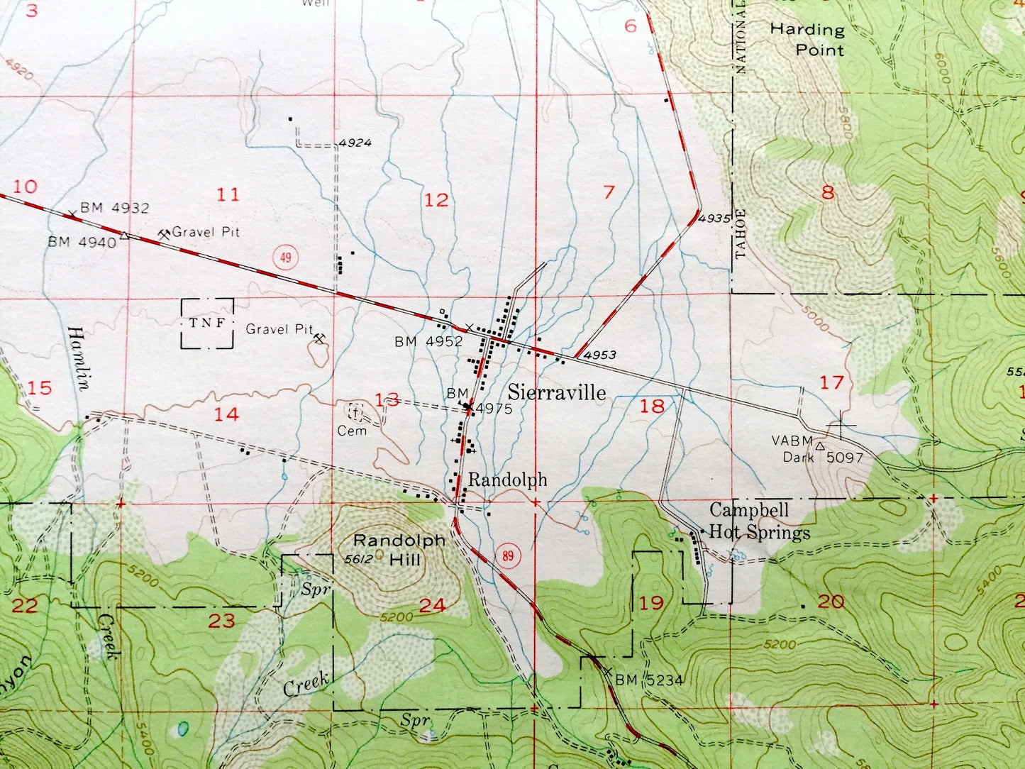
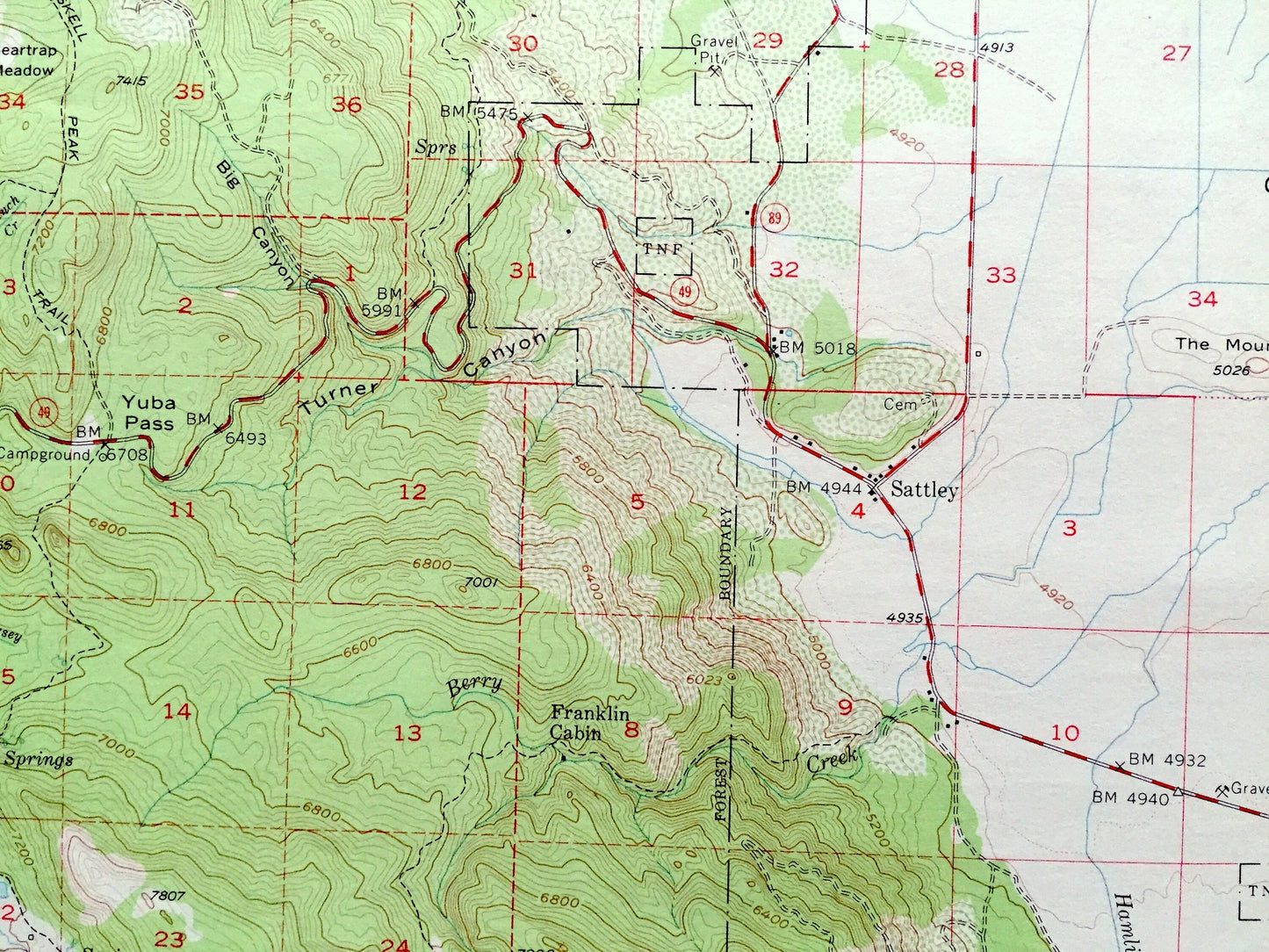
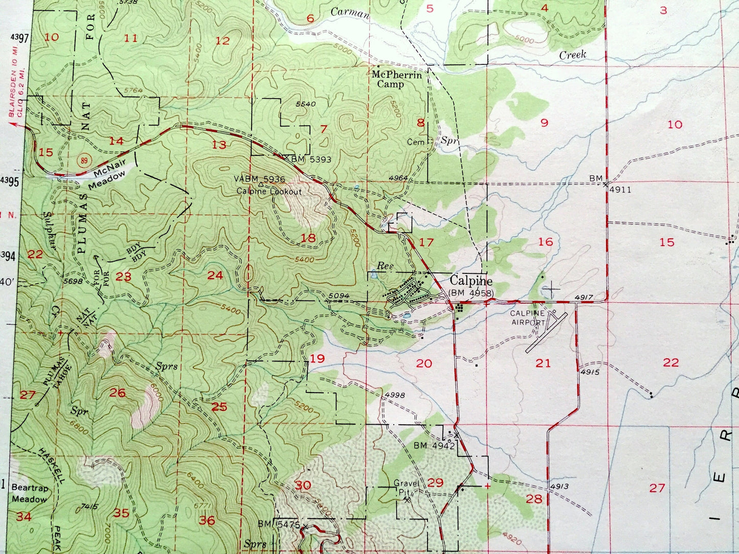
Cities & Towns: Sierraville, Calpine, Sattley, Randolph, Campbell Hot Springs.
Points of Interest: Plumas County, Sierra County, Tahoe National Forest, Plumas National Forest, Sierra Valley, Antelope Valley, Yuba Pass, Turner Canyon, Cold Creek Campground, Truckee River, Lemon Canyon, Franklin Cabin, Treasure Mountain, Lake of the Woods, Onion Creek, Harding Point, Beartrap Meadow, , and many more small towns, springs, train tracks, valleys, hills and creeks.
Condition: Very Good Vintage condition, commensurate with age. This map is in great shape for being more than 50 years old. Some light edge wear and toning, all of which will add to vintage character when framed.
----
We will happily adjust shipping price for multiple purchases. Maps are rolled up and shipped in sturdy mailing tubes, never folded.
Couldn't load pickup availability
Share