My Store
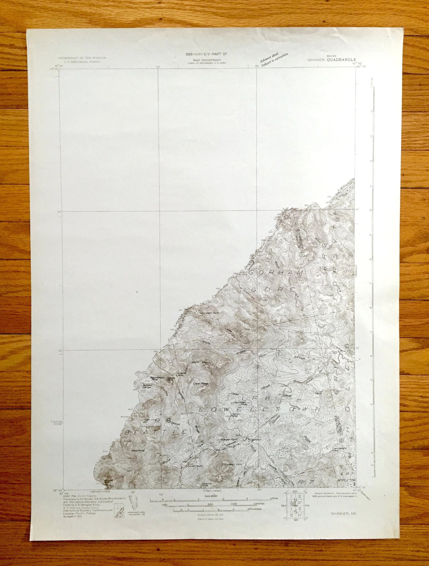
Antique Skinner, Maine 1928 US Geological Survey Topographic Map – Franklin, Somerset County, Beattie, Lowellton, Forsythe, Holeb, Appleton
Antique Skinner, Maine 1928 US Geological Survey Topographic Map – Franklin, Somerset County, Beattie, Lowellton, Forsythe, Holeb, Appleton
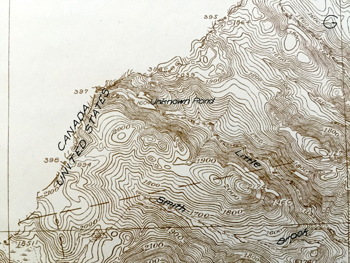
Beautiful, antique map of Skinner, Maine and surrounding Franklin & Somerset County on the Canadian border. This is an authentic 1928 print from the U.S. Geological Survey Department of the Interior and the War Department US Army Corps of Engineers. It is an original and NOT a computer reproduction. It is also a very rare Advanced Sheet.
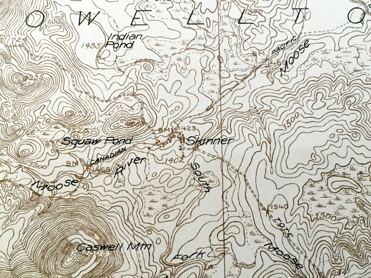
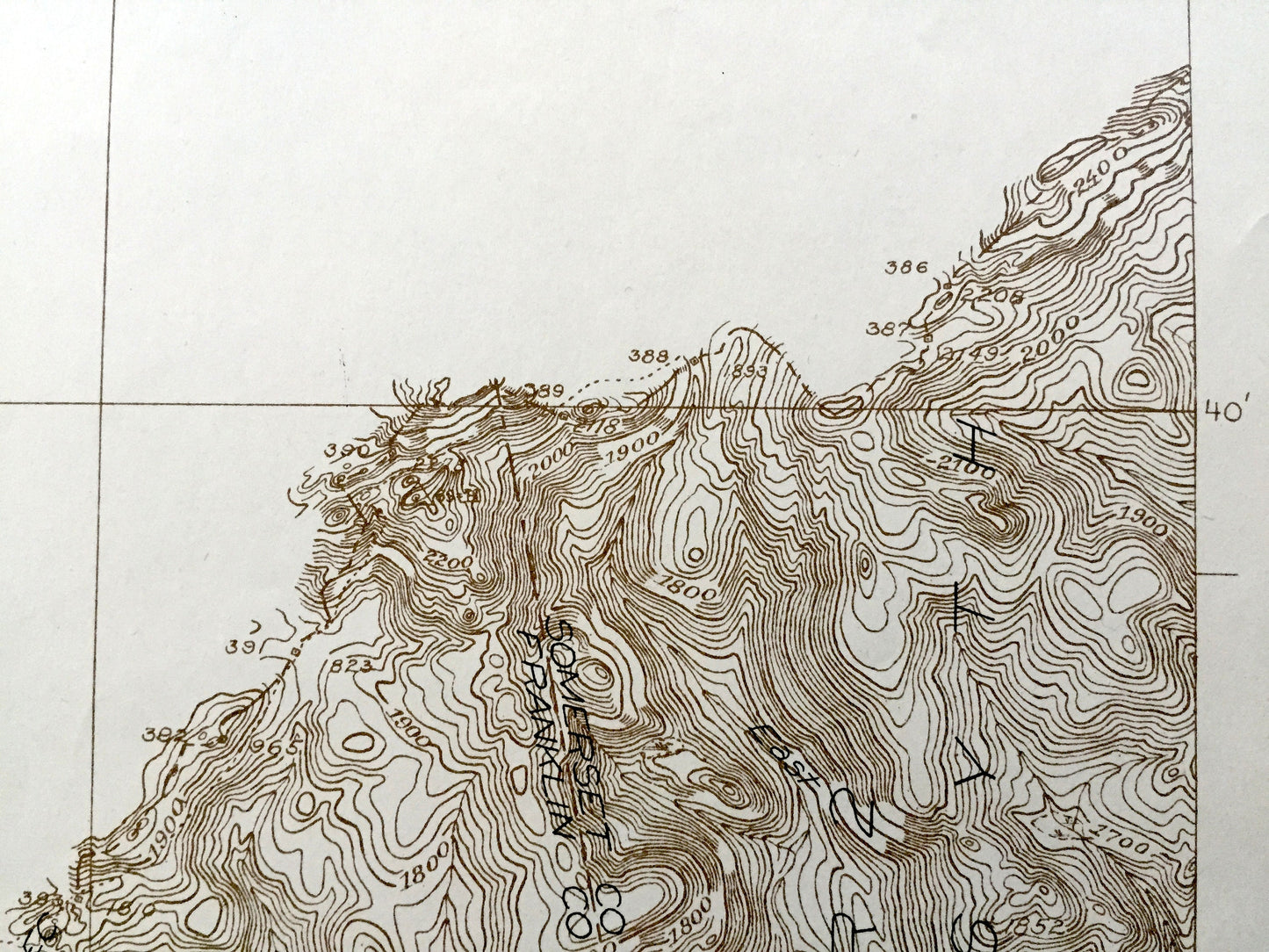
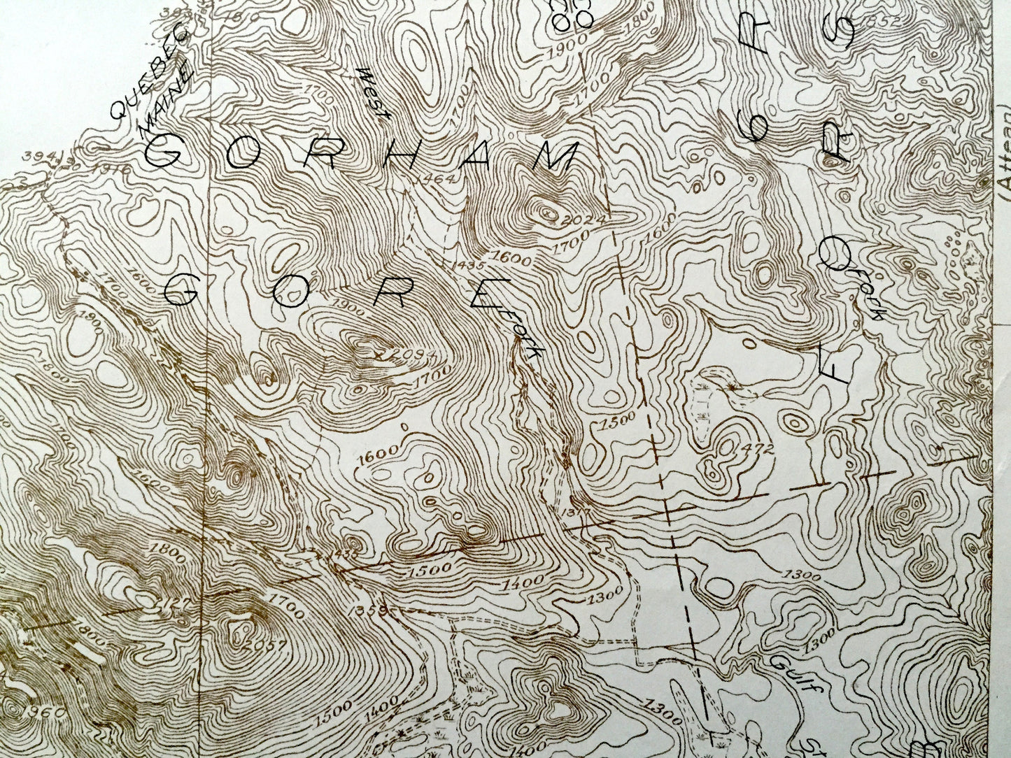
See what Maine looked like over 95 years ago. Lots of intricate details and geological contours. Map even has little squares for every house that existed at the time. The USGS cartographers were very thorough back then! On the back is a description of topographic symbols and map guide.
Perfect for the historian, map-lover, the curious or just as a conversation starter. Wonderful and rare. Vintage maps such as these make great gifts.
Edition of 1928, printed 1928
Dimensions: 20" width x 27 1/2" height
----
Features
Cities & Towns: Skinner, Beattie, Gorham Gore, Forsythe, Lowelltown, Holeb, Appleton.
Points of Interest: Franklin County, Somerset County, Clear Pond Mountain, Twin Island Pond, Little Gulf Stream, Moose Hill, Summit Camps, Unknown Pond, and lots more hills, mountains, streams, ponds, houses, schools and roads.
Condition: Good Vintage condition, commensurate with age. This map is in great shape for being over 75 years old. Has light wear, foxing and toning, but this will all add to vintage character when framed.
----
We will happily adjust shipping price for multiple purchases. Maps are rolled up and shipped in sturdy mailing tubes, never folded.
Couldn't load pickup availability
Share