My Store
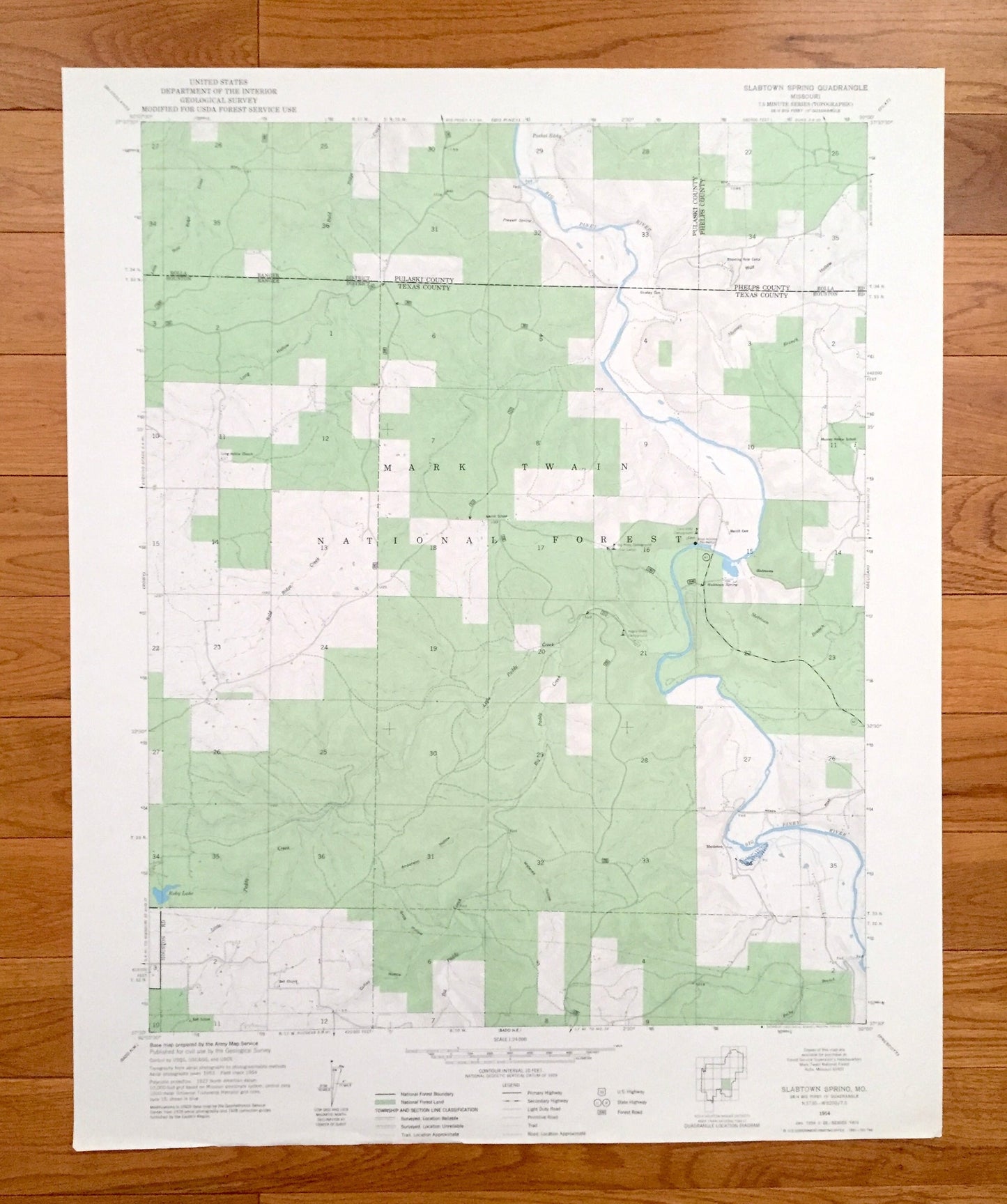
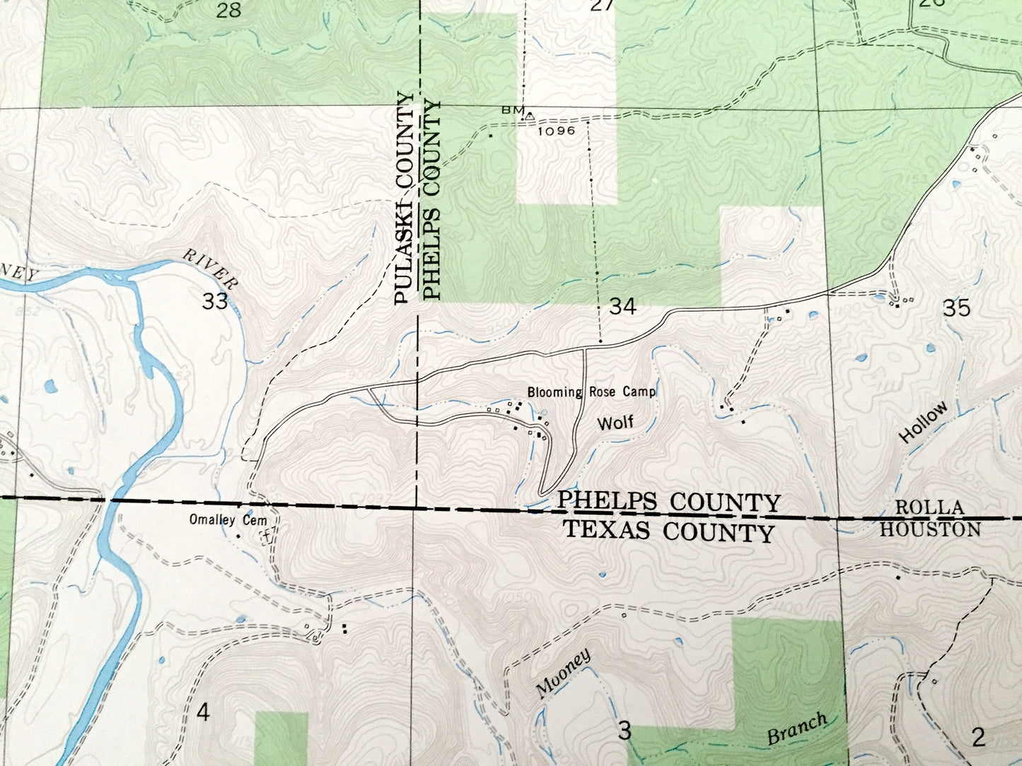
Antique Slabtown Spring, Missouri 1954 US Geological Survey Topographic Map – Pulaski, Phelps, Texas County, Hazelton, Mark Twain Forest, MO
Antique Slabtown Spring, Missouri 1954 US Geological Survey Topographic Map – Pulaski, Phelps, Texas County, Hazelton, Mark Twain Forest, MO
Beautiful, antique map of Slabtown Spring, Missouri and surrounding Pulaski County, Phelps County, and Texas County areas. This is an authentic 1954 edition, 1977 print from the U.S. Geological Survey and NOT a computer reproduction.
See what Missouri looked like over 65 years ago. Lots of intricate details and geological contours. Map even has little squares for every house that existed at the time. The USGS cartographers were very thorough back then!
Perfect for the historian, map-lover, the curious or just as a conversation starter. Wonderful and rare. Vintage maps such as these make great gifts.
Edition of 1954, printed 1977
Dimensions: 22" width x 27" height
----
Features
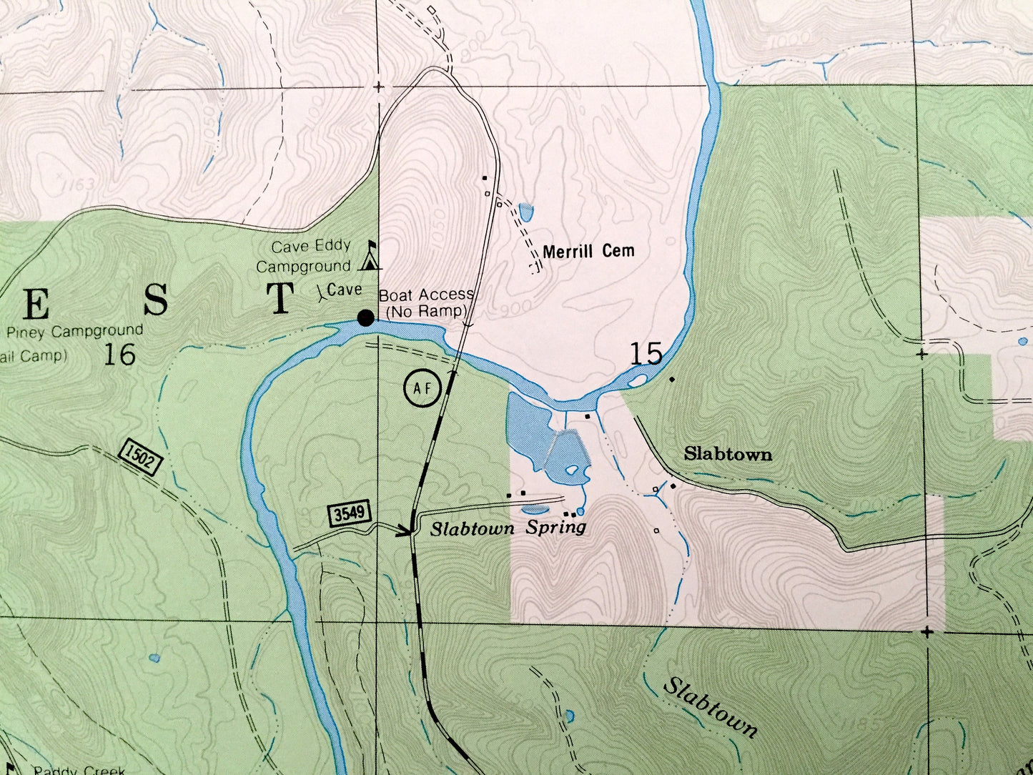
Cities & Towns: Slabtown, Hazelton.
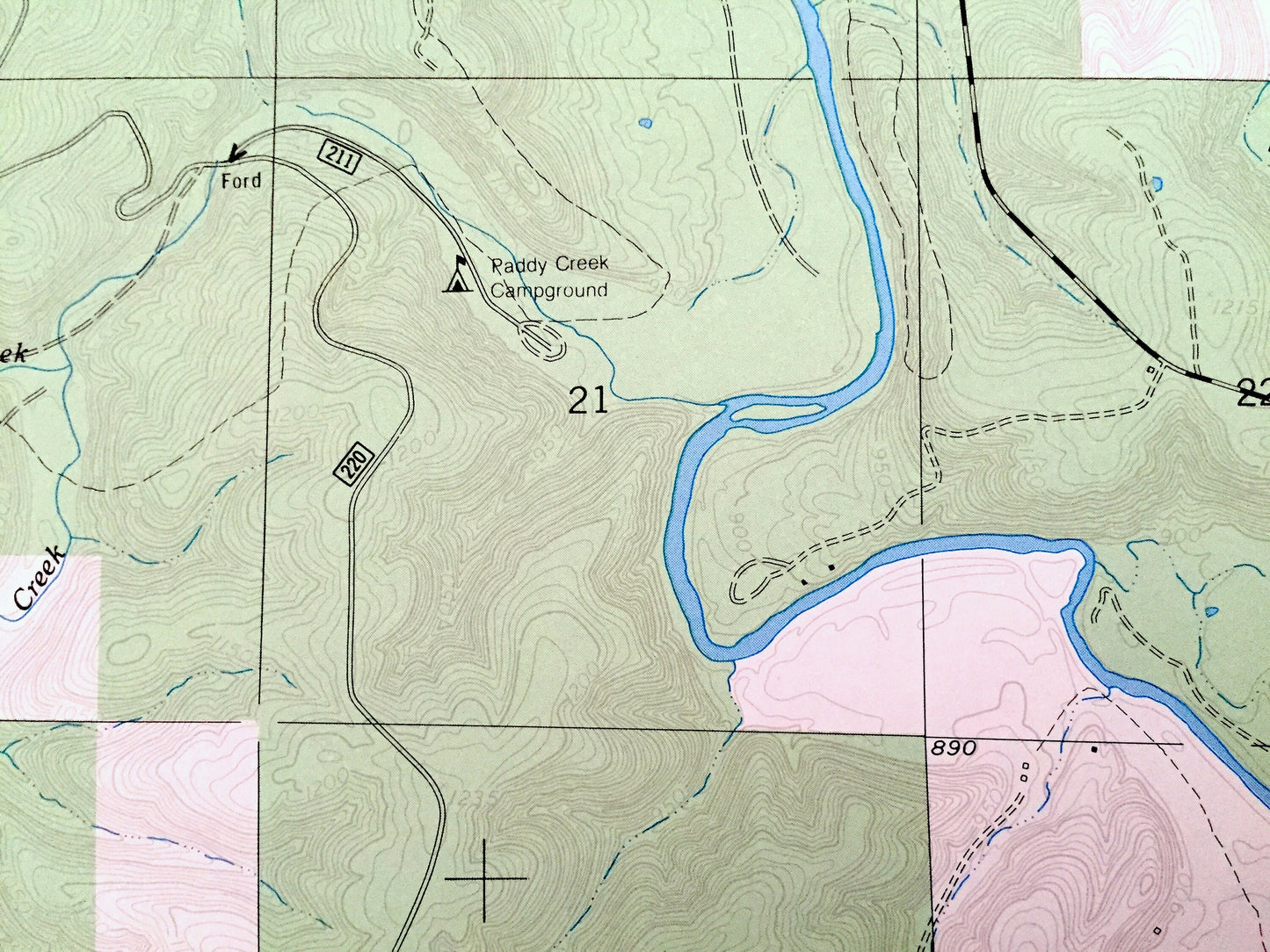
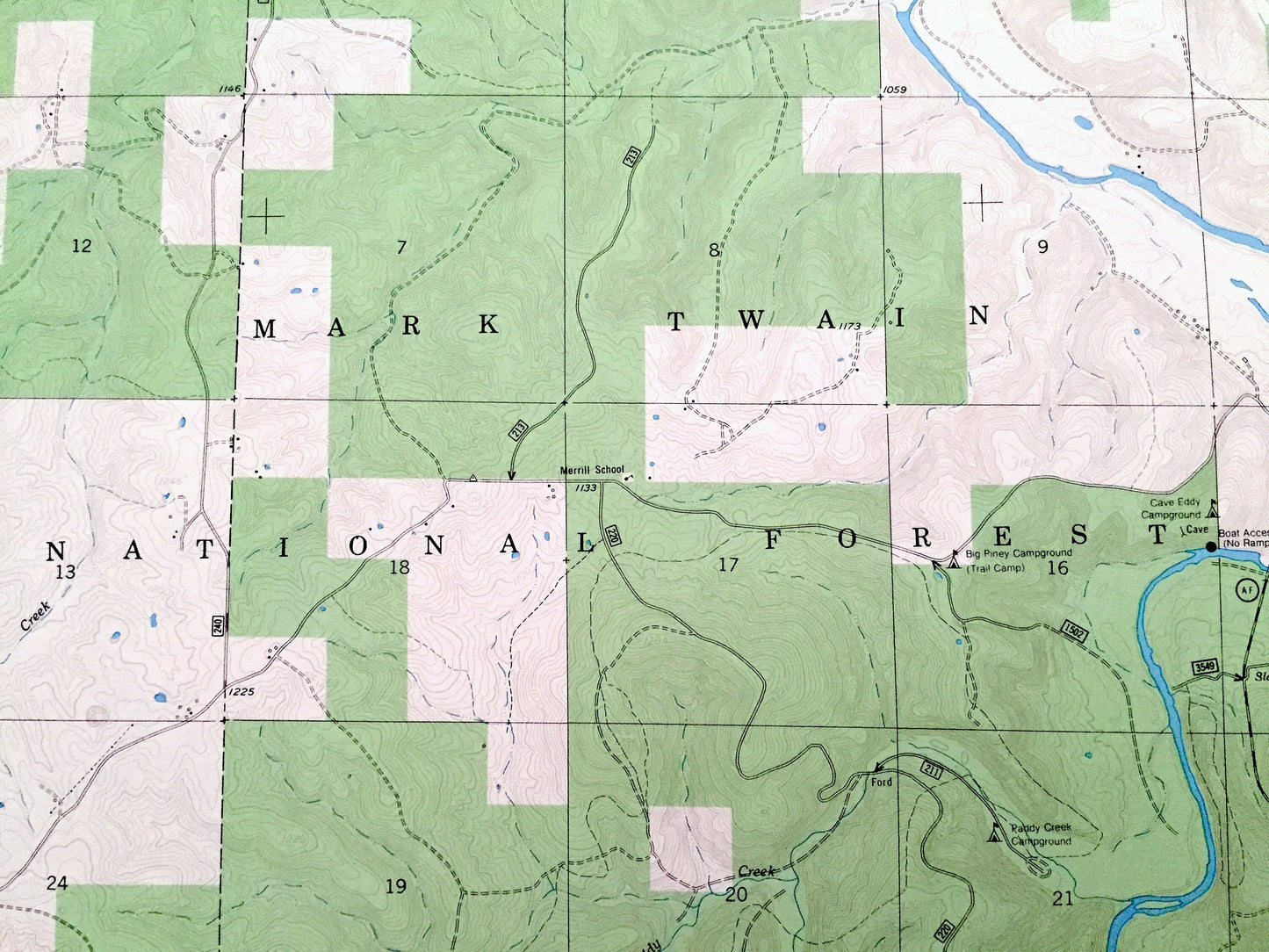
Points of Interest: Mark Twain National Forest, Big Piney Campground, Paddy Creek Campground, Cave Eddy Campground, Blooming Rose Camp, Wolf Hollow, Coffey Hollow, Anderson Hollow, Watered Hollow, Grub Hollow, Long Hollow, Bald Ridge Creek, Little Paddy Creek, Slabtown Branch, Big Piney River, Mooney Branch, Roby Lake, and many more hills, streams, ponds, houses, schools, railroads, churches and roads.
Condition: Very Good Vintage condition, commensurate with age. This map is in great shape for being over 50 years old. Has light edge-wear but will read as character when framed.
----
We will happily adjust shipping price for multiple purchases. Maps are rolled up and shipped in sturdy mailing tubes, never folded.
Couldn't load pickup availability
Share