My Store
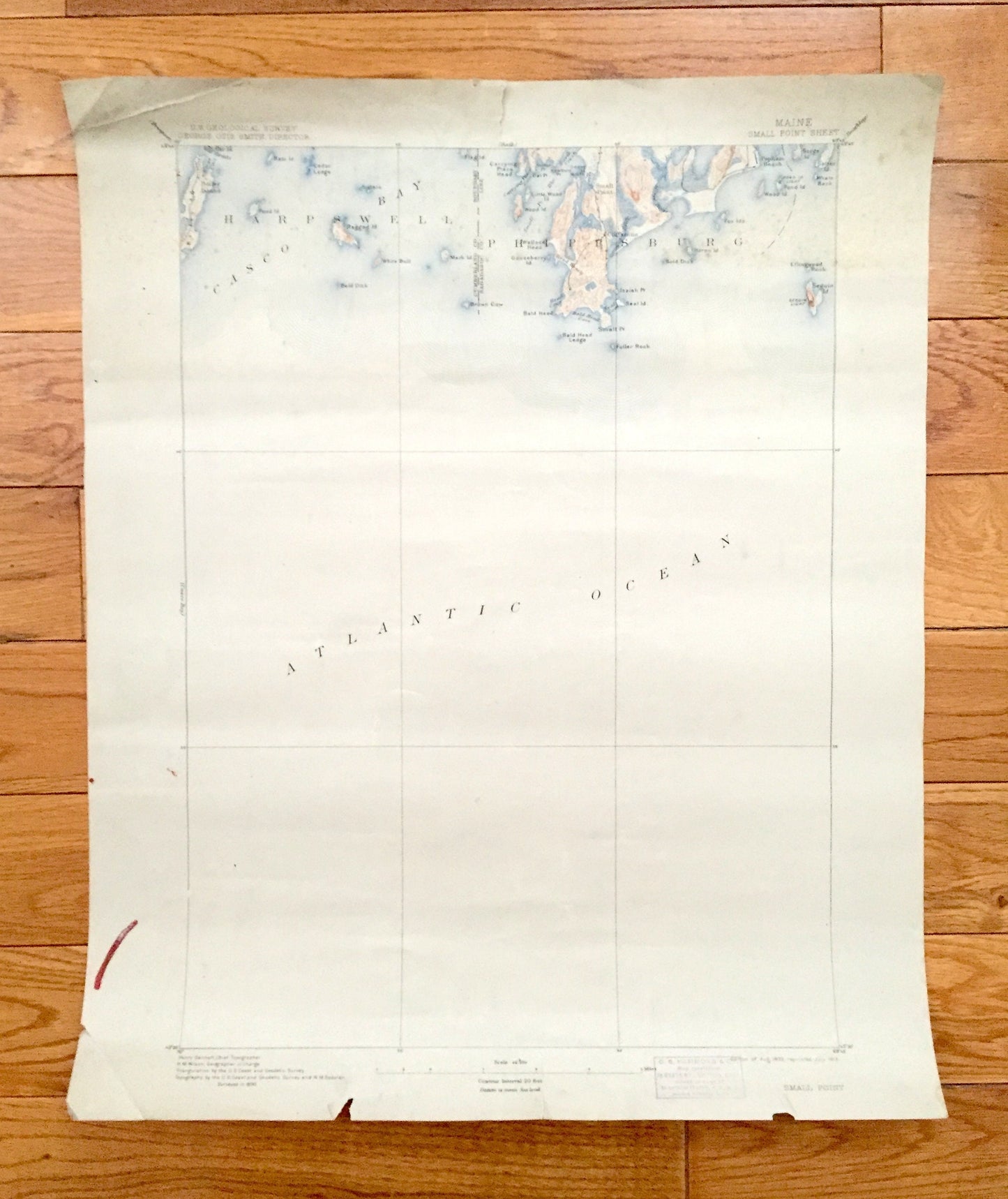
Antique Small Point, Maine 1893 US Geological Survey Topographic Map – Harpswell, Phippsburg, Cliffstone, Popham Beach, Cumberland, Casco ME
Antique Small Point, Maine 1893 US Geological Survey Topographic Map – Harpswell, Phippsburg, Cliffstone, Popham Beach, Cumberland, Casco ME
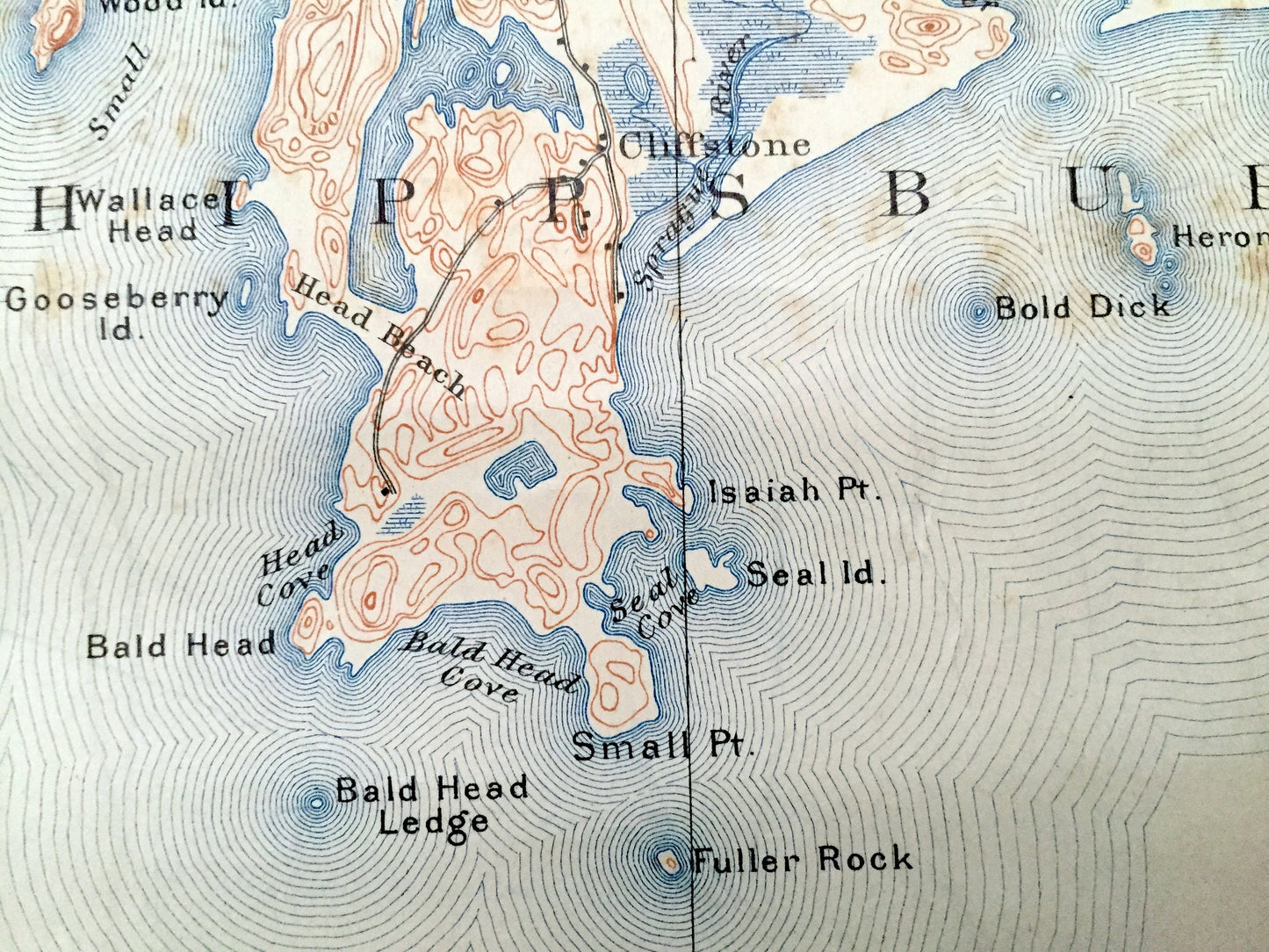
Beautiful, antique map of Harpswell & Phippsburg, Maine and the islands of Cumberland and Sagadahoc Counties. This is an authentic 1893 edition, 1913 print from the U.S. Geological Survey and not a computer reprint.
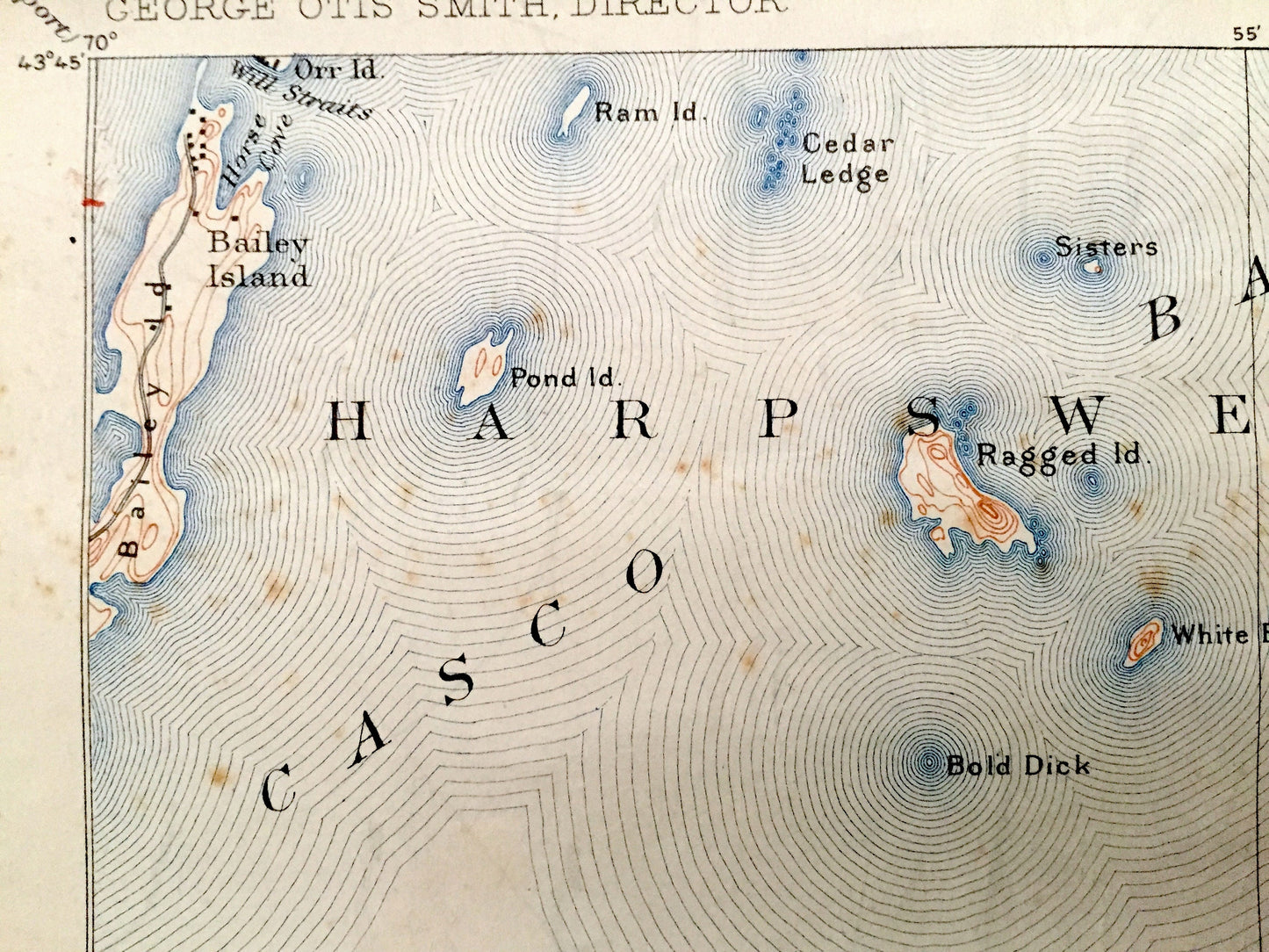
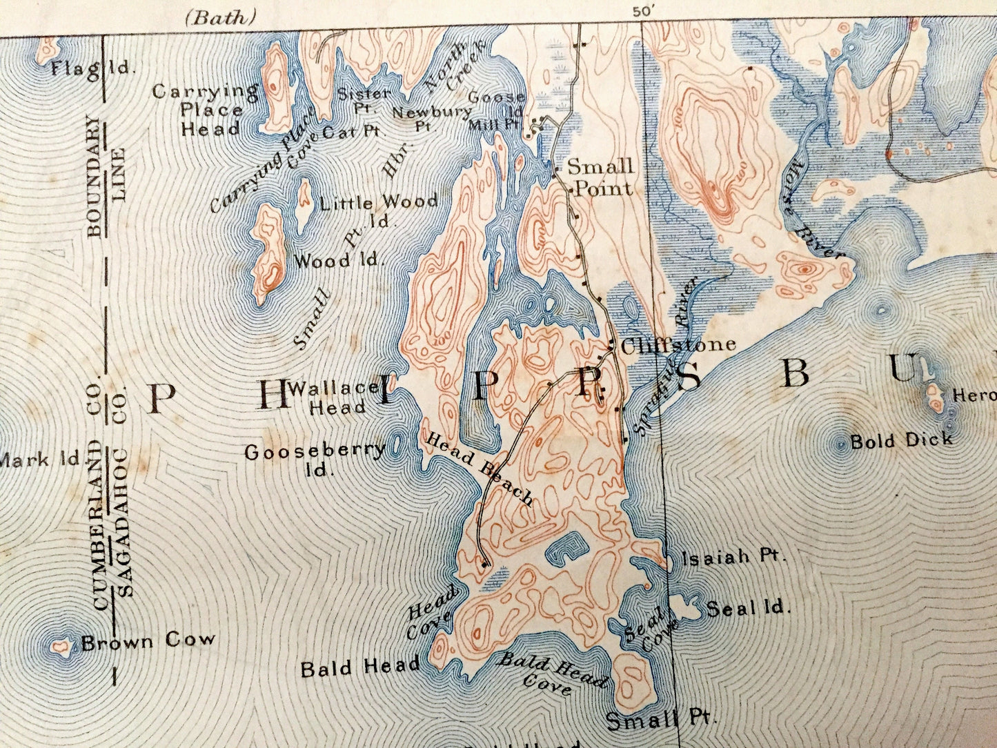
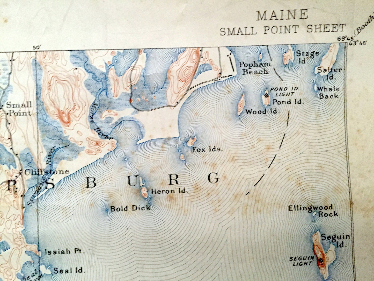
See what the coast of Maine looked like more than 120 years ago. Lots of intricate details and geological contours. Map even has little squares for every house that existed. The USGS cartographers were very thorough back then! On the back is a description of topographic symbols and map guide.
Perfect for the historian, map-lover, the curious or just as a conversation starter. Wonderful and rare. Vintage maps such as these make great gifts.
Edition of 1893, printed 1913
Dimensions: 16 1/2" width x 20" height
----
Features
Towns: Harpswell, Phippsburg, Small Point, Cliffstone, Popham Beach.
Points of Interest: Atlantic Ocean, Casco Bay, Small Point, Bailey Island, Pond Island, Ragged Island, Carrying Place Head, Gooseberry Island, Head Beach, Mark Island, Wallace Head, North Creek, Bold Dick, Bald Head Ledge, Bald Head, Seal Island, Fuller Rock, Fox Islands, Stage Island, Pond Island Light, Ellingwood Rock, Seguin Island, Seguin Island Light, Morse River, and lots more hills, creeks, points, bays, islands, beaches, towns, roads.
Condition: Good Vintage condition, commensurate with age. This map is in great shape for being more than 100 years old. Has some edge-wear and spotting, but this will all add to vintage character when framed.
----
We will happily adjust shipping price for multiple purchases. Maps are rolled up and shipped in sturdy mailing tubes, never folded.
Couldn't load pickup availability
Share