My Store
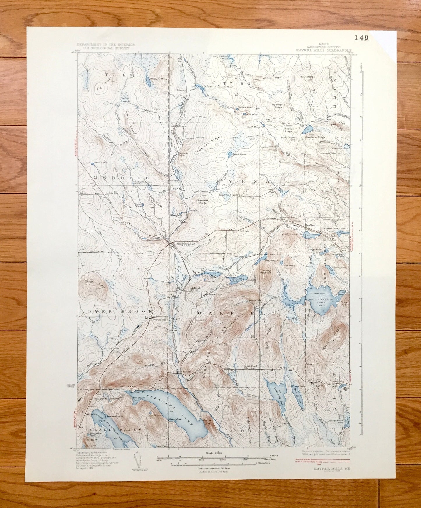
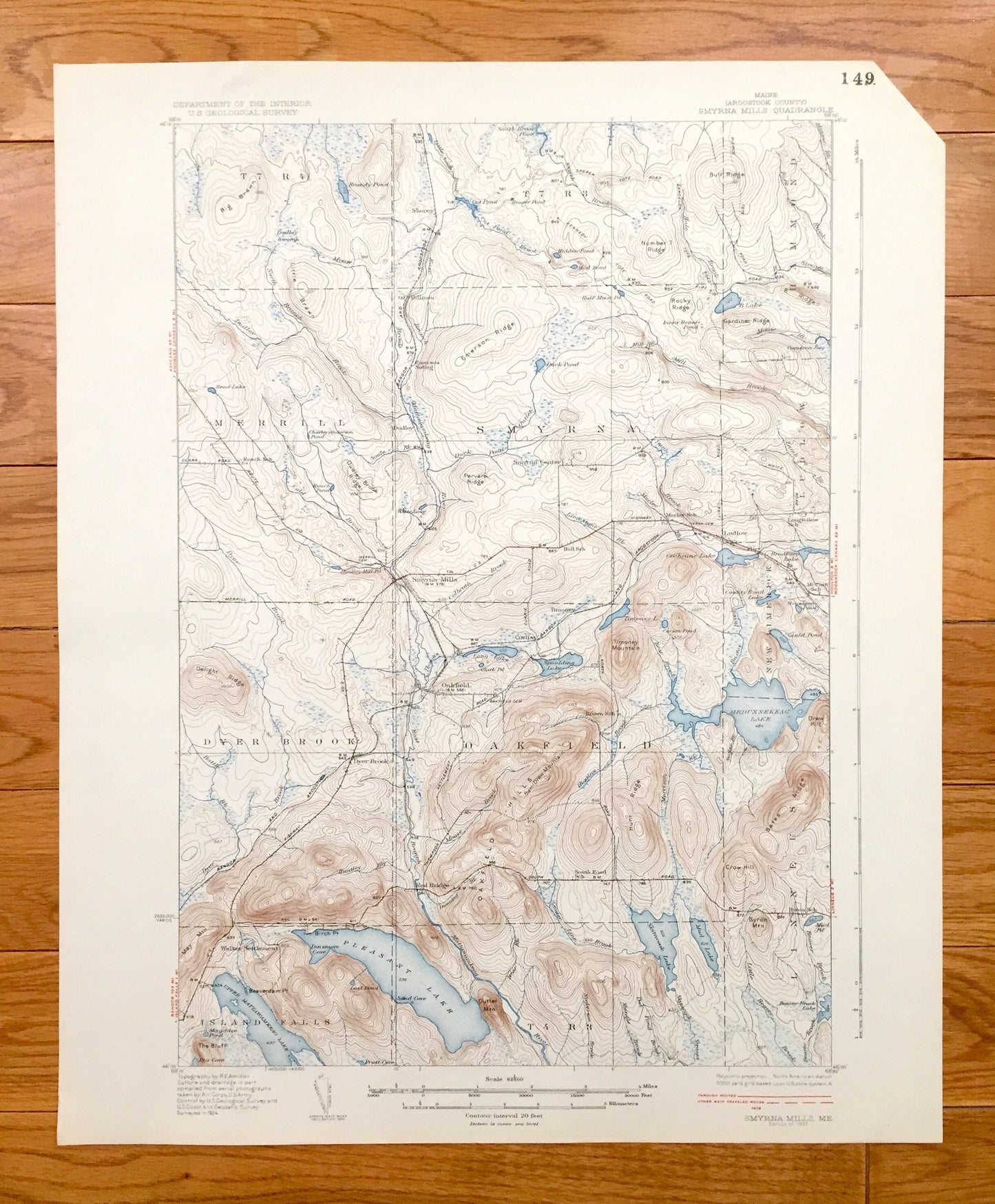
Antique Smyrna Mills, Maine 1937 US Geological Survey Topographic Map – Aroostook County, Oakfield Island Falls Pleasant Meduxnekeag Lake ME
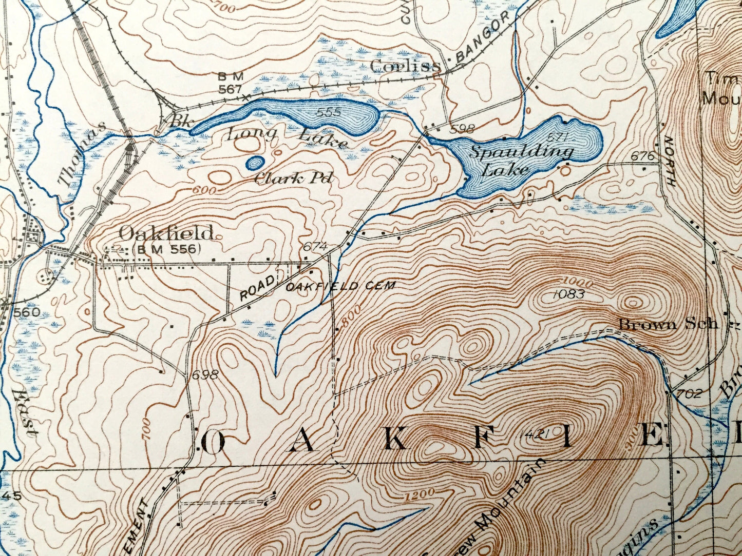
Antique Smyrna Mills, Maine 1937 US Geological Survey Topographic Map – Aroostook County, Oakfield Island Falls Pleasant Meduxnekeag Lake ME
Beautiful, antique map of Hammond, Smyrna, Merrill, Dyer Brook, Oakfield, Linneus and Island Falls, Maine. This is an authentic 1937 print from the U.S. Geological Survey and NOT a computer reproduction.
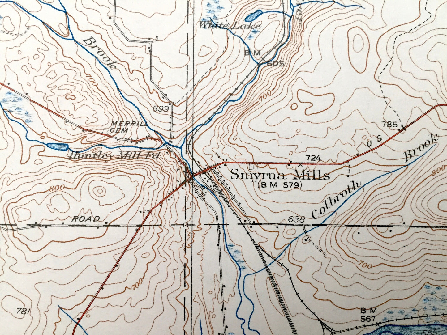
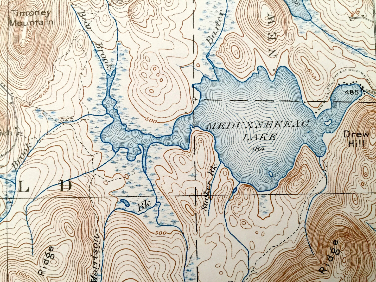
See what Aroostook County looked like over 85 years ago. Lots of intricate details and geological contours. Map even has little squares for every house that existed at the time. The USGS cartographers were very thorough back then! On the back is a description of topographic symbols and map guide.
Perfect for the historian, map-lover, the curious or just as a conversation starter. Wonderful and rare. Vintage maps such as these make great gifts.
Edition of 1937, printed 1937
Dimensions: 16 1/2" width x 20" height
----
Features
Cities & Towns: Dyer Brook, Merrill, Smyrna Mills, Smyrna Center, Emerson Siding, Hammond, Ludlow, Oakfield, Walker Settlement, Island Falls, Red Bridge, Linneus, New Limerick, Ludlow.
Points of Interest: Brandy Pond, Meduxnekeag Lake, Pleasant Lake, Upper Mattawamkeag Lake, Delight Ridge, Roach School, Hall School, Spaulding Lake, Mmoney Mountain, Skitacook Lake, Mud Lake, Byron School, Oakfield Hills, Sam Drew Mountain, Pervere Ridge, Bangor & Aroostook Railroad, Marley School, Emerson Ridge, Mattawamkeag River, and lots more hills, mountains, streams, ponds, houses, schools and roads.
Condition: Good Vintage condition, commensurate with age. This map is in great shape for being over 85 years old. Has light edge-wear, clipped upper right corner, stamp and toning, and all adds to vintage character when framed.
----
We will happily adjust shipping price for multiple purchases. Maps are rolled up and shipped in sturdy mailing tubes, never folded.
Couldn't load pickup availability
Share