My Store
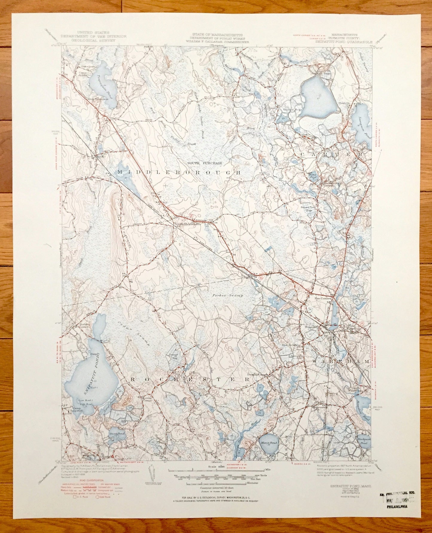
Antique Snipatuit Pond, Massachusetts 1942 US Geological Survey Topographic Map – Rochester, Middleborough, Carver, Wareham, Tremont, MA
Antique Snipatuit Pond, Massachusetts 1942 US Geological Survey Topographic Map – Rochester, Middleborough, Carver, Wareham, Tremont, MA
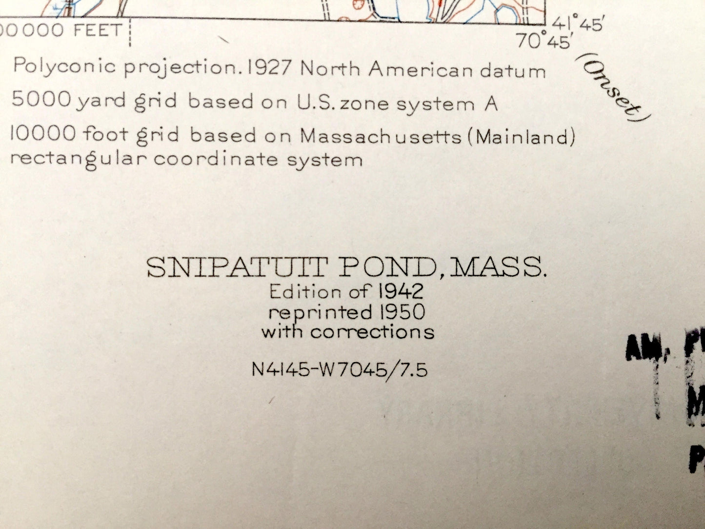
Beautiful, antique map of Rochester, Middleborough, Wareham, Carver, Massachusetts. This is an authentic edition of 1942 edition, 1950 print from the U.S. Geological Survey and NOT a computer reproduction.
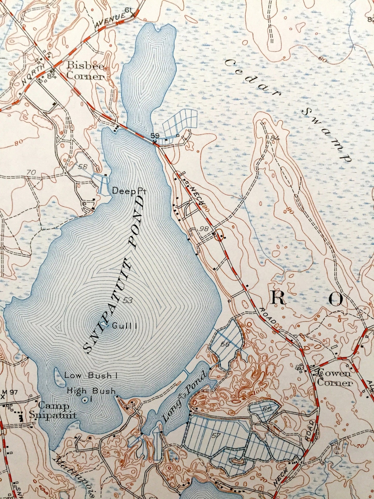
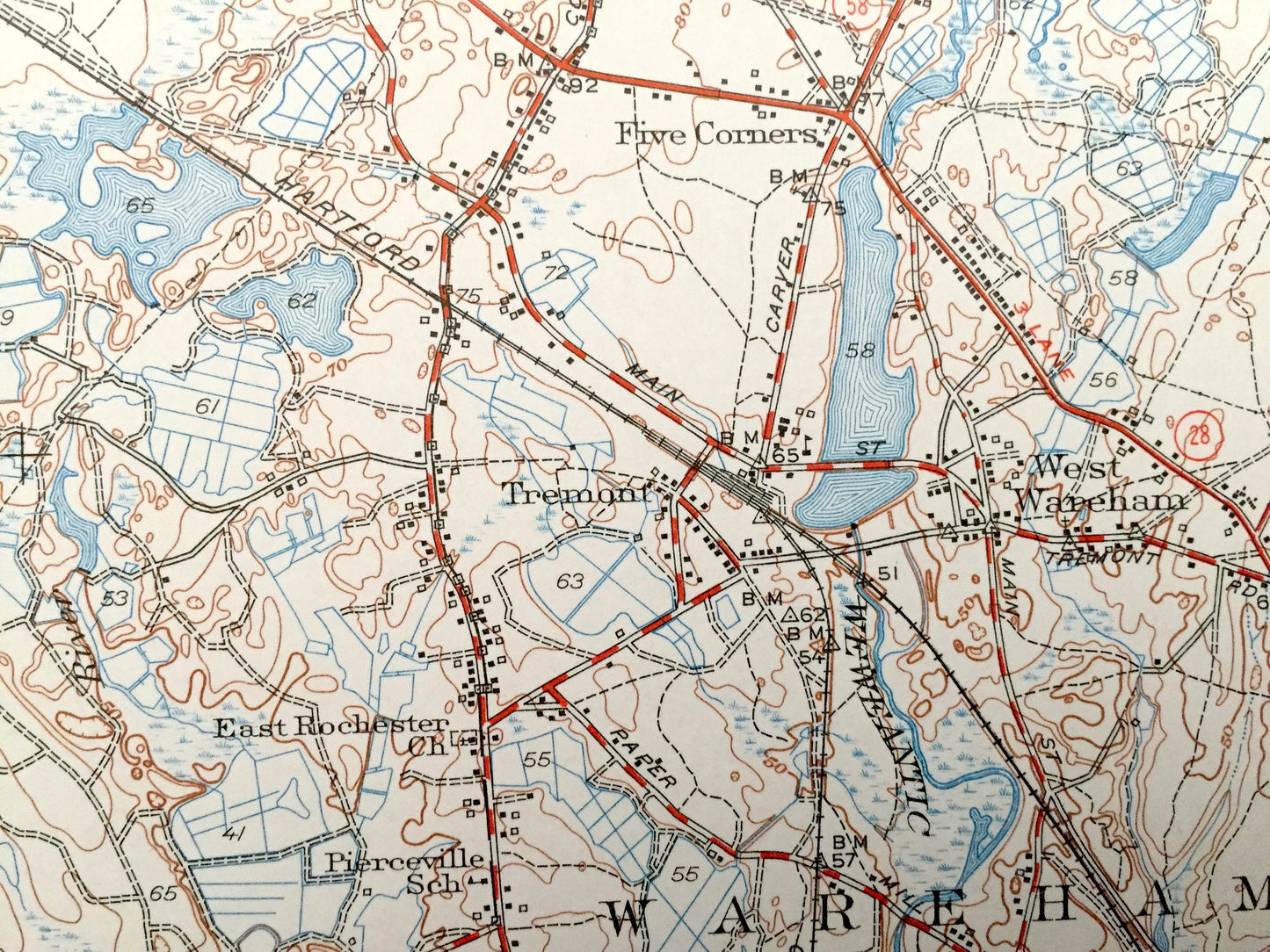
See what Rochester, Massachusetts and the surrounding Plymouth County area looked like over 75 years ago. Lots of intricate details and geological contours. Map even has little squares for every house that existed at the time. The USGS cartographers were very thorough back then!
Perfect for the historian, map-lover, the curious or just as a conversation starter. Wonderful and rare. Vintage maps such as these make great gifts.
Edition of 1942, printed 1950
Dimensions: 17" width x 21" height
----
Features
Cities & Towns: Rochester, Middleborough, Carver, Wareham, South Middleborough, South Wareham, West Wareham, Tremont.
Points of Interest: Snipatuit Pond, Snows Pond, Mary Pond, Sampson Pond, Benson Pond Bogs, South Purchase, Atwood Bogs, Camp Yomechas, Camp Aroda, Steward School, New York New Haven and Hartford Railroad and many more roads, houses, reservoirs, ponds, and hills.
Condition: Very Good Vintage condition, commensurate with age. This map is in great shape for being over 70 years old.
----
We will happily adjust shipping price for multiple purchases. Maps are rolled up and shipped in sturdy mailing tubes, never folded.
Couldn't load pickup availability
Share