My Store
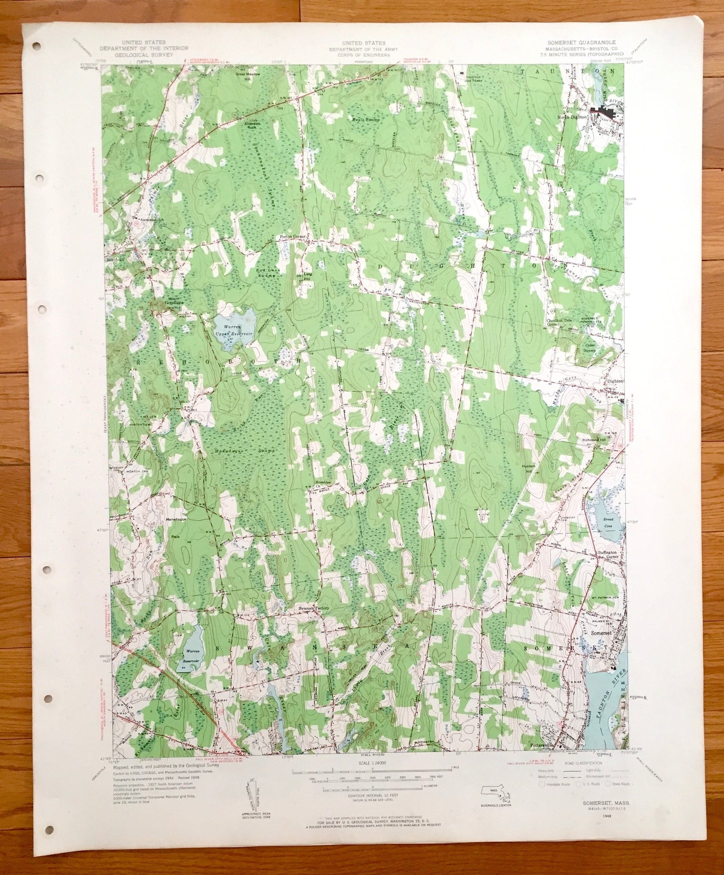
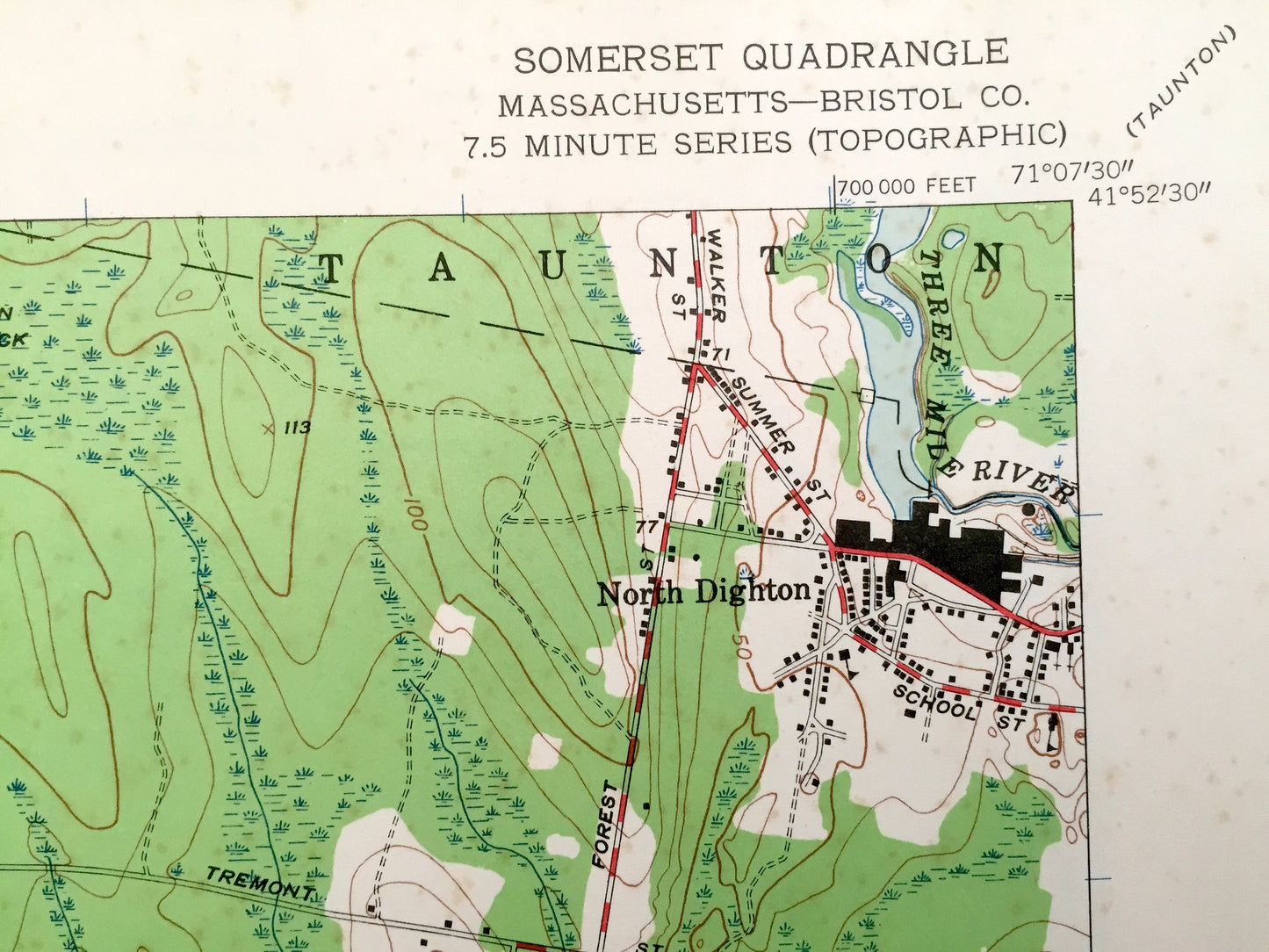
Antique Somerset, Massachusetts 1943 US Geological Survey Topographic Map – Dighton, Pottersville, Rehoboth, Manwhage, Bristol County
Antique Somerset, Massachusetts 1943 US Geological Survey Topographic Map – Dighton, Pottersville, Rehoboth, Manwhage, Bristol County
Beautiful, antique map of Somerset, Dighton, Pottersville and Rehoboth, Massachusetts. This is an authentic 1948 print from the U.S. Geological Survey and NOT a computer reproduction.
See what Somerset, Massachusetts and the surrounding Bristol County area looked like almost 70 years ago. Lots of intricate details and geological contours. Map even has little squares for every house that existed at the time. The USGS cartographers were very thorough back then!
Perfect for the historian, map-lover, the curious or just as a conversation starter. Wonderful and rare. Vintage maps such as these make great gifts.
Edition of 1948, printed 1948
Dimensions: 22" width x 27" height
----
Features
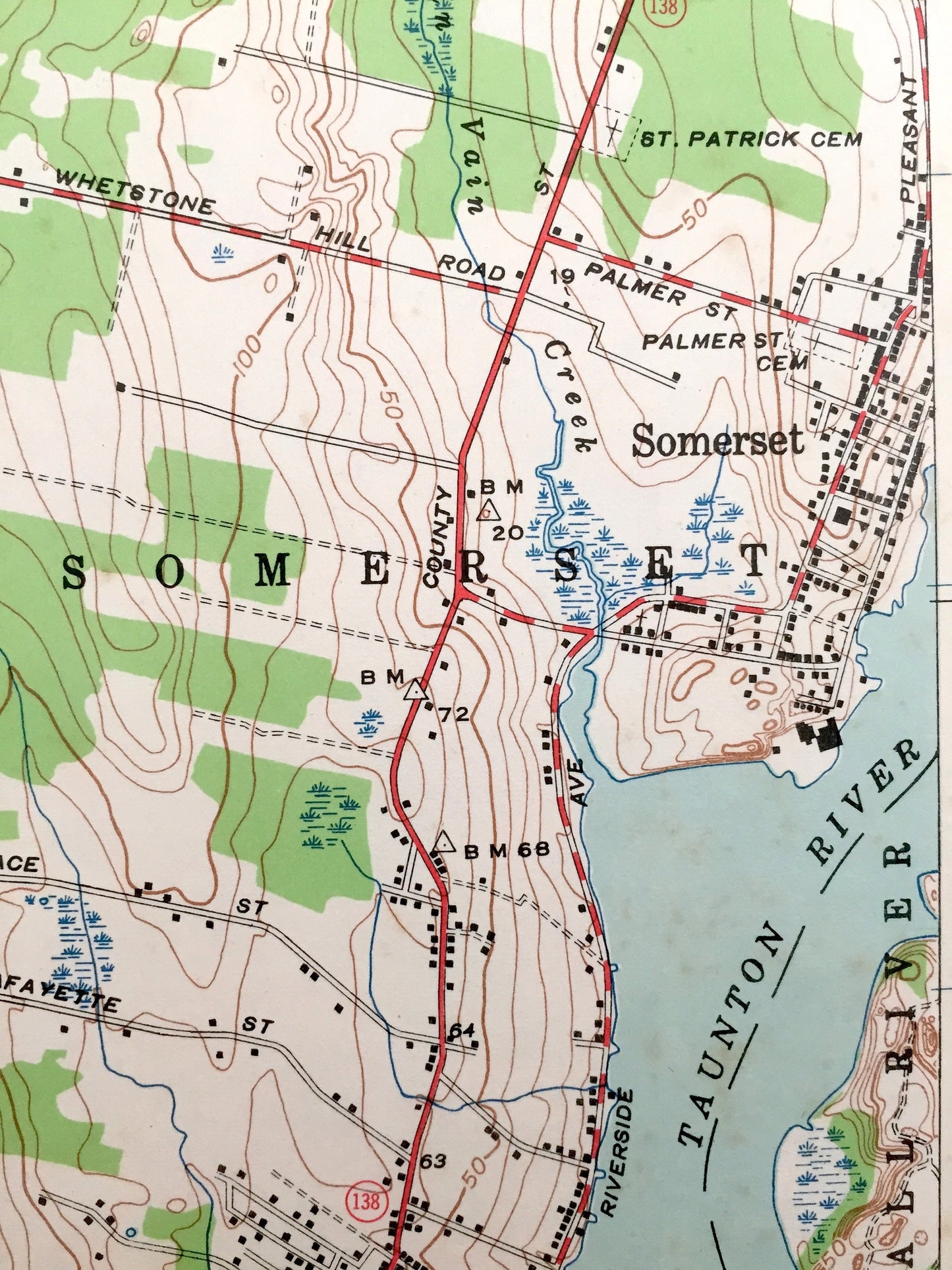
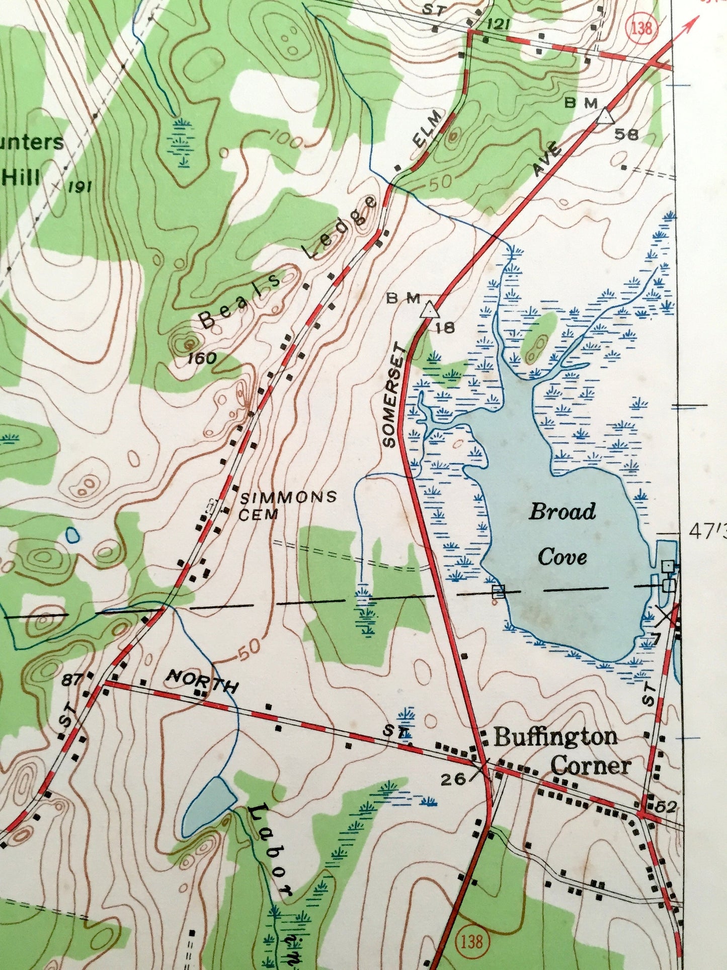
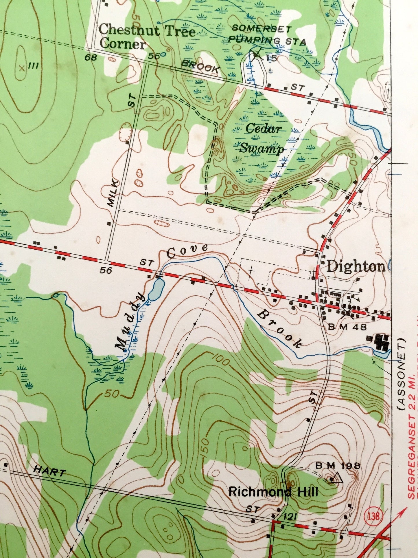
Cities & Towns: Somerset, North Dighton, Pottersville, Dighton, Rehoboth, Manwhage.
Points of Interest: Taunton River, Warren Upper Reservoir, Annawan School, Mount Terydiddle, Horbine Church and many more roads, houses, reservoirs, ponds, and hills.
Condition: Very Good condition, commensurate with age. This map is in incredible shape for being almost 70 years old. Map has punch holes but these are easily concealed with framing or placing a similar-colored paper behind the map, as can be seen in the photos.
----
We will happily adjust shipping price for multiple purchases. Maps are rolled up and shipped in sturdy mailing tubes, never folded.
Couldn't load pickup availability
Share