My Store
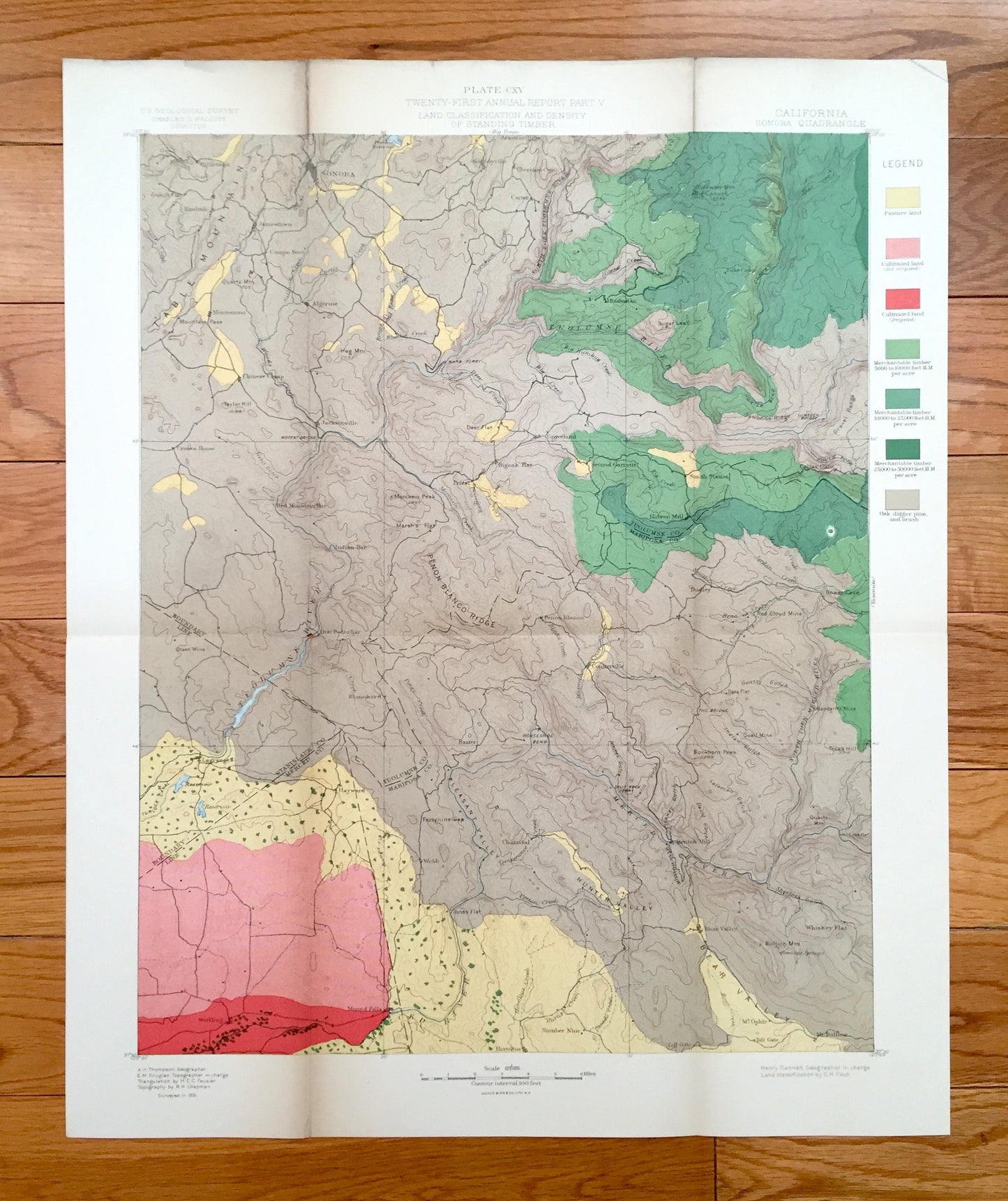
Antique Sonora, California 1891 US Geological Survey Topographic Map – Tuolumne Stanislaus Merced Mariposa County Yosemite National Park CA
Antique Sonora, California 1891 US Geological Survey Topographic Map – Tuolumne Stanislaus Merced Mariposa County Yosemite National Park CA
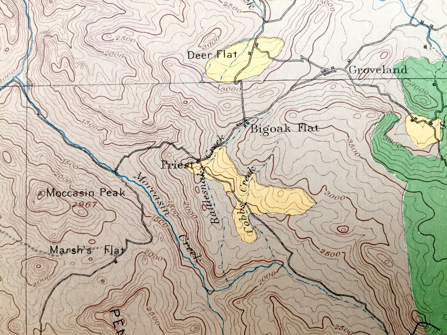
Beautiful, antique Land Classification map of Sonora, California and surrounding Tuolumne, Stanislaus, Merced & Mariposa County area. This is an authentic 1891 print from the U.S. Geological Survey and NOT a computer reproduction.
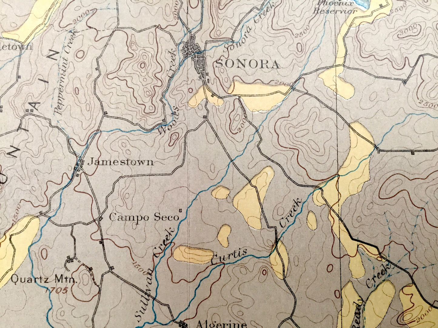
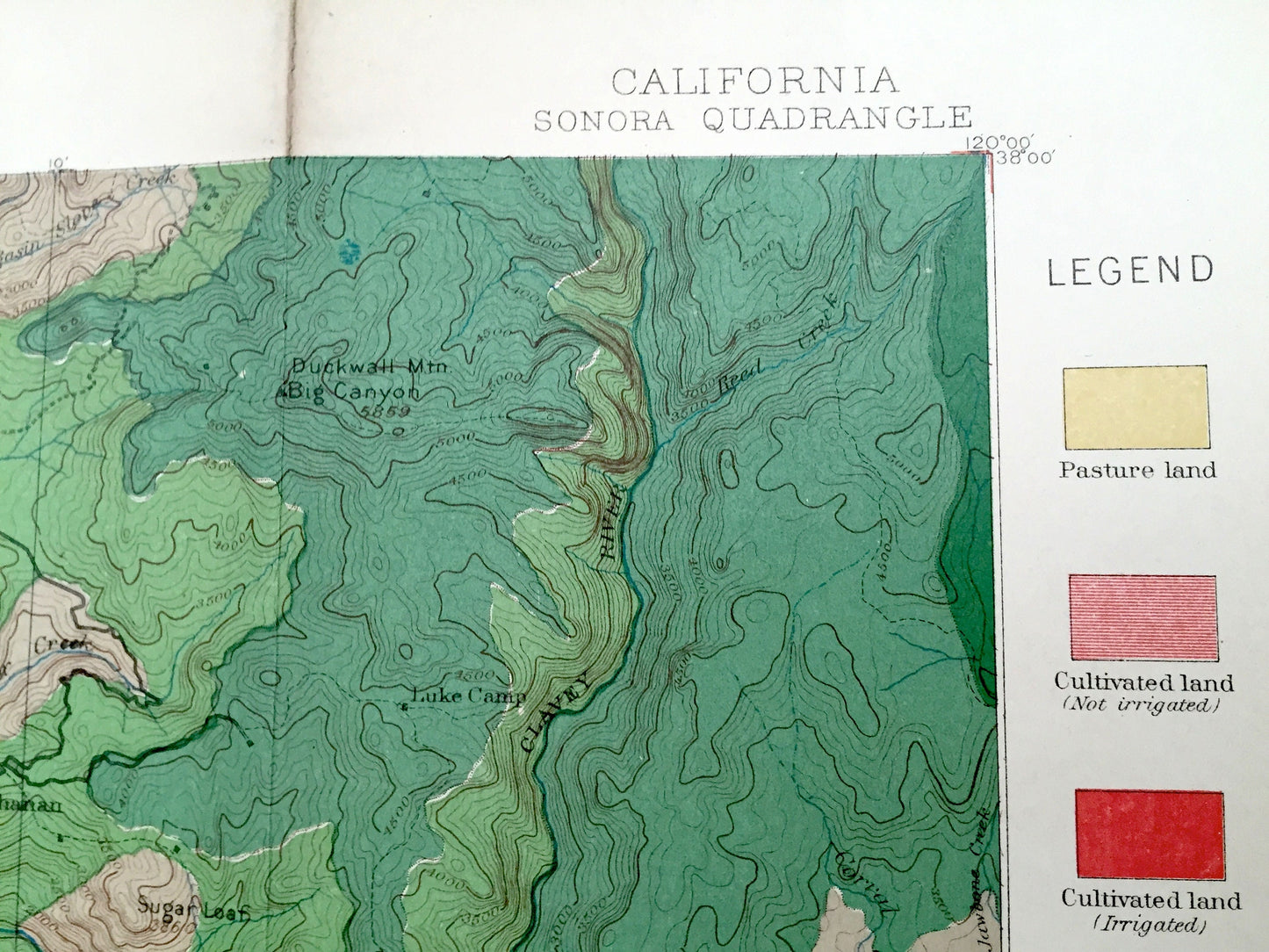
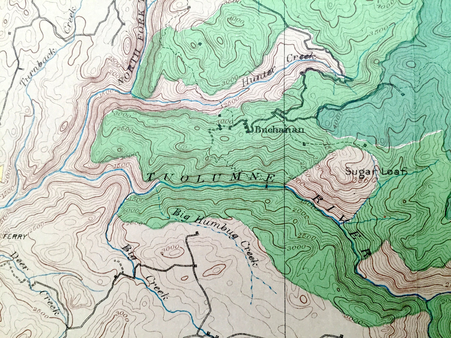
See what California looked like 130 years ago, before Don Pedro Reservoir was created. Lots of intricate details and geological contours. Map even has little squares for every house that existed at the time. The USGS cartographers were very thorough back then! This is one of the rare maps with the map legend on the front.
Perfect for the historian, map-lover, the curious or just as a conversation starter. Wonderful and rare. Vintage maps such as these make great gifts.
Edition of 1891, printed 1891
Dimensions: 16 3/4" width x 20 1/2" height
----
Cities & Towns: Sonora, Jamestown, Tuttletown, Montezuma, Chinese Camp, Algerine, Jacksonville, Rawhide, Campo Seco, Carter, Soulsbyville, Arastraville, Buchanan, Luke Camp, Groveland, Crimea House, Indian Bar, Don Pedro Bar, Blanchard, Bigoak Flat, Priest, Penon Blanco, Coulterville, Baxter, Colfax Gate, Dudley, Lagrange, Hayward, Snelling, Merced Falls, Webb, Chamisal, Number Nine, Hornitos, Benton Mill, Bear Valley, Mt Ophir, Mt Bullion.
Points of Interest: Tuolumne County, Stanislaus County, Merced County, Mariposa County, Tuolumne River, Penon Blanco Ridge, Pleasant Valley, Moccasin Peak, Hunter Valley, Bear Valley Yosemite National Forest, Stanislaus National Forest, Table Mountain, Clavey River, Merced River, Cotton Creek and many more mountains, peaks, meadows, hills, canyons, brooks, creeks, rivers, valleys, waterfalls, trails and roads.
Condition: Good, but Delicate, Vintage condition, commensurate with age. This map is in incredible shape for being 130 years old. Has light edge-wear, toning, folds as-issued and some repaired separations at folds, all of which will read as vintage character when framed. There is a small chance folds may separate more in transit, but this is easily repaired.
----
We will happily adjust shipping price for multiple purchases. Maps are rolled up and shipped in sturdy mailing tubes, never folded.
Couldn't load pickup availability
Share