My Store
Antique SOVIET English Channel 1973 Russian Army Survey Map – England, France, London, Paris, Calais, Dunkirk, Rouen, Belgium, UK EU
Antique SOVIET English Channel 1973 Russian Army Survey Map – England, France, London, Paris, Calais, Dunkirk, Rouen, Belgium, UK EU
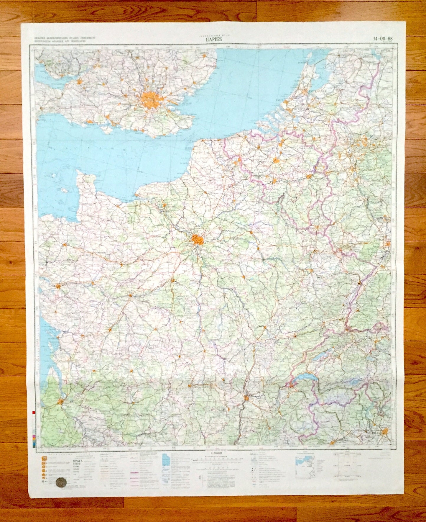
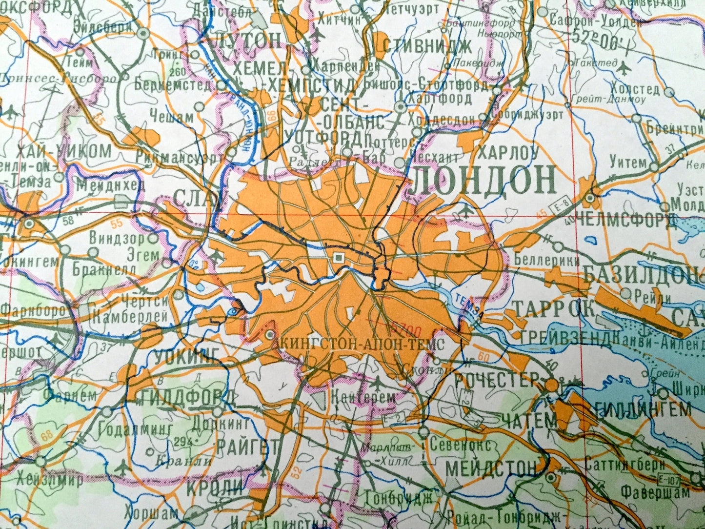
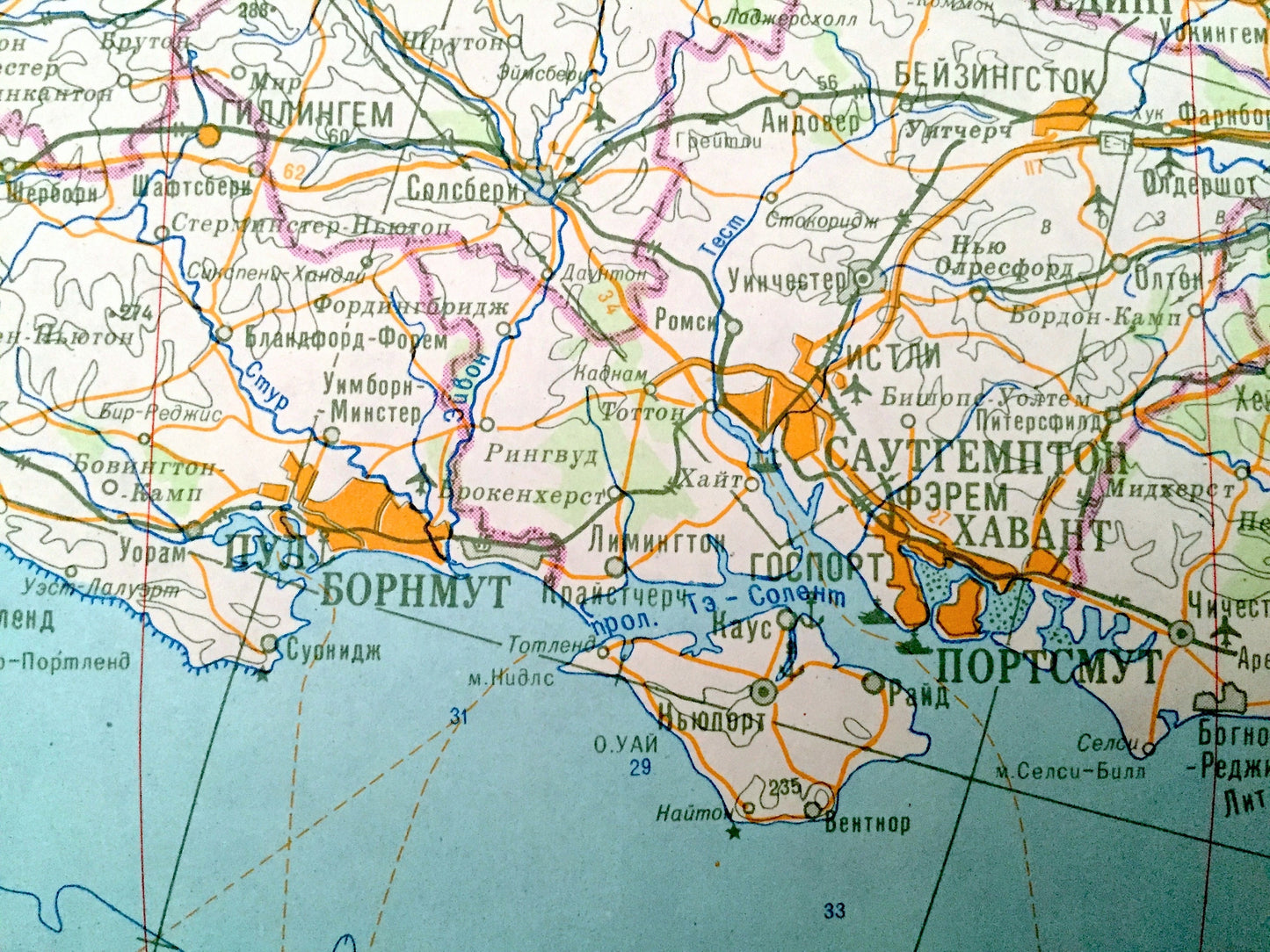
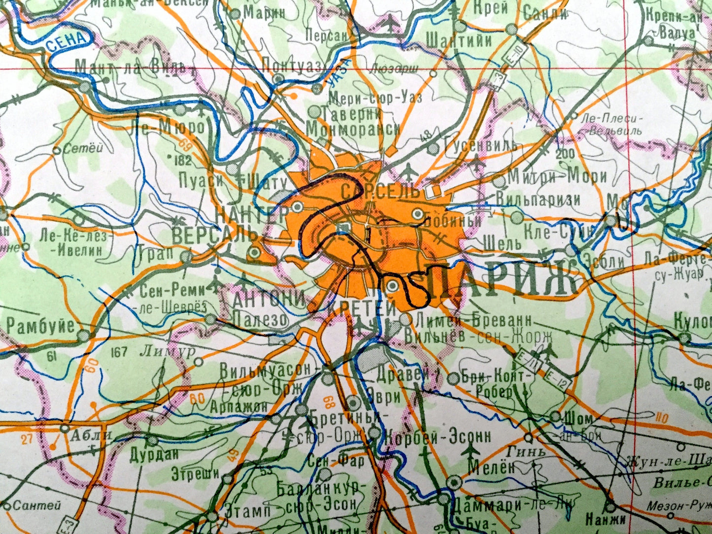
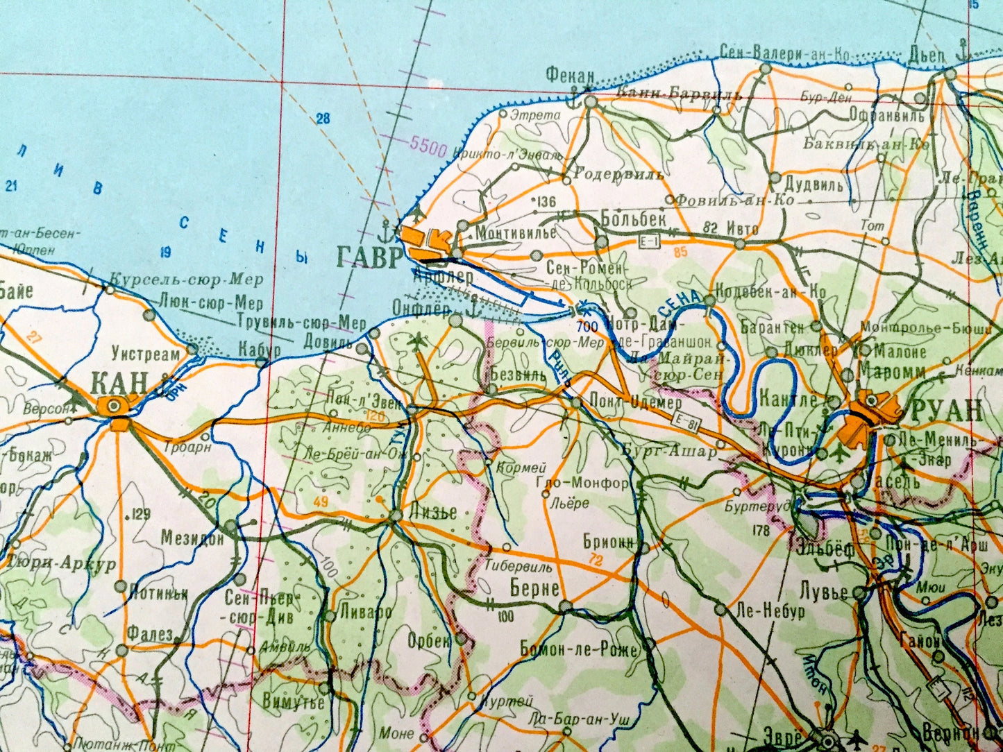
Beautiful, antique, very large and rare map of the English Channel, from London, England to Paris, France, as well as a bits Belgium, Germany, Switzerland and the Netherlands. This is an authentic 1973 edition, 1986 print from the Soviet Army. It is NOT a computer reproduction. All text is in the Cyrillic Russian alphabet.
See what the English Channel looked like over 45 years ago, as mapped by the Soviet Army! Lots of charming, intricate details and geological contours, including road, railroads and rivers and counties. The cartographers of the USSR were very thorough back then!
Map is very large and will be the focus of any wall where it is hung. (See coin in first picture for an idea of scale.)
Perfect for the historian, map-lover, the curious or just as a conversation starter. Wonderful and rare. Vintage maps such as these make great gifts.
Edition of 1973, printed 1986
Dimensions: 34" width x 42 1/2" height
----
Condition: Good Vintage condition, commensurate with age. This map is in great shape for being 35 years old. Has some edge-wear and slight warble from storage, but these will flatten easily and all will read as vintage character when framed.
----
We will happily adjust shipping price for multiple purchases. Maps are rolled up and shipped in sturdy mailing tubes, never folded.
Couldn't load pickup availability
Share