My Store
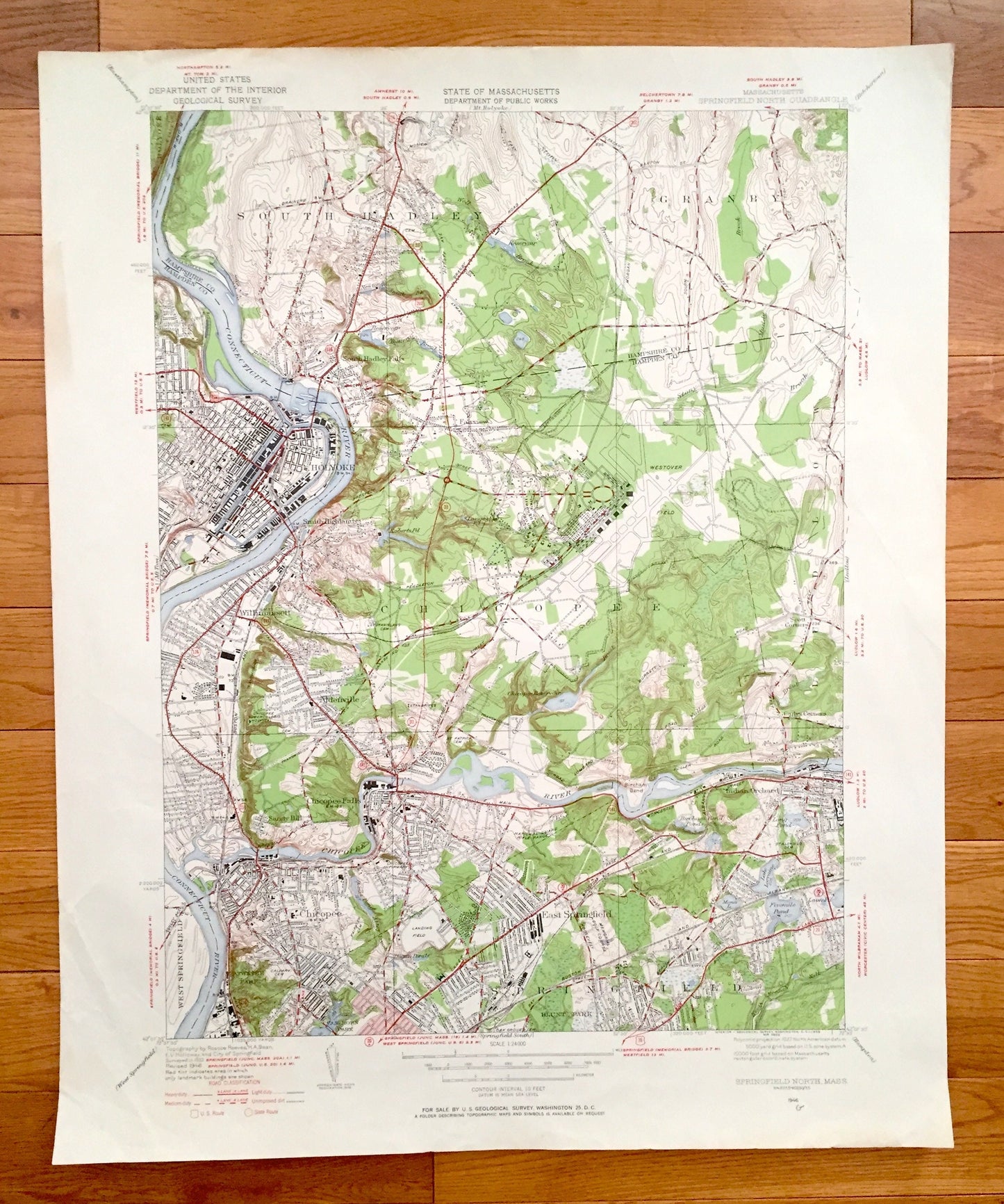
Antique Springfield North, Massachusetts 1946 US Geological Survey Topographic Map – Hampden County, South Hadley, Granby, Holyoke, Chicopee
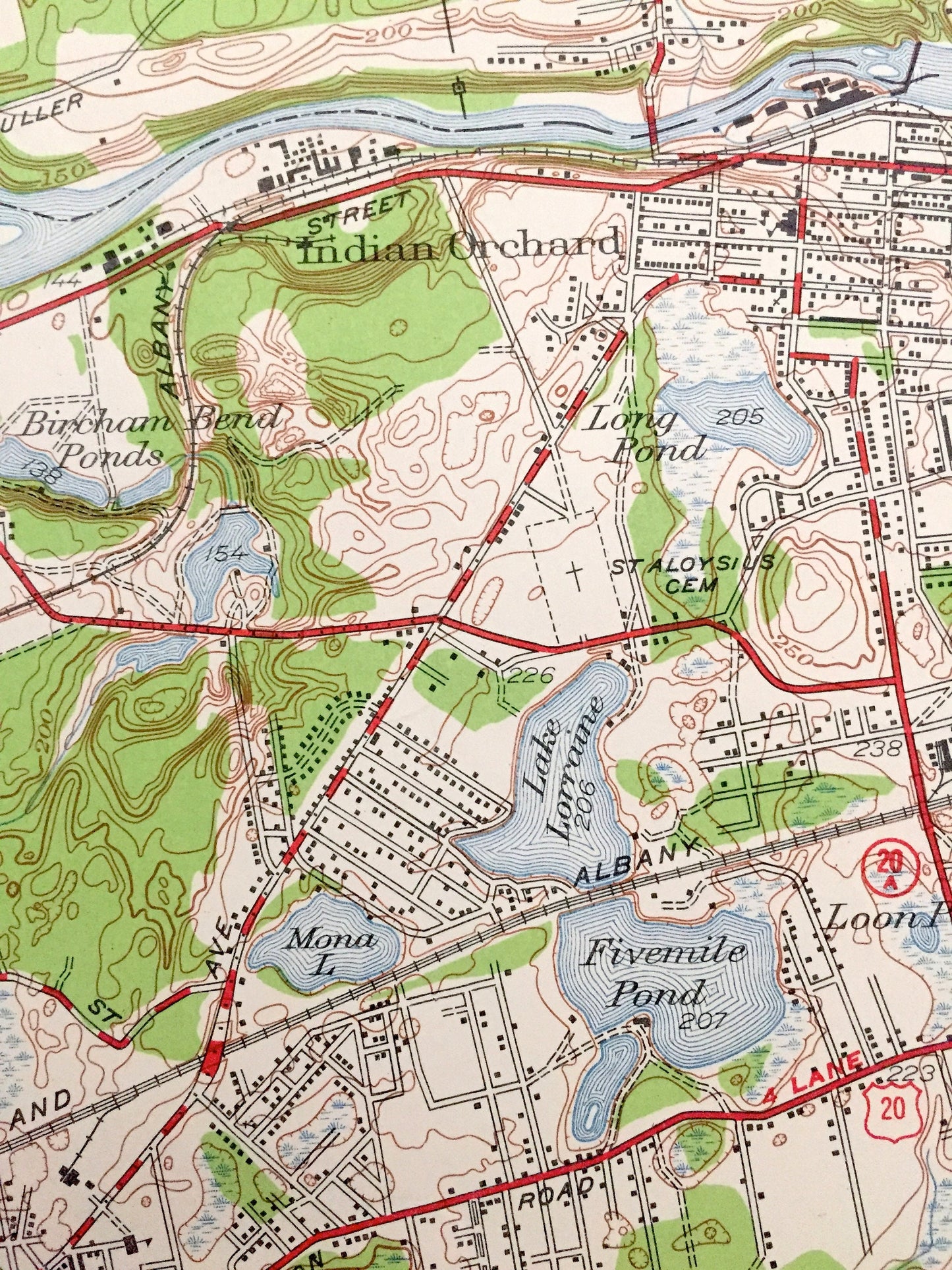
Antique Springfield North, Massachusetts 1946 US Geological Survey Topographic Map – Hampden County, South Hadley, Granby, Holyoke, Chicopee
Beautiful, antique map of Springfield North, Massachusetts and surrounding Hampden County and Hampshire County areas. This is an authentic 1946 edition, 1958 print from the U.S. Geological Survey and NOT a computer reproduction.
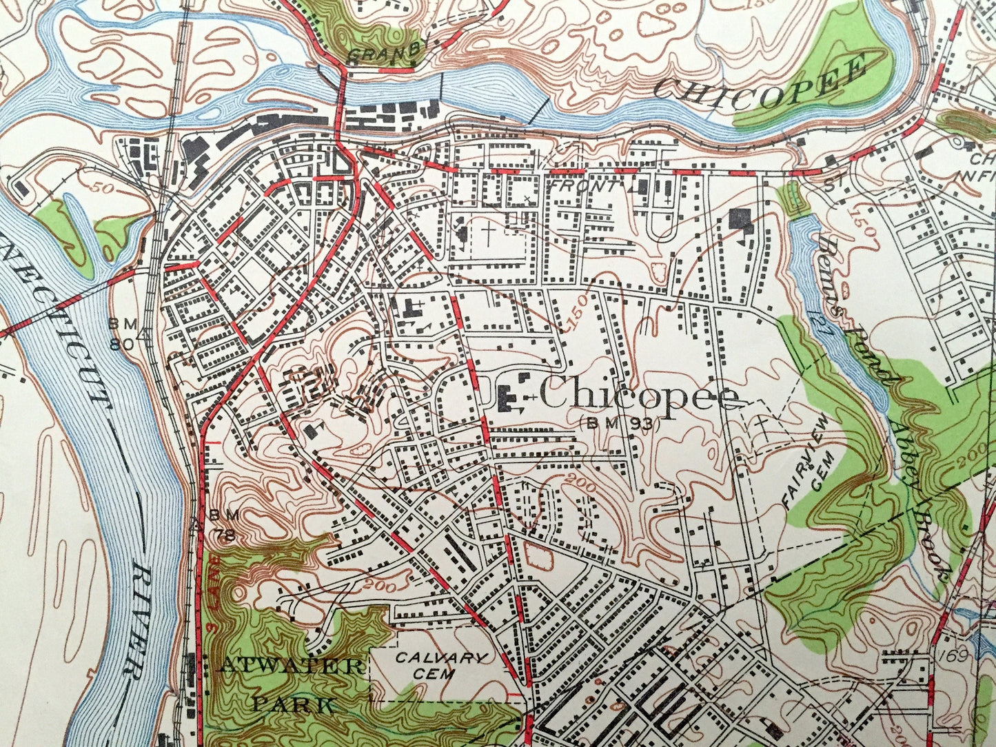
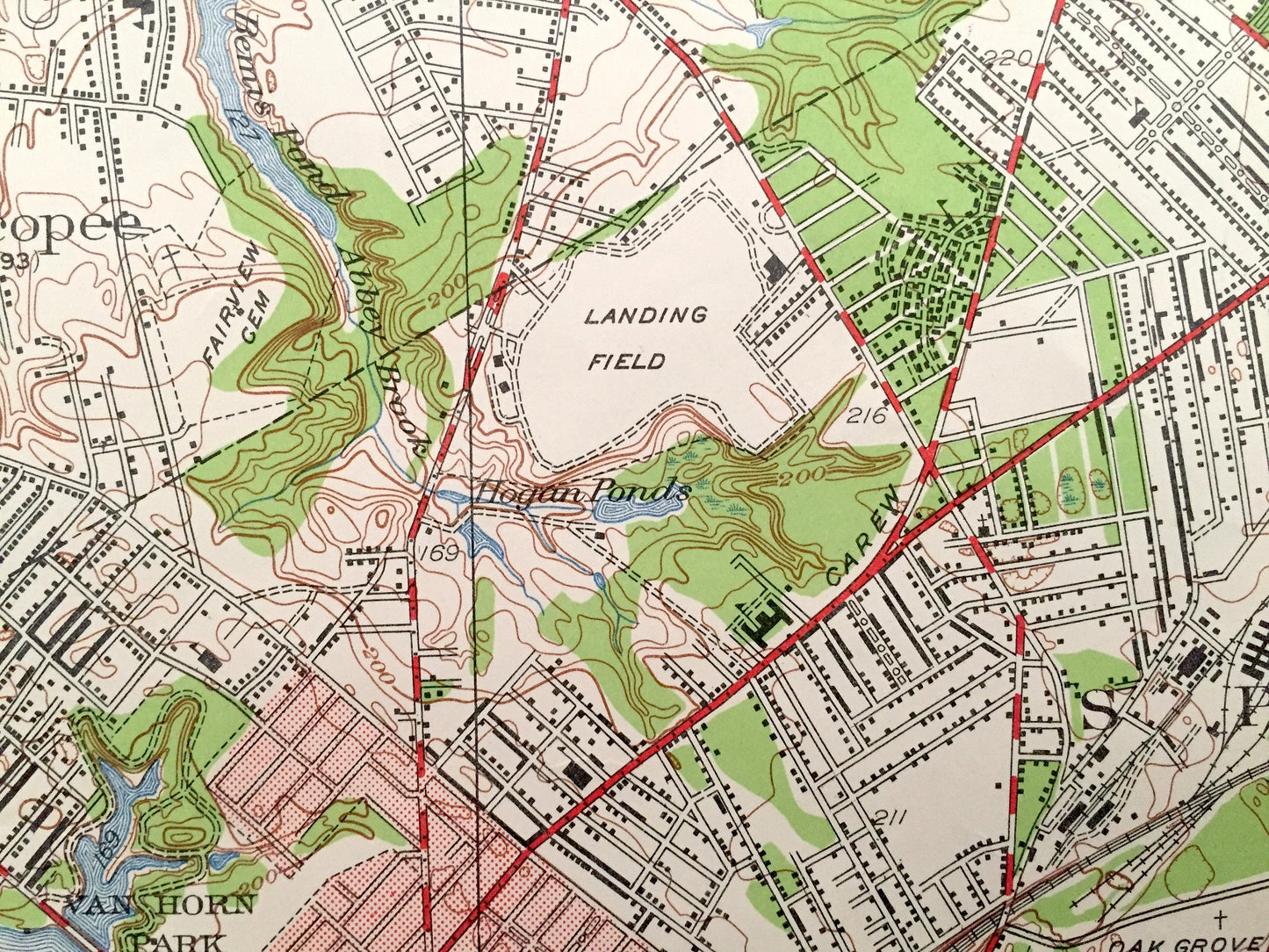
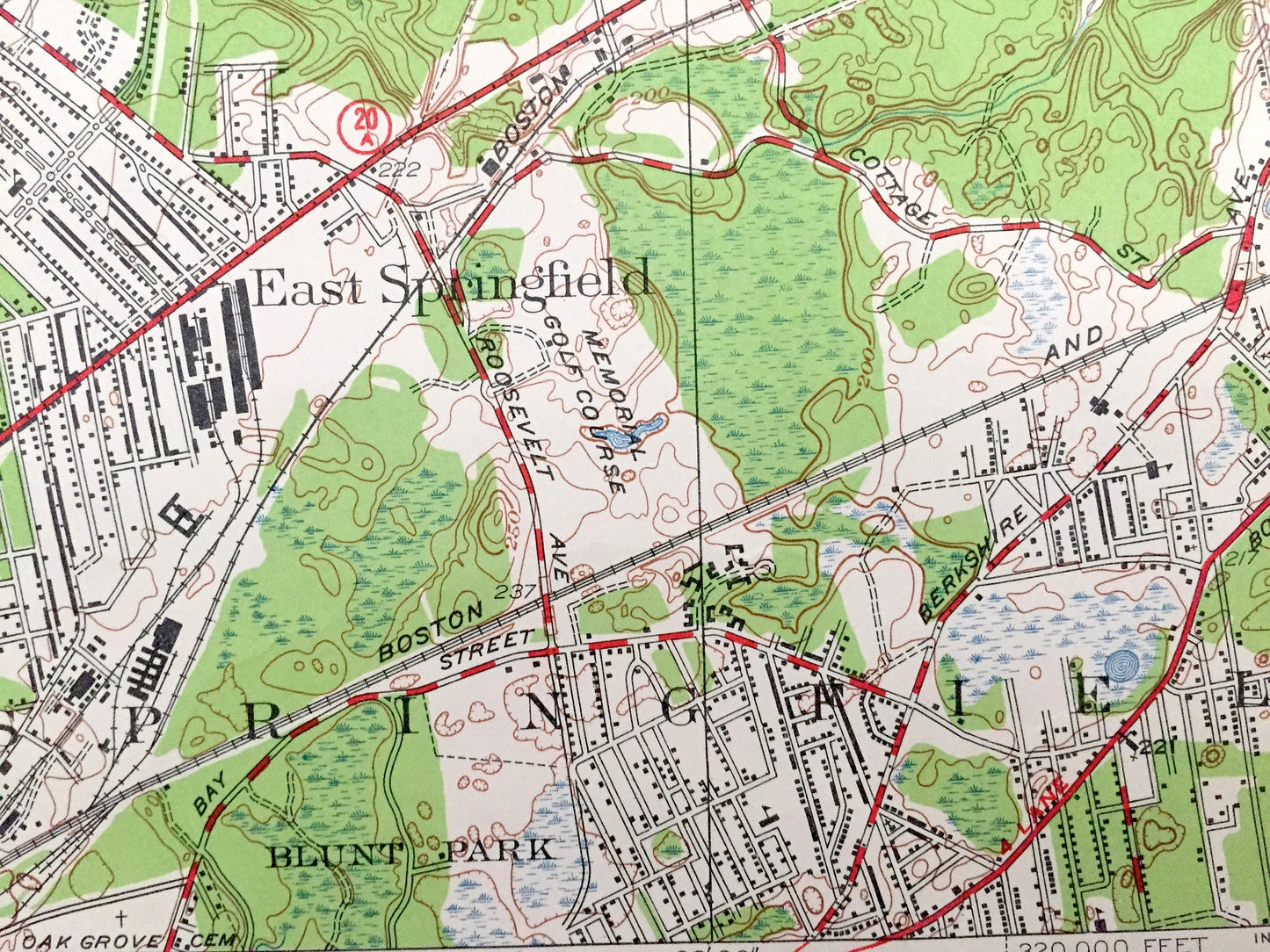
See what Massachusetts looked like over 70 years ago. Lots of intricate details and geological contours. Map even has little squares for every house that existed at the time. The USGS cartographers were very thorough back then!
Perfect for the historian, map-lover, the curious or just as a conversation starter. Wonderful and rare. Vintage maps such as these make great gifts.
Edition of 1946, printed 1958
Dimensions: 22" width x 27" height
----
Features
Cities & Towns: Springfield, East Springfield, West Springfield, Ludlow, Sandy Hill, Aldenville, Willimansett, Smith Highlands, Chicopee Falls, Indian Orchard, South Hadley Falls, South Hadley, Granby, Holyoke, Chicopee.
Points of Interest: Hampden County, Hampshire County, Connecticut River, Chicopee River, Van Horn Park, Blunt Park, Five Mile Pond, Hogan Pond, Stony Brook, Chicopee Reservoir and many more roads, houses, reservoirs, ponds, and hills.
Condition: Very Good condition, commensurate with age. This map is in incredible shape for being 60 years old. Has some light edge-wear and some pencil markings, all of which will read as vintage character when framed.
----
We will happily adjust shipping price for multiple purchases. Maps are rolled up and shipped in sturdy mailing tubes, never folded.
Couldn't load pickup availability
Share