My Store
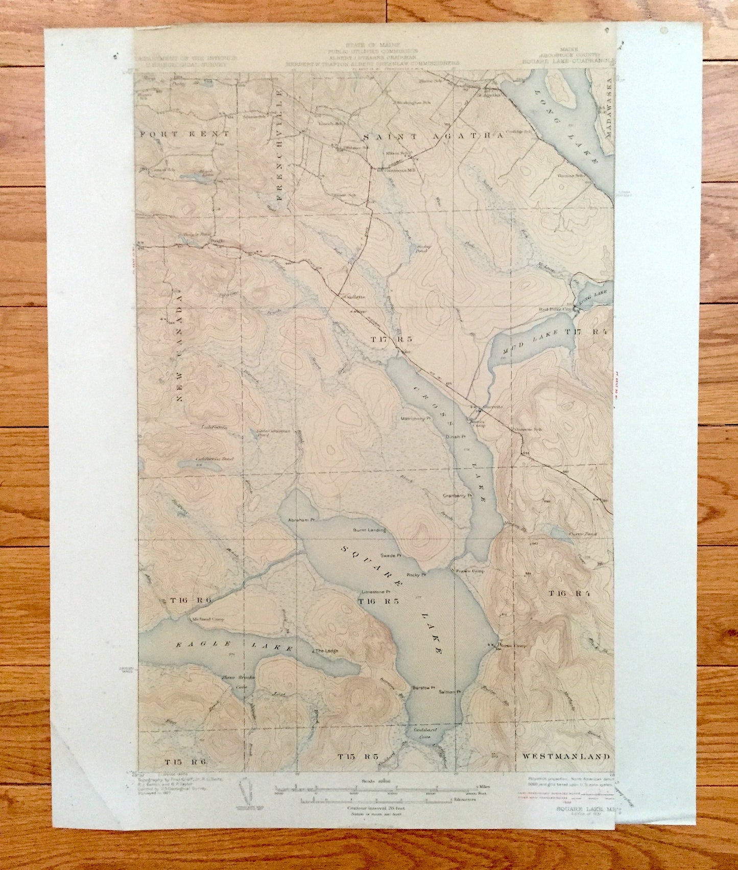
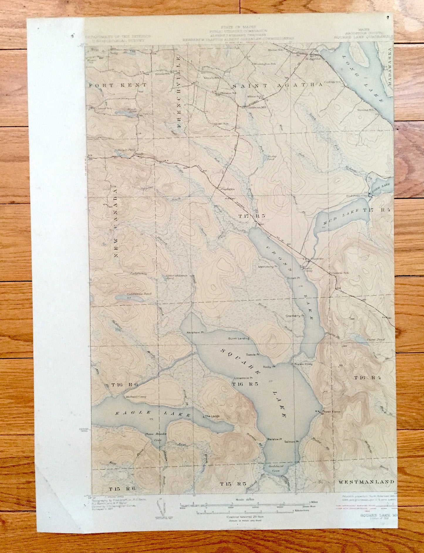
Antique Square Lake, Maine 1931 US Geological Survey Topographic Map – Fort Kent, Frenchville, Saint Agatha, New Canada, Eagle, Aroostook ME
Antique Square Lake, Maine 1931 US Geological Survey Topographic Map – Fort Kent, Frenchville, Saint Agatha, New Canada, Eagle, Aroostook ME
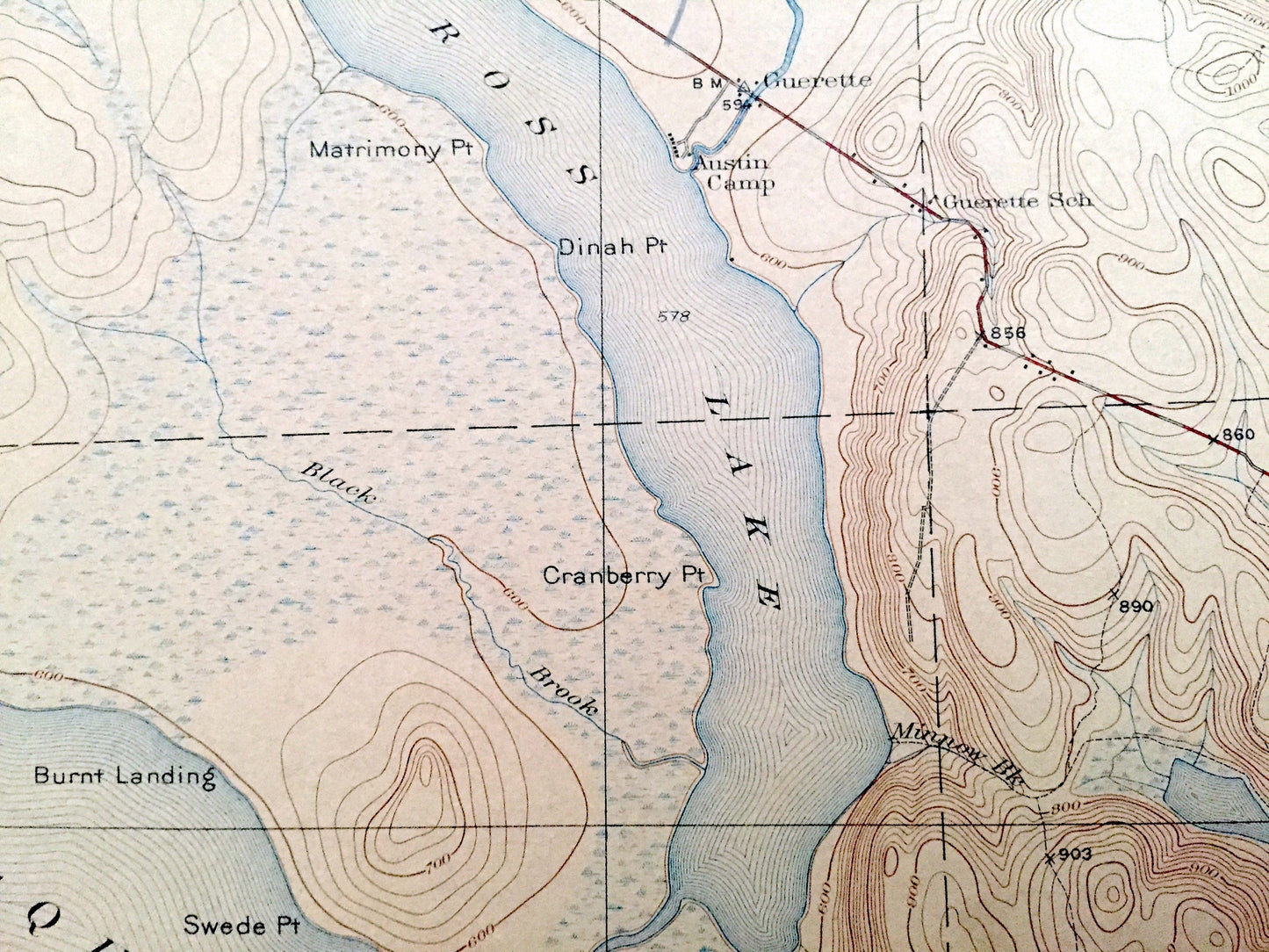
Beautiful, antique map of Square & Eagles Lakes, Maine and surrounding Aroostook County area. This is an authentic 1931 edition, 1931 print from the U.S. Geological Survey and NOT a computer reproduction.
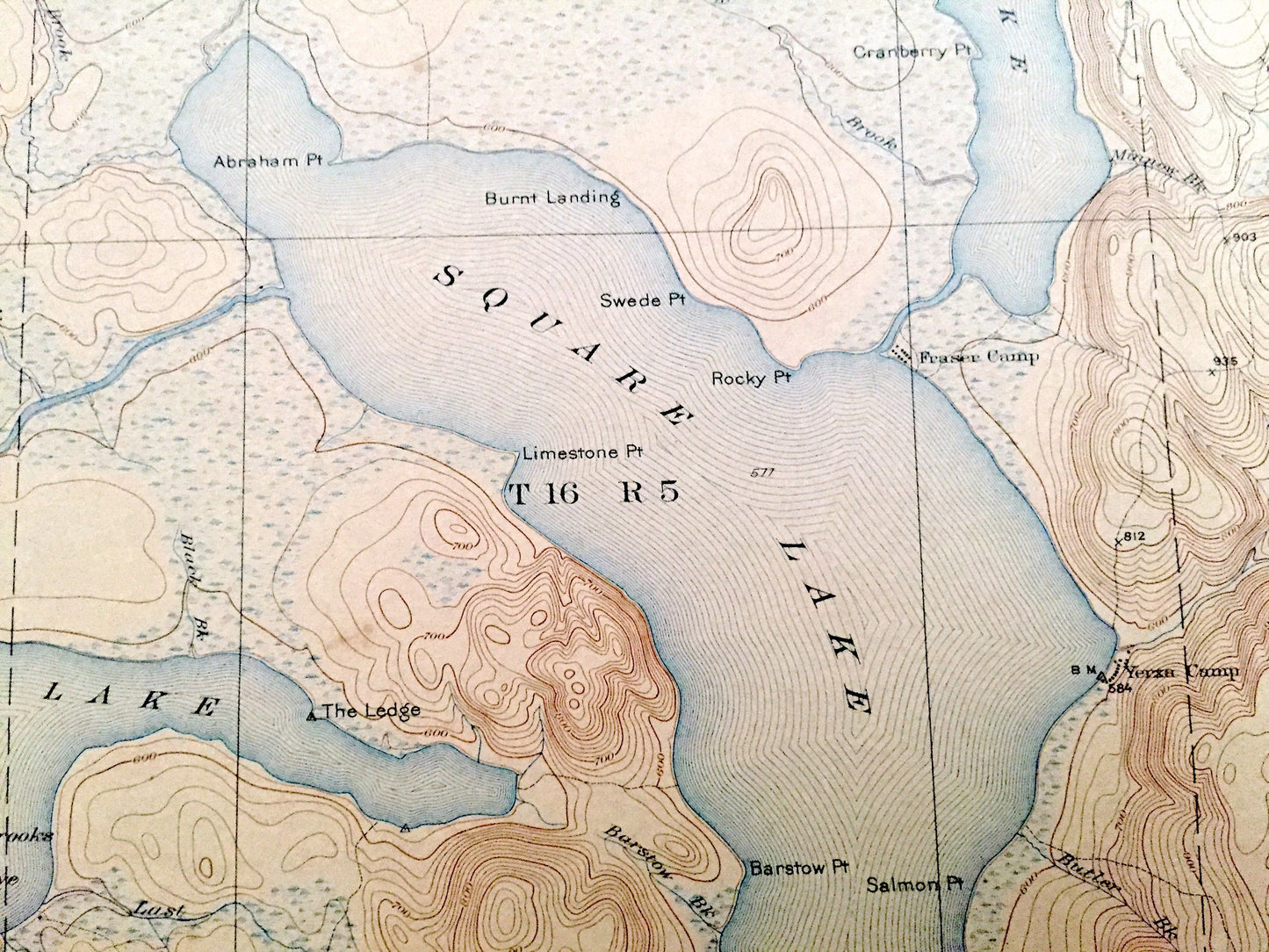
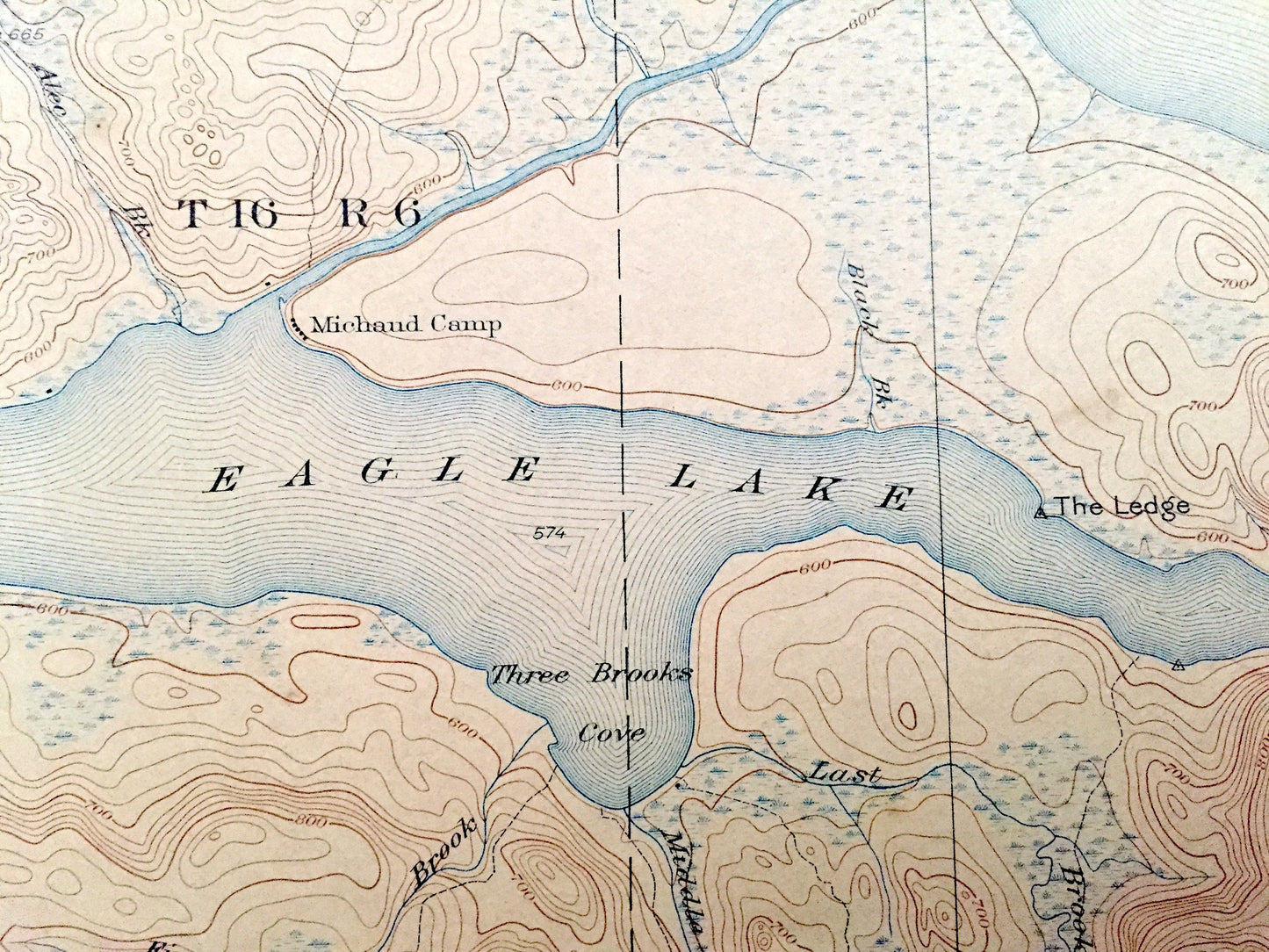
See what Aroostook County looked like almost 90 years ago. Lots of intricate details and geological contours. Map even has little squares for every house that existed at the time. The USGS cartographers were very thorough back then! On the back is a description of topographic symbols and map guide.
Perfect for the historian, map-lover, the curious or just as a conversation starter. Wonderful and rare. Vintage maps such as these make great gifts.
Edition of 1931, printed 1931
Dimensions: 14" width x 20" height
----
Features
Cities & Towns: Fort Kent, Frenchville, Saint Agatha, New Canada, Westman Land, Madawaska, Guerette, St. Agatha, Ouellette, Daigle, Sinclair.
Points of Interest: Square Lake, Eagle Lake, Cross Lake, Mud Lake, Long Lake, Gorfinkle Camp, Austin Camp, The Ledge, The Carry, Three Brooks Cove, and many more streams, ponds, villages, camps and mountains.
Condition: Good or "Very Vintage" condition, commensurate with age. This map is in great shape for being over 90 years old. Has edge-wear, pin holes and toning, but this will all add to vintage character when framed. Cropped right margin is easily-concealed by placing similar-colored paper behind the map when framing, as seen in photos.
----
We will happily adjust shipping price for multiple purchases. Maps are rolled up and shipped in sturdy mailing tubes, never folded.
Couldn't load pickup availability
Share