My Store
Antique Staceyville, Maine 1953 US Geological Survey Topographic Map – Penobscot County, Patten, Soldiertown, Millinocket, Hunt Mountain, ME
Antique Staceyville, Maine 1953 US Geological Survey Topographic Map – Penobscot County, Patten, Soldiertown, Millinocket, Hunt Mountain, ME
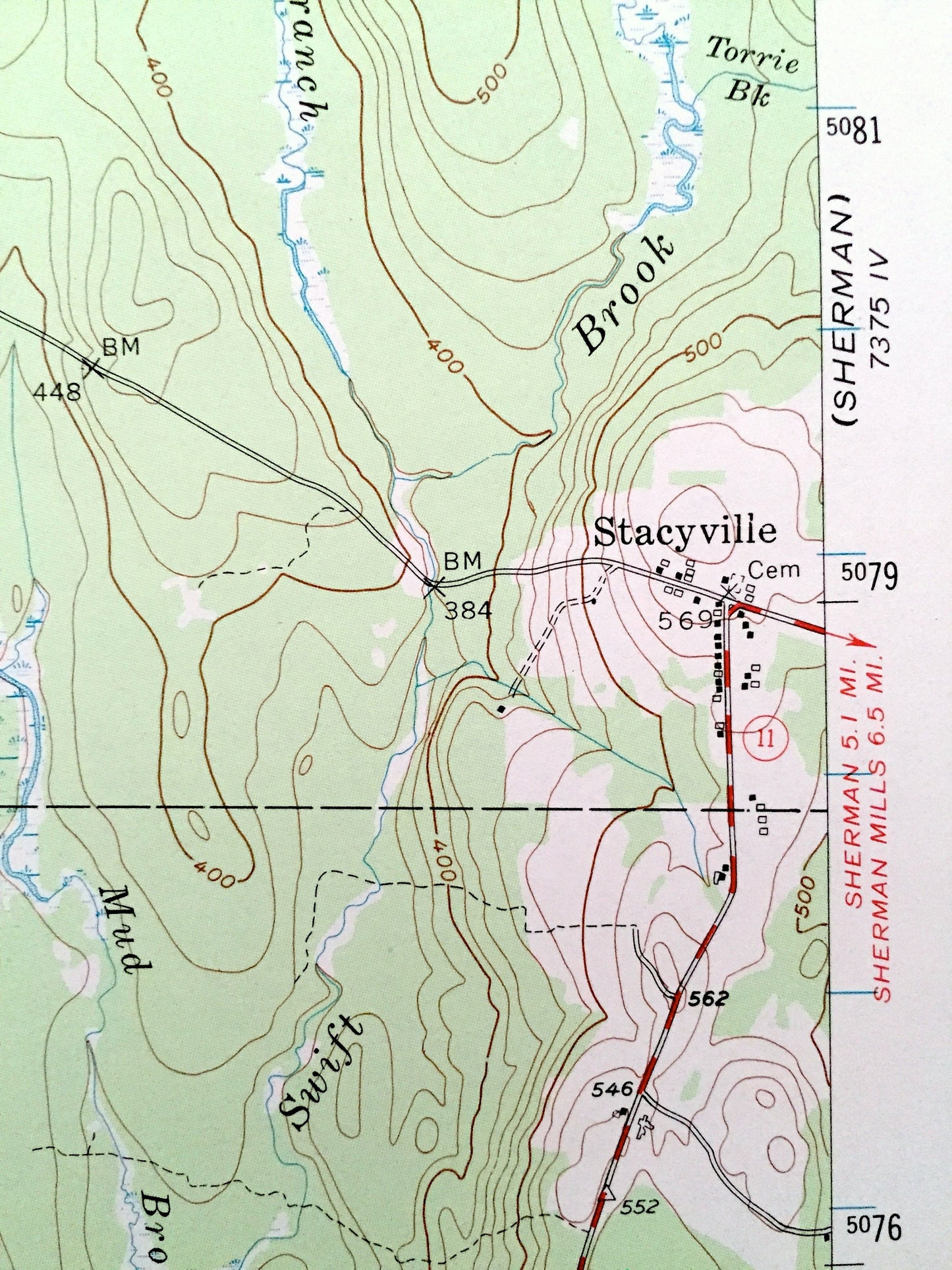
Beautiful, antique map of Stacyville, Maine and surrounding Penobscot County area just east of Mount Katahdin. This is an authentic 1953 edition, 1969 print from the U.S. Geological Survey and NOT a computer reproduction.
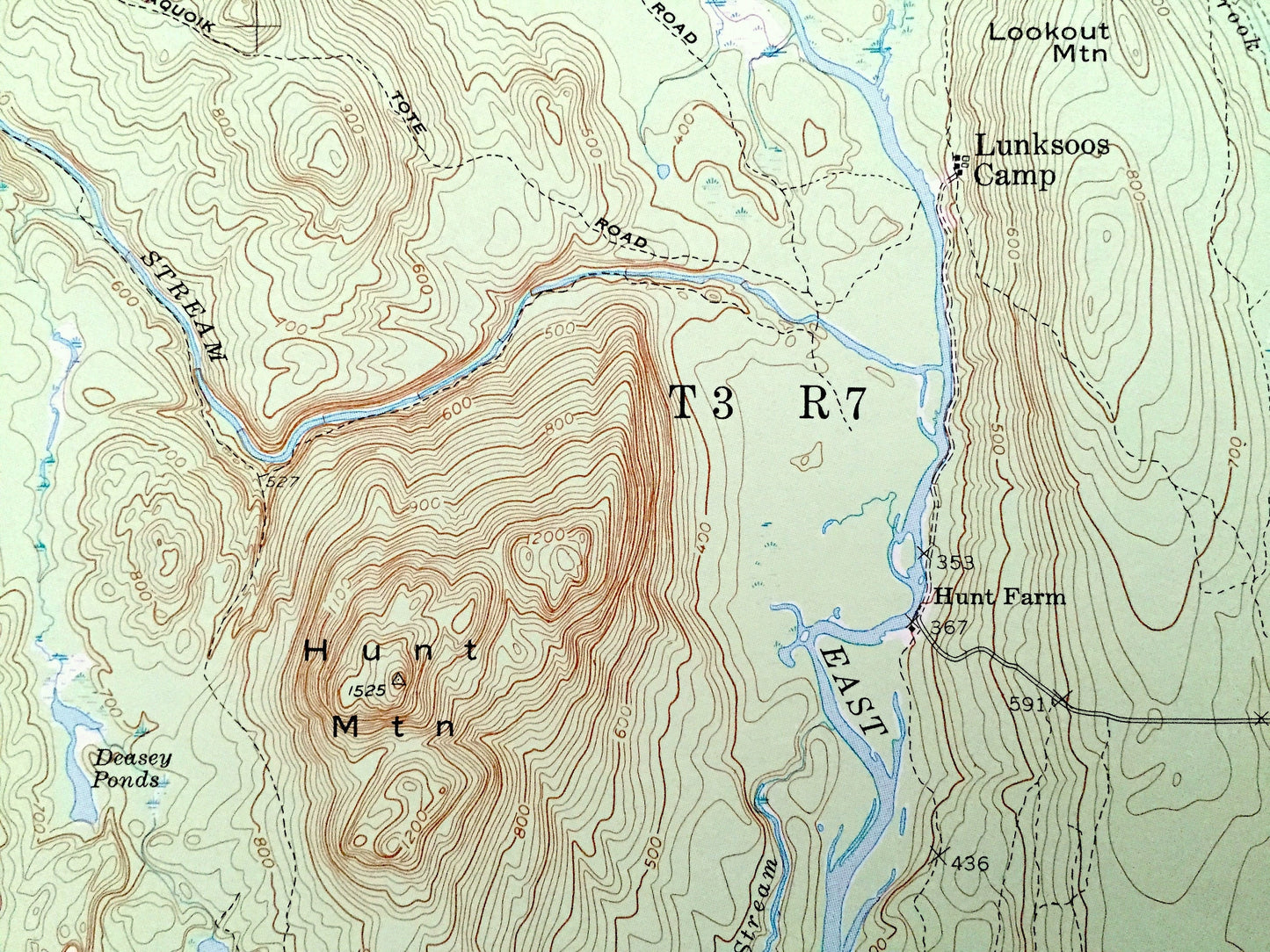
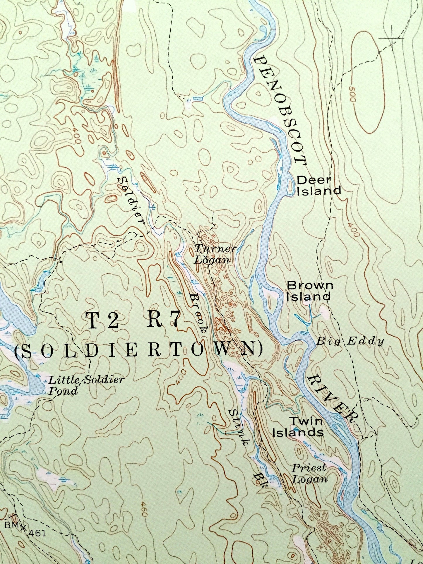
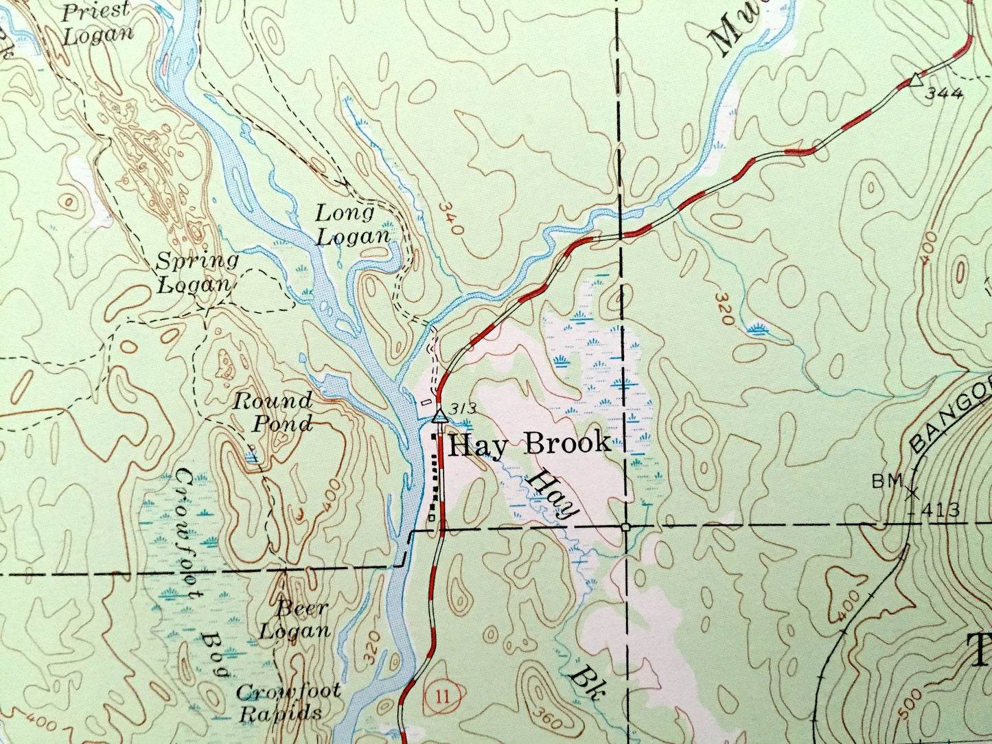
See what Maine looked like over 65 years ago. Lots of intricate details and geological contours. Map even has little squares for every house that existed at the time. The USGS cartographers were very thorough back then!
Perfect for the historian, map-lover, the curious or just as a conversation starter. Wonderful and rare. Vintage maps such as these make great gifts.
Edition of 1953, printed 1969
Dimensions: 18" width x 22" height
----
Features
Cities & Towns: Stacyville, Patten, Soldiertown, Herseytown, Grindstone, Hay Brook.
Points of Interest: Penobscot County, Hunt Mountain, Deasey Mountain, Whetstone Mountain, Little Spring Brook Mountain, Wassataquoik Mountain, Penobscot River, Seboeis River, Wassataquoik Stream, Millinocket Lake, Millinocket Ridge, Soldier Pond, Lunksoos Mountain, Lunksoos Camp, Hunt Farm, Whetstone Falls, Forest Service Camp, and many more hills, mountains, streams, ponds, houses, schools and roads.
Condition: Very Good condition, commensurate with age. This map is in incredible shape for being 50 years old.
----
We will happily adjust shipping price for multiple purchases. Maps are rolled up and shipped in sturdy mailing tubes, never folded.
Couldn't load pickup availability
Share