My Store
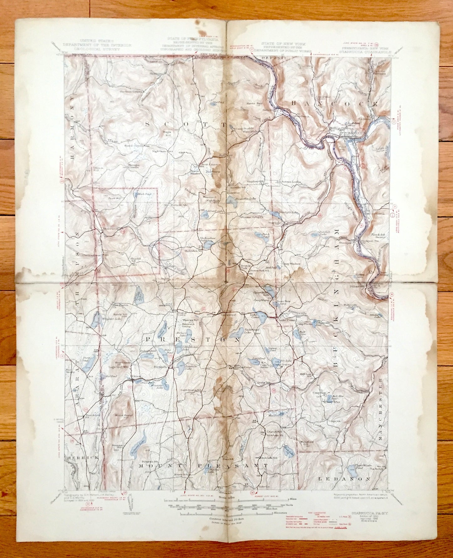
Antique Starruca, New York 1933 US Geological Survey Topographic Map – Hancock, Poyntelle, Preston, Scott, Wayne County, Delaware, NY PA
Antique Starruca, New York 1933 US Geological Survey Topographic Map – Hancock, Poyntelle, Preston, Scott, Wayne County, Delaware, NY PA
Beautiful, antique map of Starrucca, Pennsylvania & Hancock, New York and surrounding Wayne & Delaware County area on the Delaware River. This is an authentic 1933 edition, 1946 print from the U.S. Geological Survey and NOT a computer reproduction.
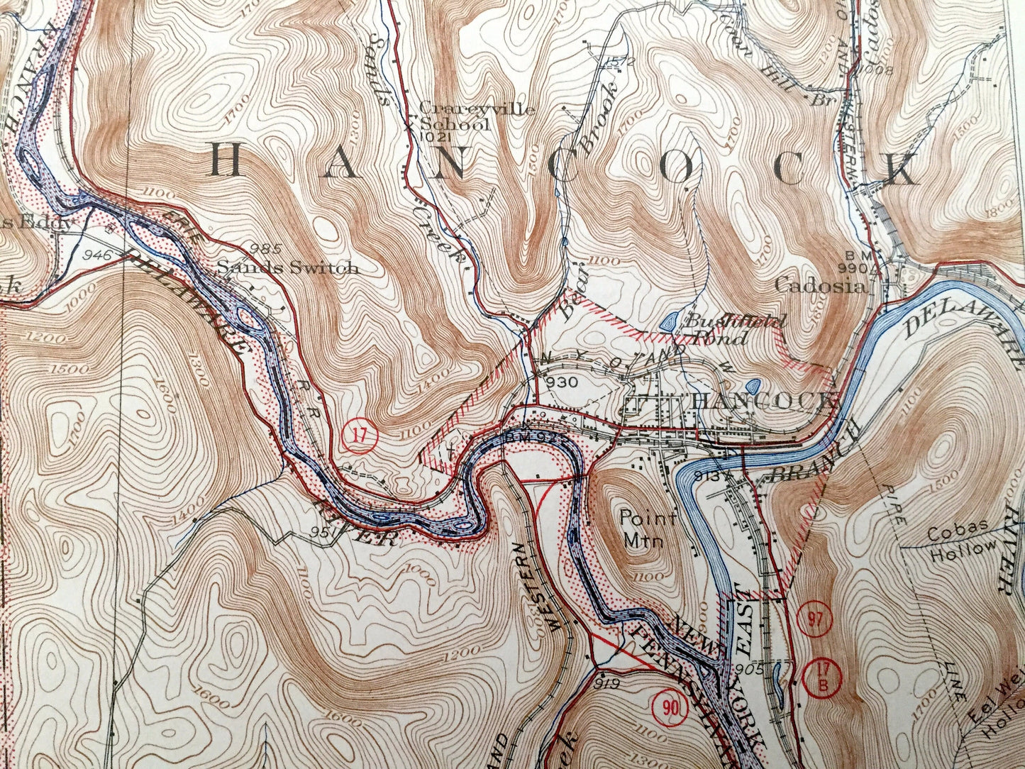
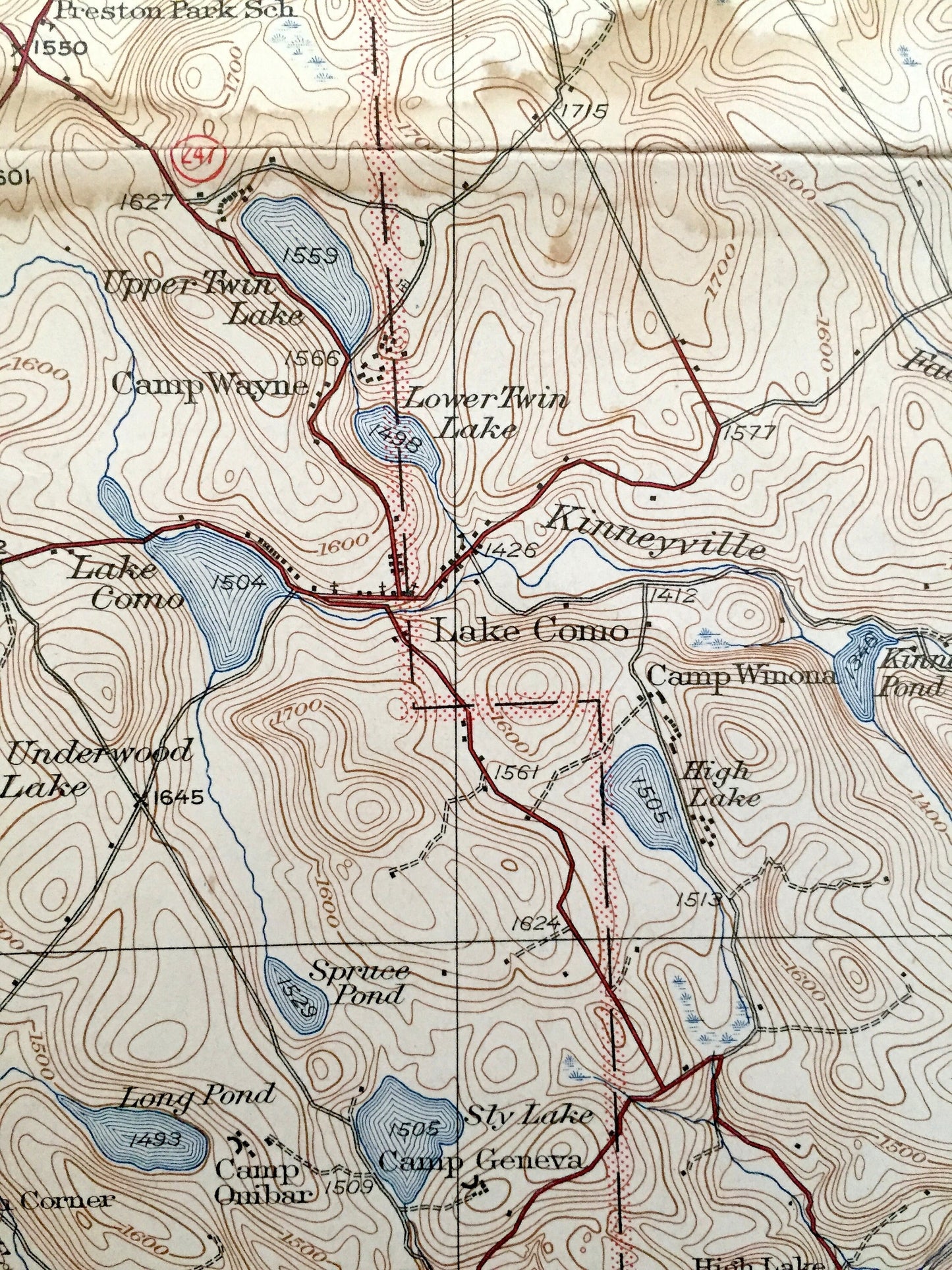
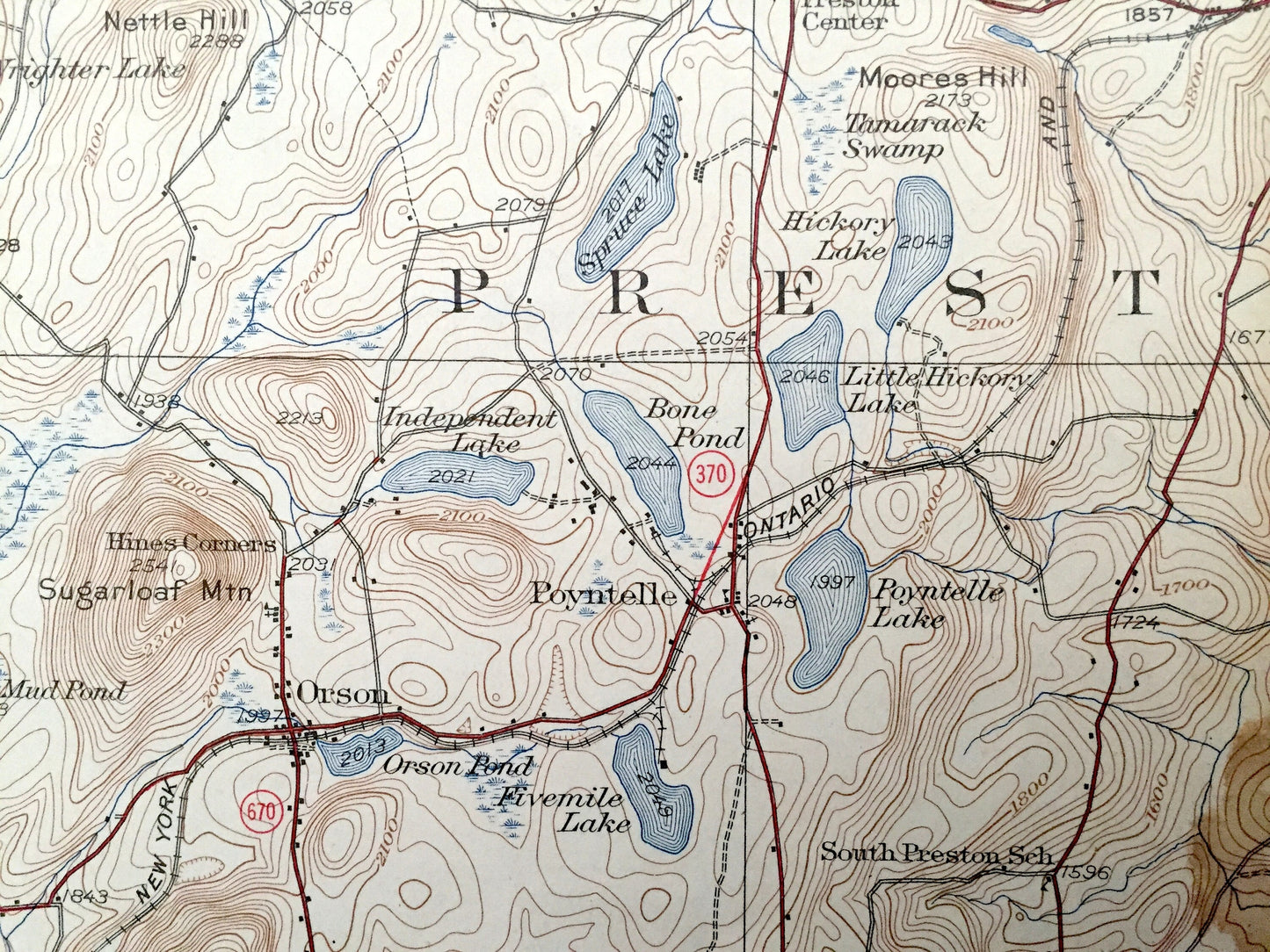
See what Pennsylvania & New York looked like 90 years ago. Lots of intricate details and geological contours. Map even has little squares for every house that existed at the time. The USGS cartographers were very thorough back then! On the back is a description of topographic symbols and map guide.
Perfect for the historian, map-lover, the curious or just as a conversation starter. Wonderful and rare. Vintage maps such as these make great gifts.
Edition of 1933, printed 1946
Dimensions: 17" width x 21" height
----
Features
Cities & Towns: PENNSYLVANIA: Harmony, Scott, Thomson, Starrucca, Preston, Buckingham, Ararat, Herrick, Mount Pleasant, Lebanon, Manchester, Sherman, Autumn Leaves, Preston Park, Starlight, Lakewood, Stockport, Dillontown, Lake Como, Poyntelle, Orson, Balls Eddy.
NEW YORK: Deposit, Hancock, Cadosia Factories, Stockport.
Points of Interest: Wayne County, Susquehanna County, Delaware County, Delaware River, Equinunk Creek, Hiawatha Lake, Island Lake, Perch Pond, Shehawken Lake, Coxton Lake, Upper Twin Lake, Underwood Lake, Wrighter Lake, Spruce Lake, Lake Como, Dunn Pond, Belmont Lake, Rock Lake, Fork Mountain Pond, Upper Woods Pond, The Notch, Shrawder Mountain, High Rock, Shingle Hollow, Mount Ararat, Sugarloaf Mountain, Nettle Hill, Kinneyville Creek, Camp Wayne, Camp Onibar, Erie Railroad, and many more towns, ponds, hills, mountains, hollows, creeks, houses, camps, railroads and roads.
Condition: Good or "Very Vintage" condition, commensurate with age. This map is in good shape for being over 75 years old. Has some real edge-wear, stains and folds as-issued, but these will all read as vintage character when framed.
----
We will happily adjust shipping price for multiple purchases. Maps are rolled up and shipped in sturdy mailing tubes, never folded.
Couldn't load pickup availability
Share