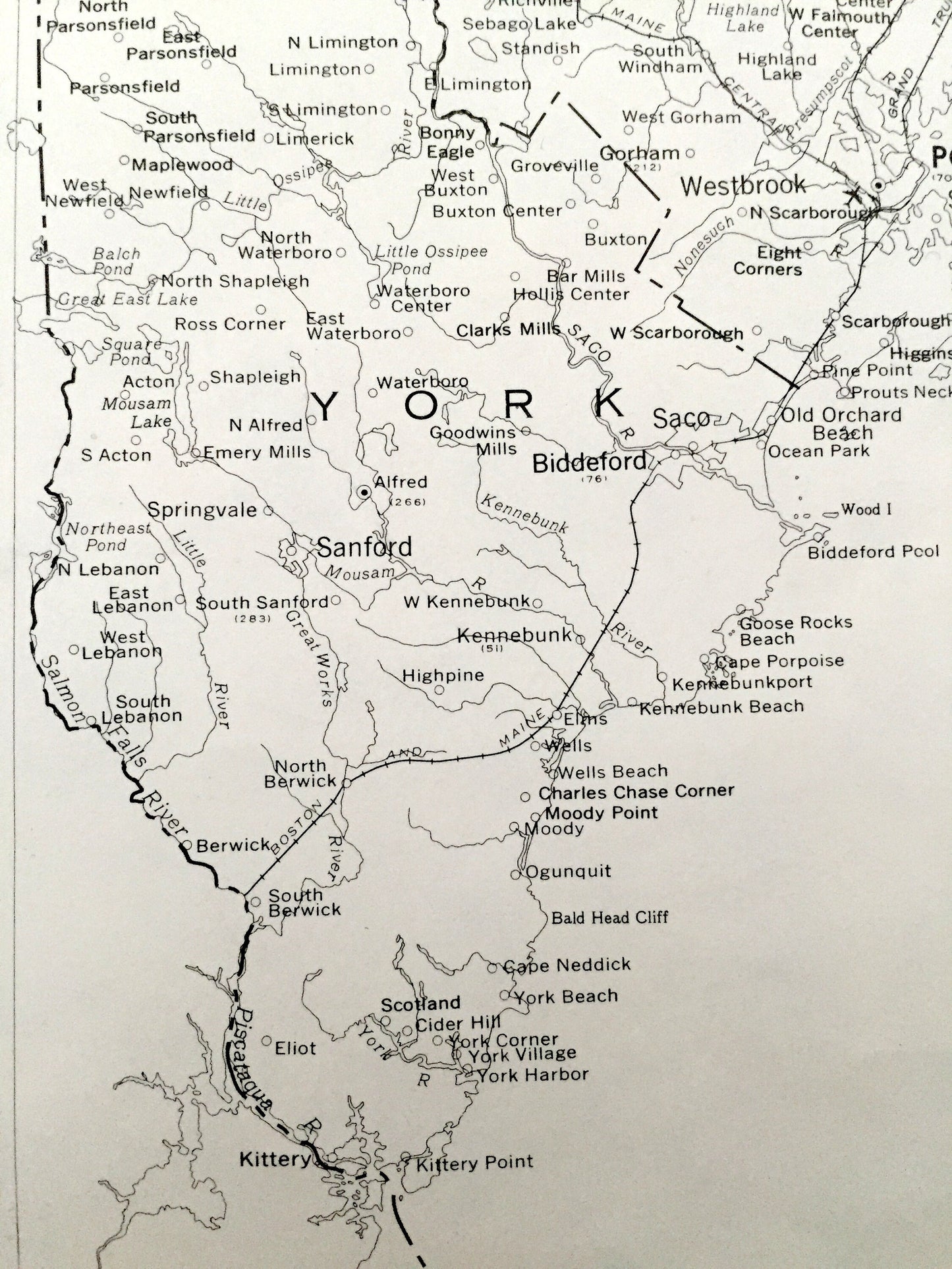
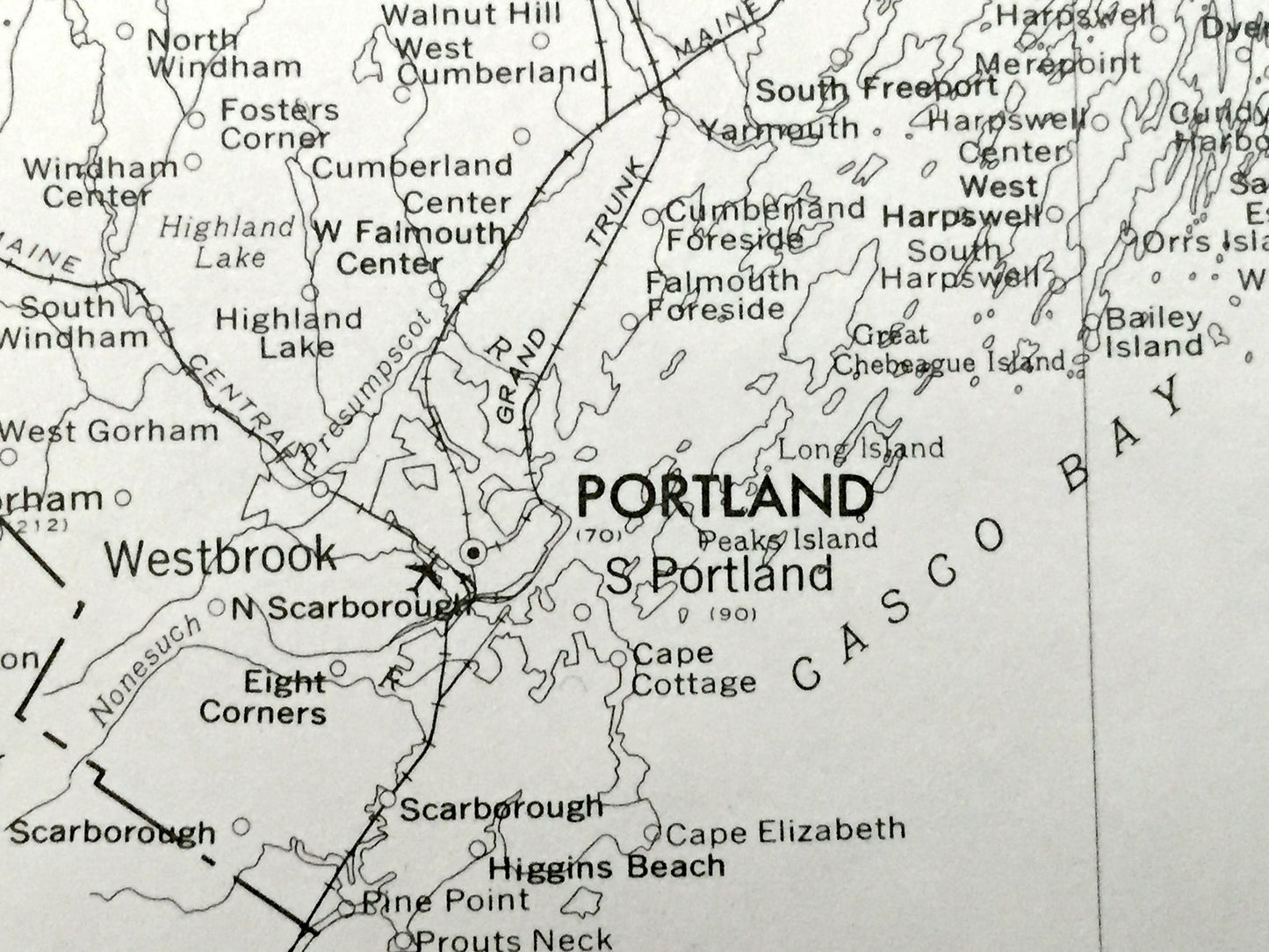
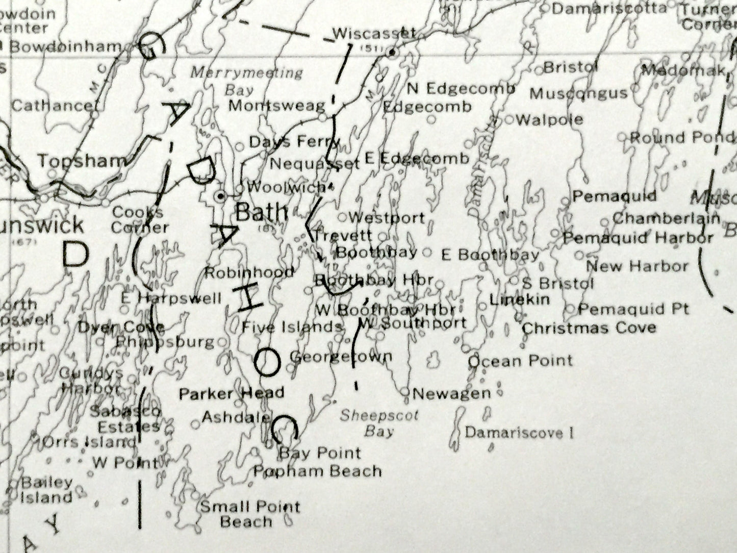
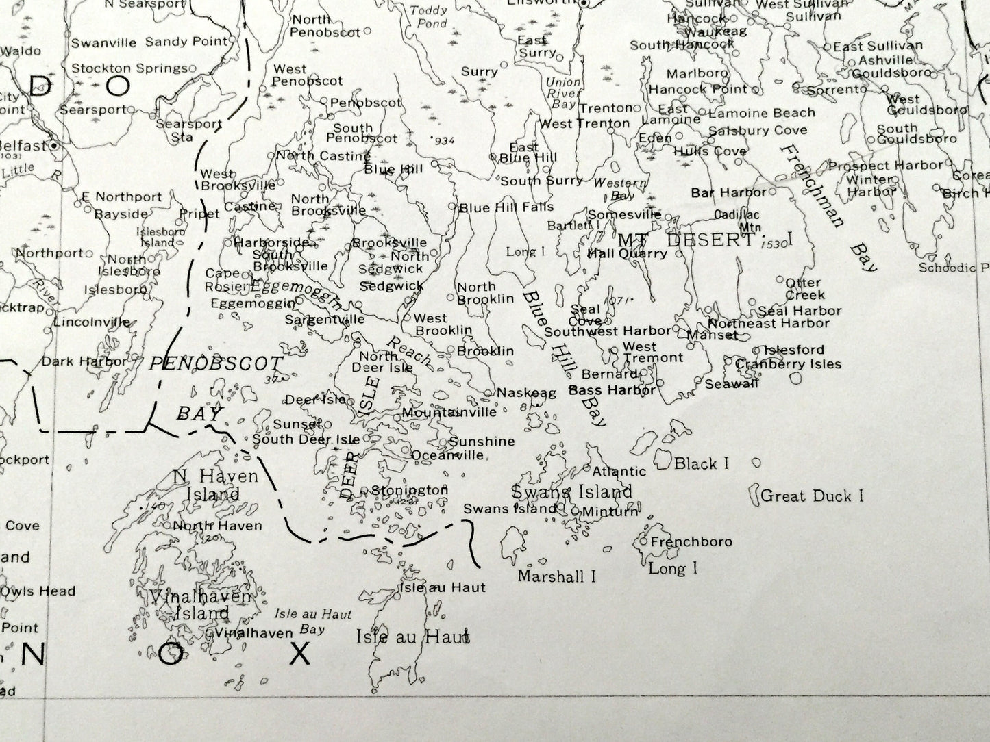
Beautiful, antique map of the great state of Maine. This is an authentic 1976 print from the U.S. Geological Survey and NOT a computer reproduction.
See what Maine looked like 45 years ago. Lots of intricate details. Map even has every little town and stream. The USGS cartographers were very thorough back then!
Perfect for the historian, map-lover, the curious or just as a conversation starter. Wonderful and rare. Vintage maps such as these make great gifts.
Edition of 1976, printed 1976
Dimensions: 16" width x 22" height
----
Condition: Very Good Vintage condition, commensurate with age. This map is in incredible shape for being over 40 years old. Has some edge-wear and ex-libris markings, but this will definitely add to authentic, vintage charm.
----
We will happily adjust shipping price for multiple purchases. Maps are rolled up and shipped in sturdy mailing tubes, never folded.