My Store
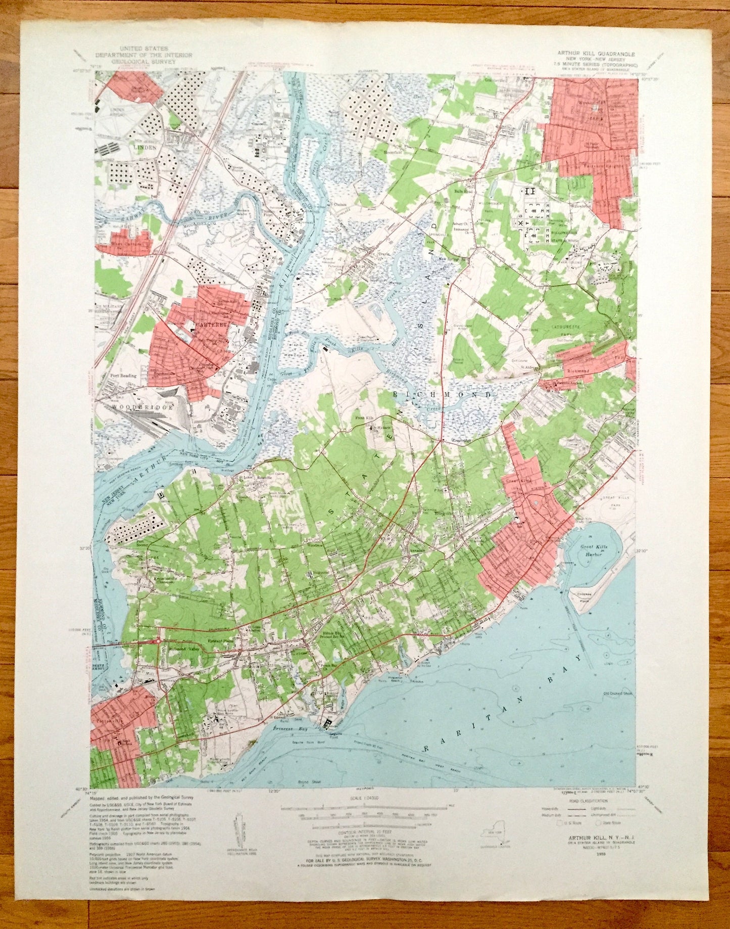
Antique Staten Island, New York 1955 US Geological Survey Topographic Map – Arthur Kill, Richmond, Linden, Tottenville, Carteret, New Jersey
Antique Staten Island, New York 1955 US Geological Survey Topographic Map – Arthur Kill, Richmond, Linden, Tottenville, Carteret, New Jersey
Beautiful, antique map of Staten Island New York City, including neighborhoods, Tottenville, Fresh Kills, Richmond, Westerleigh and Great Kills. This map also features Carteret, Grasselli and Linden, New Jersey. This is an authentic 1981 print of 1966 survey data from the U.S. Geological Survey and NOT a computer reproduction.
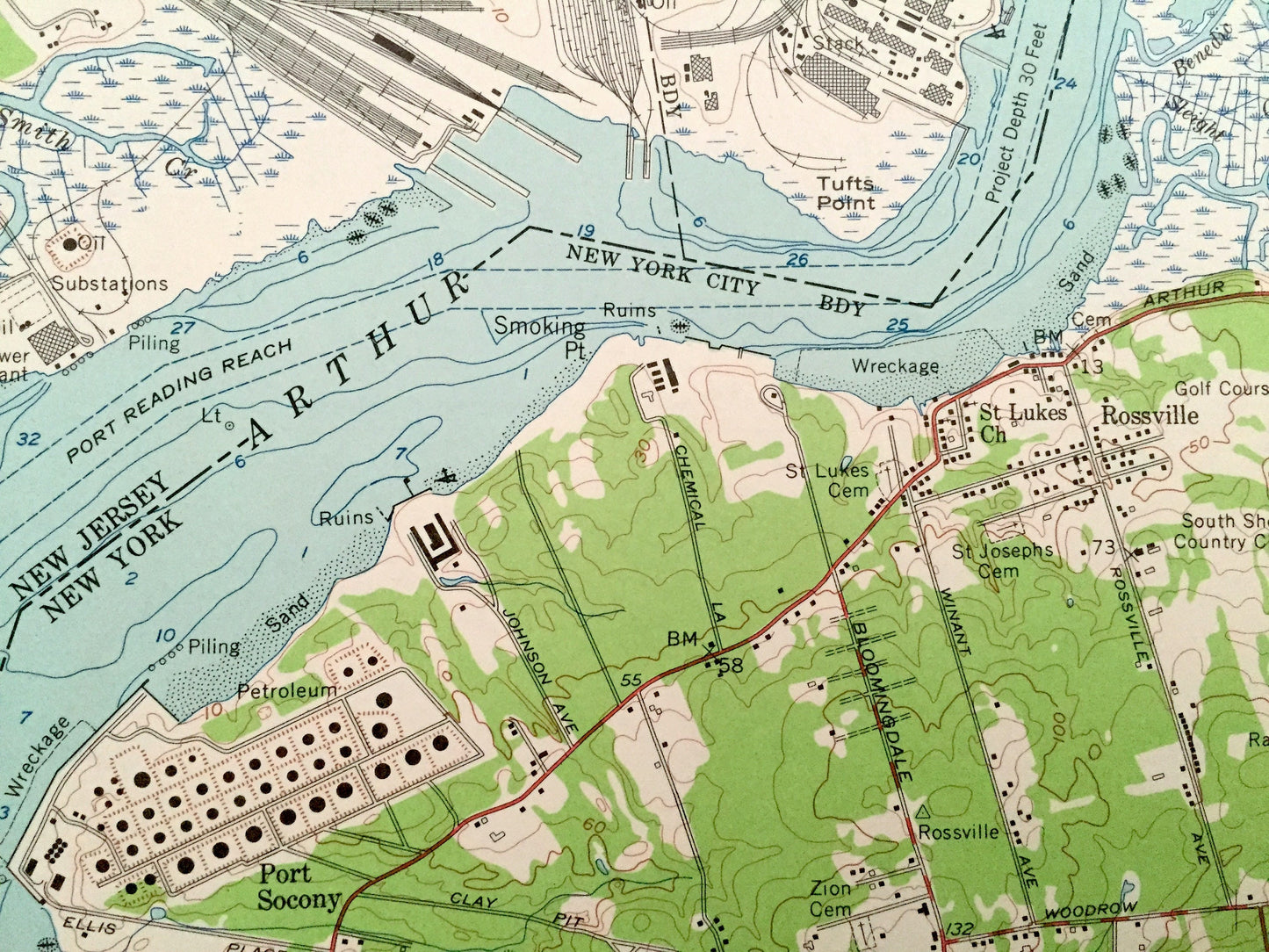
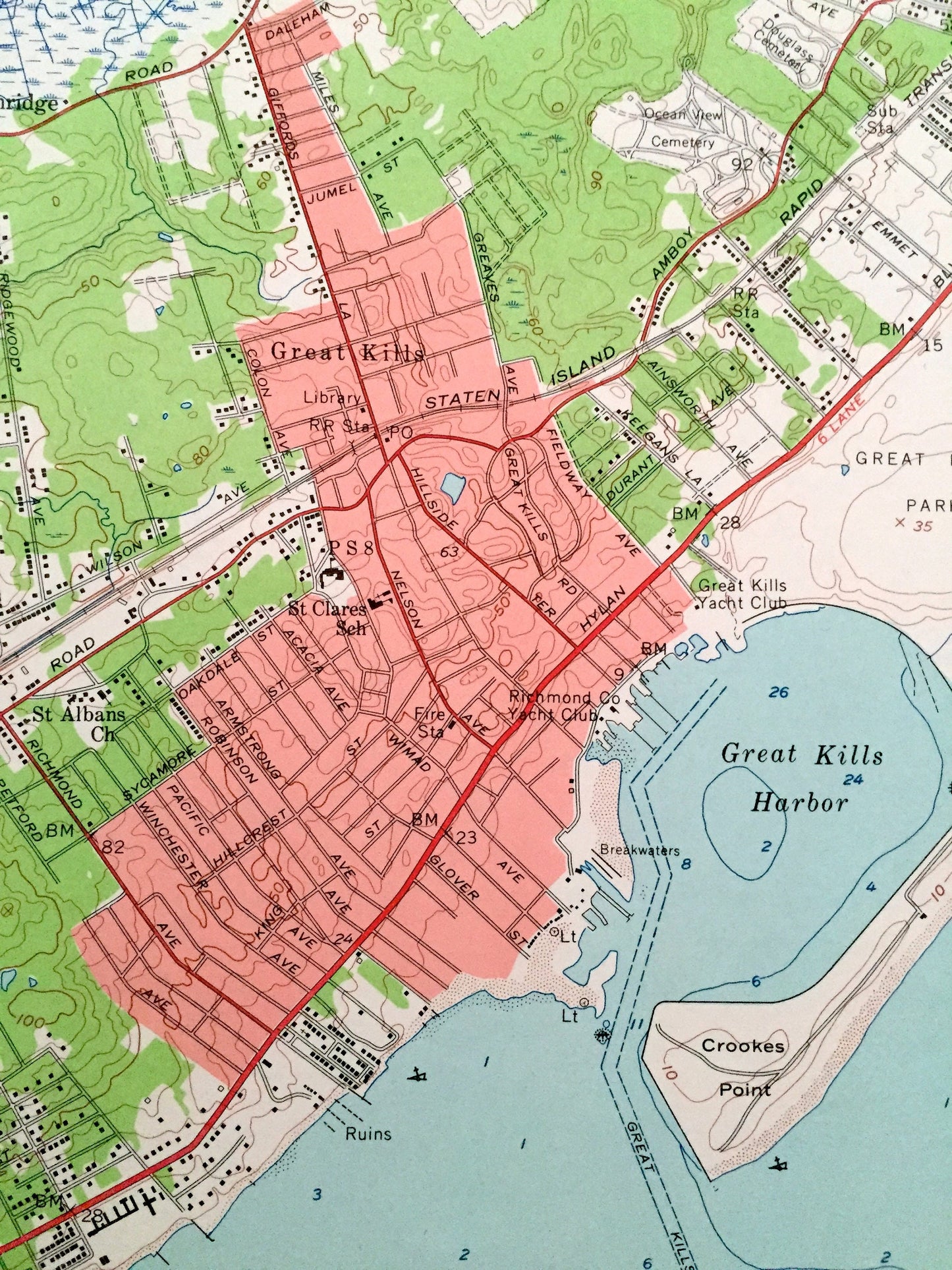
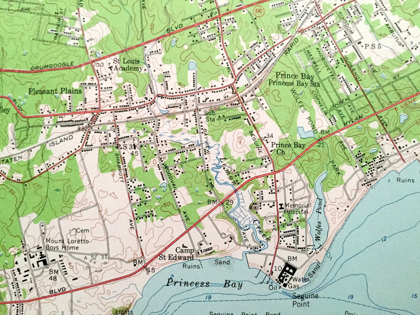
See what Richmond County of New York and Middlesex County of New Jersey looked like over 65 years ago. Lots of intricate details and geological contours. Map even has little squares for every house that existed at the time. The USGS cartographers were very thorough back then!
Perfect for the historian, map-lover, the curious or just as a conversation starter. Wonderful and rare. Vintage maps such as these make great gifts.
Edition of 1955, printed 1955
Dimensions: 22" width x 28" height
----
Features
Cities & Towns: NEW YORK: Staten Island- Graniteville, Westerleigh, Richmond, Bloomfield, Fresh Kills, Eltingville, Princes Bay, Tottenville, Great Kills, Woodrow, Haguenot, New Springville, Willowbrook, Castleton Corners, Travis, Charleston.
NEW JERSEY: Linden, Tremley, Grasselli, Tremley Point, Carteret, Woodbridge, West Carteret, Port Reading.
Points of Interest: Linden Airport, Conrail, Nathan Hale School, Tuffts Point, Arthur Kill, Schmul Playground, Rossville Golf Course, Radio Tower (WBBR), Ward Point, Princes Bay, Camp St Edward Ruins, Raritan Bay, Huguenot Beach, Arbutus Lake, Wolfes Pond Park, Our Lady Star of the Sea School, Great Kills Harbor, Gateway National Recreation Area, Monsignor Ferrel High School, The Richmondtown School, La Tourette Park and Golf Course, Farm Colony, Willowbrook State School, Willowbrook Park, Wagner High School, Sea View Hospital, St Ritas School, Countess Moore High School, Fresh Kills Main Creek, Richmond Creek, Annadale Beach, and lots more beaches, schools, towns, houses, and roads.
Condition: Very Good Vintage condition, commensurate with age. This map is in incredible shape for being over 65 years old. Has some edge-wear, which will read as character when framed.
----
We will happily adjust shipping price for multiple purchases. Maps are rolled up and shipped in sturdy mailing tubes, never folded.
Couldn't load pickup availability
Share