My Store
Antique Staten Island, New York City 1901 US Geological Survey Topographic Map – Manhattan, Brooklyn, Newark, Bayonne, Elizabeth, New Jersey
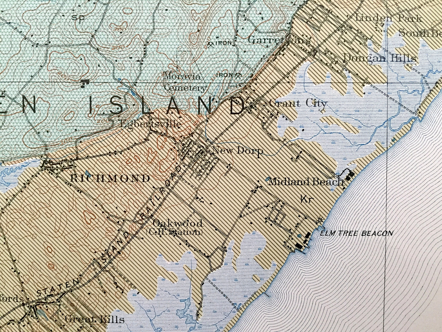
Antique Staten Island, New York City 1901 US Geological Survey Topographic Map – Manhattan, Brooklyn, Newark, Bayonne, Elizabeth, New Jersey
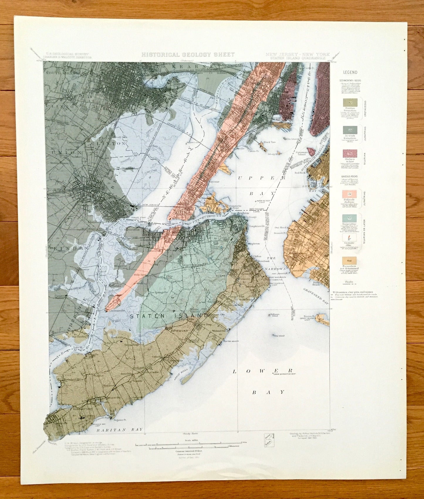
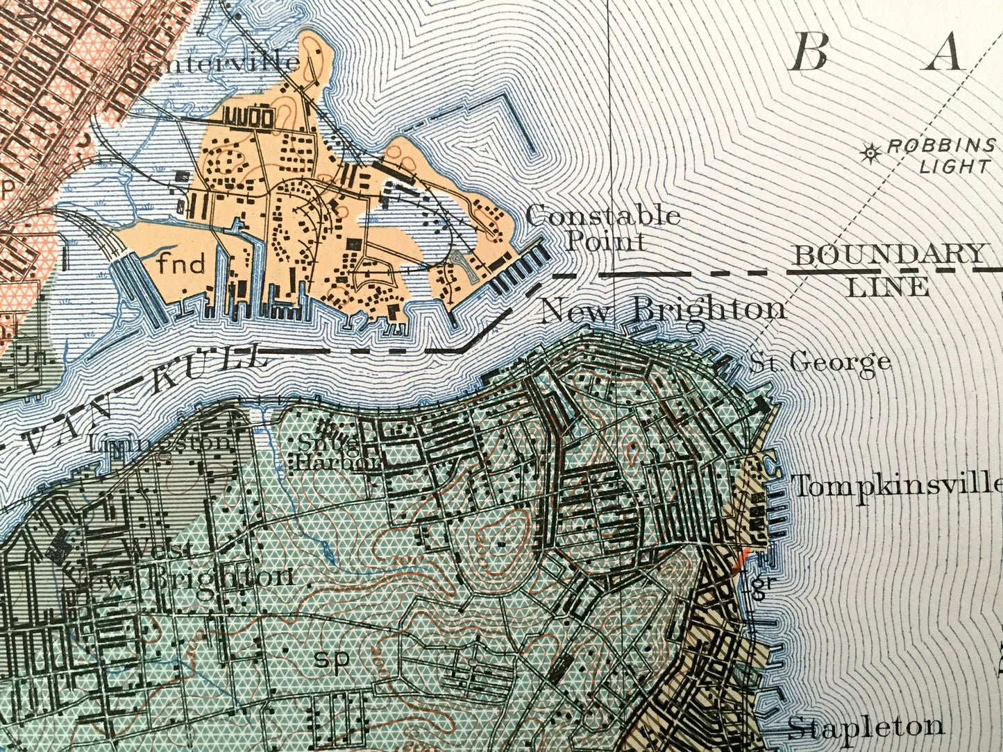
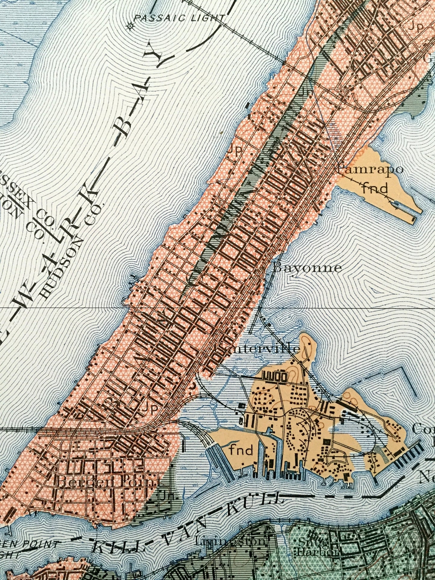
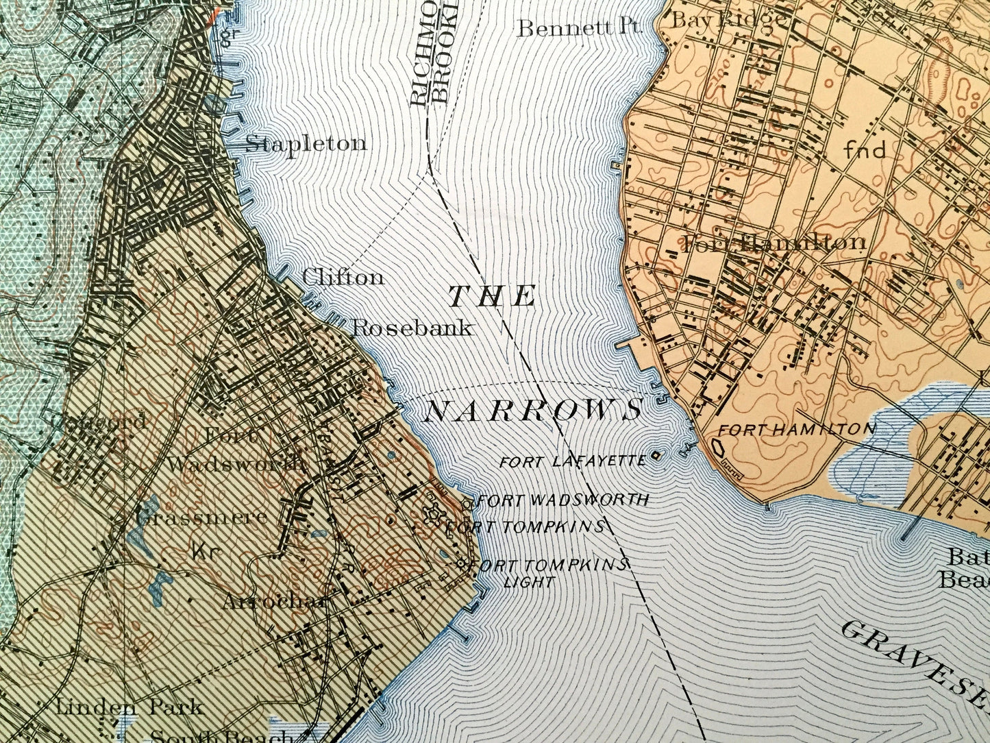
Beautiful, antique map of the sedimentary rock formations of Staten Island and surrounding New Jersey and New York City area. This is an authentic 1901 print from a U.S. Geological Survey folio and NOT a computer reproduction.
See what Staten Island, Manhattan, Brooklyn and New Jersey on the Hudson River looked like 120 years ago. Lots of intricate details and geological contours. Map even has little squares for every house that existed at the time. The USGS cartographers were very thorough back then! This is one of the rare maps with the map legend on the front.
Perfect for the historian, map-lover, the curious or just as a conversation starter. Very rare. Vintage maps such as these make great gifts.
Edition of 1901, printed 1901
Dimensions: 18 1/4" width x 21 1/2" height
----
Features
Cities, Neighborhoods & Towns: NEW YORK: New York City, Staten Island, Manhattan, Brooklyn, Battery Park, Red Hook, Owl Head, Fort Hamilton, New Utrecht, Bath Beach, Bay Ridge, Howland Hook, Old Place, Bloomfield, Chelsea, Linoleumville, Long Neck, Bulls Head, Summerville, Arlington, Graniteville, Elm Park, Willow Brook, New Springville, Castleton Corners, Brighton, New Brighton, Tompkinsville, Stapleton, Clifton, Rosebank, Grassmere, Linden Park, Dongan Hills, Fresh Kills, Green Ridge, Rossville, Green Ridge, Woodrow, Annadale, Eltingville, Seaside, Huguenot, Richmond Valley, Tottenville, Mt. Loretto, Princess Bay, Great Kills, Giffords, Woods of Arden, Midland Beach, New Dorp, Grant City, Egbertsville, Pleasant Plains.
NEW JERSEY: South Orange, Kearny, Clinton, Newark, Union, Elizabeth, Linden, Elizabethport, Woodbridge, Hilton, Parkview, Saybrook, Lyons Farms, Townley, Lorraine, Waverly Park, Great Island, Salem, El Mora, Bayway, Grasselli, Tremley, East Rahway, Carteret, Chrome, Star Landing, Bergen Point, Constable Point, Bayonne, Pamrapo, Greenville, Claremont, Black Tom, West Bergen, Centerville.
Points of Interest: Union County, Hudson County, Essex County, Hudson River, Newark Bay, Upper Bay, Lower Bay, Raritan Bay, Gravesend Bay, Gowanus Bay, The Narrows, Arthur Kill, Kill Van Kull, Hackensack River, Passaic River, Elizabeth River, Buttermilk Channel, Rahway River, Governors Island, Ellis Island, Bedloe Island, Robbins Reef Light, Norton Point, Coney Island Light, Great Kills, and lots more hills, creeks, points, bays, towns, schools, churches, roads and railroads.
Condition: Very Good Vintage condition, commensurate with age. This map is in great shape for being over 115 years old. Has light edge-wear and staple holes along the right margin, but these are easily-hidden with framing as the right margin is wider than the left.
----
We will happily adjust shipping price for multiple purchases. Maps are rolled up and shipped in sturdy mailing tubes, never folded.
Couldn't load pickup availability
Share