My Store
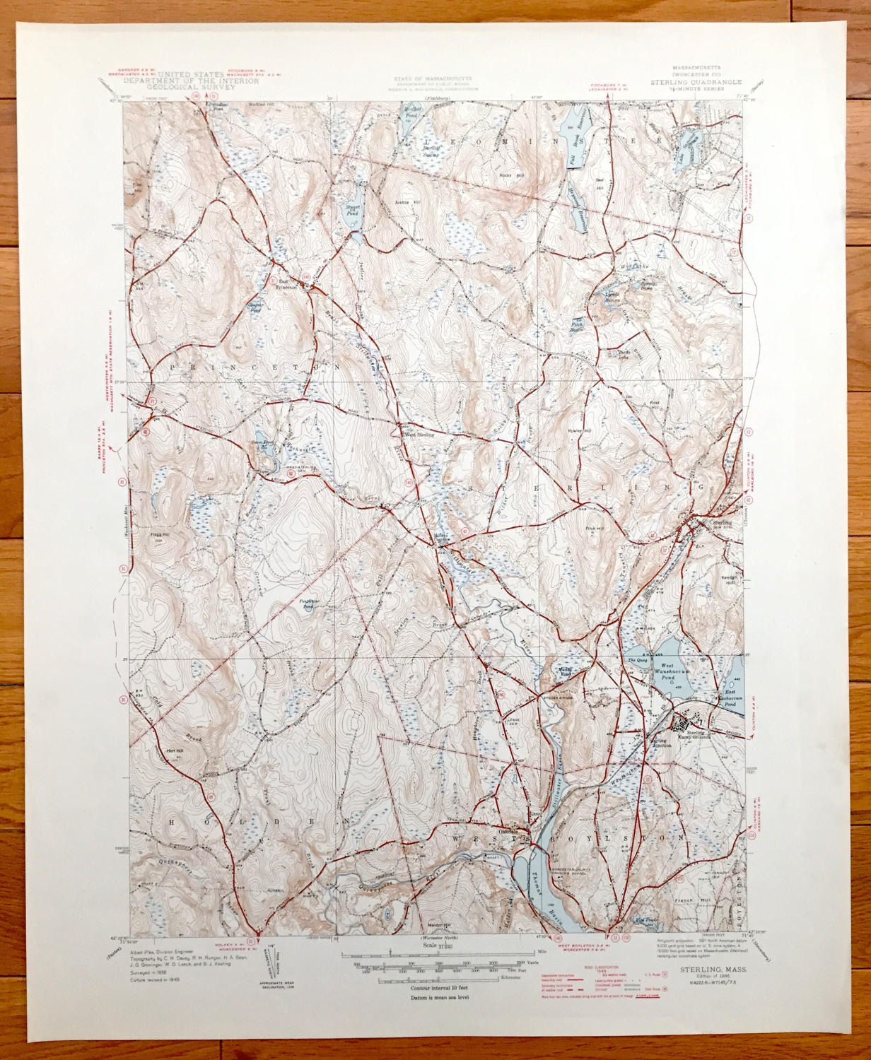
Antique Sterling, Massachusetts 1946 US Geological Survey Topographic Map – Worcester County, Princeton, Leominster, West Boylston Holden MA
Antique Sterling, Massachusetts 1946 US Geological Survey Topographic Map – Worcester County, Princeton, Leominster, West Boylston Holden MA
Beautiful, antique map of Sterling, Princeton, West Boyleston, and Holden Massachusetts. This is an authentic 1946 print from the U.S. Geological Survey and is NOT a computer reproduction.
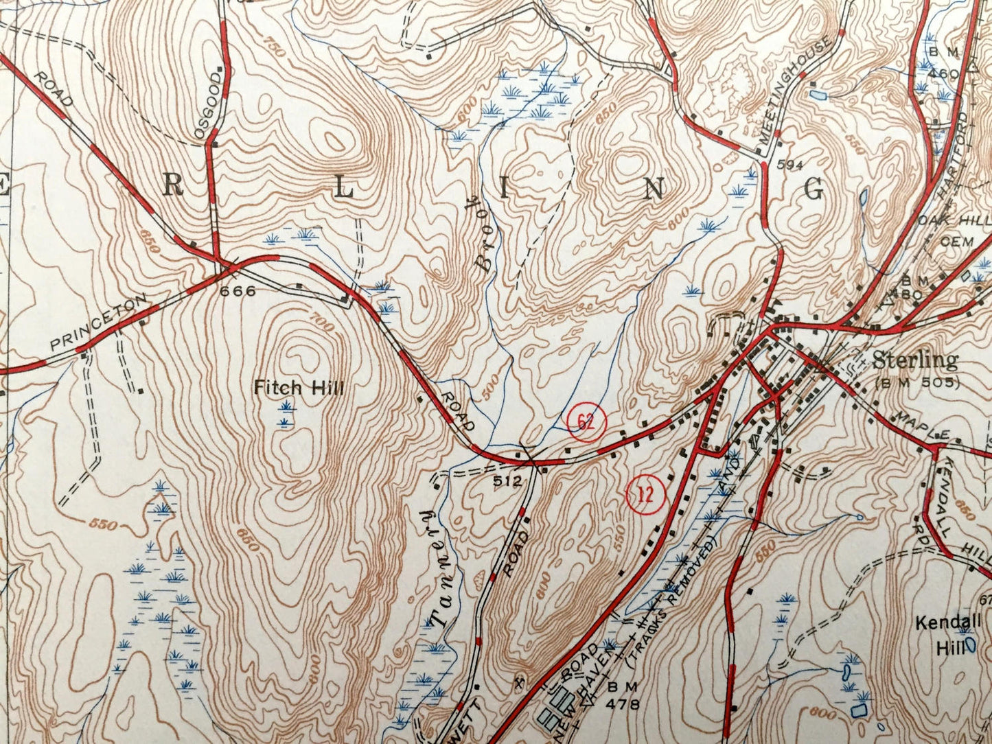
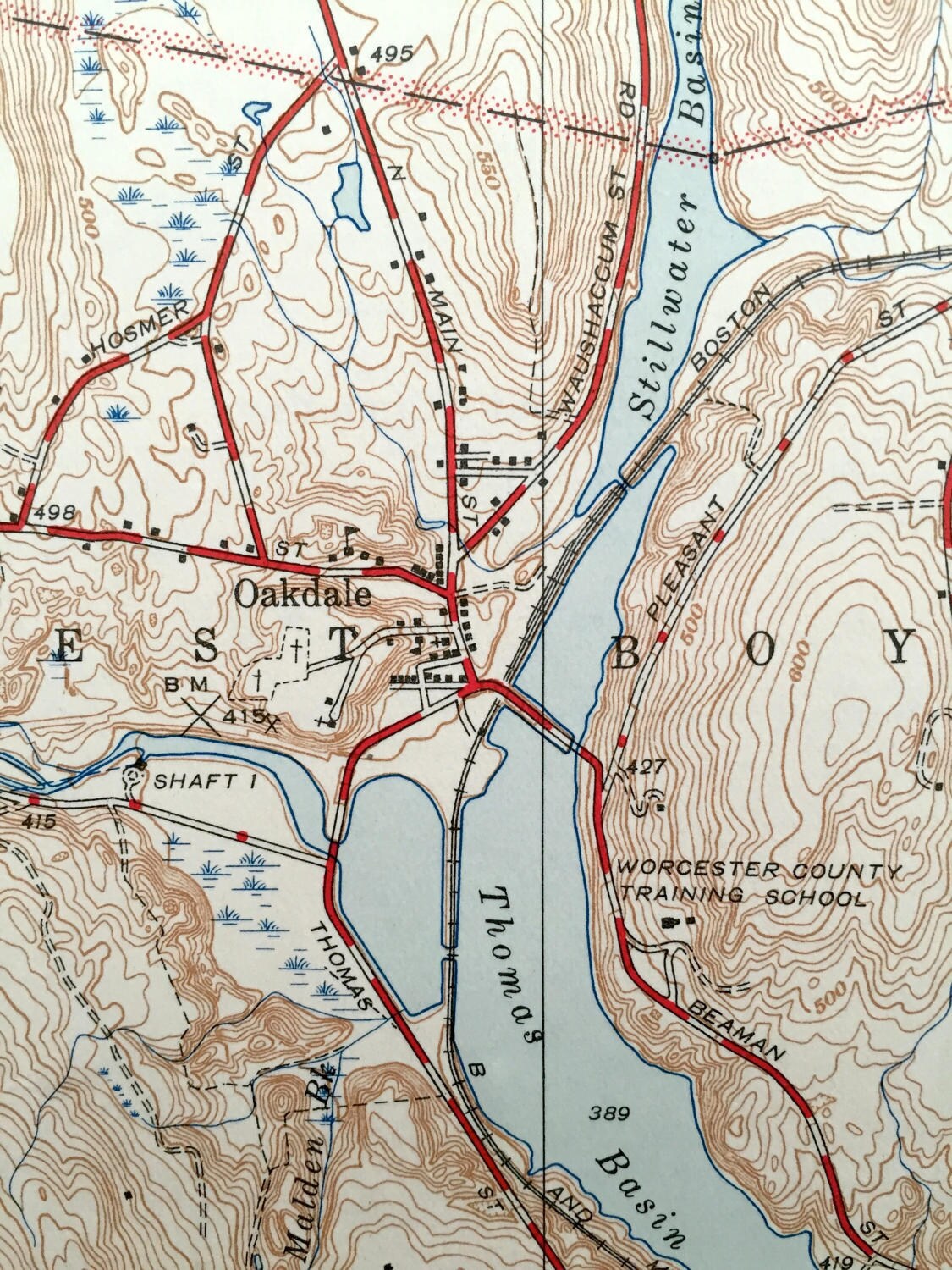
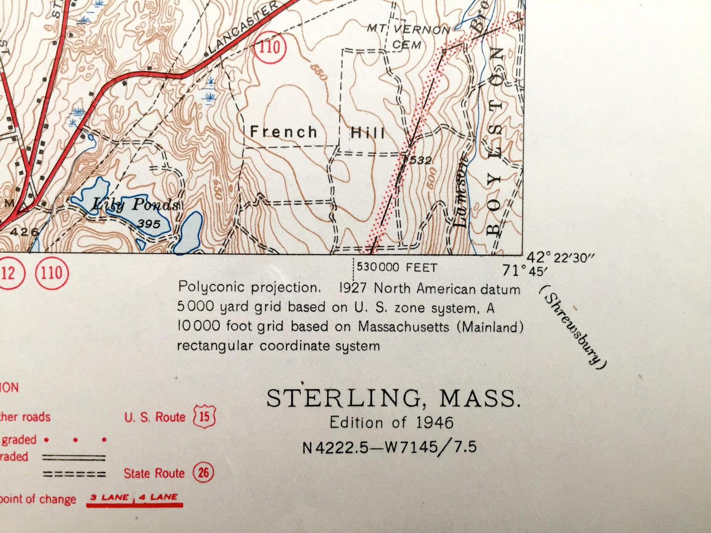
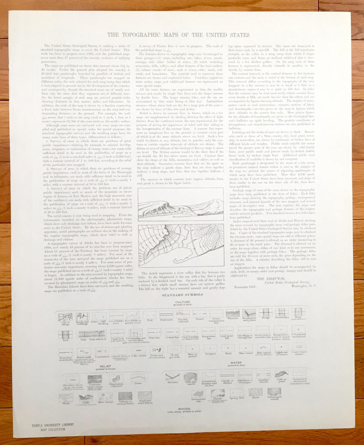
See what Worcester County, Massachusetts looked like over 75 years ago. Lots of intricate details and geological contours. Map even has little squares for every house that existed at the time. The USGS cartographers were very thorough back then! On the back is a description of topographic symbols and map guide.
Perfect for the historian, map-lover, the curious or just as a conversation starter. Wonderful and rare. Vintage maps such as these make great gifts.
Edition of 1946, printed 1946
Dimensions: 17" width x 21" height
----
Features
Cities & Towns: Leominster, Sterling, West Sterling, Sterling Junction, West Boyleston, Boyleston, Moores Corner, East Princeton, Princeton, Holden, Oakdale.
Points of Interest: Stuart Pond, Fall Brook Reservoir, Lake Samoset, Stillwater River, Thomas Basin, The Quag, West Waushaccum Pond, Sterling Camp Grounds, Stones Bridge, Justice Hill, Putwater Pond, Flagg Hill, Boston & Maine Railroad, and lots more hills, mountains, streams, ponds, houses, schools and roads.
Condition: Very Good Vintage condition, commensurate with age. This map is in great shape for being over 75 years old.
----
We will happily adjust shipping price for multiple purchases. Maps are rolled up and shipped in sturdy mailing tubes, never folded.
Couldn't load pickup availability
Share