My Store
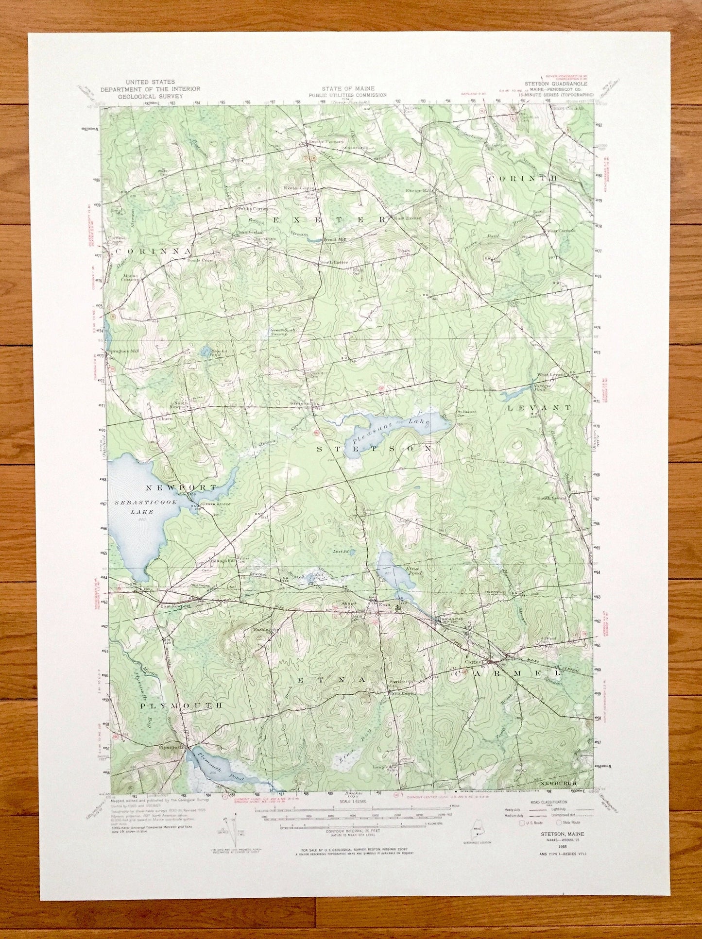
Antique Stetson, Maine 1955 US Geological Survey Topographic Map – Corinna, Exeter, Corinth, Levant, New Port, Plymouth, Etna, Carmel, ME
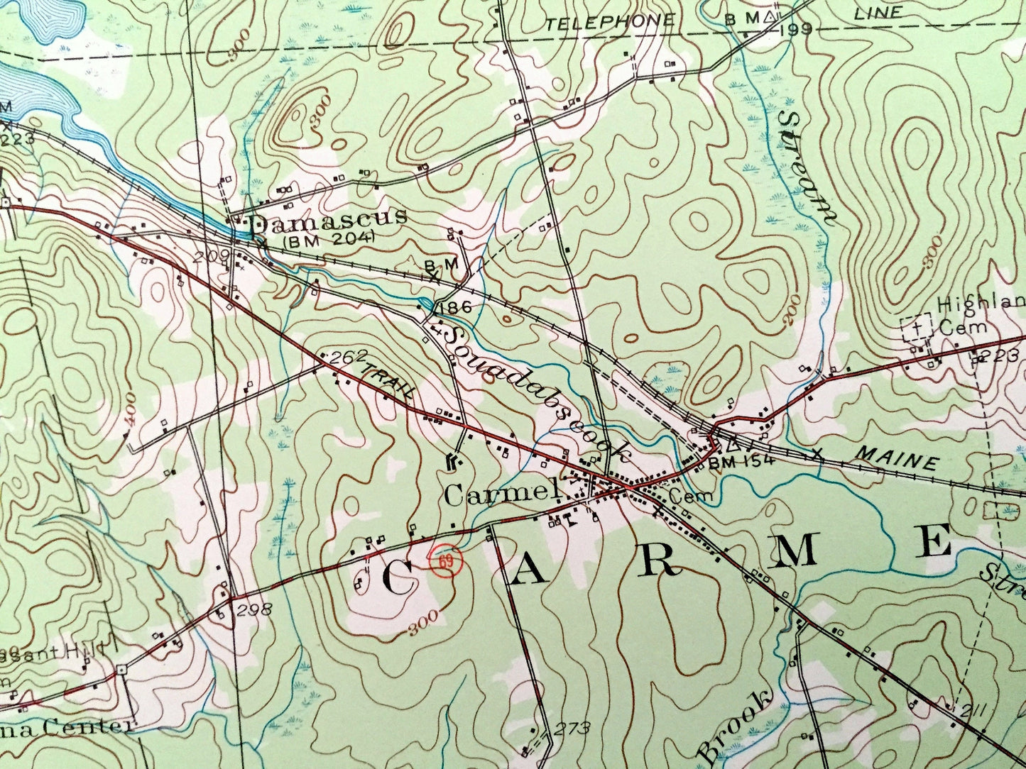
Antique Stetson, Maine 1955 US Geological Survey Topographic Map – Corinna, Exeter, Corinth, Levant, New Port, Plymouth, Etna, Carmel, ME
Beautiful, antique map of Stetson, Levant, Newport, Etna, Carmel, Plymouth, Exeter, Corinna and Corinth, Maine. This is an authentic 1955 edition, 1974 print from the U.S. Geological Survey and NOT a computer reproduction.
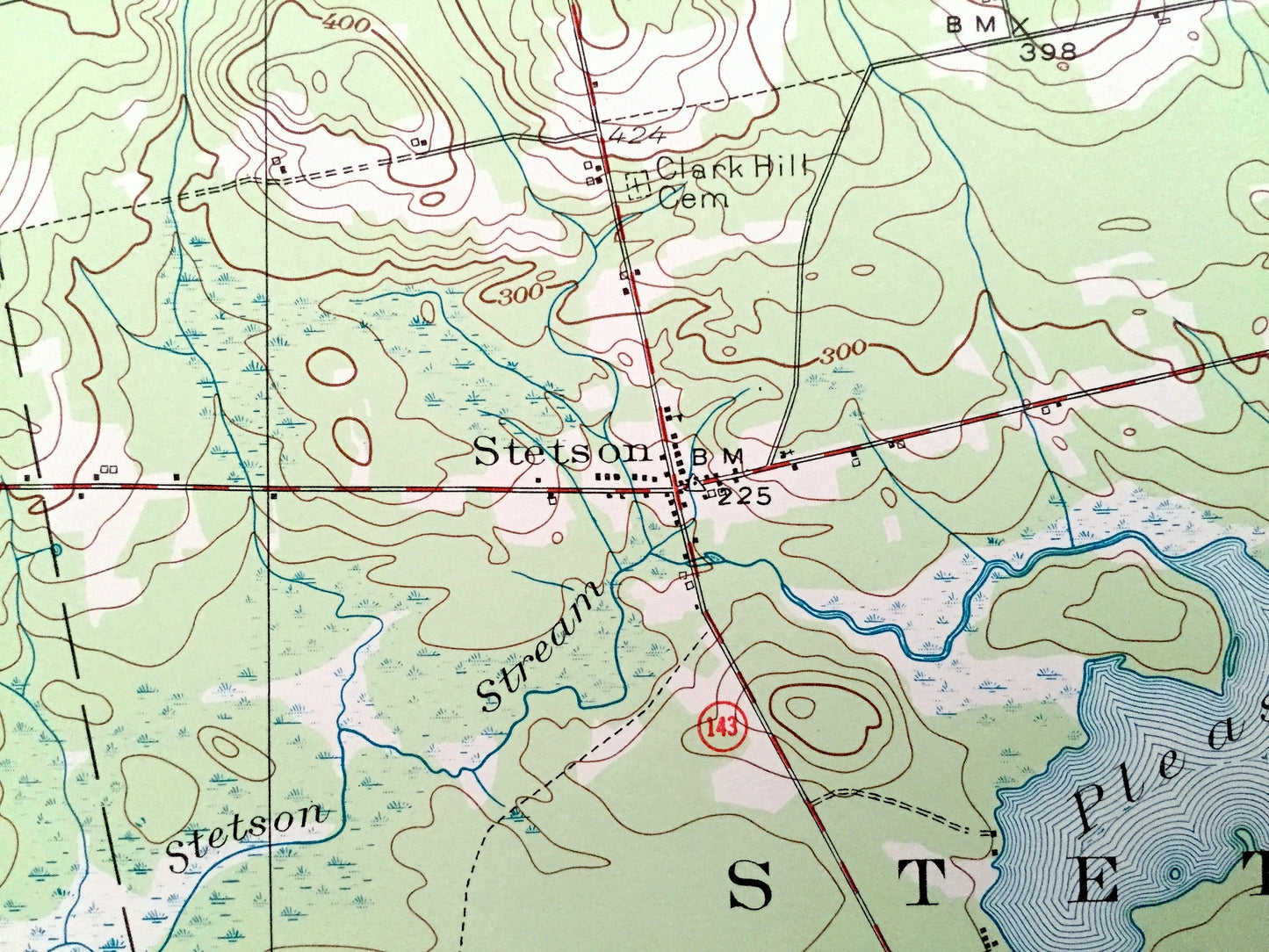
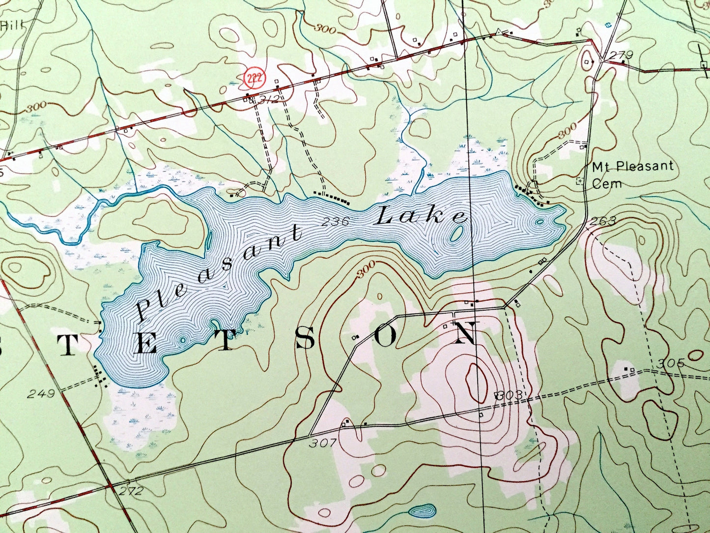
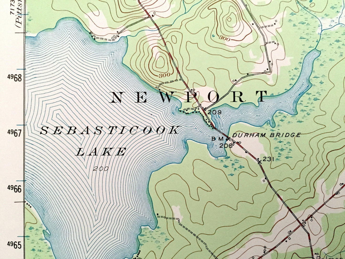
See what Penobscot County of Maine looked like over 60 years ago. Lots of intricate details and geological contours. Map even has little squares for every house that existed at the time. The USGS cartographers were very thorough back then!
Perfect for the historian, map-lover, the curious or just as a conversation starter. Wonderful and rare. Vintage maps such as these make great gifts.
Edition of 1955, printed 1974
Dimensions: 16" width x 22" height
----
Features
Cities & Towns: Corinna, Morse Corners, Spragues Mill, Coburn, North Newport, Stetson, Exeter, Exeter Corners, Exeter Center, Stubbs Corner, French Mill, East Exeter, Exeter Mills, Beans Mill, East Corinth, Corinth, West Corinth, West Levant, Levant, South Levant, Carmel, Newburgh, Etna Center, Etna, Plymouth, Billings Hill, Damascus.
Points of Interest: Chamberlain Church, Exeter Fairgrounds, Beans Mill School, Harveys Pond, Pleasant Lake, Sebasticook Lake, Durham Bridge, Maine Central Railroad, Dow School, Plymouth Pond, Longfellow School, Etna Pond and lots more hills, mountains, streams, ponds, houses, schools and roads.
Condition: Very Good condition, commensurate with age. This map is in incredible shape for being over 45 years old.
----
We will happily adjust shipping price for multiple purchases. Maps are rolled up and shipped in sturdy mailing tubes, never folded.
Couldn't load pickup availability
Share