My Store
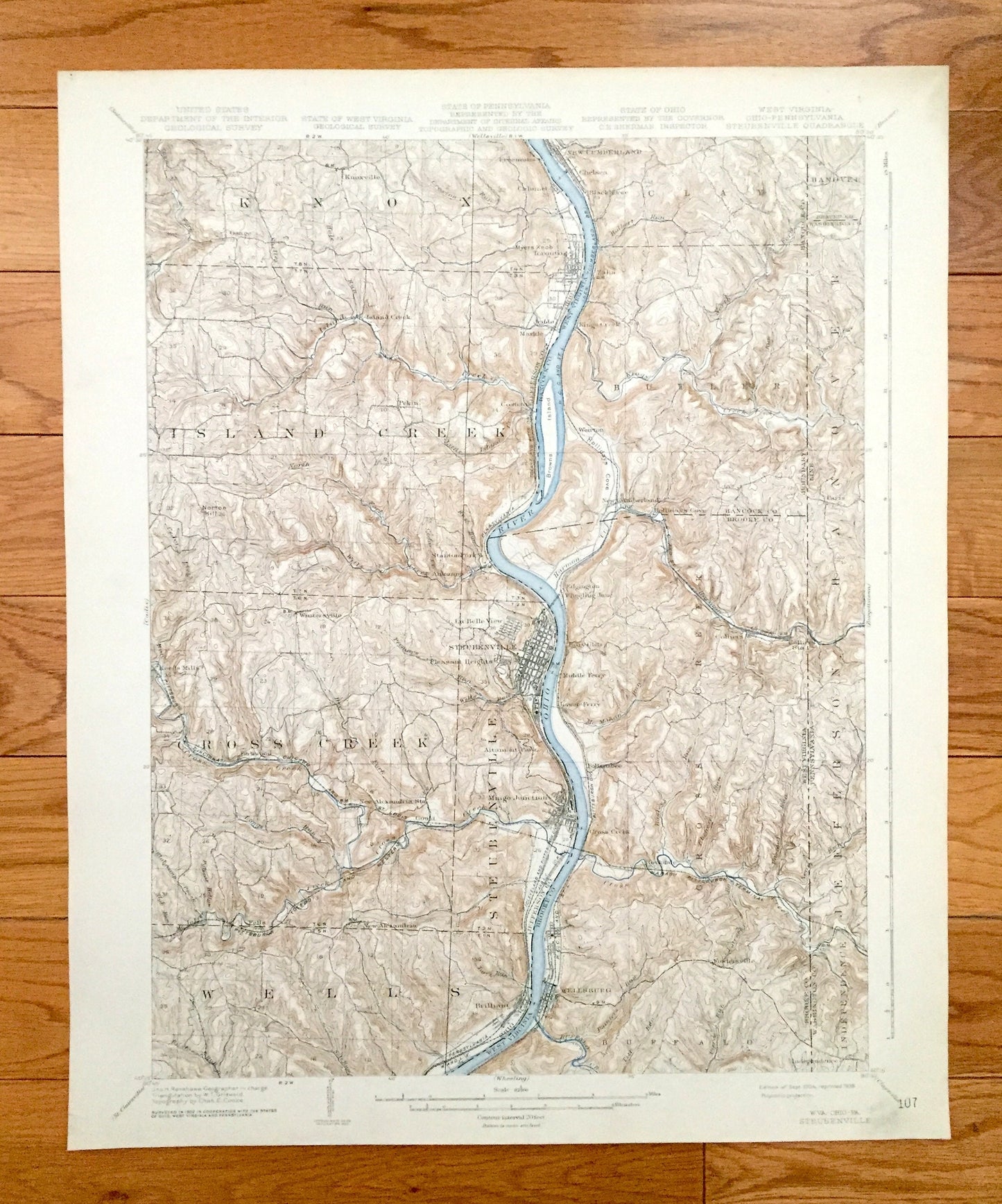
Antique Steubenville, Ohio 1904 US Geological Survey Topographic Map – Knox, Island Creek, Wells, La Belle View, Toronto, Panhandle, OH WV
Antique Steubenville, Ohio 1904 US Geological Survey Topographic Map – Knox, Island Creek, Wells, La Belle View, Toronto, Panhandle, OH WV
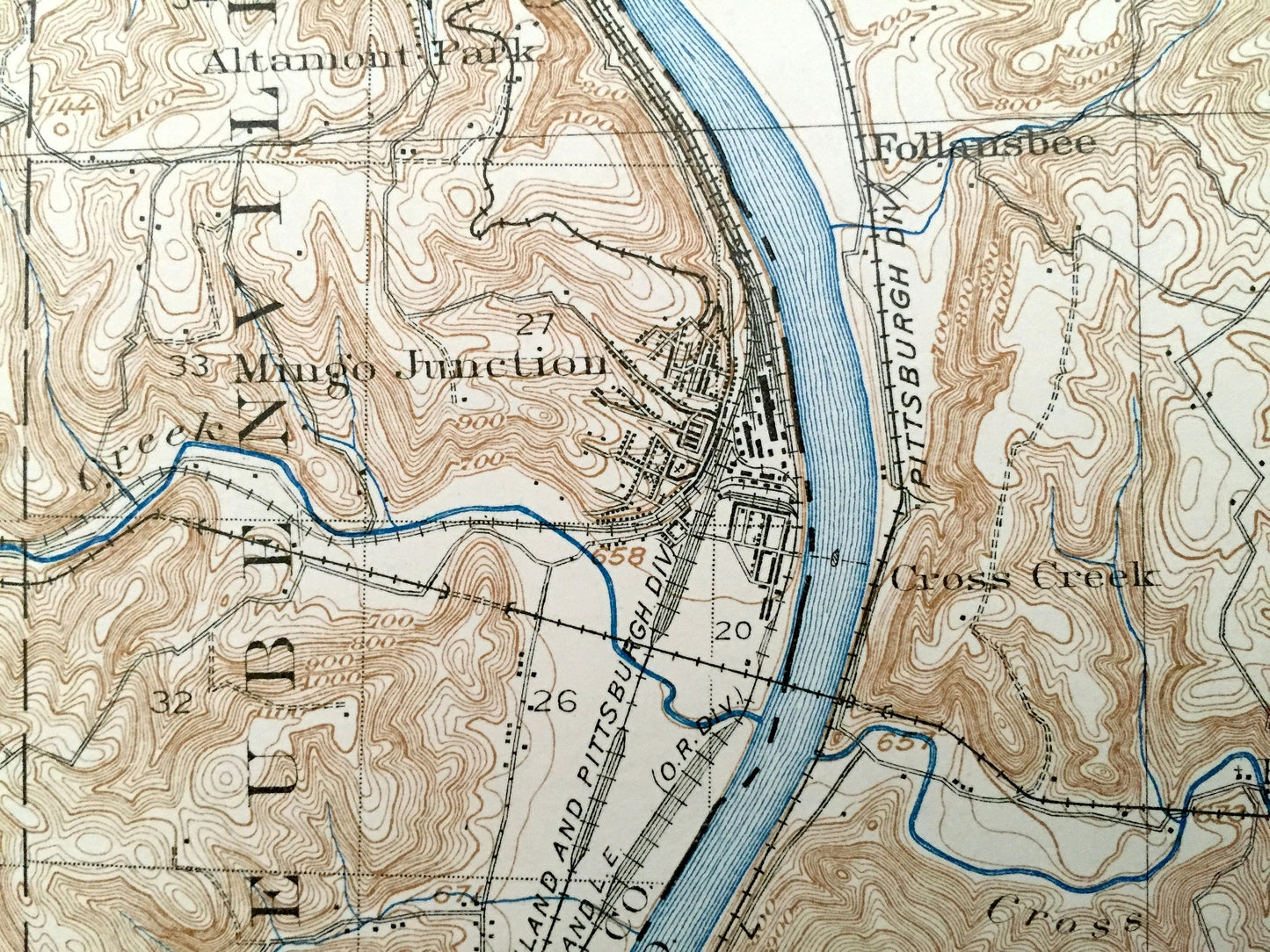
Beautiful, antique map of Steubenville, Ohio and surrounding West Virginia and Pennsylvania areas. This is an authentic 1904 edition, 1938 print from the U.S. Geological Survey and NOT a computer reproduction.
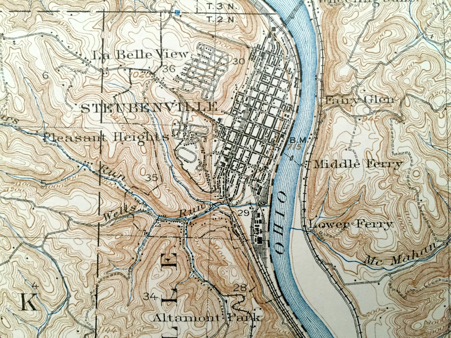
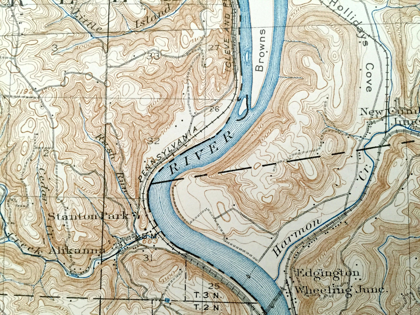
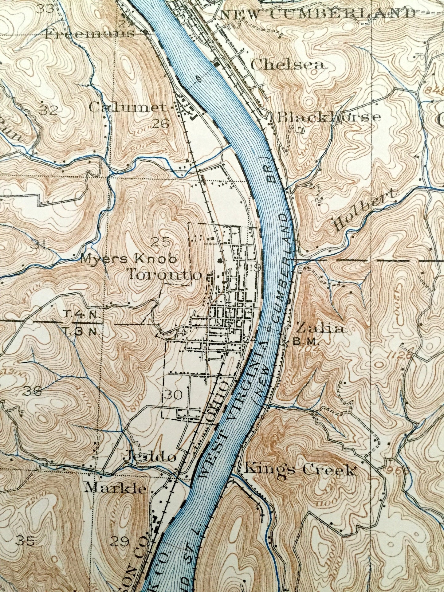
See what Ohio, West Virginia and Pennsylvania looked like over 115 years ago. Lots of intricate details and geological contours. Map even has little squares for every house that existed at the time. The USGS cartographers were very thorough back then! On the back is a description of topographic symbols and map guide.
Perfect for the historian, map-lover, the curious or just as a conversation starter. Wonderful and rare. Vintage maps such as these make great gifts.
Edition of 1904, printed 1938
Dimensions: 16 1/2" width x 20" height
----
Features
Cities & Towns: OHIO - Steubenville, Freemans, Calumet, Jeddo, Markle, Costonia, Pekin, Osage, Stanton Park, Alikanna, Reeds Mills, Fernwood, Wintersville, Pleasant Heights, Altamont Park, New Alexandria, Mingo Junction, Fells, Brilliant, Gould, Knox, Island Creek, Steubenville, Wells, La Belle View, Toronto.
WEST VIRGINIA - Clay, Butler, Cross Creek, New Cumberland, Chelsea, Blackhorse, Zalia, Kings Creek, Weirton, Edgington, Colliers, Wheeling Junction, Fairy Glen, Middle Ferry, Lower Ferry, Follansbee, Wellsburg, Fowlersville.
PENNSYLVANIA - Hanover, Jefferson, Independence, Paris.
Points of Interest: Jefferson County, Ohio, Brooke & Hancock County, West Virginia and Beaver & Washington Counties, Ohio River, West Virginia Northern Panhandle, Kings Creek, Cross Creek, McIntyre Creek, Buffalo Creek, Hollidays Cove, Browns Island, Island Creek, Norton Hill, Pennsylvania (Cleveland & Pittsburgh Division) Railroad and more roads, railroads, houses, ponds, hills, creeks, and lakes.
Condition: Very Good Vintage condition, commensurate with age. This map is in great shape for being over 80 years old. Has light edge-wear, but this will add to vintage character when framed.
----
We will happily adjust shipping price for multiple purchases. Maps are rolled up and shipped in sturdy mailing tubes, never folded.
Couldn't load pickup availability
Share