My Store
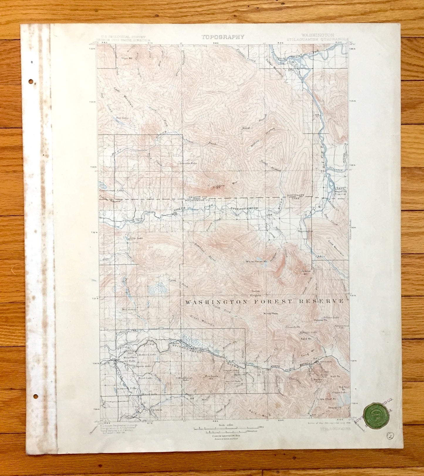
Antique Stillaguamish, Washington 1901 US Geological Survey Topographic Map – Skagit, Snohomish County, Granite Falls, Darrington, Oso, WA
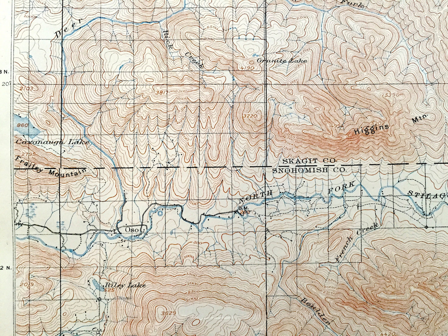
Antique Stillaguamish, Washington 1901 US Geological Survey Topographic Map – Skagit, Snohomish County, Granite Falls, Darrington, Oso, WA
Beautiful, antique map of Stillaguamish, Washington and surrounding Skagit & Snohomish County area (spelled here as Stilaguamish). This is an authentic 1901 edition, 1908 print from the U.S. Geological Survey and NOT a computer reproduction. Map was removed from a bound collection of maps of Washington State.
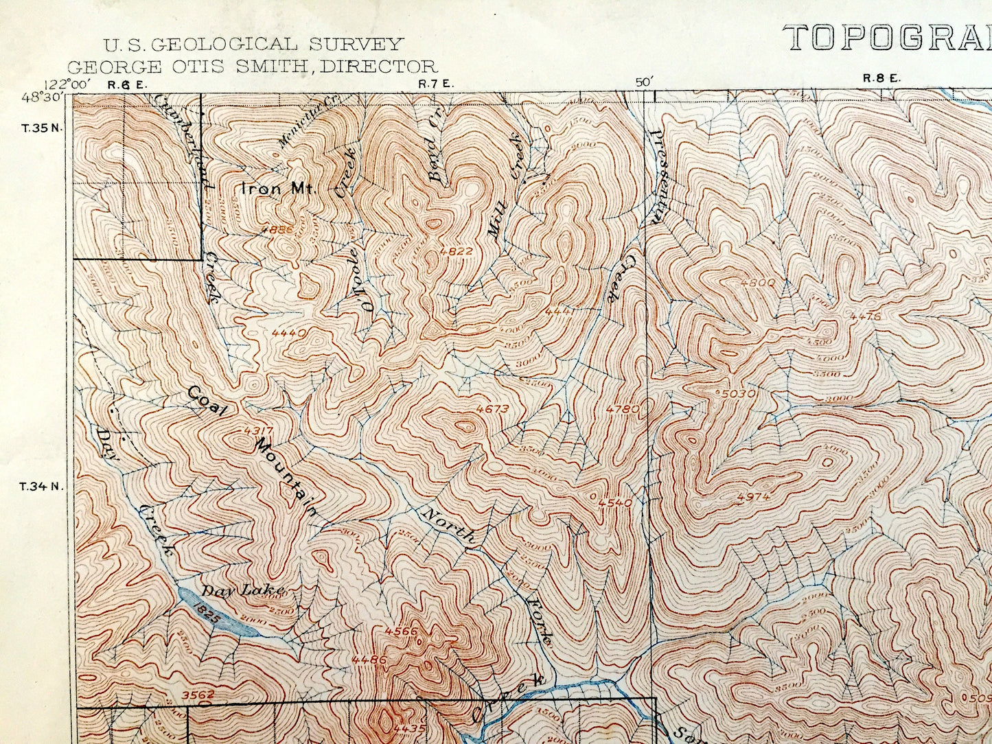
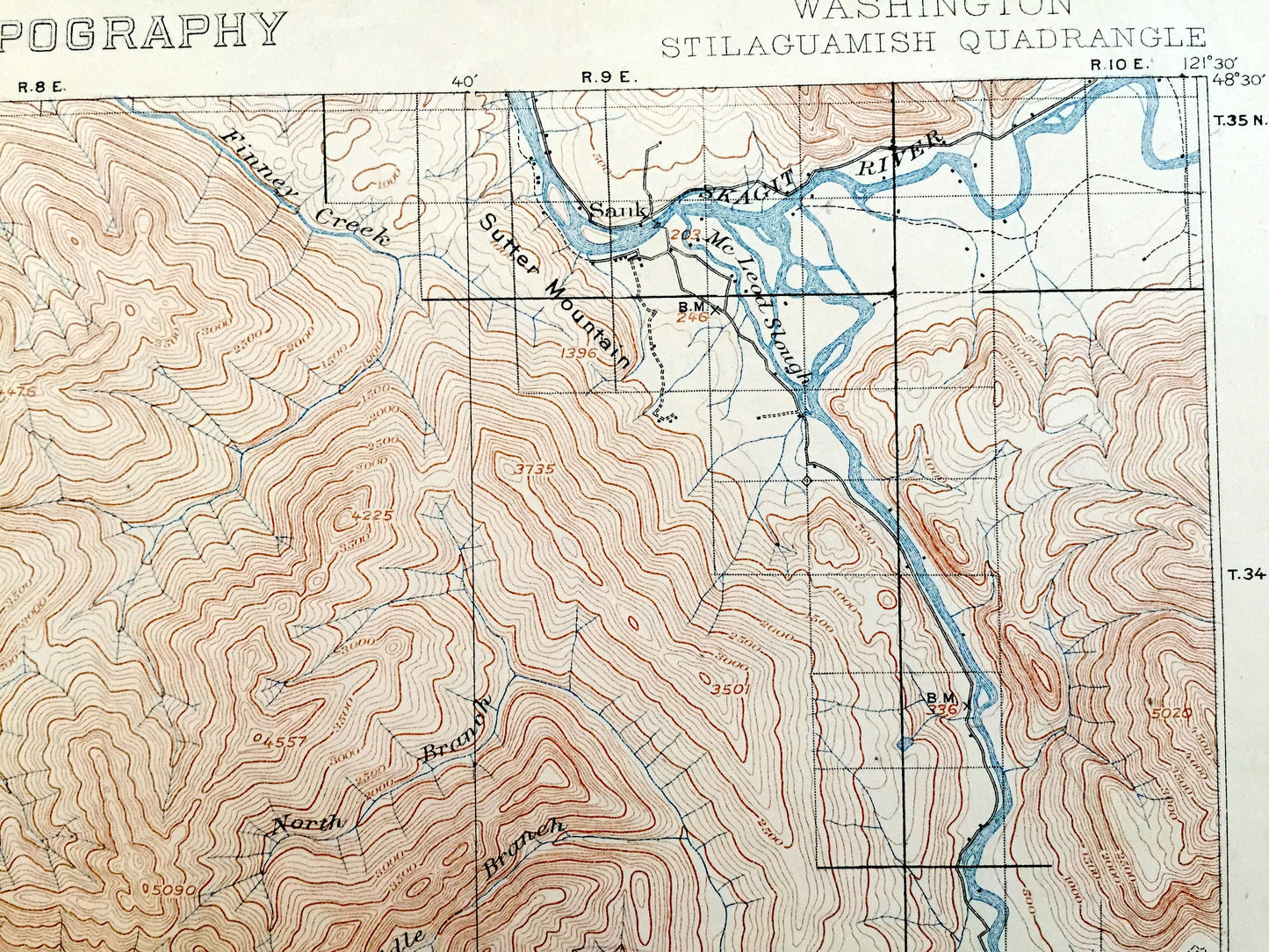
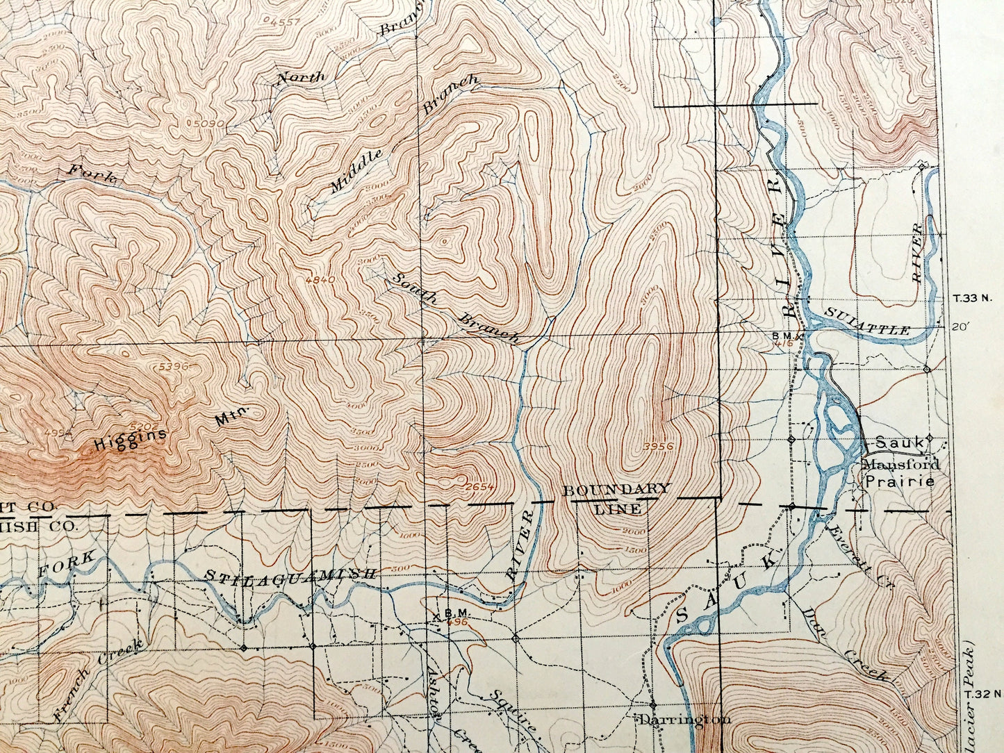
See what Washington looked like over 120 years ago. Lots of intricate details and geological contours. Map even has little squares for every house that existed at the time. The USGS cartographers were very thorough back then! On the back is a description of topographic symbols and map guide.
Perfect for the historian, map-lover, the curious or just as a conversation starter. Wonderful and rare. Vintage maps such as these make great gifts.
Edition of 1901, printed 1908
Dimensions: 16 1/2" width x 20" height (The atlas binding on the left margin is another inch.)
----
Features
Cities & Towns: Stilaguamish, Sauk, Mansford, Oso, Darrington, Granite Falls, Pilchuck, Robe, Gold Basin, Silverton.
Points of Interest: Skagit County, Snohomish County, Washington Forest Reserve, now Boulder River Wilderness and Mt. Baker-Snoqualmie National Forest, Stilaguamish River, Sauk River, Skagit River, Deer Creek, Day Creek, Pilchuck River, Suiattle River, Iron Mountain, Higgins Mountain, Sutter Mountain, Green Mountain, White Horse Mountain, Jumbo Mountain, Gold Mountain, Boulder River, Granite Lake, Coal Mountain, Sauk Prairie, Windy Pass, Helena Peak, Pilchuck Mountain, Worthy Creek, Marble Peak, Big Four Mountain, Little Chief Peak, Williamson Creek, Marble Gulch, and lots more hills, mountains, creeks, towns, roads and train tracks.
Condition: Good Vintage condition, commensurate with age. This map is in great shape for being over 110 years old. Has light wear, toning, foxing, edge-wear, as well as stamp and seal in lower right margin, but these will read as vintage character when framed. Canvas binding at left margin has been left on map, for discretion of buyer to keep or remove.
----
We will happily adjust shipping price for multiple purchases. Maps are rolled up and shipped in sturdy mailing tubes, never folded.
Couldn't load pickup availability
Share