My Store
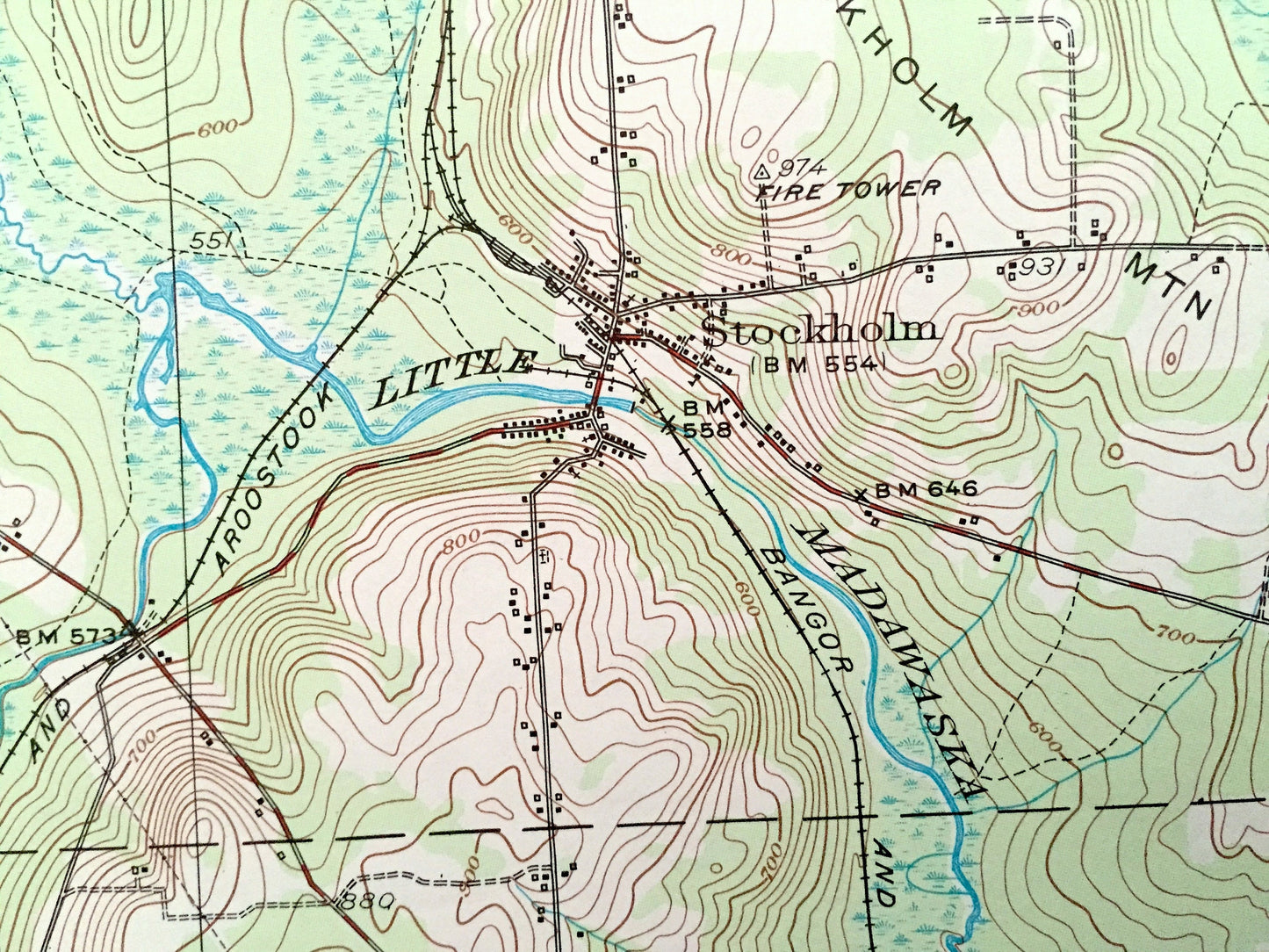
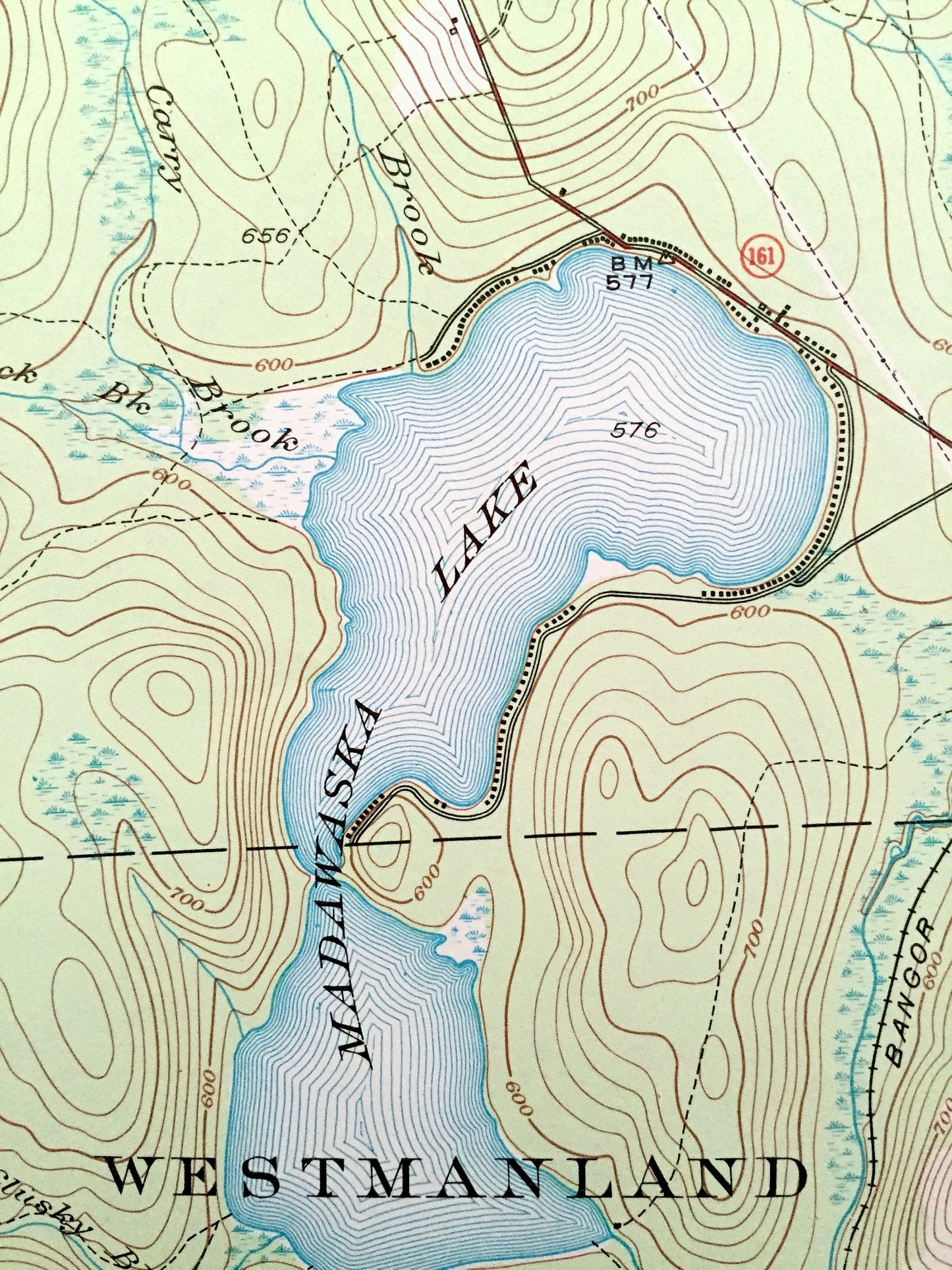
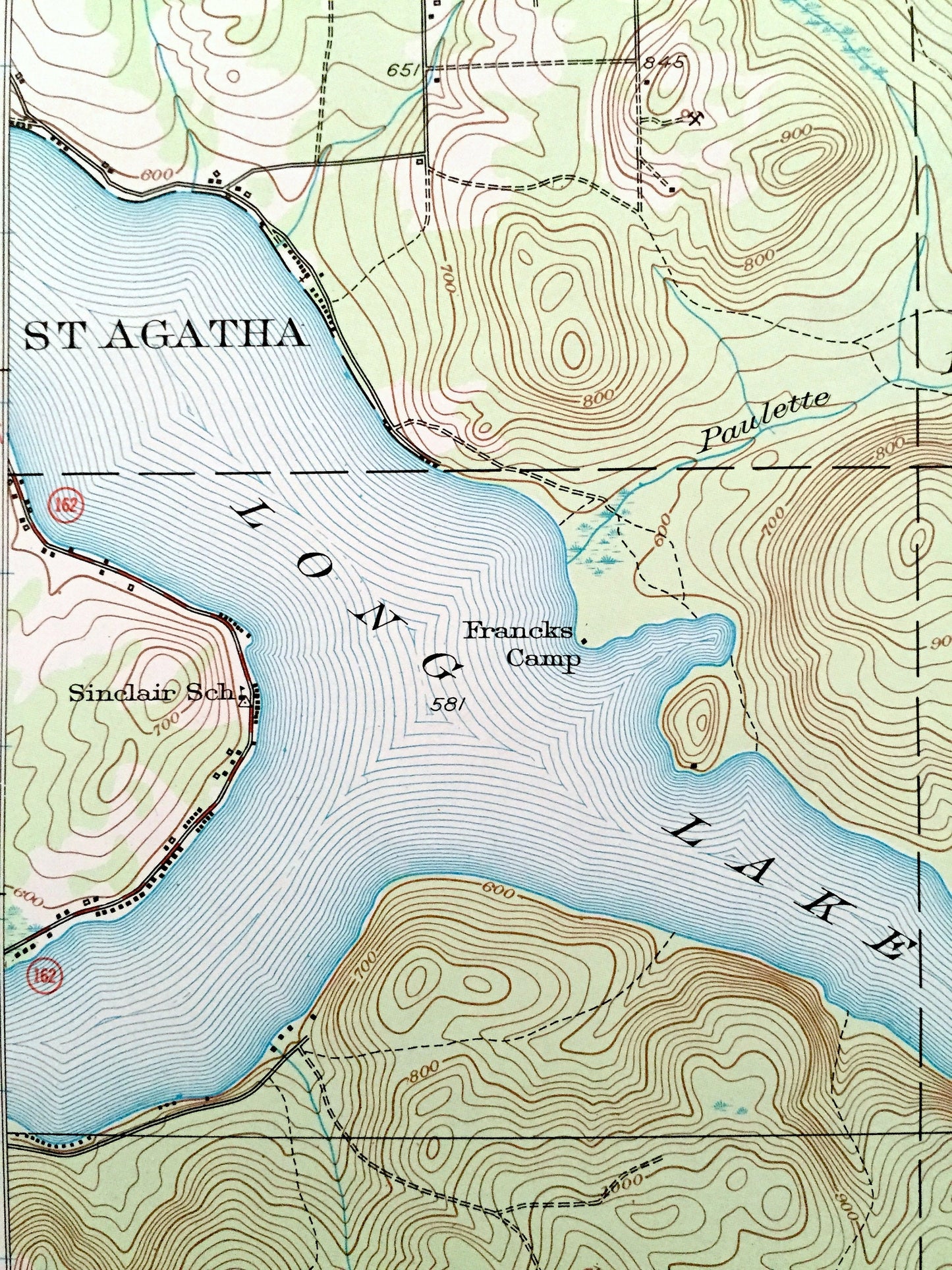
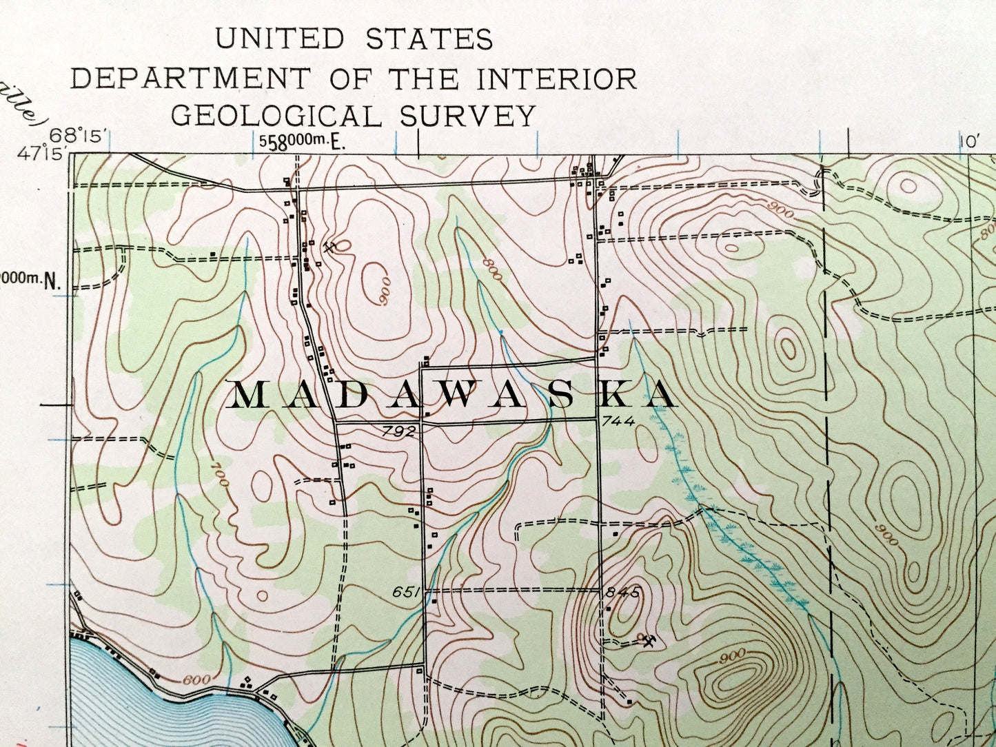
Antique Stockholm, Maine 1953 US Geological Survey Topographic Map – Madawaska, Grand Isle, Van Buren, Cyr, Connor, New Sweden, Westmanland
Antique Stockholm, Maine 1953 US Geological Survey Topographic Map – Madawaska, Grand Isle, Van Buren, Cyr, Connor, New Sweden, Westmanland
Beautiful, antique map of Stockhom, Connor, New Sweden, Westmanland, Cyr, Van Buren, Grand Isle and Madawaska, Maine. This is an authentic 1953 edition, 1958 print from the U.S. Geological Survey and NOT a computer reproduction.
See what Aroostook County of Maine looked like over 65 years ago. Lots of intricate details and geological contours. Map even has little squares for every house that existed at the time. The USGS cartographers were very thorough back then!
Perfect for the historian, map-lover, the curious or just as a conversation starter. Wonderful and rare. Vintage maps such as these make great gifts.
Edition of 1953, printed 1958
Dimensions: 18" width x 22" height
----
Features
Cities & Towns: Madawaska, Grand Isle, Van Buren, Martins Siding, Cyr, Connor, New Sweden, Jemtland, Stockholm, Colline Siding, Sinclair, California, Unorganized Territories T17, R4, T16 R4, T17, R3, all within unorganized territory township code, West of the Easterly Line of the State (WELS).
Points of Interest: Long Lake, Francks Camp, Sinclair School, Parent School, Sirois School, St John River, Bangor & Aroostook Railroad, Moose Hill, Halfway House, East Jemtland School, Berquist School, Little Madawaska River, Madawaska Lake, Stockholm Mountain, Stockholm Mountain Fire Tower.
Condition: Very Good condition, commensurate with age. This map is in incredible shape for being over 60 years old.
----
We will happily adjust shipping price for multiple purchases. Maps are rolled up and shipped in sturdy mailing tubes, never folded.
Couldn't load pickup availability
Share