My Store
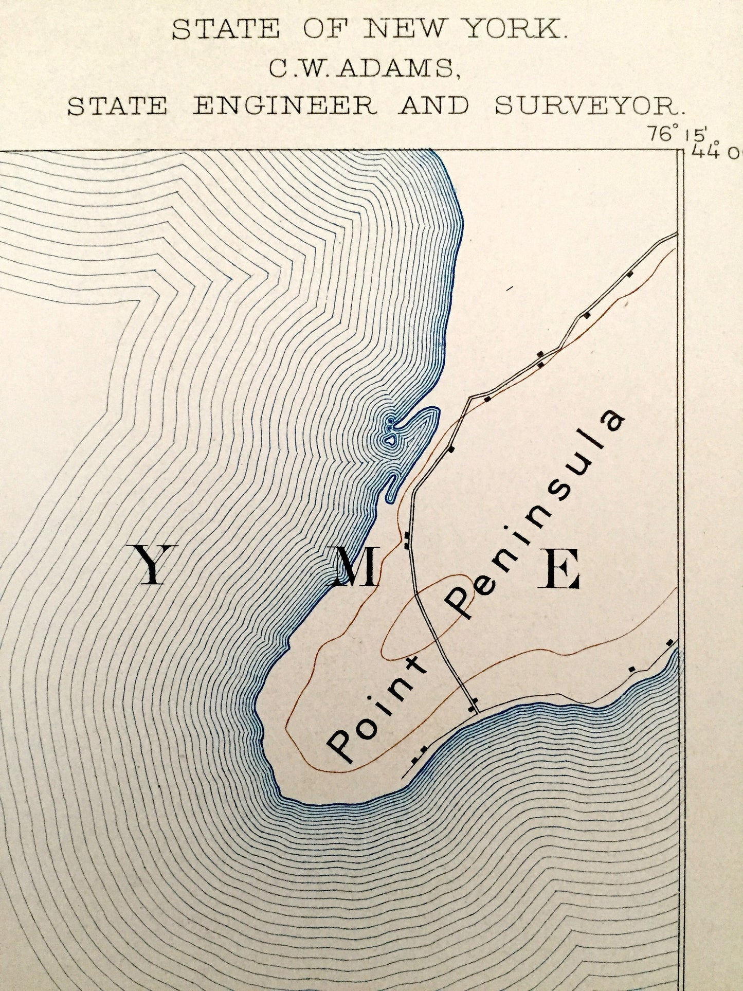
Antique Stony Island, New York 1895 US Geological Survey Map – Jefferson County, Hounsfield, Henderson, Galloo, Point, Point Peninsula NY
Antique Stony Island, New York 1895 US Geological Survey Map – Jefferson County, Hounsfield, Henderson, Galloo, Point, Point Peninsula NY
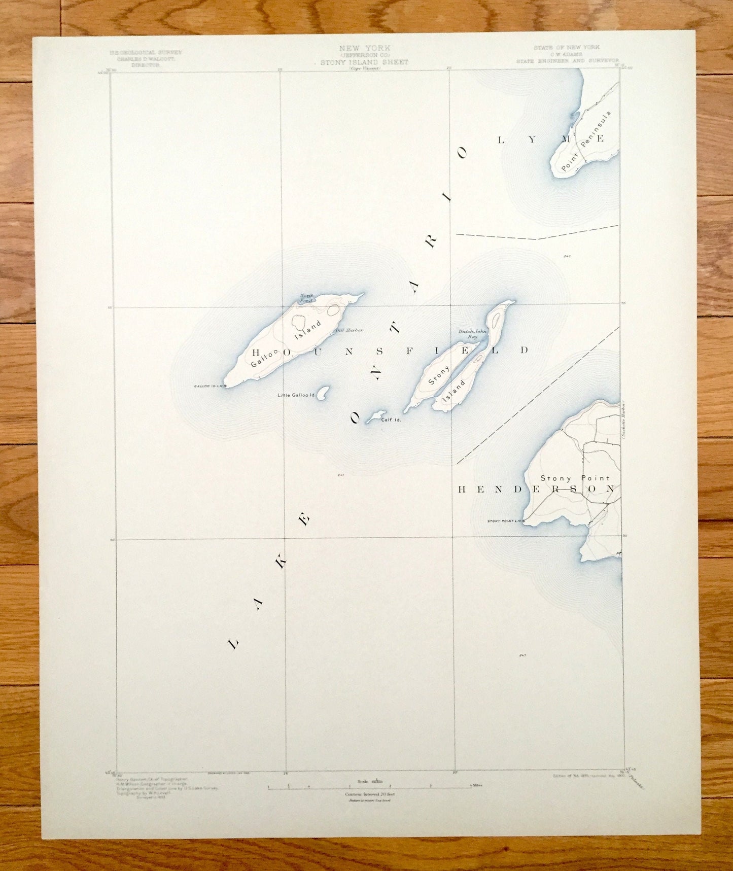
Beautiful, antique map of Stony Island, New York and surrounding Jefferson County area of eastern Lake Ontario. This is an authentic 1895 edition, 1900 print from the U.S. Geological Survey and NOT a computer reproduction.
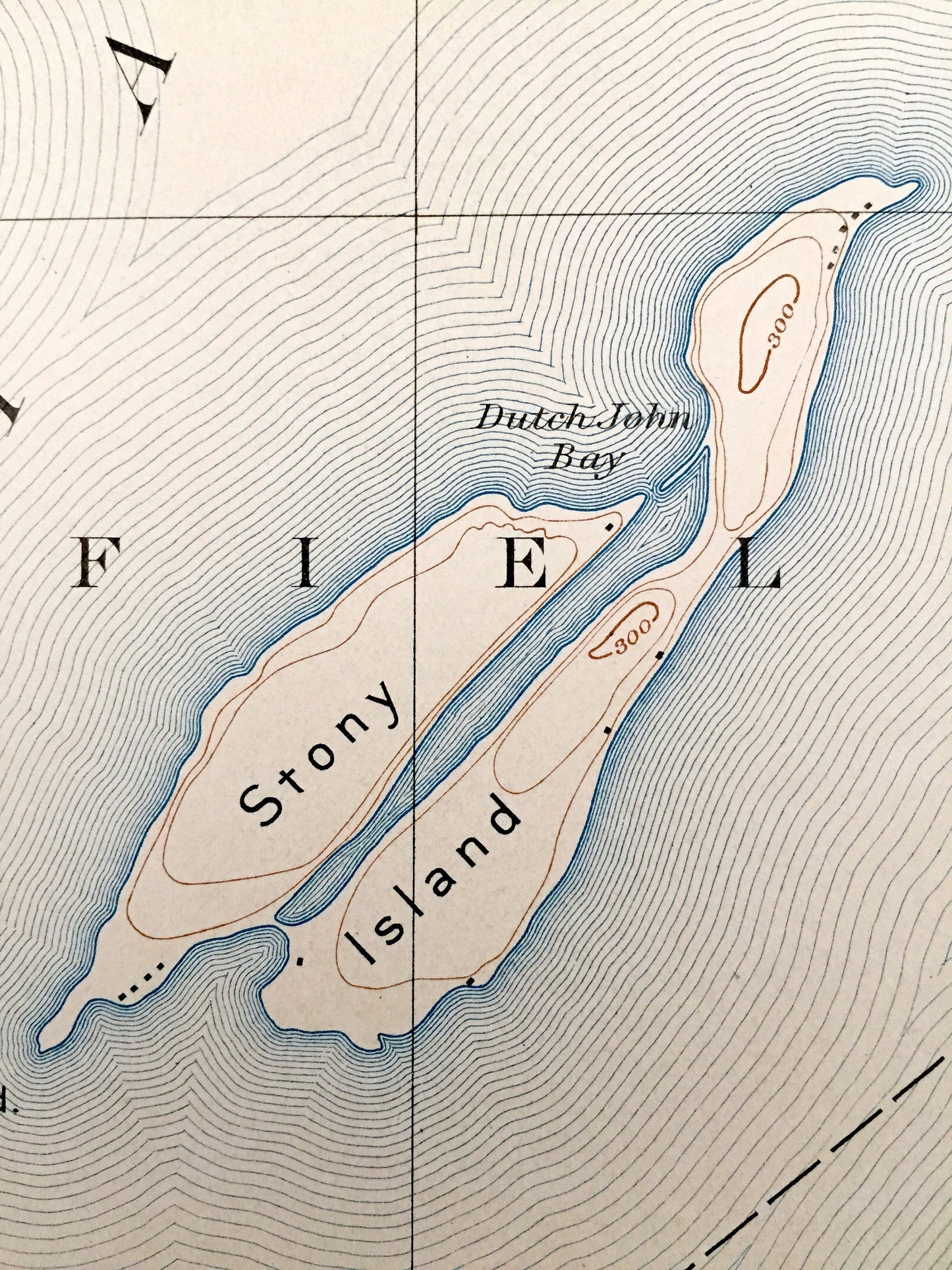
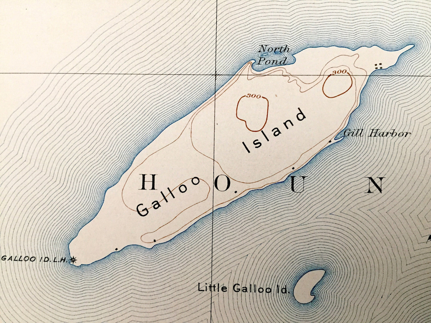
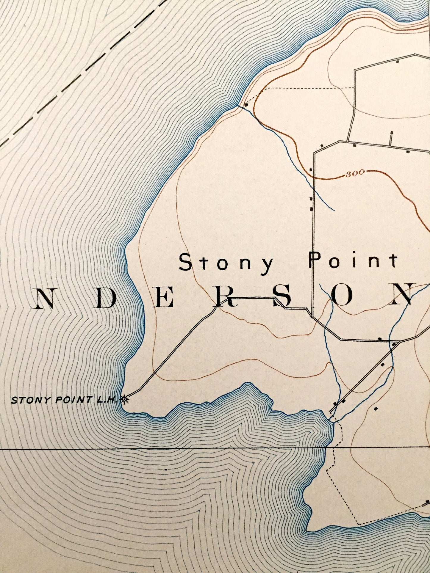
See what New York looked like more than 120 years ago. Lots of intricate details and geological contours. Map even has little squares for every house that existed at the time. The USGS cartographers were very thorough back then! On the back is a description of topographic symbols and map guide.
Perfect for the historian, map-lover, the curious or just as a conversation starter. Wonderful and rare. Vintage maps such as these make great gifts.
Edition of 1895, printed 1900
Dimensions: 16 1/2" width x 20" height
----
Features
Cities & Towns: Hounsfield, Henderson.
Points of Interest: Jefferson County, Lake Ontario, Galloo Island, Stony Island, Point Peninsula, Stony Point, Little Galloo Island, Calf Island, Gill Harbor, North Pond, Dutch John Bay, Stony Point Lighthosue and many more hills, creeks, roads.
Condition: Very Good condition, commensurate with age. This map is in incredible shape for being 120 years old. An exceedingly well-preserved print.
----
We will happily adjust shipping price for multiple purchases. Maps are rolled up and shipped in sturdy mailing tubes, never folded.
Couldn't load pickup availability
Share