My Store
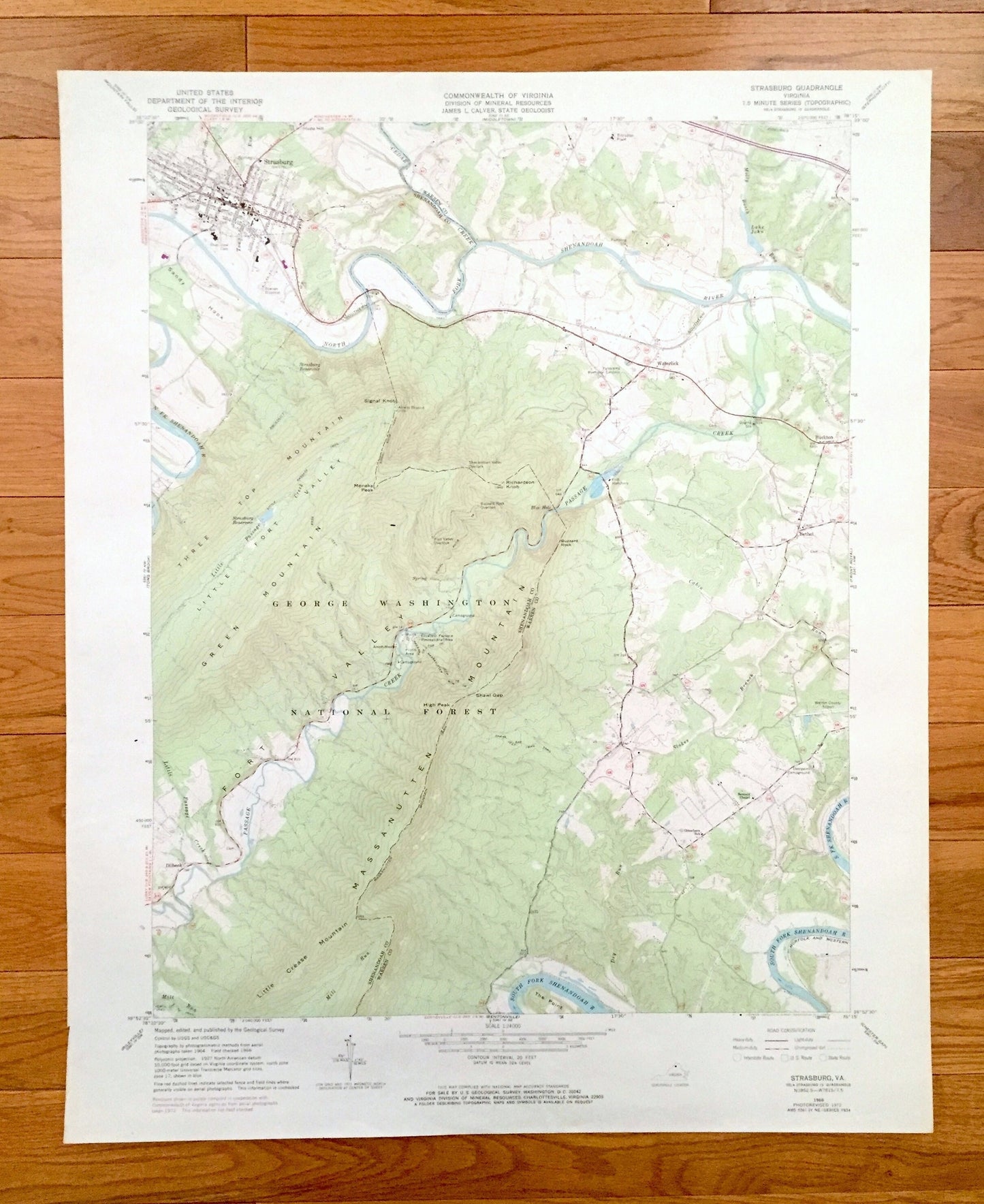
Antique Strasburg, Virginia 1966 US Geological Survey Topographic Map – Waterlick, Washington National Forest, Buckton Dilbeck Shenandoah VA
Antique Strasburg, Virginia 1966 US Geological Survey Topographic Map – Waterlick, Washington National Forest, Buckton Dilbeck Shenandoah VA
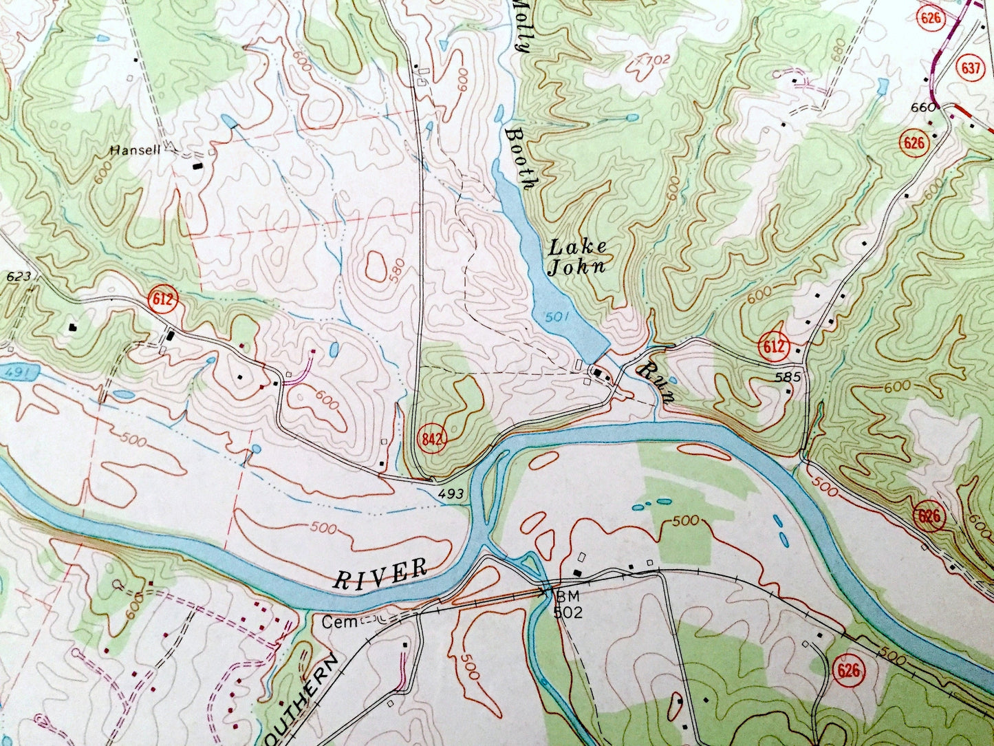
Beautiful, antique map of Strasburg, Dilbeck, Waterlick, Buckton and the George Washington National Forest of Virginia. This is an authentic 1966 edition, 1973 print from the U.S. Geological Survey and NOT a computer reproduction.
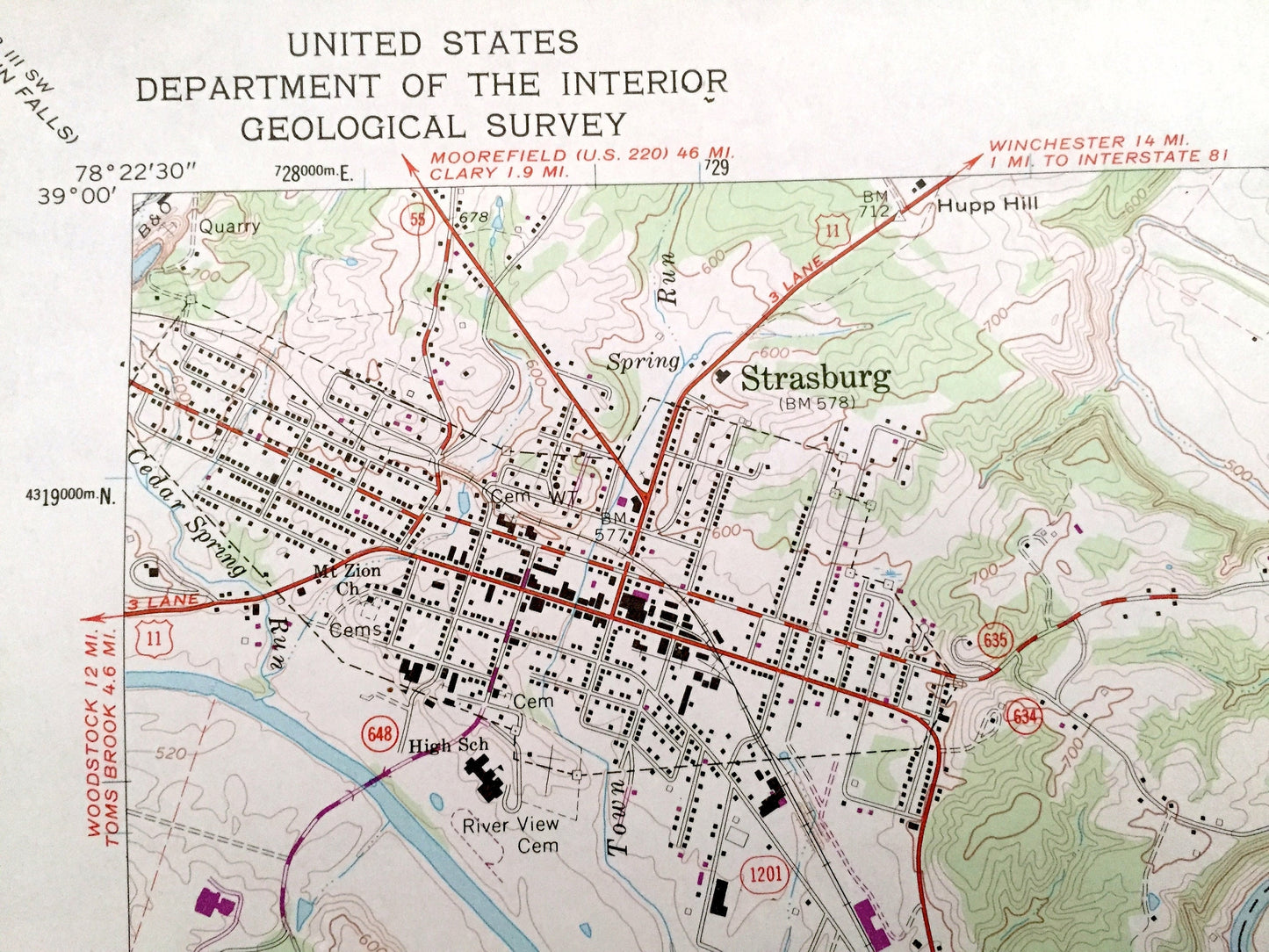
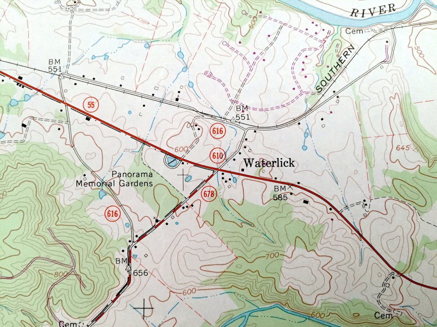
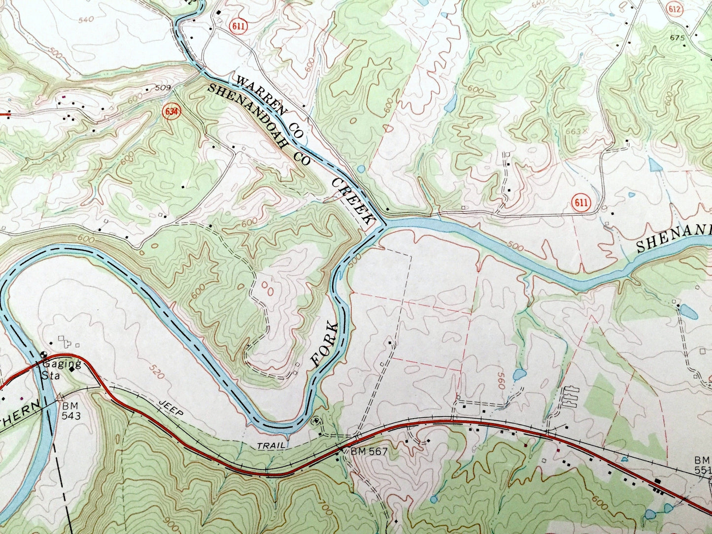
See what Shenandoah and Warren Counties of Virginia looked like over 55 years ago. Lots of intricate details and geological contours. Map even has little squares for every house that existed at the time. The USGS cartographers were very thorough back then!
Perfect for the historian, map-lover, the curious or just as a conversation starter. Wonderful and rare. Vintage maps such as these make great gifts.
Edition of 1966, printed 1973
Dimensions: 22" width x 27" height
----
Features
Cities & Towns: Strasburg, Dilbeck, Waterlick, Buckton, Bethel.
Points of Interest: George Washington National forest, Massanutten Mountain, Fort Valley Overlook, Buzzard Rock Overlook, Shenandoah Valley Overlook, Airway Beacon, Meneka Peak, Passage Creek, Amphitheater, Elizabeth Furnace Recreation Area, Campground, Strasburg High School, South Fork Shenandoah River, North Fork Shenandoah River, and lots more hills, streams, ponds, towns, houses, schools and roads.
Condition: Good Vintage condition, commensurate with age. This map is in great shape for being over 45 years old. Has some edge-wear, which will read as character when framed.
----
We will happily adjust shipping price for multiple purchases. Maps are rolled up and shipped in sturdy mailing tubes, never folded.
Couldn't load pickup availability
Share