My Store
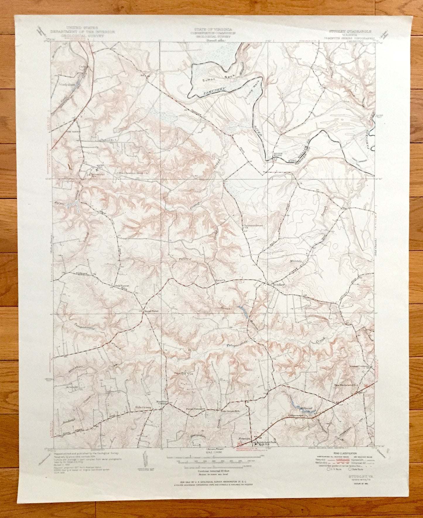
Antique Studley, Virginia 1951 US Geological Survey Topographic Map – Hanover County, Cady, Rural Point, Oak Forest, Pine Hill, Newman, VA
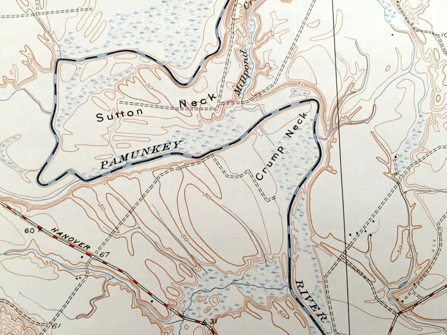
Antique Studley, Virginia 1951 US Geological Survey Topographic Map – Hanover County, Cady, Rural Point, Oak Forest, Pine Hill, Newman, VA
Beautiful, antique map of Studley, Virginia and surrounding Hanover and King William County area. This is an authentic 1951 print from the U.S. Geological Survey and NOT a computer reproduction.
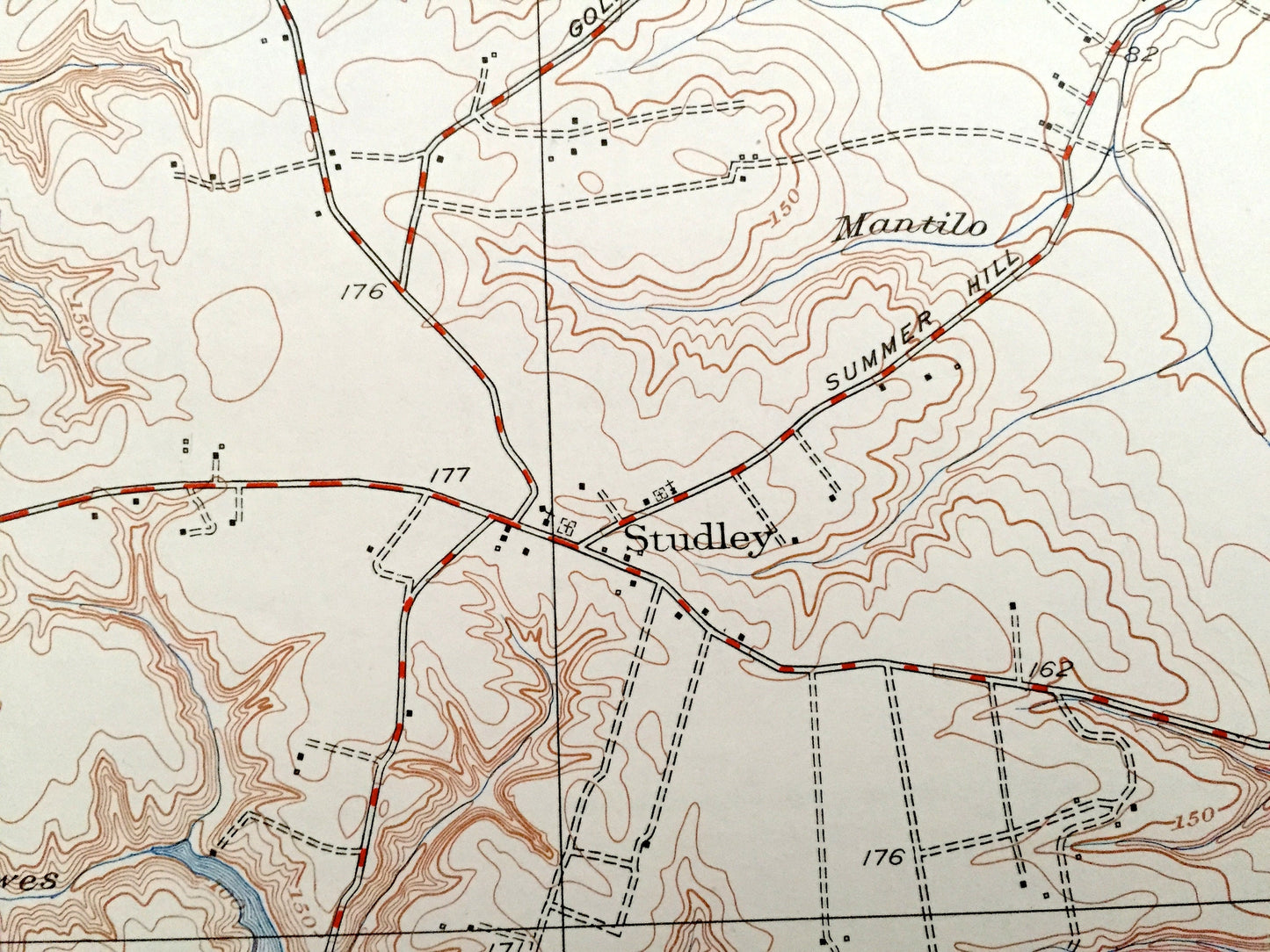
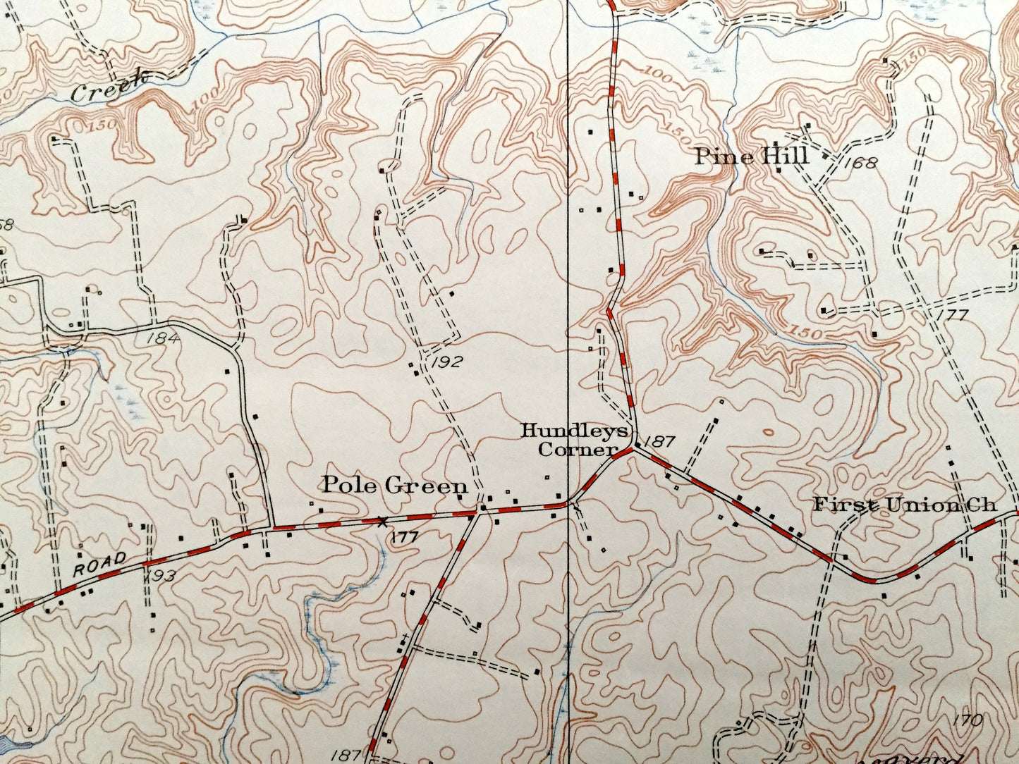
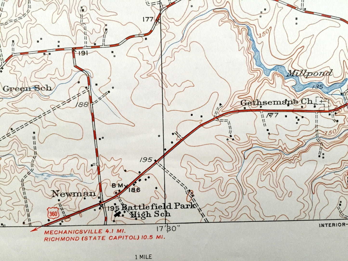
See what Virginia looked like almost 70 years ago. Lots of intricate details and geological contours. Map even has little squares for every house that existed at the time. The USGS cartographers were very thorough back then!
Perfect for the historian, map-lover, the curious or just as a conversation starter. Wonderful and rare. Vintage maps such as these make great gifts.
Edition of 1951, printed 1951
Dimensions: 22" width x 27" height
----
Features
Cities & Towns: Studley, Cady, Rural Point, Oak Forest, Academy, Pole Green, Hundleys Corner, Pine Hill, Newman, Linney Corners.
Points of Interest: Pamunkey River, Sutton Neck, Crump Neck, Cady Lake, Chesapeake & Ohio Railway, Millpond, Totopotomoy Creek, Nelson Bridge, Crump Creek, and many more hills, streams, ponds, houses, schools, churches and roads.
Condition: Very Good condition, commensurate with age. This map is in incredible shape for being almost 70 years old.
----
We will happily adjust shipping price for multiple purchases. Maps are rolled up and shipped in sturdy mailing tubes, never folded.
Couldn't load pickup availability
Share