My Store
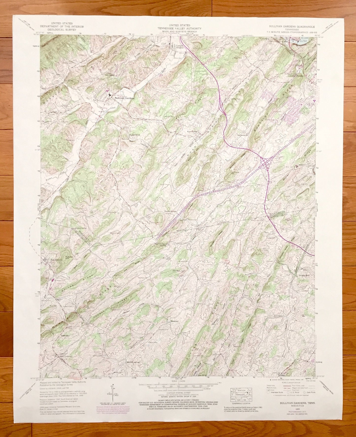
Antique Sullivan Gardens, Tennessee 1959 US Geological Survey Topographic Map – Washington County, Fall Branch Colonial Heights Lone Star TN
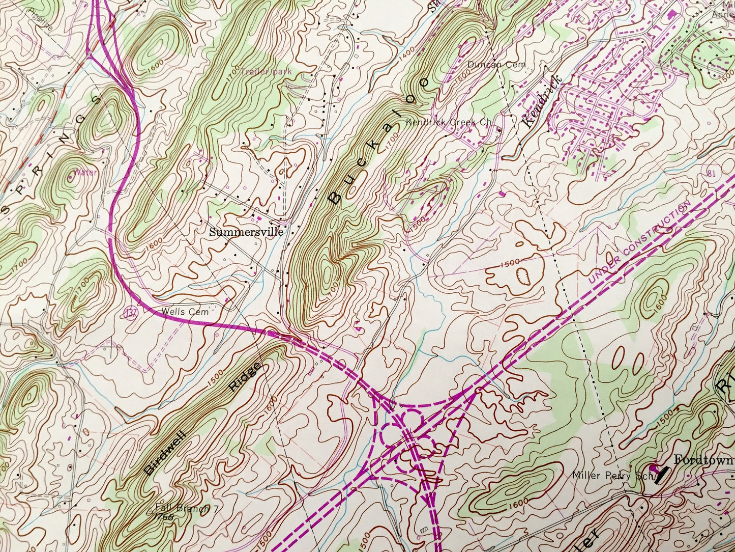
Antique Sullivan Gardens, Tennessee 1959 US Geological Survey Topographic Map – Washington County, Fall Branch Colonial Heights Lone Star TN
Beautiful, antique map of Sullivan Gardens, Tennessee and surrounding Sullivan & Washington County areas. This is an authentic 1959 edition, 1990 print from the U.S. Geological Survey and NOT a computer reproduction.
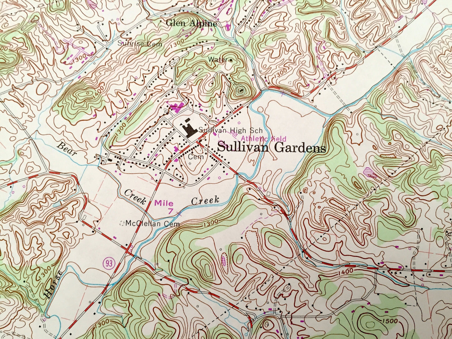
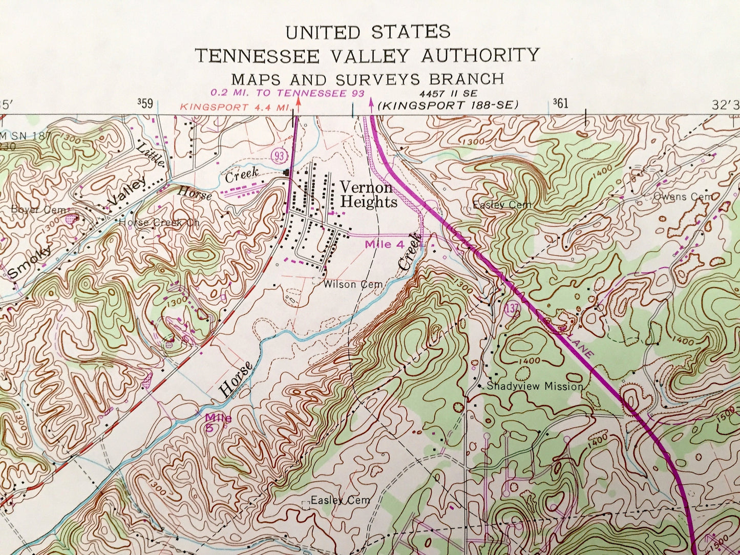
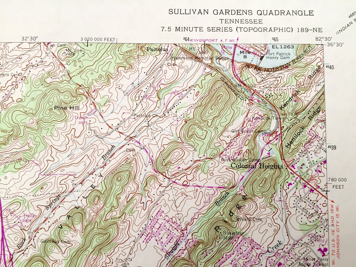
See what Tennessee looked like over 60 years ago. Lots of intricate details and geological contours. Map even has little squares for every house that existed at the time. The USGS cartographers were very thorough back then!
Perfect for the historian, map-lover, the curious or just as a conversation starter. Wonderful and rare. Vintage maps such as these make great gifts.
Edition of 1959, printed 1990
Dimensions: 22" width x 27" height
----
Features
Cities & Towns: Sullivan Gardens, Vernon Heights, Poplar Grove, Mitchell Springs, Harmony, Glen Alpine, Gabtown, Douglas Shed, Pactolus, Fordtown, Fall Branch, Colonial Heights, Lone Star.
Points of Interest: Sullivan County, Washington County, Rock Springs Valley, Roseberry Ridge, Howard Ridge, Dunham Ridge, Miller Ridge, Buckaloo Ridge, Gragg Hollow, Wheelock Hollow, Bays Mountain, South Fork Holston River, Fort Patrick Henry Dam, and lots more hills, mountains, creeks, ponds, brooks, towns, schools, churches, roads and railroads.
Condition: Good Vintage condition, commensurate with age. This map is in great shape for being 30 years old. Has light wear and foxing but this will all add to vintage character when framed.
----
We will happily adjust shipping price for multiple purchases. Maps are rolled up and shipped in sturdy mailing tubes, never folded.
Couldn't load pickup availability
Share