My Store
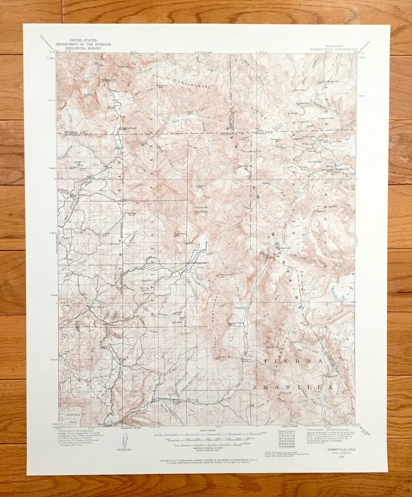
Antique Summitville, Colorado 1913 US Geological Survey Topographic Map – Rio Grande Mineral Archuleta Conejos County San Juan Mountains CO
Antique Summitville, Colorado 1913 US Geological Survey Topographic Map – Rio Grande Mineral Archuleta Conejos County San Juan Mountains CO
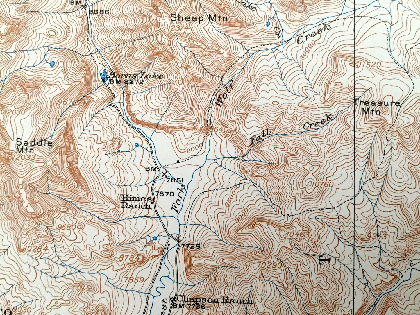
Beautiful, antique map of Summitville, Colorado and and surrounding Mineral, Rio Grande, Archuleta & Conejos County area, including Rio Grande National Forest and San Juan National Forest. This is an authentic 1913 edition, 1962 print from the U.S. Geological Survey and NOT a computer reprint.
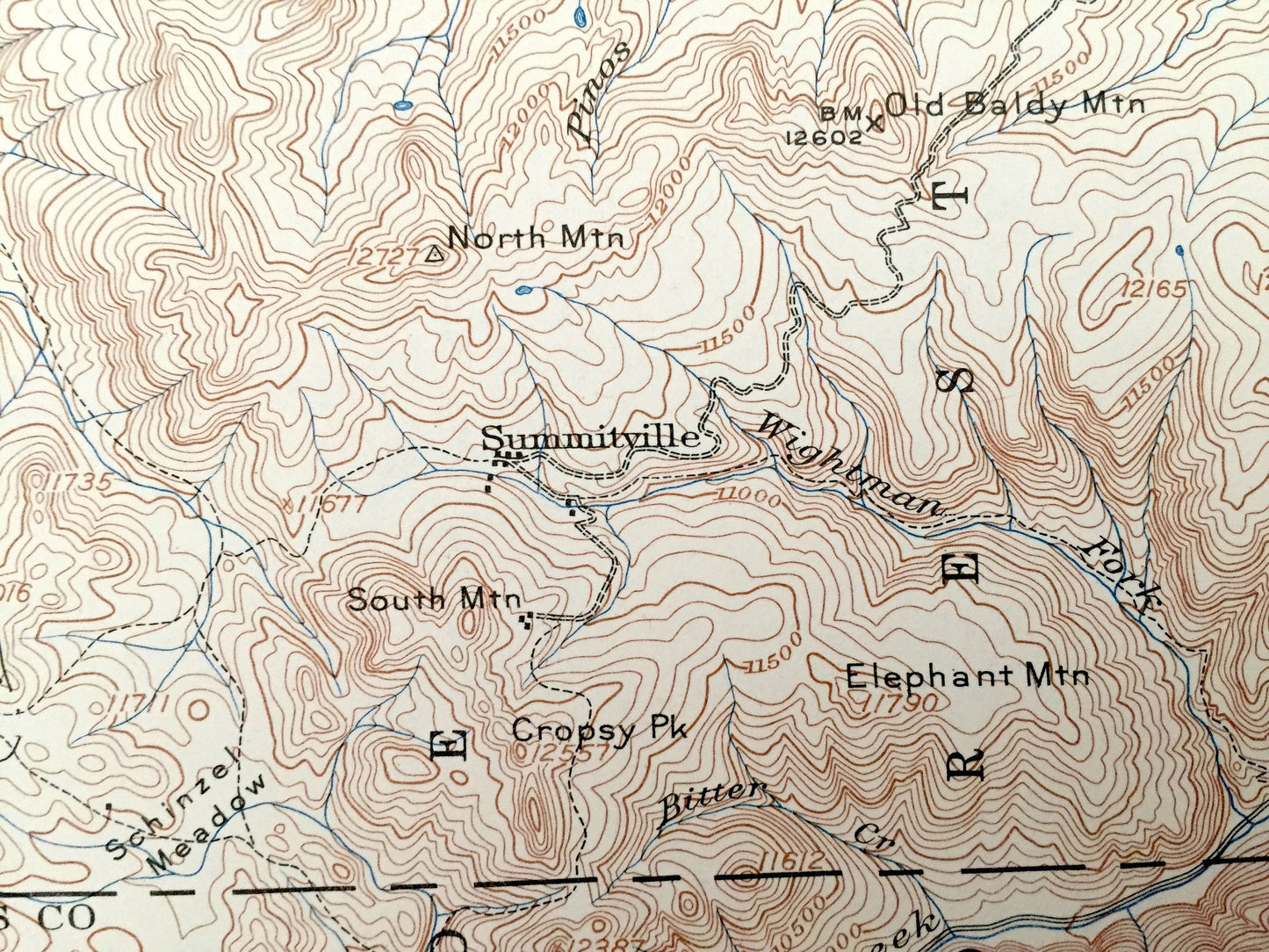
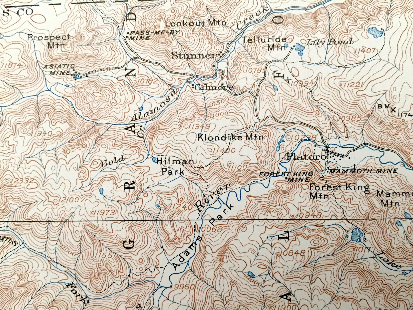
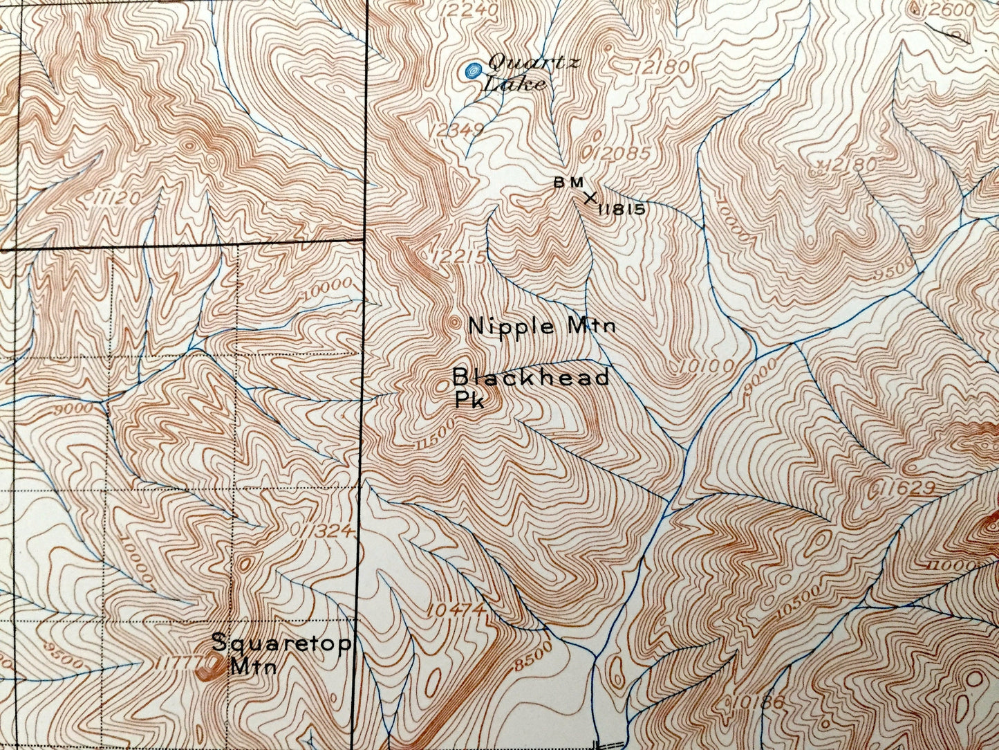
See what Colorado looked like 110 years ago. Lots of intricate details and geological contours. Map even has little squares for every house that existed. The USGS cartographers were very thorough back then!
Perfect for the historian, map-lover, the curious or just as a conversation starter. Wonderful and rare. Vintage maps such as these make great gifts.
Edition of 1913, printed 1962
Dimensions: 17" width x 21" height
----
Features
Cities & Towns: Platoro, Stunner, Gilmore, Summitville,Blanco, Edith, Chromo.
Points of Interest: Mineral County, Rio Grande County, Archuleta County, Conejos County, San Juan National Forest, Rio Grande National Forest, Continental Divide, San Juan Mountains, Tierra Amarilla, Chalk Mountains, Coyote Park, Blanco Basin, Nipple Mountain, Blackhead Peak, Treasure Mountain, Old Baldy Mountain, Telluride Mountain, Montezuma Peak, Rio Blanco River, Sheep Cabin Creek, Elk Creek, Navajo River, and many more hills, mountains, creeks, gulches, houses, roads and railroads.
Condition: Very Good Vintage condition, commensurate with age. This map is in great shape for being 60 years old.
----
We will happily adjust shipping price for multiple purchases. Maps are rolled up and shipped in sturdy mailing tubes, never folded.
Couldn't load pickup availability
Share