My Store
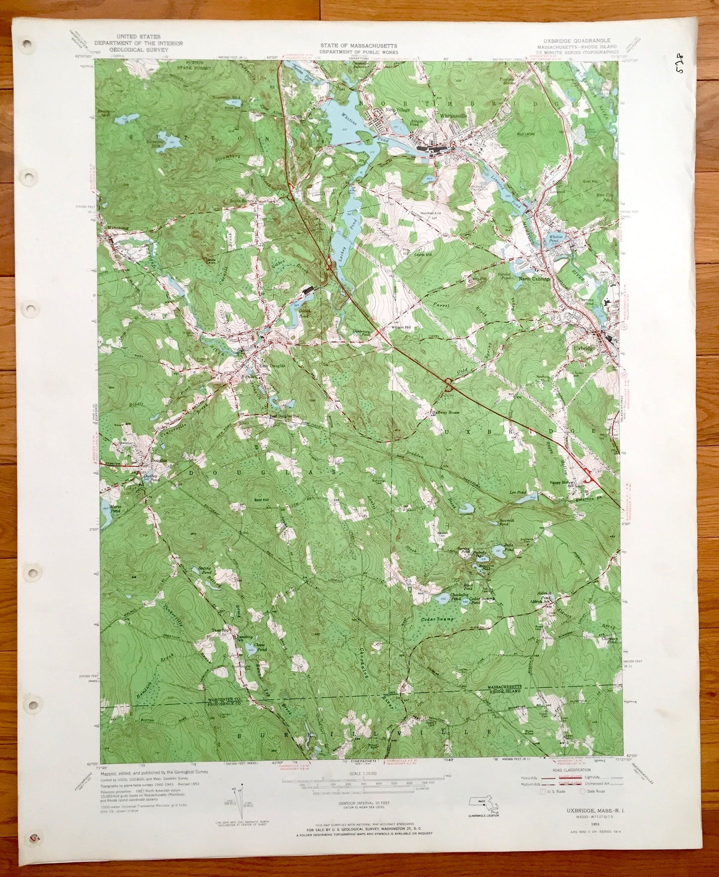
Antique Sutton, Witinsville, Uxbridge and Douglas, Massachusetts, Burrillville, Rhode Island 1953 US Geological Survey Topographic Map MA RI
Antique Sutton, Witinsville, Uxbridge and Douglas, Massachusetts, Burrillville, Rhode Island 1953 US Geological Survey Topographic Map MA RI
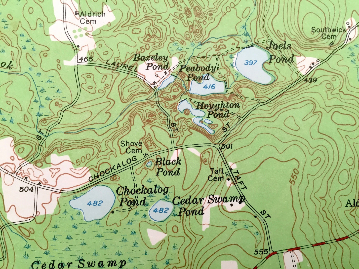
Beautiful, antique map of Sutton, Northbridge, Uxbridge and Douglas, Massachusetts and Burrillville, Rhode Island. This is an authentic 1953 print from the U.S. Geological Survey and NOT a computer reproduction.
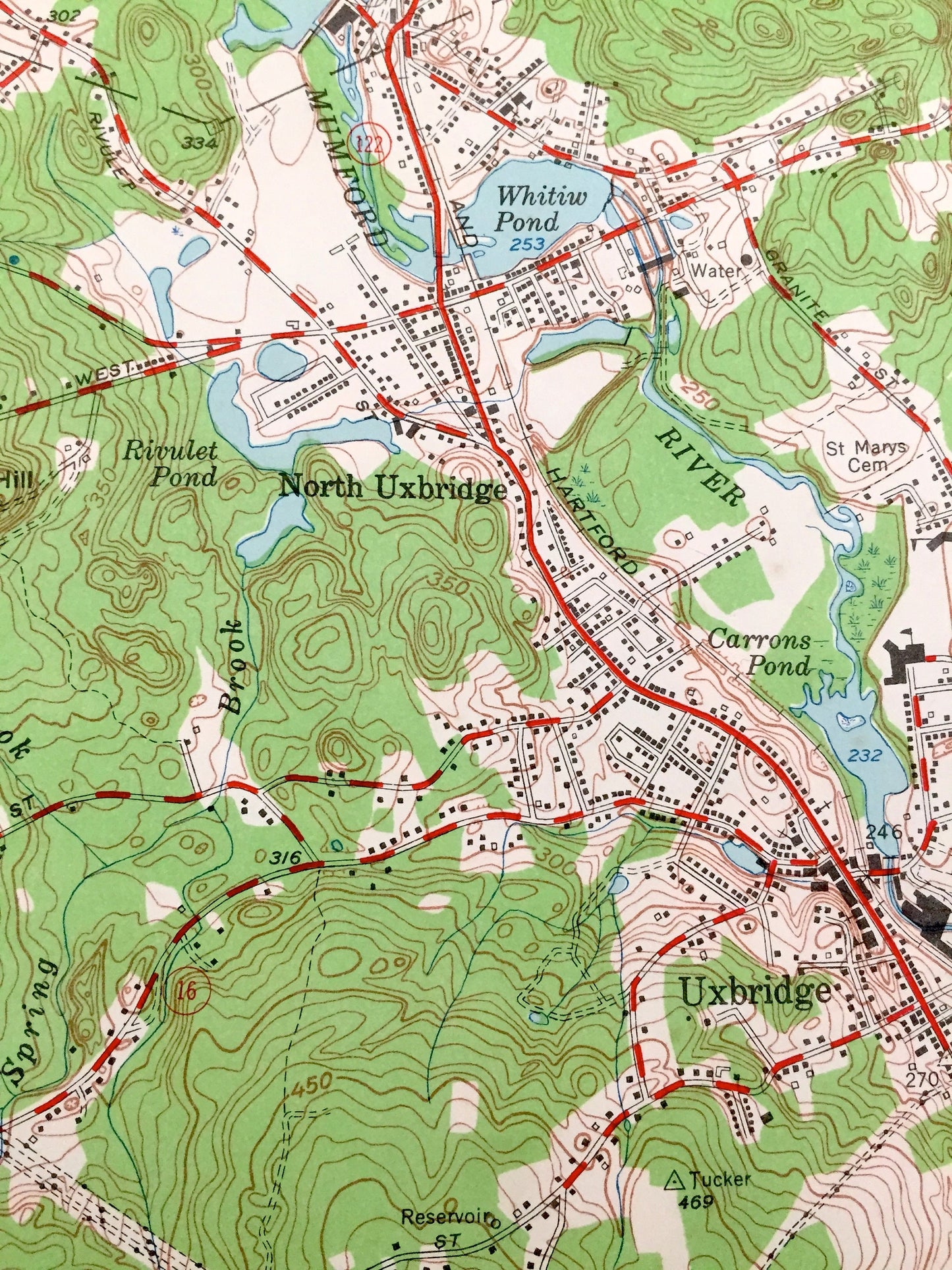
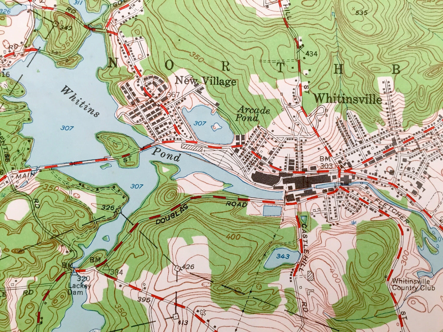
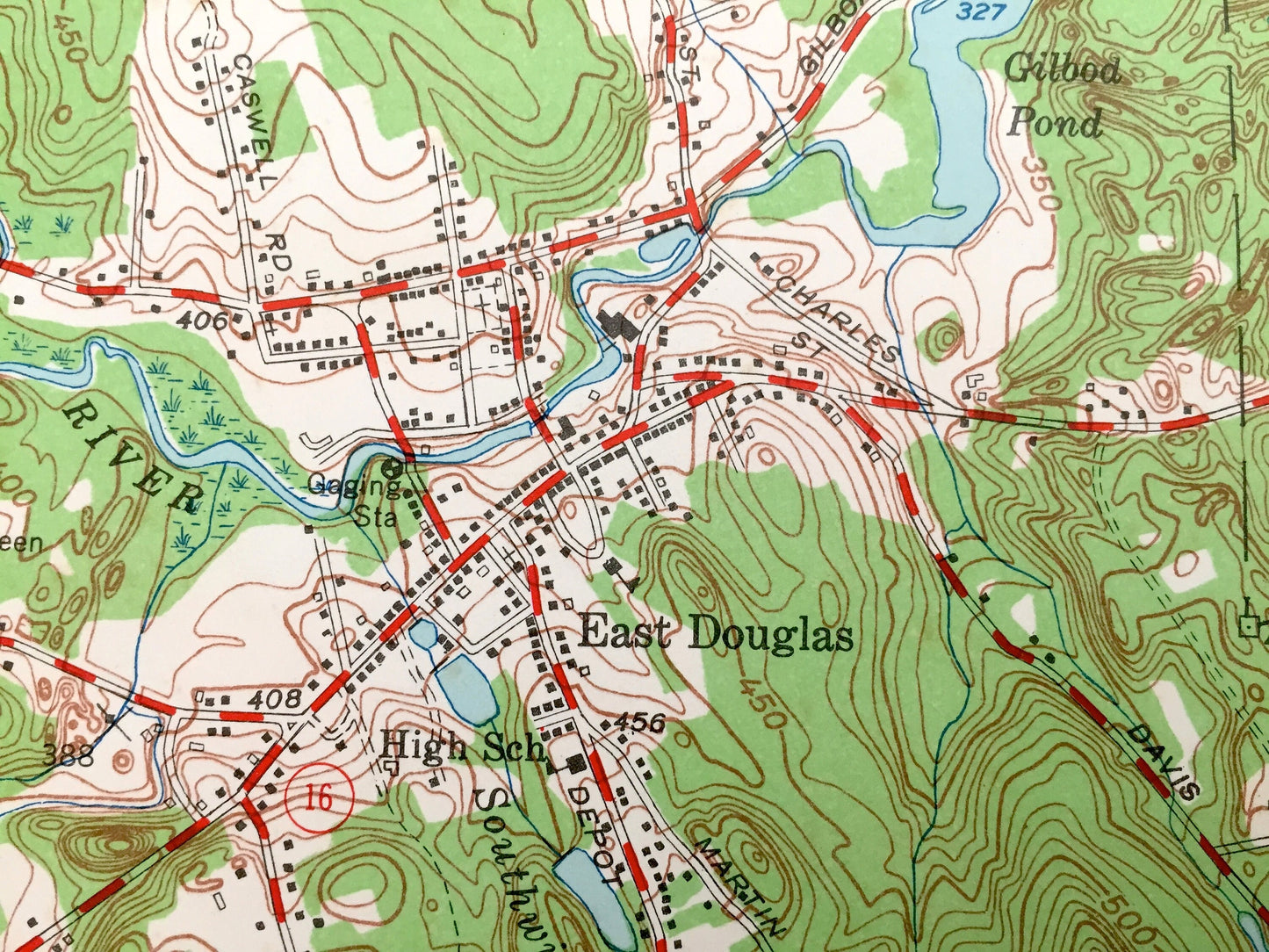
See what Uxbridge, Massachusetts and the surrounding area looked like over 65 years ago. Lots of intricate details and geological contours. Map even has little squares for every house that existed at the time. The USGS cartographers were very thorough back then!
Perfect for the historian, map-lover, the curious or just as a conversation starter. Wonderful and rare. Vintage maps such as these make great gifts.
Edition of 1953, printed 1953
Dimensions: 22" width x 27" height
----
Features
Cities & Towns: Massachusetts: Sutton, Northbridge, Whitinsville, Linwood, North Uxbridge, East Douglas, Manchaug, Whitinsville
Rhode Island: Burrillville
Points of Interest: Tassletop School, Aldrich Pond, Aldrich School, Happy Hollow School, New York New Haven and Hartford Railroad, East Douglas Station, Lackey Pond, Whitins Pond, Whitinsville Country Club, Blackstone Canal, Peabody Pond and many more roads, houses, reservoirs, ponds, and hills.
Condition: Very Good Vintage condition, commensurate with age. This map is in great shape for being over 65 years old. Map has punch holes but these are easily concealed with framing or placing a similar-colored paper behind the map, as can be seen in the photos.
----
We will happily adjust shipping price for multiple purchases
Couldn't load pickup availability
Share