My Store
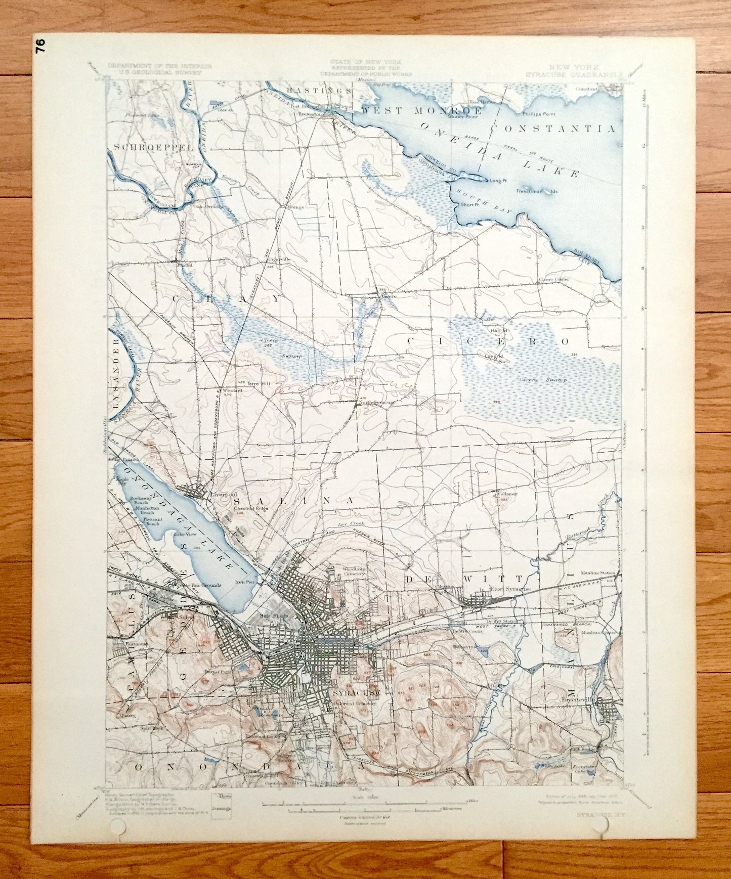
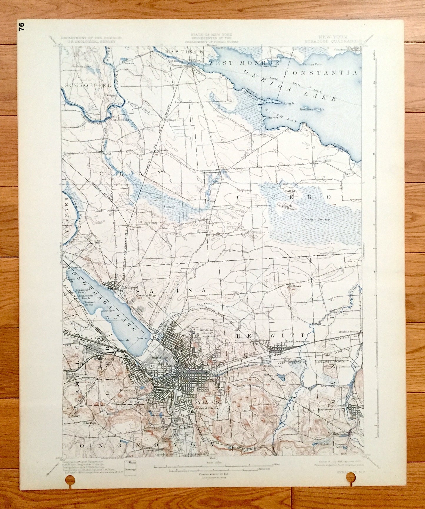
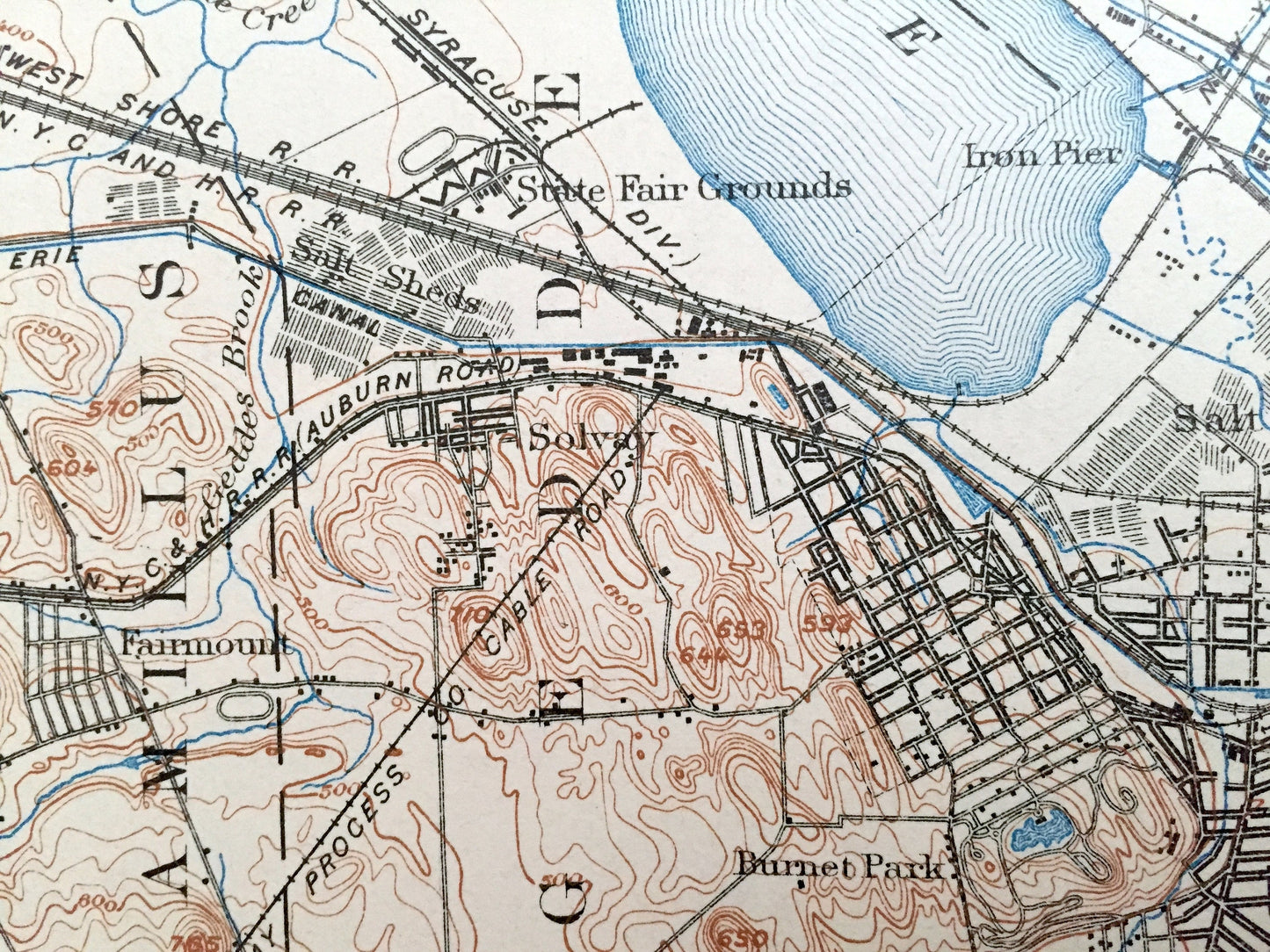
Antique Syracuse, New York 1898 US Geological Survey Topographic Map – Schroeppel, Clay, West Monroe, Constantia, Cicero, Lysander Salina NY
Antique Syracuse, New York 1898 US Geological Survey Topographic Map – Schroeppel, Clay, West Monroe, Constantia, Cicero, Lysander Salina NY
Beautiful, antique map of Syracuse, New York and surrounding Onondaga & Oswego County areas. This is an authentic 1898 edition, 1930 print from the U.S. Geological Survey and NOT a computer reproduction.
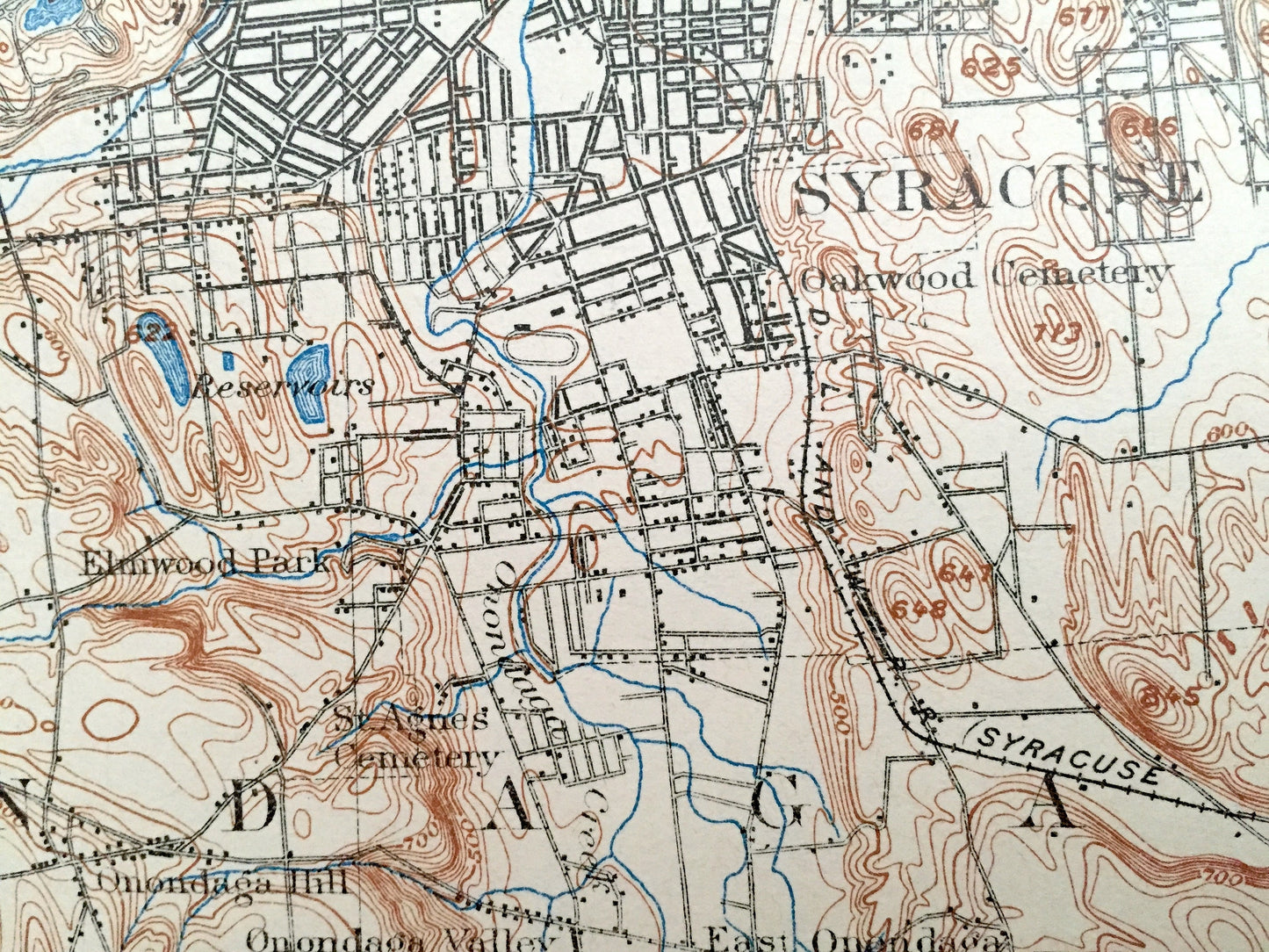
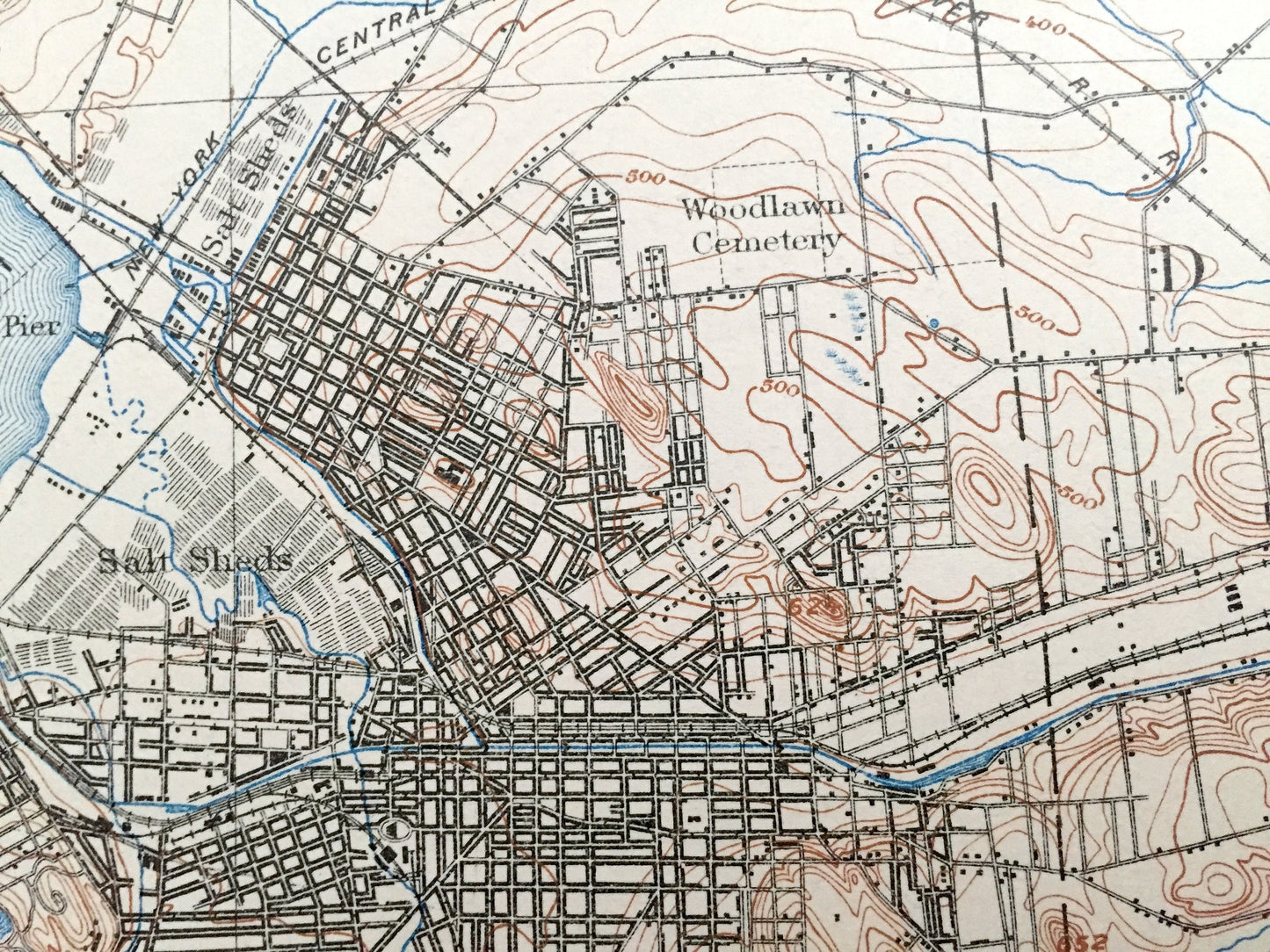
See what New York looked like over 120 years ago. Lots of intricate details and geological contours. Map even has little squares for every house that existed at the time. The USGS cartographers were very thorough back then! On the back is a description of topographic symbols and map guide.
Perfect for the historian, map-lover, the curious or just as a conversation starter. Wonderful and rare. Vintage maps such as these make great gifts.
Edition of 1898, printed 1930
Dimensions: 16 1/2" width x 20" height
----
Features
Cities & Towns: Syracuse, Hastings, Camillys, Gedde, Onondaga, Syracuse, De Witt, Manlius, Oak Orchard, Cigarville, Euclid, Fort Brewarton, Brewerton, Youngs, Toad Harbor, Cicero Center, Woodard, Liverpool, Maple Bay, Rockaway Beach, Manhattan Beach, Pleasant Beach, Lake View, North Syracuse, Collamer, Iron Pier, Solvay, Fairmount, Burnet Park, Salt Sheds, Quarry, Split Rock, Elmwood Park, Onondaga Hill, Onondaga Valley, Messina Springs, East Syracuse, De Witt Center, De Witt Station, Fayetteville, High Bridge, Schroeppel, Clay, West Monroe, Constantia, Cicero, Lysander, Salina.
Points of Interest: Onondaga County, Oswego County, Oneida Lake, Big Bay, Threemile Bay, Frenchman Island, Dunham Island, Wantry Island, Barge Canal Route, Muskrat Bay, Short Point Bay, Long Point, Boysen Bay, Maple Bay, Hall Island, Cicero Swamp, Long Island, Geersbeck Island, Mud Creek, Sandy Bay, Seneca River, Oneida River, Onondaga Lake, Ninemile Creek, Syracuse Universty, Rome Watertown and Ogdensburg Railroad, Erie Canal, Beartrap Creek and more roads, railroads, houses, ponds, hills, creeks, and lakes.
Condition: Good Vintage condition, commensurate with age. This map is in great shape for being over 90 years old. This map has punch holes towards the bottom. This is easily concealed by placing a similar piece of paper behind it as shown in the above photos. Also has light edge-wear and library markings, but this will add to vintage character when framed.
----
We will happily adjust shipping price for multiple purchases. Maps are rolled up and shipped in sturdy mailing tubes, never folded.
Couldn't load pickup availability
Share