My Store
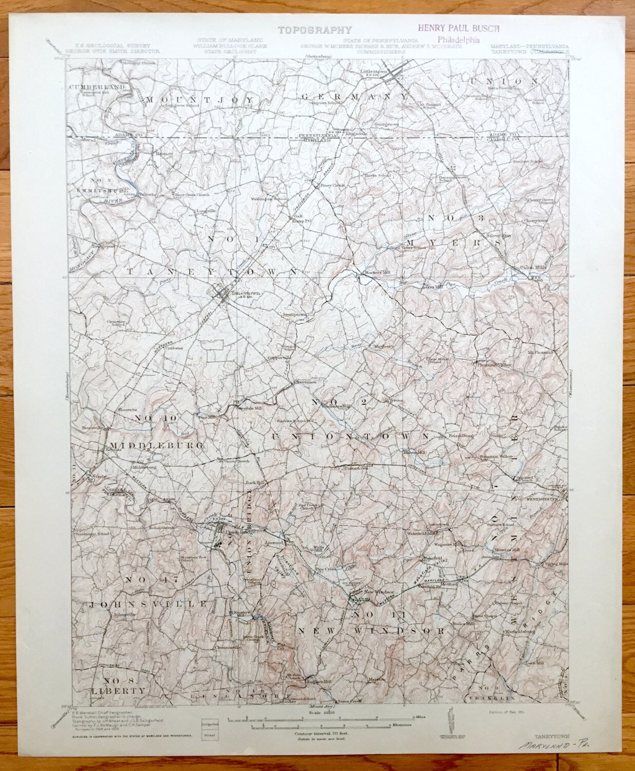
Antique Taneytown, Maryland 1911 US Geological Survey Topographic Map – Carroll, Frederick County, Union Bridge, Westminster, Adams, MD
Antique Taneytown, Maryland 1911 US Geological Survey Topographic Map – Carroll, Frederick County, Union Bridge, Westminster, Adams, MD
Beautiful, antique map of Carroll County and Frederick County Maryland around Taneytown & Adams County, Pennsylvania just south of Gettysburg. This is an authentic 1911 print from the U.S. Geological Survey and NOT a computer reproduction.
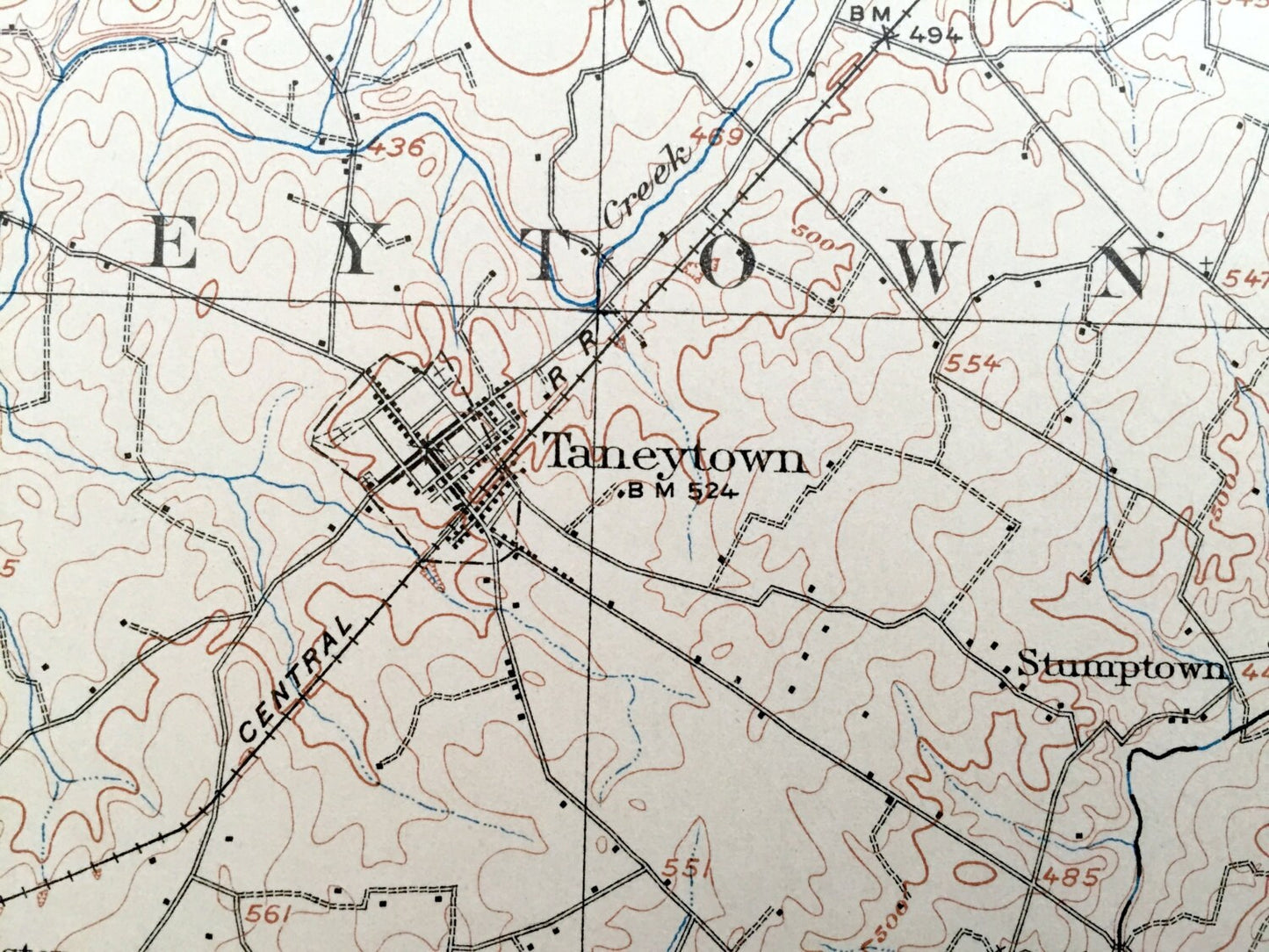
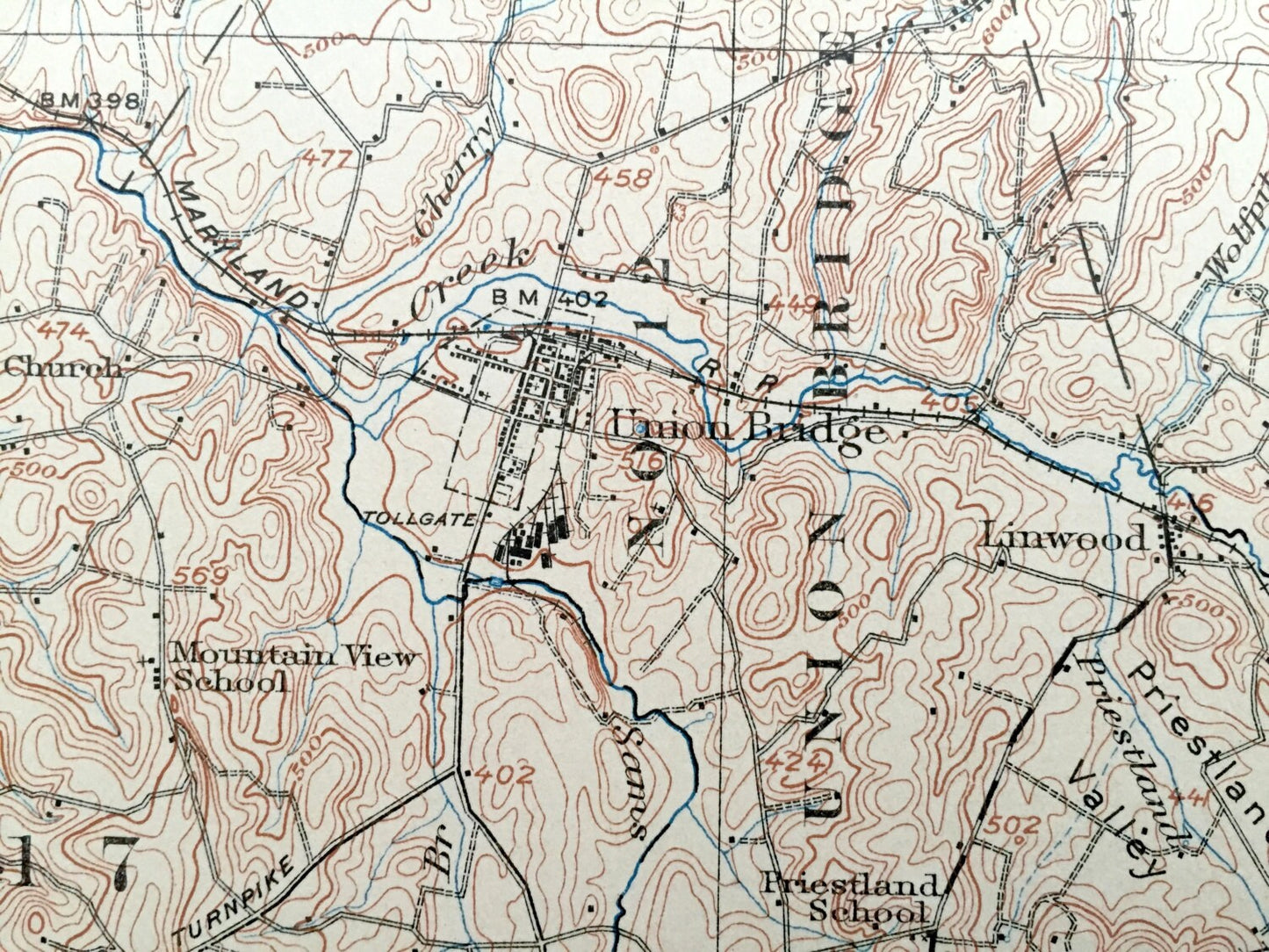
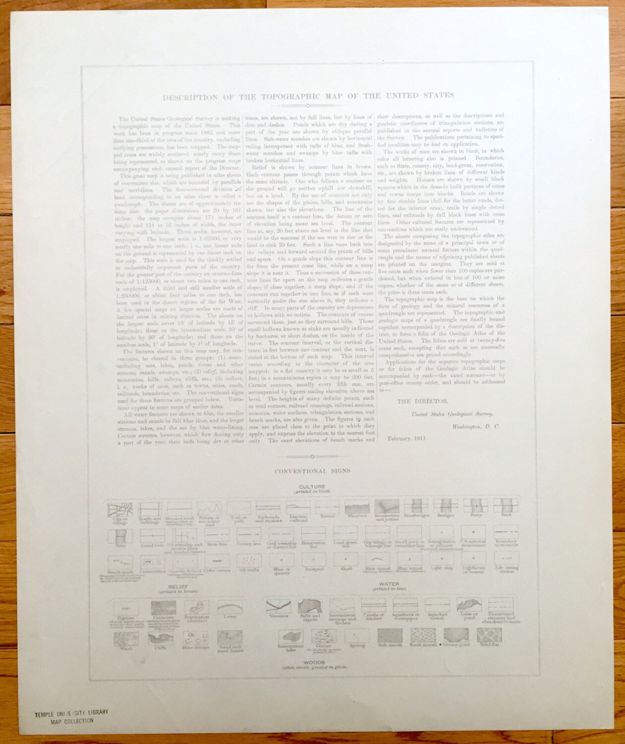
See what Maryland & Pennsylvania looked like more than 110 years ago. Lots of intricate details and geological contours. Map even has little squares for every house that existed at the time. The USGS cartographers were very thorough back then! On the back is a description of topographic symbols and map guide.
Perfect for the historian, map-lover, the curious or just as a conversation starter. Wonderful and rare. Vintage maps such as these make great gifts.
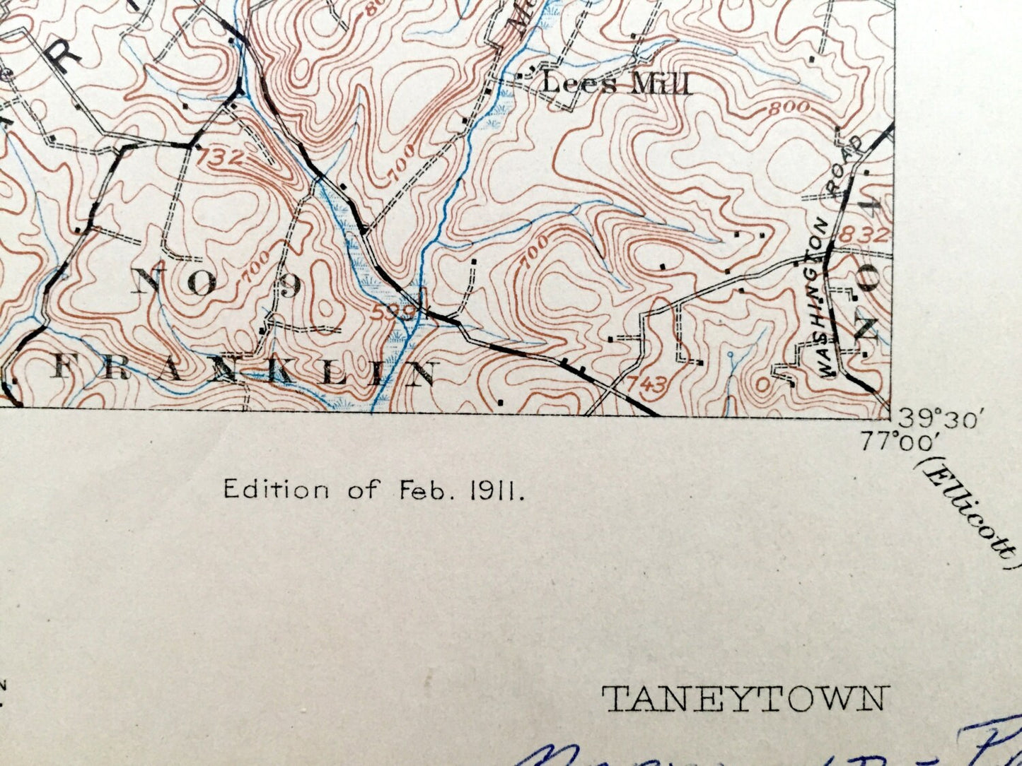
Edition of 1911, printed 1911
Dimensions: 16 1/2" width x 20" height
----
Features
Cities & Towns: MARYLAND: Bridgeport, Harney, Longville, Galt, Piney Creek, Markers Mill, Silver Run, Cherrytown, Union Mills, Taneytown, Crabster, Sharretts, Bruceville, Keymar, Middleburg, Fues Mill, Stumptown, Copperville, Mayberry, Trevanion, Copperville, Otterdale Mill, Weishaars Mill, Tyrone, Uniontown, Bark Hill, Pleasant Valley, Mt. Pleasant, Arters Mill, Frizzleburg, Hahns Mill, Fountain Valley, Union Bridge, Johnsville, Clemsonville, Walls Mill, Linwood, New Windsor, Englars Mill, Marston, Sams Creek, Wakefield Mill, Wagners Mill, Jasontown, Westminster, Shrivers Mill, Avondale, Spring Mills, Bailes Mill, Warfieldsburg, Lees Mill, Baile.
PENNSYLVANIA: Cumberland, Mount Joy, Germany, Union, Kingsdale, Littlestown.
Points of Interest: Carrol County, Frederick County, Adams County, Monocacy River, Parrs Ridge, Northern Central Railroad, Western Maryland Railroad, Pipe Creek, Western Maryland College, New Windsor College, Priestland Valley, and lots more hills, hollows, mountains, creeks, towns, schools, churches, roads and turnpikes.
Condition: Very Good Vintage condition, commensurate with age. This map is in incredible shape for being over 110 years old.
----
We will happily adjust shipping price for multiple purchases. Maps are rolled up and shipped in sturdy mailing tubes, never folded.
Couldn't load pickup availability
Share