My Store
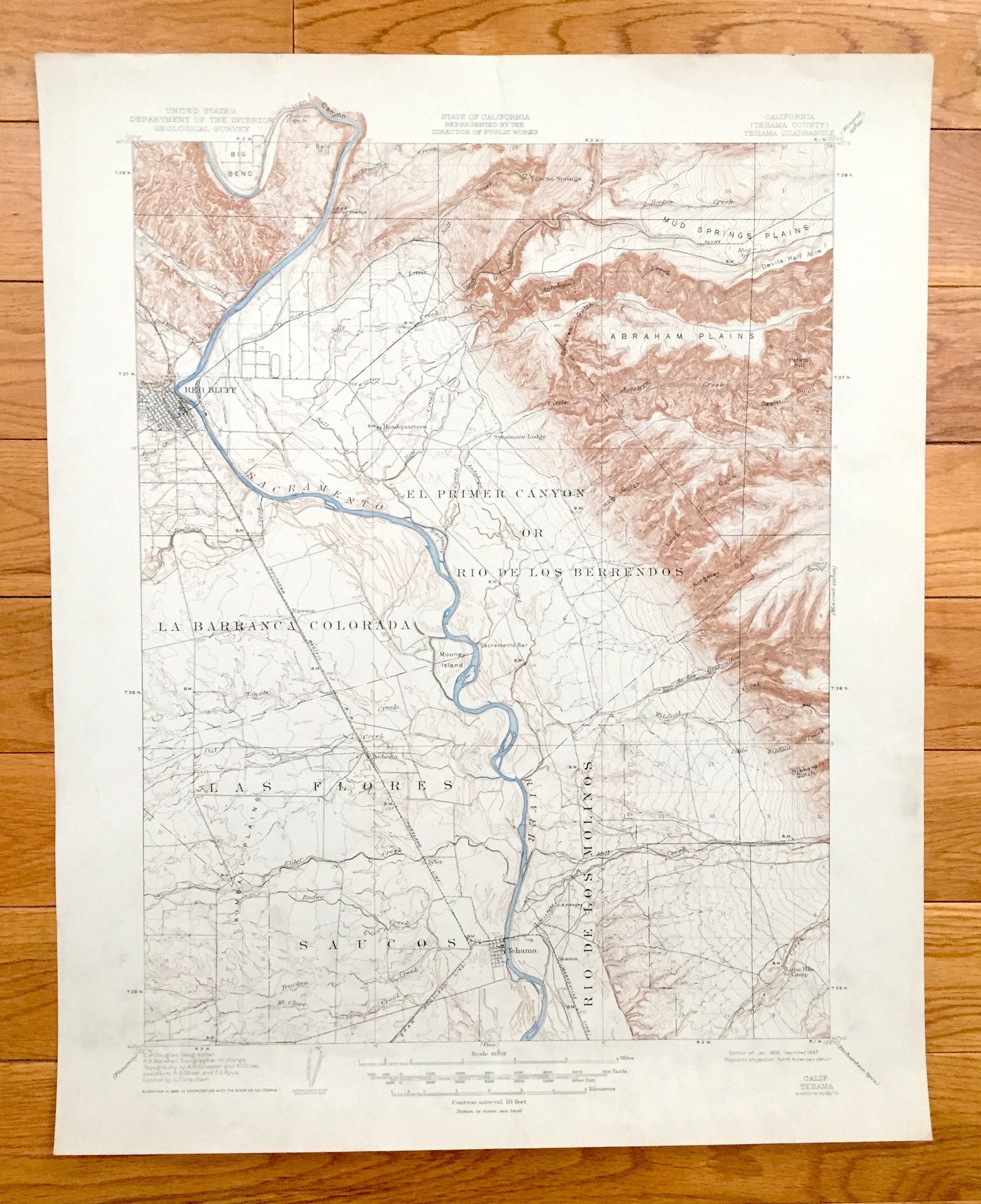
Antique Tehama, California 1905 US Geological Survey Topographic Map – Red Bluff, Sacramento River, Big Bend, Proberta, Las Flores, Tyler CA
Antique Tehama, California 1905 US Geological Survey Topographic Map – Red Bluff, Sacramento River, Big Bend, Proberta, Las Flores, Tyler CA
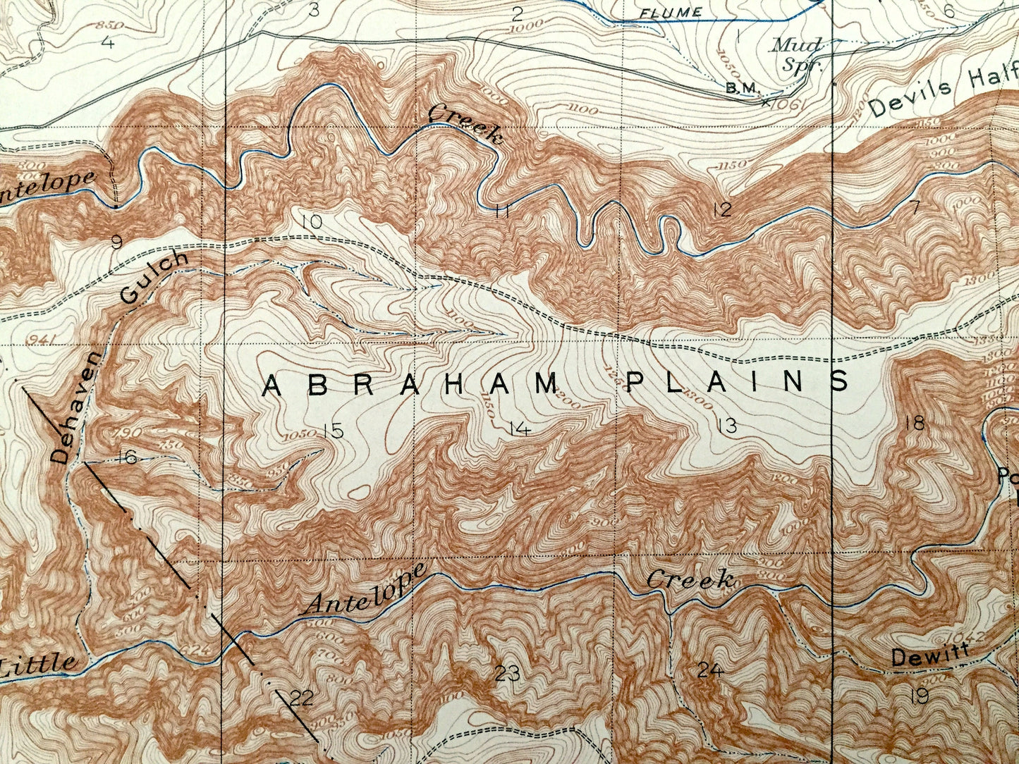
Beautiful, antique map of Tehama, California and surrounding Tehama County area, including Red Bluff. This is an authentic 1905 edition, 1947 print from the U.S. Geological Survey and NOT a computer reproduction.
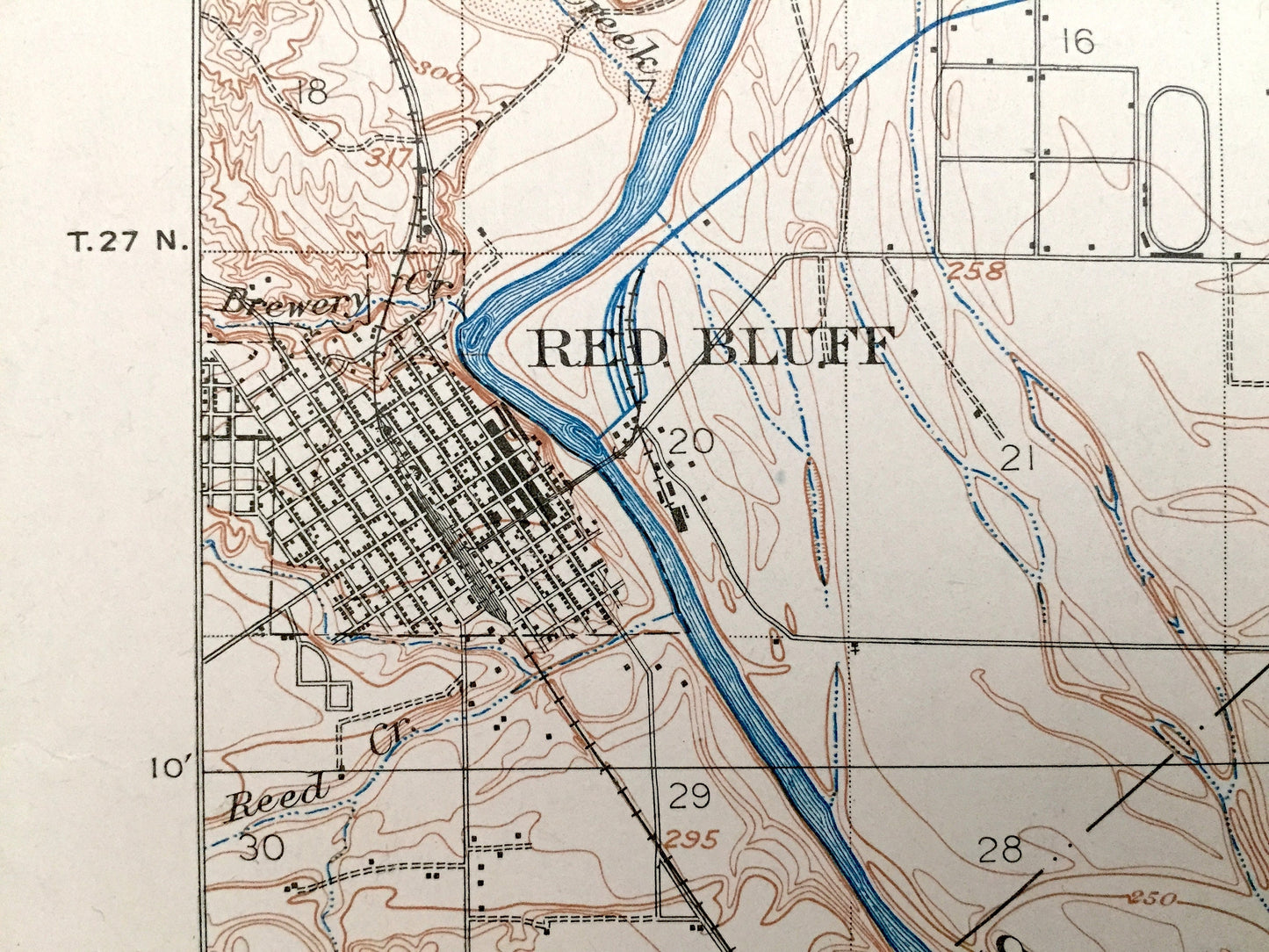
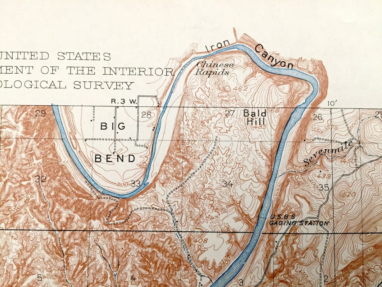
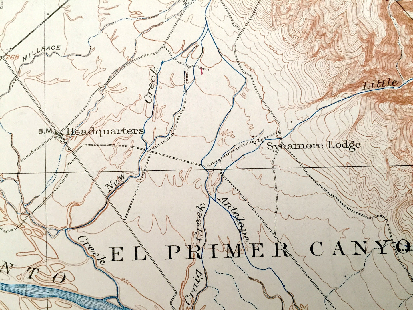
See what California looked like more than 110 years ago. Lots of intricate details and geological contours. Map even has little squares for every house that existed at the time. The USGS cartographers were very thorough back then! On the back is a description of topographic symbols and map guide.
Perfect for the historian, map-lover, the curious or just as a conversation starter. Wonderful and rare. Vintage maps such as these make great gifts.
Edition of 1905, printed 1947
Dimensions: 17" width x 21" height
----
Features
Cities & Towns: Tehama, Red Bluff, Headquarters, Sycamore Lodge, Tuscan Springs, Proberta, Tyler, Sesma, Lone Pine Camp.
Points of Interest: Tehama County, Sacramento River, Elder Creek, Wildcat Creek, Abraham Plains, Mud Springs Plains, Big Bend, Iron Canyon, Bald Hill, Mooney Island, Sacramento Bar, Rodeo Creek, New Creek, Blue Tent Creek, Salt Creek, Antelope Creek, Kingsley Gulch, and many more mountains, canyons, houses, schools, churches, roads and train tracks.
Condition: Good condition, commensurate with age. This map is in great shape for being more than 70 years old. Has edge-wear but this will read as vintage character when framed.
----
We will happily adjust shipping price for multiple purchases. Maps are rolled up and shipped in sturdy mailing tubes, never folded.
Couldn't load pickup availability
Share