My Store
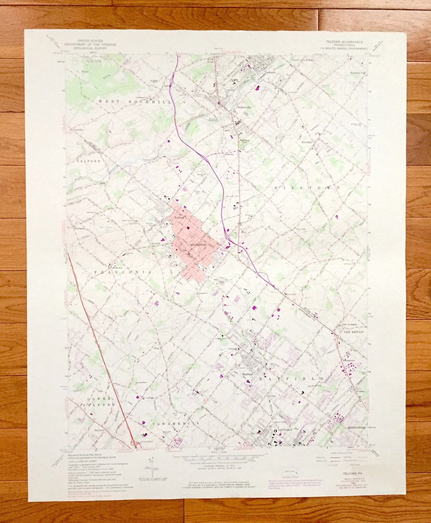
Antique Telford, Pennsylvania 1960 US Geological Survey Topographic Map – Montgomery, Bucks County, Souderton, Hatfield, Sellersville, PA
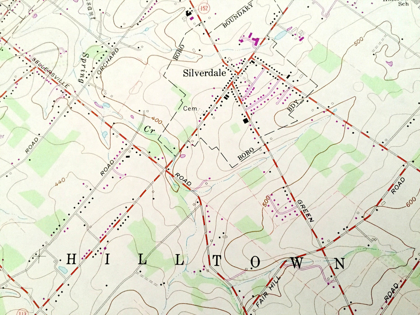
Antique Telford, Pennsylvania 1960 US Geological Survey Topographic Map – Montgomery, Bucks County, Souderton, Hatfield, Sellersville, PA
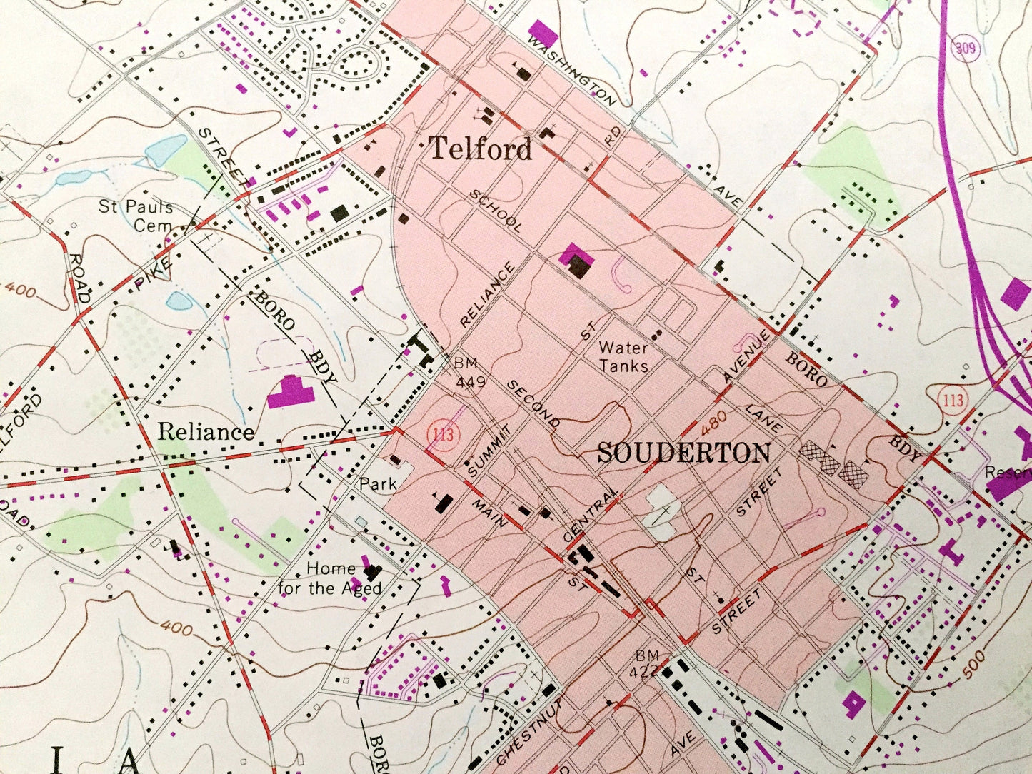
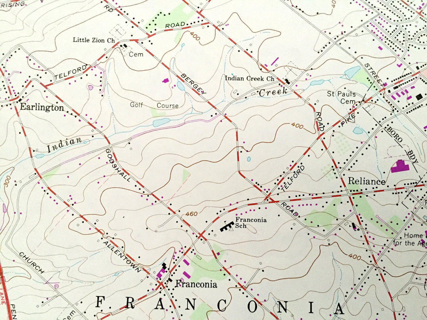
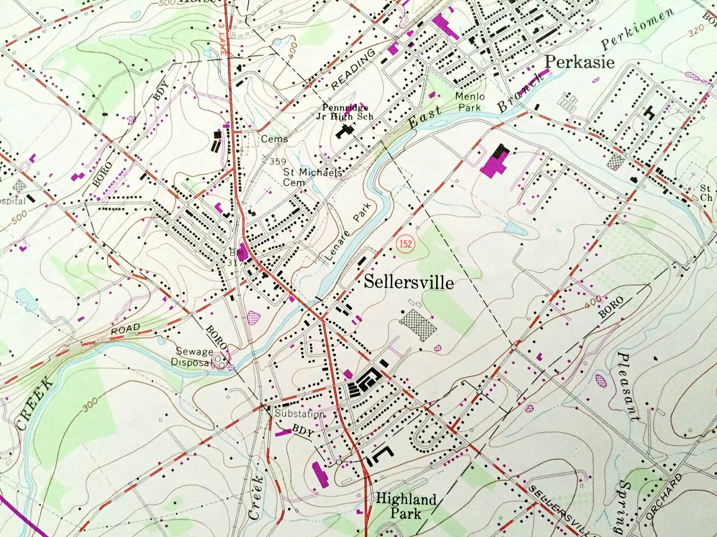
Beautiful, antique map of Telford, Pennsylvania and surrounding Montgomery County and Bucks County area. This is an authentic 1960 edition, 1983 print from the U.S. Geological Survey and NOT a computer reproduction.
See what Pennsylvania looked like over 60 years ago. Lots of intricate details and geological contours. Map even has little squares for every house that existed at the time. The USGS cartographers were very thorough back then!
Perfect for the historian, map-lover, the curious or just as a conversation starter. Wonderful and rare. Vintage maps such as these make great gifts.
Edition of 1960, printed 1983
Dimensions: 22" width x 27" height
----
Features
Cities & Towns: Mainland, Lower Salford, Towamencin, Oak Park, Lansdale, Fortuna, Montgomery, Colmar, Trewigtown, Elroy, Franconia, Earlington, Salford, Naceville, Almont, White Horse, Perkasie, East Rockhill, Blooming Glen, Highland Park, Silverdale, Hilltown, Fair Hill, Unionville, Line Lexington, New Britain.
Points of Interest: East Branch Perkiomen Creek, Reading Railroad, Indian Creek, Ridge Valley Creek, State Game Lands, Menlo Park, Pleasant Spring Creek, and many more hills, streams, ponds, houses, schools, railroads, churches and roads.
Condition: Very Good Vintage condition, commensurate with age. This map is in great shape for being over 35 years old. Has light edge-wear but this will read as character when framed.
----
We will happily adjust shipping price for multiple purchases. Maps are rolled up and shipped in sturdy mailing tubes, never folded.
Couldn't load pickup availability
Share